
Record setting heat is expected over the next several days from the Intermountain West through the northern Plains. Furthermore, fire weather concerns increase with dry and breezy conditions. Meanwhile, heavy rainfall and severe thunderstorm threats for the Ohio/Tennessee Valleys, central Appalachians and Southeast today. The threat shifts to central Gulf Coast and across central Texas this week. Read More >
Central Illinois
Weather Forecast Office
Tornado #3: Pana (Christian County)
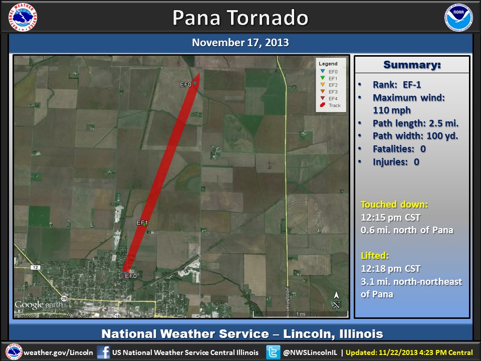
Summary:
|
The tornado developed near the intersection of Almond and Elm Streets on the north side of Pana. Damage was done to siding and roofs of homes. Several trees were knocked down, damaging 3 cars. Power lines were also downed. The tornado continued to the north-northeast doing damage to a home and destroying an outbuilding at East 400 North Road. The tornado dissipated about 2 miles to the north-northeast in an open field.
Event Links: Overview | Pekin | Washington | Pana | Altamont | West Liberty
Garrett | Gifford | Villa Grove | Tuscola | Westville | Radar

US Dept of Commerce
National Oceanic and Atmospheric Administration
National Weather Service
Central Illinois
1362 State Route 10
Lincoln, IL 62656
217-732-7321 (forecast recording) or 217-732-3089
Comments? Questions? Please Contact Us.


 Follow us on X
 Follow us on Facebook
 Follow us on YouTube
 ILX RSS Feed