Interesting Radar Imagery:
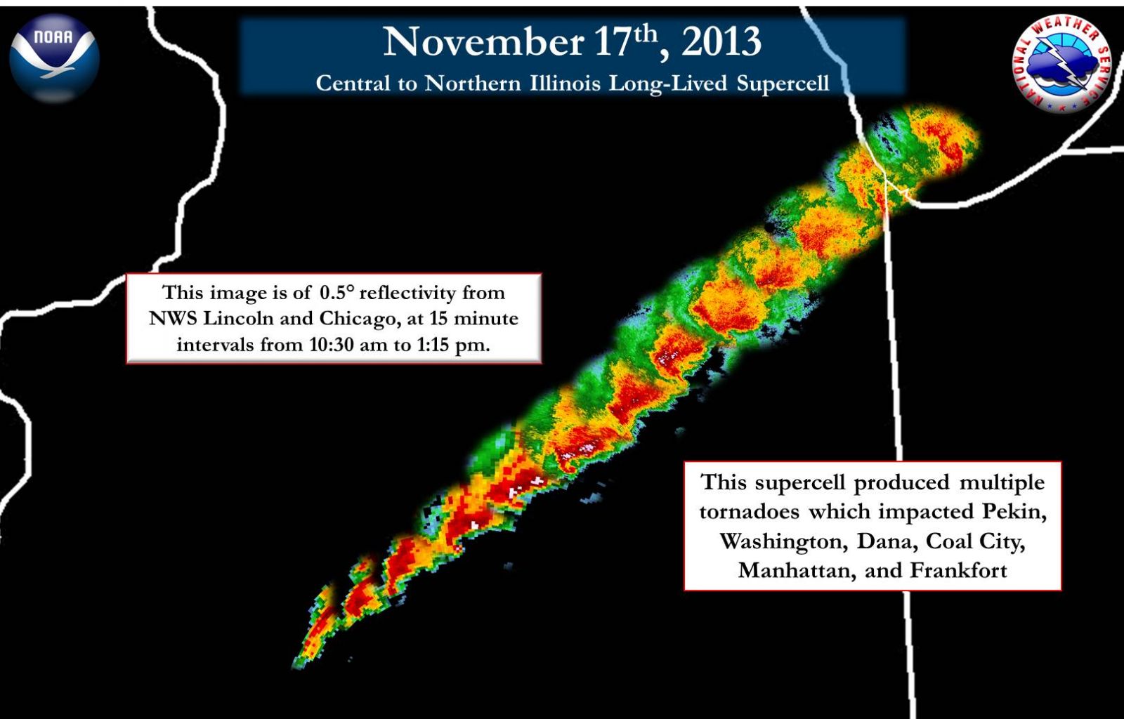 |
This image, courtesy of the NWS office in Chicago, shows the sequence of radar echoes associated with the supercell that produced the EF-4 tornado in Washington. The images were taken every 15 minutes between 10:30 am, when it was still southwest of Peoria, and 1:15 pm, when the storm had moved onto Lake Michigan. Additional tornadoes were produced in northeast Illinois from this supercell. |
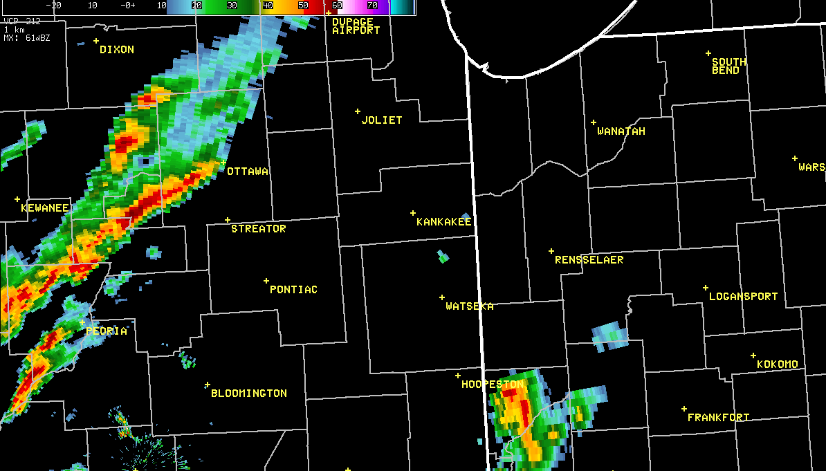 |
This is a sequence of radar images for the supercell that produced the long-track tornado, beginning at 10:30 am and ending at 2 pm. The persistent hook echo (counter-clockwise curl along the bottom edge of the storm) is visible for an extended period of time. |
 |
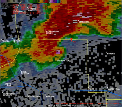
These images were taken at 11:07 am, and are reflecting what is referred to as a Tornado Debris Signature. By this time, the tornado had passed through Washington. The pinkish shades located within the hook echo (located northeast of Washington in the top left image) represent a "debris ball". The radar is showing significantly higher intensities, due to the radar beam reflecting off of debris that is present aloft. The other images are part of the dual-polarization upgrade that was performed on the radar in the fall of 2012. The top right image is called "differential reflectivity" (ZDR), and is a ratio of the reflected horizontal and vertical parts of the radar beam. The lower right image is called "correlation coefficient" (CC), and is a measure of how the horizonal and vertical pulses of the radar beam are behaving. Low values of CC are an indication of non-precipitation targets detected by the radar beam. The low values of ZDR and CC (blue shades) within the yellow circles, which line up with the sigificantly high values of the standard reflectivity, help the radar operator be certain that a tornado is occurring. |
 |
A larger image of the top left quadrant of the previous picture, showing the debris ball northeast of Washington (white and pink shades). |
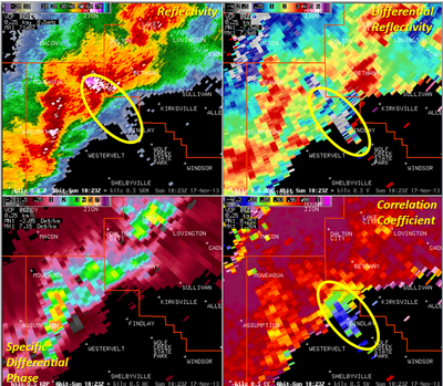 |
This is an example of a "three-body scatter spike" (TBSS), on a severe thunderstorm that was moving across northern Shelby County. The radar is located to the northwest on the image, so it was pointing southeast. A weak echo is shown extending southeast from the storm (yellow oval). Dual-polarization data (differential reflectivity, top right, and correlation coefficient, bottom right) also show this signature. A TBSS is indicative of very large hail in a storm. Several minutes before this radar image was taken, the storm produced baseball size hail as it moved through Assumption. |

