Central Illinois
Weather Forecast Office
Tornado #10: Westville Tornado (Vermilion County)
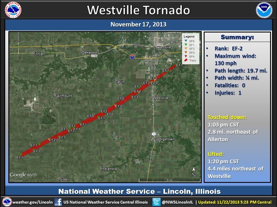
Summary:
|
Survey Results:
This tornado touched down in an open field 2.8 miles northeast of Allerton at 1:03 PM CST. The tornado tracked to the northeast for about 15 miles and did major damage to 2 homes, roof damage to 4 other homes, and destroyed 9 outbuildings, 4 garages, and 2 grain bins. Numerous trees and power poles were also snapped. The tornado crossed State Route 1 about 2 miles north of Westville, impacting the villages of Belgium and Hegeler where 1 person was injured. Nine homes sustained major damage, 26 had significant roof damage, and more than 100 had minor roof damage. The tornado also damaged more than 50 mobile homes, numerous garages and vehicles, and destroyed about 25 outbuildings. The tornado crossed the Vermilion River and moved through about a mile of forested area before dissipating 4.4 miles northeast of Westville and 3 miles west of the Indiana border. Total damage was estimated at $9.5 million.
Event Links: Overview | Pekin | Washington | Pana | Altamont | West Liberty
Garrett | Gifford | Villa Grove | Tuscola | Westville | Radar
US Dept of Commerce
National Oceanic and Atmospheric Administration
National Weather Service
Central Illinois
1362 State Route 10
Lincoln, IL 62656
217-732-7321 (forecast recording) or 217-732-3089
Comments? Questions? Please Contact Us.

