Tornado #7: Gifford Tornado (Champaign and Vermilion Counties)
Summary:
|
Survey Results:
A tornado touched down in an open field about 1 mile southeast of Thomasboro at 12:45 PM CST and rapidly moved to the northeast. In less than a minute it increased in intensity, causing damage to 3 nearby farms and pushing 2 farm houses off their foundations. The tornado moved through open fields for about 2 miles at which time it widened to nearly 1/4 mile wide and became wrapped in rain. It destroyed 3 homes, several outbuildings, and damaged a few other homes before it moved into the town of Gifford. The rain-wrapped tornado was about 1/2 mile wide when it moved through the center of Gifford. Nearly 30 homes were destroyed, more than 40 suffered major damage, and around 125 had minor damage. Around 15 businesses sustained moderate to major damage and the roof of a school was peeled back. Hundreds of vehicles were damaged or destroyed. The tornado tracked for another 5 miles to the northeast, destroying 3 homes and numerous outbuildings, damaging several other homes, and snapping many trees and power poles. Six people were injured in Champaign County, with damage estimated around $60 million.
The tornado then crossed into Vermilion County about 3 miles north-northeast of Penfield at 1:00 PM CST, tracking northeastward across rural northwest Vermilion County. The tornado destroyed 1 home, 20 outbuildings, and a camper. It also damaged 7 other homes and snapped numerous power poles and trees. The tornado weakened as it moved out of Vermilion County into Iroquois County about 3.7 miles west-northwest of Hoopeston at 1:14PM CST. Damage in the Vermilion County portion of the track was around $2.5 million.
Radar images:
 |
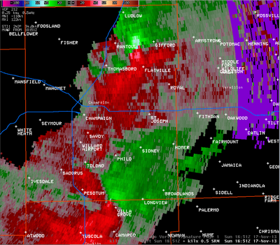
This radar image, from 12:51 pm, shows the wind motion within the storms. In this one, two strong circulations are displayed, as the bright green and bright red shades next to each other. The northern one, between Rantoul and Gifford, was associated with the EF-3 tornado in that area. The southern one, along the Champaign/Douglas county line northwest of Villa Grove, was also caused by an EF-3 tornado. |
 |
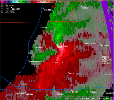
This radar picture from 12:56 pm showed the tornado as it was moving through Gifford. |
 |
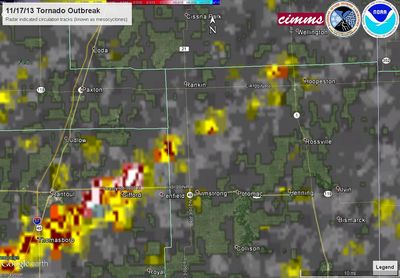
This image, from the National Severe Storms Laboratory, is a composite of radar rotations associated with this particular severe thunderstorm. |
Photos (click images to enlarge):
Event Links: Overview | Pekin | Washington | Pana | Altamont | West Liberty
Garrett | Gifford | Villa Grove | Tuscola | Westville | Radar