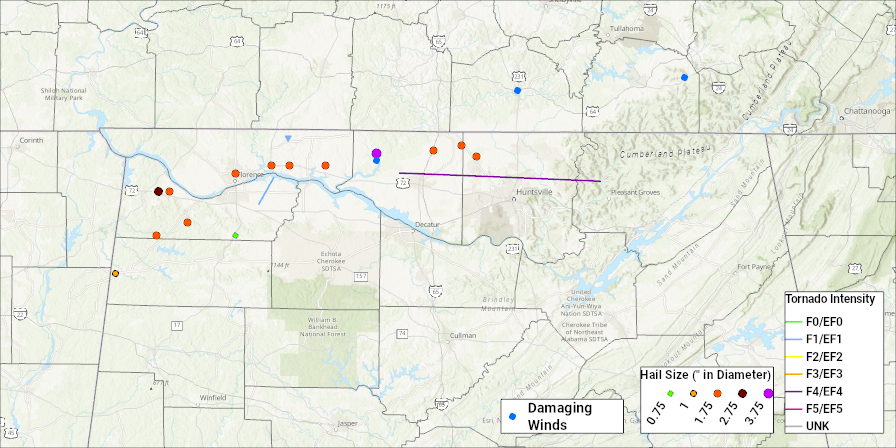
| At the surface, a strong area of low pressure was centered over the mid-Mississippi River Valley on the morning of the 18th. A stationary front extended from the low into the Ohio Valley. A strong cold front trailed from the low in Missouri southward into Eastern Texas and into the Rio Grande Valley. Ahead of the cold front, winds were south to southwest, advecting warm, moist Gulf of America moisture into the southeastern states. Throughout the day, the strong area of low pressure advanced along the Ohio River to near the tri-state region of Illinois, Indiana, and Kentucky by early evening. The cold front continued to advance east and was positioned from near Paducah, Kentucky to near Memphis, Tennessee to Monroe, Louisiana to near Lake Charles, LA by early evening. Strong southwest flow continued ahead of the front, pumping moisture into the Tennessee Valley region. Birmingham Sounding 5-19-95 0ZAloft, a 500mb trough axis extended along the Mississippi River Valley, with jet stream maximums noted over the northeast United States and from Arizona eastward into Texas. A strong 500mb vorticity maximum passed north of the Tennessee Valley during the day. Also, strong instability was noted across the region. Evening analyses indicated Lifted indices of as low as -8, Total Totals indices around 53, Sweat indices in the 300s, and helicities between 300 and 500. The evening sounding at Birmingham (see image at right) indicated strong low-level shear, dry air in the mid levels of the atmosphere, and impressive instability.A relatively strong upper level system moved from the Central Plains and into the Mid Mississippi Valley during the morning and afternoon of March 19, 2018. At the surface, low pressure lifted out of Texas and into the Mid South region during the day, trailing a cold front eastward and bringing a warm front northward through the Tennessee Valley. As this warm front lifted north of the Tennessee Valley during the early afternoon, the atmosphere quickly destabilized despite early morning cloud cover and rainfall. Due to the increased instability and the eastward progression of the upper trough, scattered thunderstorms developed during the early afternoon and moved eastward across the Tennessee Valley, producing several reports of up to quarter size hail. The atmosphere continued to destabilize trough the afternoon as a strong low level jet moved into the region ahead of the upper level trough. Observed soundings south of the area showed CAPE values as high as 3000 j/kg in areas that received the most sunshine during the day. Meanwhile, the northeastward movement of the surface low and the low level jet helped to increase the vertical wind shear across the area. The combination of these ingredients, aided by strong lift associated with the approaching cold front, primed the Tennessee Valley for significant severe thunderstorms during the late afternoon and early evening hours. A PDS (Particularly Dangerous Situation) watch was issued by 3:30 pm prior to arrival of the thunderstorms. This was the first PDS watch issued for the area since early 2014. The first warning was issued by 4:48 pm and over the next 6 hours additional tornado warnings were issued. A total of 11 tornadoes touched down in the Tennessee Valley and the storms produced several instances of hail to the size of softballs. |
|
|
