HOME
FORECAST
Local
Graphical
Aviation
Marine
Rivers and Lakes
Hurricanes
Severe Weather
Fire Weather
Sunrise/Sunset
Long Range Forecasts
Climate Prediction
Space Weather
PAST WEATHER
Past Weather
Astronomical Data
Certified Weather Data
SAFETY
INFORMATION
Wireless Emergency Alerts
Brochures
Weather-Ready Nation
Cooperative Observers
Daily Briefing
Damage/Fatality/Injury Statistics
Forecast Models
GIS Data Portal
NOAA Weather Radio
Publications
SKYWARN Storm Spotters
StormReady
TsunamiReady
Service Change Notices
EDUCATION
NEWS
SEARCH
Search For
NWS
All NOAA
ABOUT
About NWS
Organization
For NWS Employees
National Centers
Careers
Contact Us
Glossary
Social Media
NWS Transformation
Local forecast by
"City, St" or ZIP code
Sorry, the location you searched for was not found. Please try another search.
Multiple locations were found. Please select one of the following:
Location Help
News Headlines
January 24th - February 1st: Winter Weather/Bitter Cold
Drought Conditions Persist Across Most of the Area - See Our Latest Drought Information Statement
Customize Your
Weather.gov
Enter Your City, ST or ZIP Code
Remember Me
LOADING...
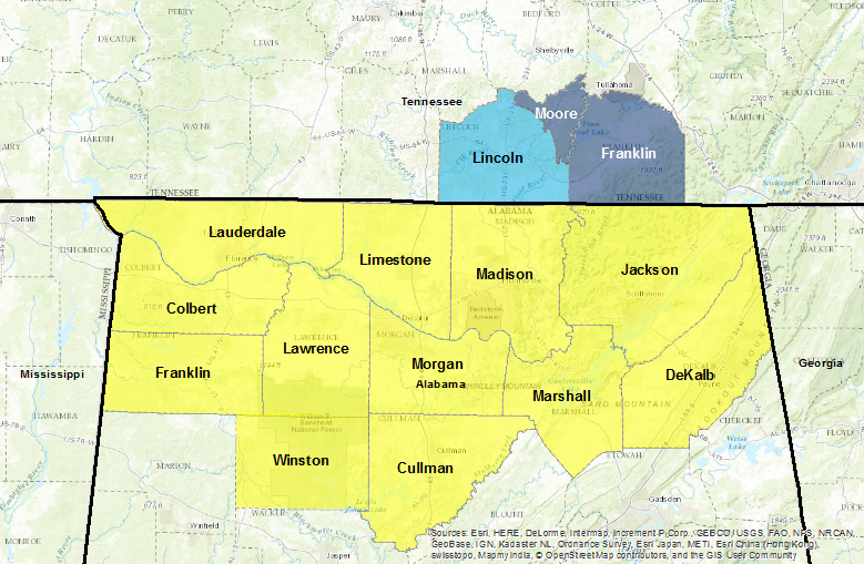
Huntsville, AL
Weather Forecast Office
Fire Weather
Weather.gov
>
Huntsville, AL
> Fire Weather
Current Hazards
Graphical Hazardous Weather Outlook
Submit a Storm Report
Outlooks
Current Conditions
Observed Precipitation
Satellite
Surface Observations
Local Satellite
Radar
Local Enhanced Radar
Local Standard Radar (low bandwidth)
Regional/National Standard Radar (low bandwidth)
Forecasts
Probabilistic Precipitation
Forecaster's Discussion
Fire
Hourly View
Aviation
Tropical
Local Graphical Forecast
Air Quality
Rivers and Lakes
*New* National Water Prediction Service (NWPS)
*New* NWPS - Local View
Latest River Forecast Information
Climate and Past Weather
Climate Prediction
Drought
Other Local Climate Information
Huntsville Normals and Extremes
Muscle Shoals Normals and Extremes
Historical Weather Events
Local Programs
Activity Planner Tool
Recent Storm Reports
Volunteer Observing Programs
Safety Information
Contact Us
StormReady Program
Office Research
Area Tornado History
A Tribute to H.D. Bagley
Storm Reports Database
Temp/Precip Data
Real-Time Obs. Monitor/Analysis Network
CoCoRAHS Precip -
Alabama
CoCoRAHS Precip - Tennessee
AHPS Rainfall Estimate Maps
Drought Tools
Drought Monitor
30 Day Temp &
Precip Outlook
30-90 Day Temp &
Precip Outlook
8-14 Day Temp &
Precip Outlook
Other Links of Interest
Alabama Forestry
Commission
Alabama National
Forests (USFS)
Little River Canyon (NPS)
Wheeler Refuge (U.S. Fish/Wildlife Service)
Other Fire Wx Tools
Fuel Moisture and Other Information
Click On The Map Below for Fire Weather Forecasts from Various NWS Offices
NWS Huntsville Spot Request Feedback Link
Some Current Hourly Forecast Data For Specific Locations (Mousover Tabs to Change Location)
Muscle Shoals-AL
Huntsville-AL
Atlanta-GA
Nashville-TN
Bankhead Forest (Near Hagood Creek)
Back to Main Huntsville Weather Forecast Office Page
Local Radar
Weather Map
NWS Huntsville SitRep
Follow us on X
Follow us on Facebook
Follow us on YouTube
HUN RSS Feed


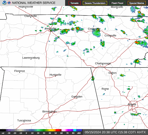

 Local Radar
 Weather Map