- Putting it all together -
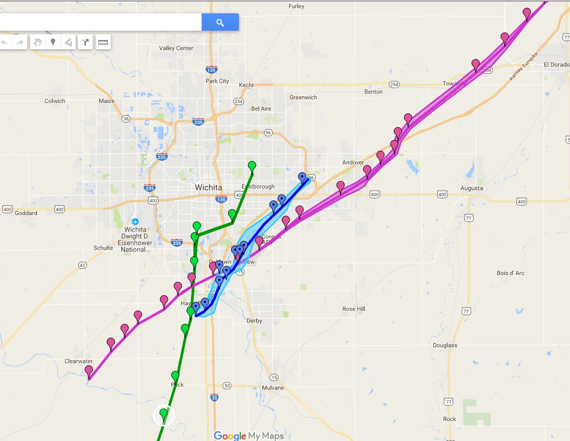
3 Tornados impact Wichita and surrounding areas in 21 years
This map shows the track of the 3 major tornadoes to impact the Wichita area in the past 21 years. The Andover 1991 tornado track is in purple. The Haysville 1999 tornado track is in green. The Wichita 2012 tornado track is in blue.
Additional Interesting Pictures
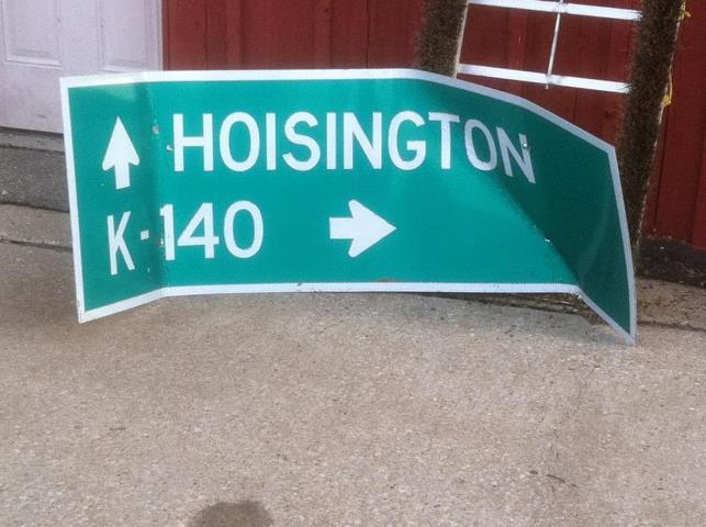
The sign originated 3 miles SSE of Kanopolis Lake and was recovered at the Salina Municipal golf course after it was picked up by the tornado. It traveled a distance of around 27 miles!
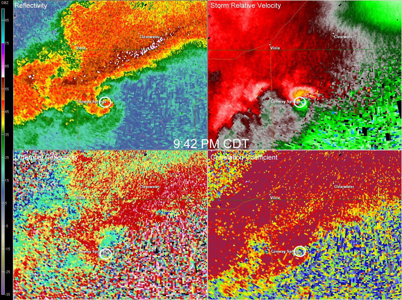
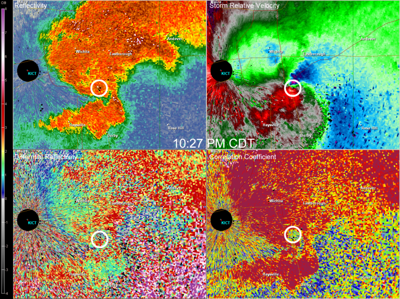
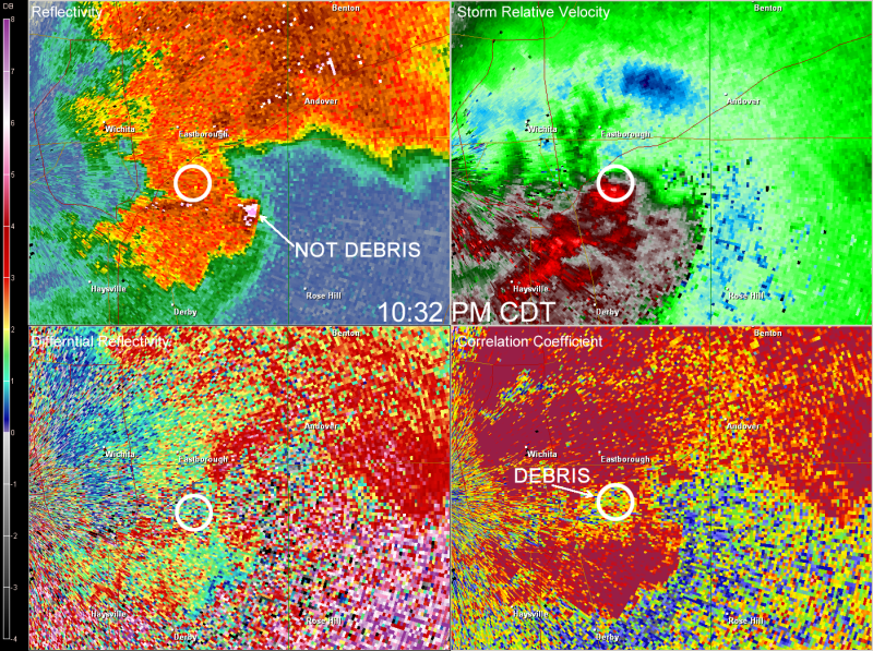
Dual-Pol Images showing the tornadic debris
Dual Pol radar image valid at 0242Z showing a debris signature east of Conway Springs. Image courtesy of Paul Schlatter
Dual Pol radar image valid at 0327Z showing a debris signature in southeast Wichita. Image courtesy of Paul Schlatter
Dual Pol radar image valid at 0331Z showing a debris signature in southeast Wichita. This signature in the bottom right image is not co-located with the high reflectivity that could be mis-interpreted as a "debris ball". Image courtesy of Paul Schlatter
Video courtesy of Evan Ammeson. Description of video: Following a large and violent tornado driving north on 26th Rd near the Rice, Ellsworth County line, just south of Route 4 on April 14th 2012. This was about 30 miles southwest of Salina and 40 miles ENE of Great Bend. We were blocked by the damage path before reaching Route 4. We then went back south on 26th Rd, west on Ave B, then north on 25th. The video runs from 5:48 to 5:58 PM CT. This tornado has been given a preliminary rating of EF4.
Video Courtesy of Evan Ammeson.Description of video: Tornado footage from just east of Salina, KS while driving east on I-70 on April 14th 2012. This was from the same supercell which produced the Rice/Ellsworth County EF4 tornado. The video runs from 7:06-7:23 PM CDT.
Video courtesy of Erik Perozo. Description of video: Tornado I captured as it crossed just east of Hwy 14 near Geneseo. It caused EF4 Damage along Kanopolis Lake near the town of Kanopolis..
Video courtesy of Winston Wells. Description of video: Video shot near the intersection of K-4 and K 175 between 6:15 and 6:20 pm
Video courtesy of Douglas Watson. Description of video: Tornado filmed southeast of Kanopolis Lake.
Video courtesy of Douglas Watson. Description of video: Tornado filmed southeast of Kanopolis Lake.
Tornado as it moved into Wichita (EF 3)
Video courtesy of Brandon Ivey. Description of Video: A large tornado moves through southeast Wichita around 10:30PM on April 14th, 2012.
.
McPherson - Marion Tornado (EF 1)
Video courtesy of Mikey Gribble. Description of Video: Mikey Gribble's storm chasing footage from April 14, 2012 tornado outbreak. This was a tornado that tracked from Hesston to Goessel in Kansas
Video courtesy of Robb Lawson. Description of Video: This video was shot around 8 pm south of Moundridge looking off to the northeast.
Video from The Weather Channel from inside the NWS Wichita