Why NWS Wichita Took Shelter and Requested Service Back-up
the Evening of April 14, 2012
by: Kevin Darmofal
NWS Wichita Lead Meteorologist
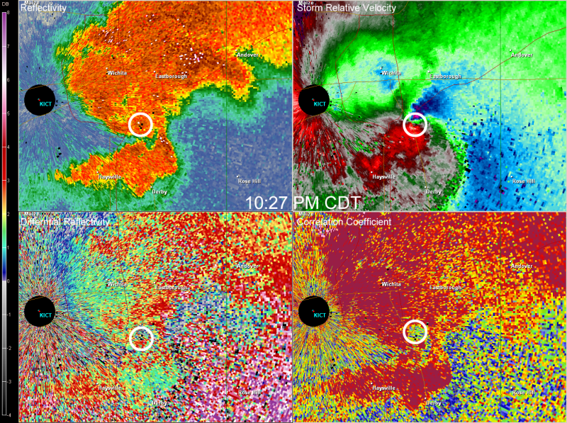
A tornadic, cyclic supercell storm moved across the south and east portions of the Wichita metropolitan area on Saturday evening, April 14th, 2012. The tornado did EF3 damage in southeast Wichita, including severe damage to a mobile home park, Spirit Aerosystems and many other homes and businesses in the area. While this tornado from the parent cyclic supercell narrowly missed Wichita's Mid-Continent airport and the National Weather Service office (approximately 6 miles at its nearest point), it was close enough that safety precautions were taken at both facilities that evening.
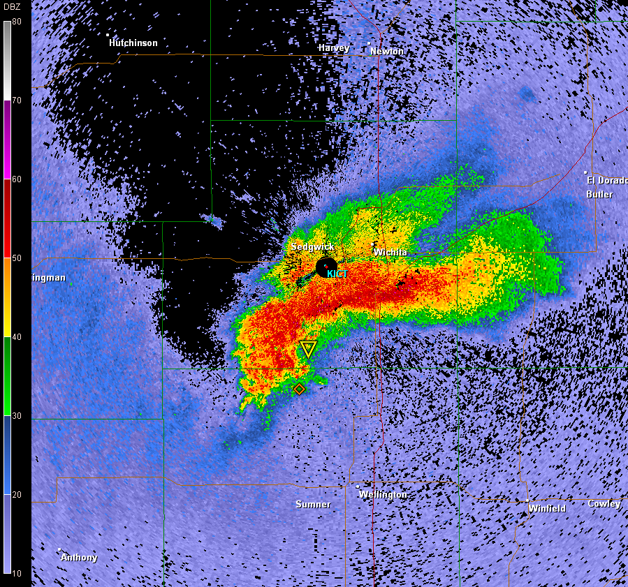
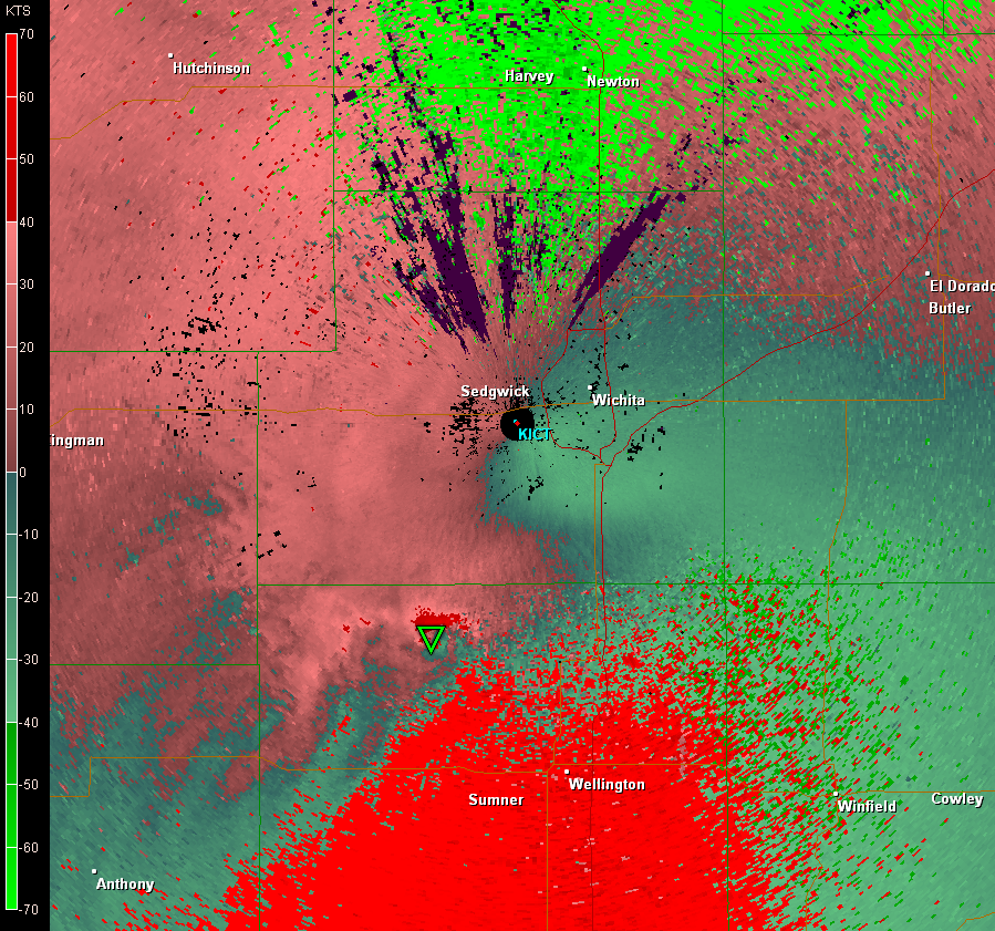
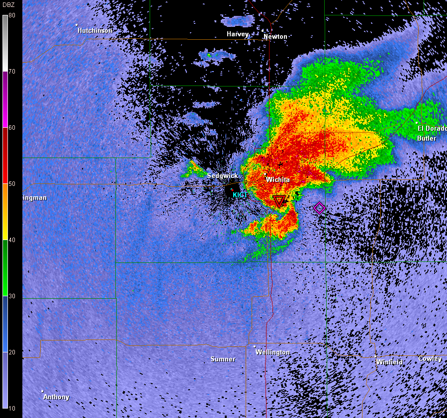
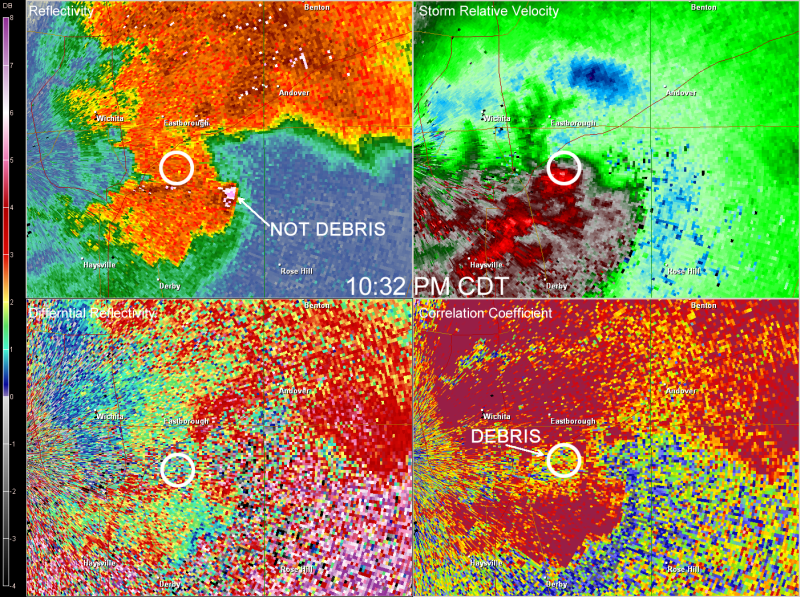
The radar images below show the progression of the tornadic supercell as it moved northeast across the southern and eastern portion of the metro area. As the storm approached, strong inflow winds from the south were felt at the NWS office in the hour or so before it moved into Wichita. Winds steadily increased with gusts rising from the 30-40 mph range to above 50 mph from around 9 pm to just after 10 pm. The tornadic supercell began to go through one of its many occlusion processes as it approached Haysville and south Wichita just after 10 pm, with the old tornadic circulation/mesocyclone lifting more northerly toward and passing just southeast of the Mid-Continent airport. Meanwhile the new tornadic circulation developed a few miles to the east, which severely impacted southeast Wichita with EF3 damage. Seeing this occlusion process taking place and still some potential for a tornado, or at the very least strong damaging winds moving toward the airport and NWS office, the decision was made to request service back-up from Topeka to assume the warning and forecast function at about 10 pm. Meanwhile, a similar such decision was made by the FAA Control Tower personnel at the Mid-Continent airport, by abandoning the tower (which stands about 90 feet in the air).
The decisions made by the FAA and NWS were not only precautionary for safety, but in the case of the NWS, ensured that an uninterrupted and seamless flow of pertinent storm warning and safety information continued to reach the public, media, and other public safety officials. In fact, the apparent meso-scale circulation of the supercell storm did affect the Mid-Continent airport and NWS office (which is located on the far west side of the airport grounds). The strong south inflow winds ahead of the storm, quickly backed to the east and increased, exceeding severe thunderstorm criteria (62 mph around 1015 pm). This was followed by even stronger winds around the periphery of the meso-circulation, reaching well above hurricane force (84 mph) from the west around 1025 mph. The force of these winds resulted in minor wind damage in and around the airport grounds. The NWS staff continued to monitor radar from the safe room at the office by using a laptop and personal smartphones. It was deemed safe to assume warning responsibility again by 1030 pm, as the tornado continued to move northeast and ravage parts of east Wichita.
The series of radar images below, including GR-analyst archives and dual pole data, are accompanied by wind measurements as reported by the KICT ASOS, located at mid-field of the Mid-Continent airport, which is about 1 mile southeast of the NWS office. Due to slight differences in location and also how the ASOS reports time of wind measurements, the strongest winds observed by the staff at the NWS office generally occurred several minutes before they were reported by ASOS.
 |
 |
 |
| Radar Time: 0246Z | Radar Time: 0300Z | Radar Time: 0315Z |
| KICT 0237Z, 17035G46KTS | KICT 0253Z, 17035G49KTS | KICT 0316Z, 15023G53KTS |
 |
 |
 |
 |
 |
 |
| Radar Time: 0326Z | Radar Time: 0331Z | Radar Time: 0345Z |
| KICT 0326Z, 07024G40KTS | KICT PKWND 27073/0329 (occurred at office several mins earlier). | KICT 0342Z, 20017G30KT |
 |
 |
 |
Below are surface observations from the KICT ASOS within an hour or so either side of the passing supercell and tornado. Of special note, the remarks section of the actual transmitted observations, which documented the abandoning of the tower and also the observance of the actual tornado as it moved into southeast Wichita.
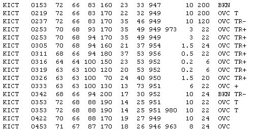
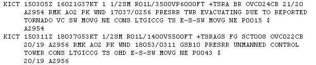

Photo showing the NWS Wichita operations area empty as the employees took shelter.

Contingencies for providing service back-up are part of every NWS office's pre-planinng for instances such as that which arose on the evening of April 14th, 2012. The Wichita National Weather Service office appreciated the quick and excellent service that the Topeka office provided Wichitan's and the surrounding area during those 30 minutes or so when the tornadic storm was dangerously close to the Wichita office. There is no doubt that heeding warnings and taking shelter saved lives that evening, and the Wichita office led by example, while still ensuring the mission of the NWS was carried out to save lives as well.

