|
| High Water Situations |
| To help the local community in times of high water, the National Weather Service is spreading the word about Turn Around Don't DrownTM. |
|
|
 |
Turn Around Don't DrownTM (Albion, Arkansas) |
 |
| |
|
|
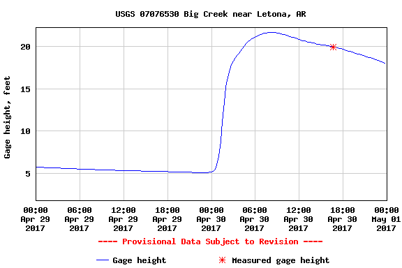
| In the picture: The Big Creek climbed more than 15 feet (from 5 feet to almost 22 feet) early on 04/30/2017. The hydrograph is courtesy of the United States Geological Survey (USGS). |
|
| |
|
There are a lot of flashy creeks and streams in Arkansas. When heavy to excessive rain occurs, these small tributaries can rise very quickly and flow across roads. This can be very dangerous, especially in the middle of the night when flash flooding is not as obvious. On April 29th in 2017, central sections of the state received more than six inches of precipitation in places. The Big Creek near Albion (White County) came up more than 15 feet between midnight and 500 am CDT. The flow rate went from a trickle (174 cubic feet per second) to a torrent of water (peaking at 12,900 cubic feet per second). This threatened people driving along an otherwise quiet stretch of Albion Road.
|
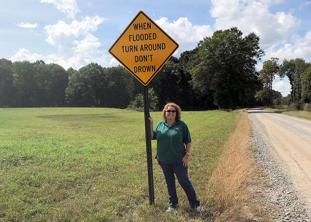 |
| In the picture: White County Emergency Manager Tamara Jenkins stands next to a Turn Around Don't DrownTM sign near Big Creek along Albion Road just east of Albion (White County) in early October, 2018. |
|
| |
|
Events like this remind us of how quickly things can change, and to be aware of flood prone areas following torrential downpours. To help bring attention to the hazards associated with flooding, Turn Around, Don’t DrownTM signs were dedicated to White County by the National Weather Service in Little Rock..
|
|
|
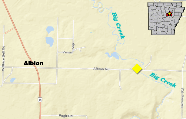
| In the picture: Map of Albion Road and where it meets Big Creek just east of Albion (White County). High water sign placement is in yellow. |
|
| |
|
Each year, more deaths occur due to flooding than from any other thunderstorm related event. Why? People tend to underestimate the power of moving water. More than half of all flood related fatalities occur in automobiles that are swept downstream.
|
 |
Whether you are driving or walking, if you come to a flooded road, TURN AROUND DON'T DROWN. |
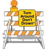
| In the picture: Barriers are there for a reason. Don't ignore the barriers! |
|
Turn Around Don't DrownTM (or TADD) is a National Weather Service campaign to warn people of the hazards of walking or driving a vehicle through flood waters. Several counties are adopting TADD signs and posting them at locations where flash flooding often leads to water over the roads.
These TADD Warning Signs are compliant with the Federal Highway Administration's regulations and can be produced and deployed as an official road sign. If your community would like more information on purchasing these signs, contact the Senior Service Hydrologist at the NWS Little Rock office. Civic groups may consider donating or raising money to give to their local community officials for purchase of these TADD signs.
|
|
|