HOME
FORECAST
Local
Graphical
Aviation
Marine
Rivers and Lakes
Hurricanes
Severe Weather
Fire Weather
Sunrise/Sunset
Long Range Forecasts
Climate Prediction
Space Weather
PAST WEATHER
Past Weather
Astronomical Data
Certified Weather Data
SAFETY
INFORMATION
Wireless Emergency Alerts
Weather-Ready Nation
Brochures
Cooperative Observers
Daily Briefing
Damage/Fatality/Injury Statistics
Forecast Models
GIS Data Portal
NOAA Weather Radio
Publications
SKYWARN Storm Spotters
StormReady
TsunamiReady
Service Change Notices
EDUCATION
NEWS
SEARCH
Search For
NWS
All NOAA
ABOUT
About NWS
Organization
For NWS Employees
National Centers
Careers
Contact Us
Glossary
Social Media
NWS Transformation
Local forecast by
"City, St" or ZIP code
Sorry, the location you searched for was not found. Please try another search.
Multiple locations were found. Please select one of the following:
Location Help
News Headlines
2026 Rain Gauge Rally: Click to Learn More About CoCoRaHS
Drought Conditions Across Arkansas
Storms of 2026 in Arkansas
Other Local News
Customize Your
Weather.gov
Enter Your City, ST or ZIP Code
Remember Me
LOADING...
Little Rock, AR
Weather Forecast Office
NWS Little Rock, AR - Decision Support Page
Weather.gov
>
Little Rock, AR
> NWS Little Rock, AR - Decision Support Page
Current Hazards
Submit a Storm Report
Weather Briefing
Outlooks
Local Hazards
NOAA Weather Radio
Get Prepared/Skywarn
Road Conditions
Experimental Graphical Hazardous Weather Outlook
Current Conditions
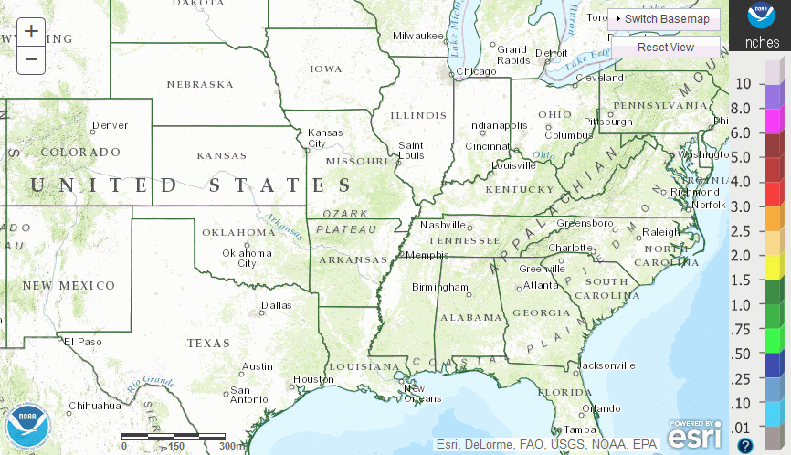
Satellite
Observed Precipitation
Surface Observations
Arkansas Precipitation Plot
Local Observations Page
Air Quality
Radar
Local Standard Radar (low bandwidth)
Local Enhanced Radar
Regional Standard Radar (low bandwidth)
Radar Links
Forecasts
Probabilistic Precipitation
Forecaster's Discussion
Fire
Hourly View
Local Forecast Page
Graphical Forecast
Aviation
Travel
Tropical
Winter Weather
Rivers and Lakes
*New* National Water Prediction Service (NWPS)
*New* NWPS - Local View
Rivers and Lakes
Local Hydrology Page
Climate and Past Weather
Climate Prediction
Drought
Storm Reports/Storm Data
Historic Events
Local Climate Page
Tropical Cyclone Reports
Local Programs
Local Links
Decision Support
This page is designed for the Arkansas Emergency Management community as a one stop shop for pertinent weather information.
Hazardous Weather in Arkansas
Checking for Hazards. Please wait...
Follow The National Weather Service (NWS)
Stay in Touch with Us
Facebook:
Little Rock
|
Tulsa
|
Shreveport
|
Memphis
|
Jackson
X:
Little Rock
|
Tulsa
|
Shreveport
|
Memphis
|
Jackson
Quick Forecast
Click a location below for detailed forecast.
Point Forecasts
Pick a City
Type a City, St or Zip Code
Pick a City
Alma (Crawford Co.)
Arkadelphia (Clark Co.)
Arkansas City (Desha Co.)
Ash Flat (Sharp Co.)
Ashdown (Little River Co.)
Atkins (Pope Co.)
Augusta (Woodruff Co.)
Bald Knob (White Co.)
Barling (Sebastian Co.)
Batesville (Independence Co.)
Bay (Craighead Co.)
Bearden (Ouachita Co.)
Beebe (White Co.)
Benton (Saline Co.)
Bentonville (Benton Co.)
Berryville (Carroll Co.)
Blytheville (Mississippi Co.)
Bono (Craighead Co.)
Booneville (Logan Co.)
Brinkley (Monroe Co.)
Bryant (Saline Co.)
Bull Shoals (Marion Co.)
Cabot (Lonoke Co.)
Camden (Ouachita Co.)
Caraway (Craighead Co.)
Carlisle (Lonoke Co.)
Cave City (Sharp Co.)
Charleston (Franklin Co.)
Clarendon (Monroe Co.)
Clarksville (Johnson Co.)
Clinton (Van Buren Co.)
Conway (Faulkner Co.)
Corning (Clay Co.)
Cotton Plant (Woodruff Co.)
Crossett (Ashley Co.)
Danville (Yell Co.)
Dardanelle (Yell Co.)
Dermott (Chicot Co.)
Des Arc (Prairie Co.)
Dierks (Howard Co.)
Dover (Pope Co.)
Dumas (Desha Co.)
Earle (Crittenden Co.)
El Dorado (Union Co.)
England (Lonoke Co.)
Eudora (Chicot Co.)
Eureka Springs (Carroll Co.)
Fairfield Bay (Van Buren Co.)
Farmington (Washington Co.)
Fayetteville (Washington Co.)
Flippin (Marion Co.)
Fordyce (Dallas Co.)
Foreman (Little River Co.)
Forrest City (St. Francis Co.)
Fort Smith (Sebastian Co.)
Gassville (Baxter Co.)
Gentry (Benton Co.)
Glenwood (Pike Co.)
Gosnell (Mississippi Co.)
Gould (Lincoln Co.)
Gravette (Benton Co.)
Greenbrier (Faulkner Co.)
Green Forest (Carroll Co.)
Greenwood (Sebastian Co.)
Gurdon (Clark Co.)
Hamburg (Ashley Co.)
Hampton (Calhoun Co.)
Hardy (Sharp Co.)
Harrisburg (Poinsett Co.)
Harrison (Boone Co.)
Haskell (Saline Co.)
Hazen (Prairie Co.)
Heber Springs (Cleburne Co.)
Helena (Phillips Co.)
Hope (Hempstead Co.)
Horseshoe Bend (Izard Co.)
Hot Springs (Garland Co.)
Hot Springs Village (Garland Co.)
Hoxie (Lawrence Co.)
Hughes (St. Francis Co.)
Huntsville (Madison Co.)
Jacksonville (Pulaski Co.)
Jasper (Newton Co.)
Jonesboro (Craighead Co.)
Judsonia (White Co.)
Kensett (White Co.)
Lake Village (Chicot Co.)
Lavaca (Sebastian Co.)
Lepanto (Poinsett Co.)
Lewisville (Lafayette Co.)
Little Rock (Pulaski Co.)
Lonoke (Lonoke Co.)
Lowell (Benton Co.)
Madison (St. Francis Co.)
Magnolia (Columbia Co.)
Malvern (Hot Spring Co.)
Mammoth Spring (Fulton Co.)
Manila (Mississippi Co.)
Mansfield (Sebastian Co.)
Marianna (Lee Co.)
Marion (Crittenden Co.)
Marked Tree (Poinsett Co.)
Marmaduke (Greene Co.)
Marshall (Searcy Co.)
Marvell (Phillips Co.)
Maumelle (Pulaski Co.)
Mayflower (Faulkner Co.)
McCrory (Woodruff Co.)
McGehee (Desha Co.)
Melbourne (Izard Co.)
Mena (Polk Co.)
Monette (Craighead Co.)
Monticello (Drew Co.)
Morrilton (Conway Co.)
Mount Ida (Montgomery Co.)
Mountain Home (Baxter Co.)
Mountain View (Stone Co.)
Mulberry (Crawford Co.)
Murfreesboro (Pike Co.)
Nashville (Howard Co.)
Newark (Independence Co.)
Newport (Jackson Co.)
North Little Rock (Pulaski Co.)
Ola (Yell Co.)
Osceola (Mississippi Co.)
Ozark (Franklin Co.)
Paragould (Greene Co.)
Paris (Logan Co.)
Parkin (Cross Co.)
Pea Ridge (Benton Co.)
Perryville (Perry Co.)
Piggott (Clay Co.)
Pine Bluff (Jefferson Co.)
Pocahontas (Randolph Co.)
Prairie Grove (Washington Co.)
Prescott (Nevada Co.)
Rector (Clay Co.)
Redfield (Jefferson Co.)
Rison (Cleveland Co.)
Rogers (Benton Co.)
Russellville (Pope Co.)
Salem (Fulton Co.)
Searcy (White Co.)
Sheridan (Grant Co.)
Sherwood (Pulaski Co.)
Siloam Springs (Benton Co.)
Smackover (Union Co.)
Springdale (Washington Co.)
Stamps (Lafayette Co.)
Star City (Lincoln Co.)
Stephens (Ouachita Co.)
Stuttgart (Arkansas Co.)
Texarkana (Miller Co.)
Trumann (Poinsett Co.)
Tuckerman (Jackson Co.)
Van Buren (Crawford Co.)
Vilonia (Faulkner Co.)
Waldo (Columbia Co.)
Waldron (Scott Co.)
Walnut Ridge (Lawrence Co.)
Ward (Lonoke Co.)
Warren (Bradley Co.)
West Fork (Washington Co.)
West Helena (Phillips Co.)
West Memphis (Crittenden Co.)
White Hall (Jefferson Co.)
Wickes (Polk Co.)
Wilmot (Ashley Co.)
Wrightsville (Pulaski Co.)
Wynne (Cross Co.)
Yellville (Marion Co.)
Active Hazards for Counties in Arkansas
Arkansas
Ashley
Baxter
Benton
Boone (Most)
Boone (Southwest)
Bradley
Calhoun
Carroll
Chicot
Clark
Clay
Cleburne
Cleveland
Columbia
Conway
Craighead
Crawford (North)
Crawford (South)
Crittenden
Cross
Dallas
Desha
Drew
Faulkner
Franklin (North)
Franklin (Central/South)
Fulton
Garland
Grant
Greene
Hempstead
Hot Spring
Howard
Independence
Izard
Jackson
Jefferson
Johnson (North)
Johnson (South)
Lafayette
Lawrence
Lee
Lincoln
Little River
Logan (North/West)
Logan (South/East)
Lonoke
Madison
Marion
Miller
Mississippi
Monroe
Montgomery (Central/East)
Montgomery (North)
Montgomery (Southwest)
Nevada
Newton (Most)
Newton (Northeast)
Ouachita
Perry
Phillips
Pike
Poinsett
Polk (Central/Southwest)
Polk (North)
Polk (Southeast)
Pope (North)
Pope (South)
Prairie
Pulaski
Randolph
Saline
Scott (North)
Scott (Central/South)
Searcy (Far Northwest)
Searcy (Northwest)
Searcy (South/East)
Sebastian (North/Central)
Sebastian (South)
Sevier
Sharp
St. Francis
Stone
Union
Van Buren (North/West)
Van Buren (South/East)
Washington
White
Woodruff
Yell (Most)
Yell (Northwest)
Note:
For help locating parts of counties in the list above, click
here
.
Current Conditions in Arkansas
|
Rainfall Reports
River Forecast (Much of Arkansas)
Weather Maps
Today's Weather Map
(
Enlarge
) |
Tomorrow's Weather Map
(
Enlarge
)
Step Through Weather Maps
Maps Every 6 to 12 Hours
U.S. Temperatures
Latest Hourly Temperatures
Radar Data
National Mosaic (Small)
|
National Mosaic (Large)
|
Regional Mosaic
Little Rock
Fort Smith
Springfield
Memphis
Shreveport
Jackson
Severe Weather
Day 1 Severe Outlook (National)
|
Arkansas Only
Help with Severe Weather Categories
Day 2 Severe Outlook (National)
|
Arkansas Only
Help with Severe Weather Categories
Current Severe Weather Watches (National)
Latest Storm Reports (National)
Long Term Severe Weather Outlooks
Day 3
|
Day 3 (Arkansas Only)
|
Days 4-8
Storm Reports from Offices Serving Arkansas
Local Storm Reports (Today)
|
Local Storm Reports (Yesterday)
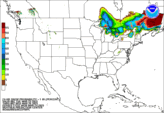
Heavy Rain/Flooding
Day 1 Precipitation Forecast (National)
|
GIS Format
Excessive Amounts?
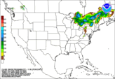
Day 2 Precipitation Forecast (National)
|
GIS Format
Excessive Amounts?
Regional 24 Hour Rain
|
Rain Last 7 Days
(click "Precipitation Estimate" for rainfall legend)
River/Lake Information
Significant River Flooding (National)
Long Term Precipitation Forecasts
Days 1-3
|
Days 4-5
|
Days 6-7
|
Days 1-5
|
Days 1-7
Significant River Flooding in Arkansas
Arkansas/Red River Basins
|
Black/White/Ouachita River Basins
Rivers at a Glance
Little Rock Hydrologic Area Hydrographs
Little Rock Hydrologic Area River Monitor
(colorized chart showing expected levels on area tributaries)
Monitor Streamflow
(25th to 75th percentile is normal)
Winter Weather
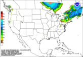
% Chance of >= 1" of Snow (Next 24 Hours)
% Chance of >= 2" of Snow (Next 48 Hours)
% Chance of >= 2" of Snow (Next 72 Hours)
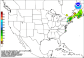
% Chance of >= .01" of Frz Rain (Next 24 Hours)
% Chance of >= .10" of Frz Rain (Next 48 Hours)
% Chance of >= .10" of Frz Rain (Next 72 Hours)
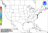
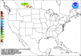
Snow/Ice Probabilities (Slight/Moderate/High)
>= 4" of Snow (00-24 Hours)
|
>= 4" of Snow (24-48 Hours)
>= 8" of Snow (00-24 Hours)
|
>= 8" of Snow (24-48 Hours)
>= .25" of Ice (00-24 Hours)
|
>= .25" of Ice (24-48 Hours)
Forecast Snow/Ice and IDriveArkansas Links
Expected Snow Accumulations
|
Expected Ice Accruals
What is on the Road?
(examples: clear, slush, ice patches, ice, snow)
Note: When there are issues on the roads, click on affected routes(s) for more information (such as extent of route covered by snow/ice).
Understanding Route Conditions
(interpreting snow/ice coverage on roads)
Drought/Heat
U.S. Drought Monitor
|
Arkansas Only
U.S. Seasonal Drought Outlook
Arkansas Forestry Commission/Heat Links
Wildfire Danger
|
Burn Bans
|
Mean Heat Index Forecast
Back to Main
Back to Office Links
http://www.weather.gov/lzk/dssarkansas.htm
Follow us on X
Follow us on Facebook
Follow us on YouTube
LZK RSS Feed