 |
| High Water Situations |
| To help the local community in times of high water, the National Weather Service is spreading the word about Turn Around Don't DrownTM. |
|
|
 |
Turn Around Don't DrownTM (Pocahontas, Arkansas) |
 |
| |
 |
| In the picture: A record crest of 29.0 feet occurred along the Black River at Pocahontas (Randolph County) on 05/02/2017. |
|
| |
|
Conditions were looking very favorable for a huge rainfall event in late April, 2017. A storm system wobbled toward the region from the southern Plains, and the atmosphere contained at least double the usual moisture. Developing thunderstorms eventually wrung this moisture out as torrential downpours. On the 29th, more than a half foot of rain fell in parts of northern Arkansas and much of southern Missouri. Some locations got two months of precipitation in only a day. Area rivers and streams were on the rise.
|
|
A record crest of 29.0 feet was reached along the Black River at Pocahontas (Randolph County) on May 2nd (breaking the previous record of 28.5 feet in late April, 2011). Prior to this unprecedented rise, evacuations were ordered on the east side of town, and Highway 67 was shut down.
|
| Not Just the Black River |
|
The Current River runs out of southern Missouri into northern Arkansas, and flows into the Black River just east (upstream) of Pocahontas (Randolph County). Twenty five miles away at Doniphan, MO, the Current River crested at 33.13 feet on May 1st. This was well above the previous high mark of 26.80 feet on March 1, 1904. The flow rate was an exceptional 183,000 cubic feet per second (CFS), dwarfing the usual trickle of 2,000 to 3,000 CFS. This tremendous and historic amount of water was injected into the Black River, and was a huge contributor to the flooding that occurred locally.
|
 |
| In the picture: Pocahontas (Randolph County) and surrounding areas were inundated with water from an overflowing Black River (and failed levees along the river) on 05/03/2017. This is looking north from Walnut Ridge (Lawrence County). The photo is courtesy of Tracy Brengard (via Twitter). |
|
| |
|
On the 3rd, the river started dropping as a local levee failed in multiple spots. This led to imminent and widespread flooding in parts of Lawrence and Randolph Counties. A Flash Flood Emergency (mentioning "an extremely dangerous and life-threatening situation") was issued by the National Weather Service in Memphis, TN. Water spread out and covered thousands of acres, and caused million of dollars in damage.
|
 |
| In the picture: Some of the participants at the Turn Around, Don’t DrownTM dedication at Pocahontas (Randolph County) on 06/22/2017 included (from left) Jim Belles, Meteorologist in Charge at the National Weather Service in Memphis, TN, Steve Drillette, Meterolologist in Charge at the National Weather Service in Little Rock, AR (WFO LZK), Randolph County Judge David Jansen, Warning Coordination Meteorologist Dennis Cavanaugh from WFO LZK, Northeast Arkansas Coordinator Anthony Coy, Randolph County Emergency Manager Bo Graham, and Senior Service Hydrologist Tabitha Clarke from WFO LZK. The photo is courtesy of the Pocahontas Star Herald. |
|
| |
|
Events like this remind us of how destructive and potentially deadly flooding can be, and the crippling effects of high water (including stranded motorists, residents in homes turned into islands, etc). To help bring attention to the hazards associated with flooding, Turn Around, Don’t DrownTM signs (placed at two locations in the county) were formally dedicated to Randolph County on June 22nd.
|
|
|
| In the picture: Map of Pocahontas (Randolph County), with high water sign placement in yellow. |
|
| |
|
Each year, more deaths occur due to flooding than from any other thunderstorm related event. Why? People tend to underestimate the power of moving water. More than half of all flood related fatalities occur in automobiles that are swept downstream.
|
 |
Whether you are driving or walking, if you come to a flooded road, TURN AROUND DON'T DROWN. |
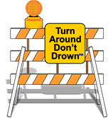
| In the picture: Barriers are there for a reason. Don't ignore the barriers! |
|
Turn Around Don't DrownTM (or TADD) is a National Weather Service campaign to warn people of the hazards of walking or driving a vehicle through flood waters. Several counties are adopting TADD signs and posting them at locations where flash flooding often leads to water over the roads.
These TADD Warning Signs are compliant with the Federal Highway Administration's regulations and can be produced and deployed as an official road sign. If your community would like more information on purchasing these signs, contact the Senior Service Hydrologist at the NWS Little Rock office. Civic groups may consider donating or raising money to give to their local community officials for purchase of these TADD signs.
|
|
|


