 |
| About This Page |
| Arkansas has had its share of historic events, many of which will be in our memories for years to come. |
|
|
 |
Massive Hail on April 2-3, 2006 |
 |
| |
|
|
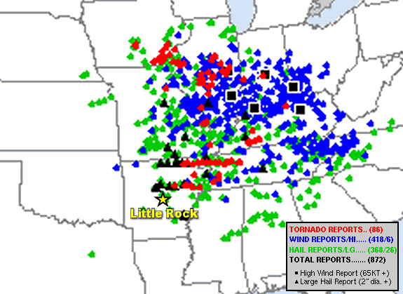
| In the picture: Severe weather reports in the twenty four hour period ending at 700 am CDT on 04/03/2006. The graphic is courtesy of the Storm Prediction Center. |
|
| |
|
A huge severe weather outbreak unfolded on April 2nd in the mid-Mississippi, Ohio, and Tennessee Valleys. More than 800 reports of tornadoes, large hail, and damaging winds were received by the National Weather Service. There were also significant severe storms in Arkansas.
|
|
|
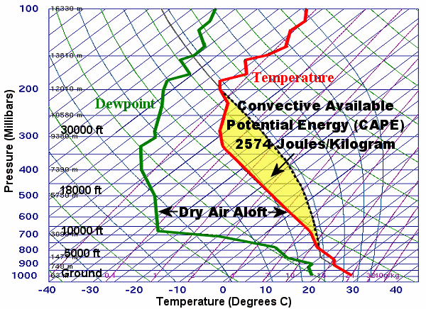
| In the picture: The sounding (temperature and dewpoint profile with height) at North Little Rock (Pulaski County) indicated a lot of instability to get storms going, and a lot of dry air aloft to support large hail at 700 pm CDT on 04/02/2006. As far as instability, it was noted that saturated parcels tracked (along a dashed line) to the right of the temperature line (in red), or stayed warmer than the surrounding environment (promoting rising air/updrafts to create storms). The amount of instability (in yellow between parcel and temperature) was measured with CAPE (Convective Available Potential Energy). Once moisture ascended into drier air aloft, cooling occurred (through evaporation) and ice (hail) formed. |
|
| |
|
While there was a lot of instability locally, moisture was lacking. Given this, storms that managed to develop were few, but they packed a wallop!
|
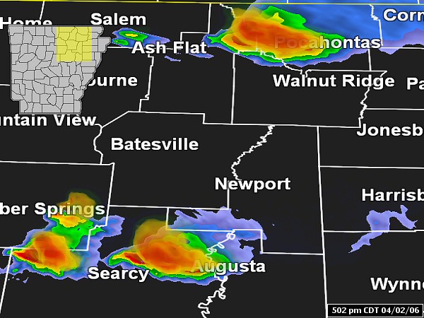 |
| In the picture: The WSR-88D (Doppler Weather Radar) showed isolated severe storms from central into northeast Arkansas at 502 pm CDT on 04/02/2006. |
|
| |
|
Storm updrafts drove moisture into very dry air aloft. This created a cooling effect, making it easy for hail to form. The updrafts suspended hailstones aloft, which allowed the stones to grow. In the end, there were several instances where hail was larger than softballs!
|
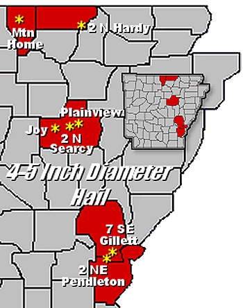 |
Four to five inch diameter hail was reported at Mountain Home (Baxter County), 2 miles north of Hardy (Fulton County), near Joy (White County), 2 miles north of Searcy (White County), Plainview (White County), about 2 miles northeast of Pendleton (Desha County) and 7 miles southeast of Gillett (Arkansas County). |
| In the picture: There were several reports of softball size (four inch diameter) hail or larger on 04/02/2006. |
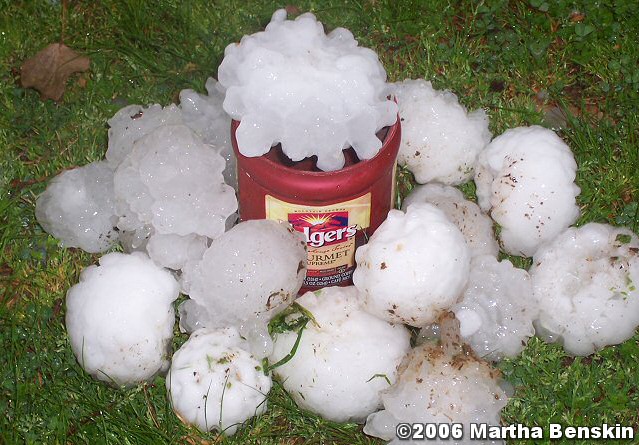 |
| In the picture: There was massive hail (bigger than grapefruits) just north of Searcy (White County) on 04/02/2006. The photo is courtesy of Martha Benskin. |
|
| |
|
The stones just north of Searcy (White County) were not only the largest during this event (five inches in diameter), they were tied for the biggest on record in Arkansas. Similar stones were witnessed at Newark (Independence County) during the tornado outbreak of January 21-22, 1999.
|
| How Rare is Huge Hail? |
|
With the exception of 2005 and 2013, baseball size or larger hail was observed in Arkansas at least once a year since 1980 (through 2022). Hail at least softball size occurred once every other year (22 of 43 years). As far as numbers of reports, of the roughly 6,063 instances of quarter size or larger hail, 2,537 were at least golf balls (41.8% of reports), 269 were at least baseballs (4.4% of reports), and 54 were at least softballs (0.9% of reports). The largest hailstones were five inches in diameter (slightly larger than a DVD) on January 21, 1999; April 2, 2006; and May 4, 2020.
|
| In addition to hail, four tornadoes were spawned in eastern sections of the state. Two of these tornadoes were strong (F3), and mainly affected areas east of the Little Rock County Warning Area. One tornado tracked through Marmaduke (Greene County), and damaged or destroyed 80 percent of the buildings in town. The other tornado hit areas near Wynne (Cross County), especially the Fitzgerald Crossing community. |
|
|
| In the picture: Massive hail from Vandervoort (Polk County) on 06/19/2019 was 3D scanned just over a week later (on the 27th) to determine its exact size. In the end, the 4.6 inch diameter fell just short of the five inch Arkansas state record. |
|
| |
|
Thirteen years later, there was monster hail between Vandervoort and Cove (both in Polk County) on June 19, 2019. One of the largest stones was 3D scanned by researchers from the Insurance Institute for Business and Home Safety (IBHS). The stone was 4.6 inches in diameter (a little larger than a grapefruit), or just shy of the record.
|
| Link of Interest |
| (courtesy of Justin Bond via Twitter) |
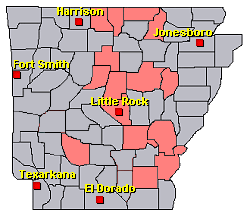
| There were numerous reports of very large hail and isolated tornadoes in central and eastern Arkansas on April 2nd and 3rd. For a look at the reports, click here. |
|
| In the picture: Preliminary reports of severe weather in the Little Rock County Warning Area on April 2-3, 2006 (in red). |
|
|