
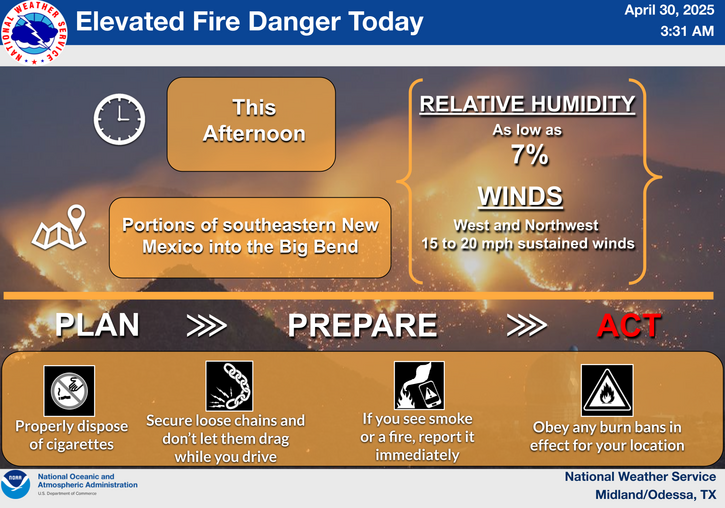
A prolonged atmospheric river will continue to impact the Pacific Northwest into the Northern Rockies with heavy rainfall, areas of urban and river flooding, landslides, heavy mountain snow, and gusty winds into Thursday. A strong clipper system will bring the threat of heavy snow and high winds across the Upper Midwest/Great Lakes as well as portions of the interior Northeast and Appalachians. Read More >
Last Map Update: Wed, Dec 10, 2025 at 12:30:18 am CST
|
Text Product Selector (Selected product opens in current window)
|
|
 |
 |
 |
 |
 |
 |
| Storm Reports | Spotter Briefing | Storm Spotters | Storm Data | Tornado Statistics | Social Media |
 |
 |
 |
 |
 |
 |
| Forecast Discussion | Hourly Forecast | Graphical Forecast | Fire Weather | Aviation | Hydrology |
 |
 |
 |
 |
 |
 |
| Observations | Air Quality | Satellite | Climate | Past Events | Weather Radio |


 Local Radar
 Weather Map
 Satellite