National Weather Service United States Department of Commerce

Severe Thunderstorms in the Southeast U.S. Saturday; Flash Flooding Threat for the Northern Gulf Coast

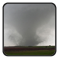
Isolated to scattered severe thunderstorms appear possible across portions of the Southeast and Carolinas on Saturday where a Slight Risk (Level 2 of 5) has been issued. A Slight Risk Excessive Rainfall Outlook (Level 2 of 4) has been issued for part of the northern Gulf Coast Saturday due to the threat of flash, urban, and riverine flooding. Read More >

Click a location below for detailed forecast.

Last Map Update: Sat, May. 18, 2024 at 2:12:58 am CDT

National Weather Service Albuquerque, NMNational Weather Service Lubbock, TXNational Weather Service Fort Worth/Dallas, TX
National Weather Service El Paso, TXZoom
Out

National Weather Service San Angelo, TX
National Weather Service Austin/San Antonio, TX

An early season heat wave will arrive Saturday and continue into next week. Highs Saturday will be in the 90s for most with lower 100s along the river valleys, with lower 100s becoming more widespread Sunday and Monday. No rain is expected.
Protect yourself from heat and sun! Drink plenty of water and avoid alcohol. Beverages with electrolytes can also help protect against heat stress. Apply sunscreen (SPF 30 or higher) every two hours. Wear lightweight, loose-fitting, and light colored clothing. Take regular breaks in the shade or air conditioning.

Text Product Selector (Selected product opens in current window)
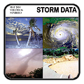
Submit Storm Report Spotter Briefing Skywarn Storm Data Tornado Statistics Social Media
Storm Reports Spotter Briefing Storm Spotters Storm Data Tornado Statistics Social Media
 
Area Forecast Discussion Hourly Forecast Graphs Digital Forecasts Fire Weather Aviation Hydrology
Forecast Discussion Hourly Forecast Graphical Forecast Fire Weather Aviation Hydrology
 
Observations Air Quality Satellite Climate Past Events weather Radio
Observations Air Quality Satellite Climate Past Events Weather Radio