National Weather Service United States Department of Commerce


Central Alabama Tornado Outbreak - April 19, 2009


Event Summary for Central Alabama

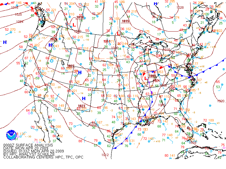
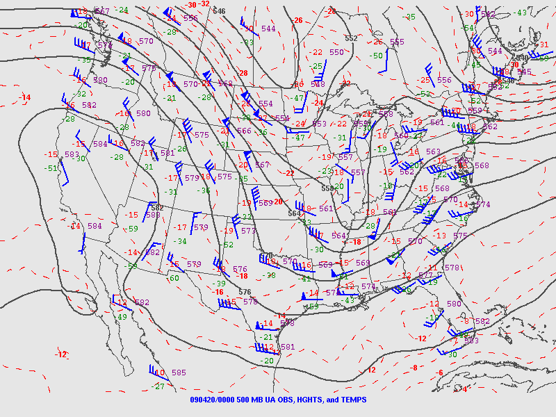
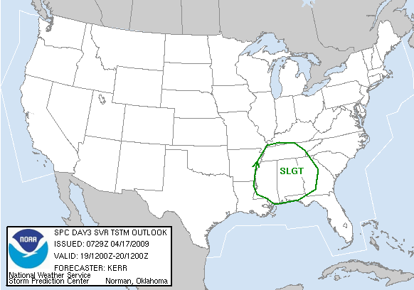
On April 19th, several bands of severe thunderstorms developed during the late afternoon and lasted into the evening hours. These thunderstorms produced 11 tornadoes, large hail, and locally heavy rainfall. Some storms exhibited persistent rotation and were likely supercell thunderstorms. These storms developed ahead of a strong cold front that pushed eastward into Georgia after midnight. This storm system produced at least 7 tornadoes in the Tennessee Valley and 2 more tornadoes in Georgia.

Our thoughts will be with all those whose lives were impacted by these storms.

Location/Clickable Detailed Summary Link
Damage Rating/Estimated Maximum Wind Speeds
Injuries/Fatalities
Damage Path Length/Width
Starting Point/Time
Ending Point/Time
EF-0
60-70 mph
None
3.55 miles
25 yards
32.6261/-87.5949
552 pm
32.6447/-87.5377
600 pm
EF-1
90 mph
None
3.77 miles
50 yards
32.6443/-87.4958
604 pm
32.6492/-87.4278
615 pm
EF-0
80 mph
None
2.10 miles
800 yards
33.2566/-86.8123
616 pm
33.2775/-86.7891
620 pm
EF-1
90-100 mph
None
1.25 miles
100 yards
32.6740/-87.3138
628 pm
32.6767/-87.2931
631 pm
EF-0
60-65 mph
None
3.30 miles
100 yards
33.2035/-86.8627
653 pm
33.2315/-86.8165
658 pm
EF-0
70-80 mph
None
0.15 miles
150 yards
32.0881/-86.1864
810 pm
32.0883/-86.1838
810 pm
EF-1
100 mph
None
0.20 miles
50 yards
32.1136/-86.0693
820 pm
32.1147/-86.0659
820 pm
EF-0
60-70 mph
None
0.10 miles
50 yards
32.1617/-85.9345
836 pm
32.1621/-85.9335
836 pm
EF-2
122 mph
None
6.53 miles
300 yards
33.8605/-86.4420
859 pm
33.8977/-86.3376
910 pm
EF-1
100 mph
None
2.92 miles
75 yards
33.8643/-86.2199
921 pm
33.8805/-86.1728
927 pm
EF-2
115 mph
None
4.00 miles
250 yards
32.4594/-85.0231
1033 pm
32.4745/-84.9564
1042 pm

Preliminary Local Storm Reports
Public Information Statement


Tornado Watch 173 was in effect from 223 pm CDT until 9 pm CDT for parts of southwest central Alabama.
Tornado Watch 173 was extended at 247 pm CDT to include Jefferson, Shelby, Walker and Fayette Counties until 9 pm CDT.
Tornado Watch 173 was extended at 405 pm CDT to include Marion, Winston and Lamar Counties until 9 pm CDT.
Tornado Watch 173 was extended at 522 pm CDT to include Blount, Chilton, St. Clair and Talladega Counties until 9 pm CDT.
Tornado Watch 173 was extended at 640 pm CDT to include the rest of central Alabama until 9 pm CDT.
Tornado Watch 174 was issued at 845 pm CDT counties along and east of Interstate 65 until 1 am CDT on April 20th.


Severe Weather Episode Data


April 19th, 2009
Surface Analysis
Apr. 19th 7 pm
April 19th, 2009
500 mb Chart
Apr. 19th 7 pm
April 19th, 2009
Day 3 Severe Weather Outlook
Issued Apr. 17th
April 19th, 2009
Day 3 Probabilistic Outlook
Issued Apr. 17th
April 19th, 2009
Day 2 Severe Weather Outlook
Issued Apr. 18th
April 19th, 2009
Day 2 Probabilistic Outlook
Issued Apr. 18th
April 19th, 2009
Day 1 Severe Weather Outlook
Issued Apr. 19th
April 19th, 2009
Day 1 ProbabilisticOutlook
Issued Apr. 19th
April 19th, 2009
Severe Weather Reports
Apr. 19th