|
|
National Weather Service Mission Statement: Provide weather, water and climate data, forecasts, warnings, and impact-based decision support services for the protection of life and property and enhancement of the national economy.
Our office is located adjacent to the Shelby County Airport, just off Interstate 65 exit 234, within the city limits of Calera. We operate 24/7/365!
National Weather Service |
|
Top five NWS Birmingham counties by population (using 2020 Census data): 1st: Jefferson County (674,721) 2nd: Montgomery County (228,954) 3rd: Tuscaloosa County (227,036) 4th: Shelby County (223,024) 5th: Lee County (174,241) NWS Birmingham's forecast area includes five of the state's top ten cities by population: 2nd: Birmingham (200,733) 3rd: Montgomery (200,603) 4th: Tuscaloosa (99,600) 6th: Hoover (92,606) 7th: Auburn (76,143) The NWS Birmingham forecast area is home to:
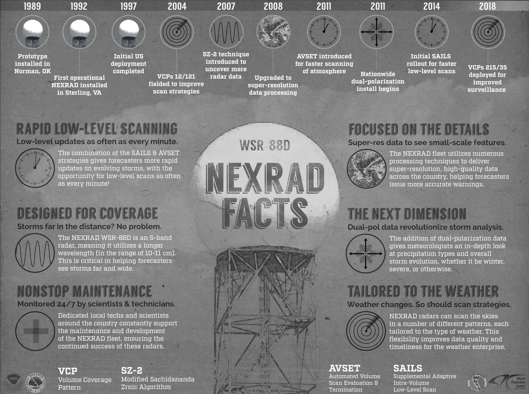
Radar Comes to Alabama! The use of Doppler radar in Alabama began in February 1992 with the completion of the WSR-88D near Montgomery, AL (KMXX). The radar is located about 30 miles east-northeast of Montgomery. Two days after becoming operational, the first mesocyclone shown by Doppler radar in Alabama was detected with a complex of thunderstorms moving from Cherokee County, AL into Polk County, GA. The storm produced a tornado that left a damage path more than 40 miles long. WSR-88D (Doppler) radars, capable of producing velocity data and informing meteorologists about wind speed and direction within storms, replaced a network of WSR-57 radars that did not provide such information. One of these WSR-57 radars, now decommissioned, was located in Centreville, AL.
Does your office work with anyone? Yes! We are not isolated within the walls of our building, but rather we collaborate with neighboring NWS offices, national-level NWS centers, emergency management at the local / state / Federal level, and even academia / researchers and media partners. What does your office provide? We proudly provide a 24/7/365 weather service for Central Alabama. Some of our duties include:
What areas do you serve? We serve 39 counties in Central Alabama: Autauga, Barbour, Bibb, Blount, Bullock, Calhoun, Chambers, Cherokee, Chilton, Clay, Cleburne, Coosa, Dallas, Elmore, Etowah, Fayette, Greene, Hale, Jefferson, Lamar, Lee, Lowndes, Macon, Marengo, Marion, Montgomery, Perry, Pickens, Pike, Randolph, Russell, Shelby, St. Clair, Sumter, Talladega, Tallapoosa, Tuscaloosa, Walker, and Winston.
What kind of weather does the area get? 🌪️ Central Alabama is most known for its severe weather, specifically tornadoes. The months of November to May feature the most tornadoes, with a prominent peak in March and April. Tornadoes can occur at any time of the day or night. While not commonplace, violent, long-track tornadoes have occurred. Our part of the country is particularly vulnerable to tornadoes and their impacts due to the intersection of high tornado frequency and a population affected by a range of socioeconomic factors. We also receive other kinds of severe weather including damaging straight-line winds and large hail, especially during the spring. 💧 Rainfall is abundant and fairly well distributed throughout the year. Fronts during the fall, winter, and spring bring bands of rain and storms in a reasonably consistent manner. Summer rainfall is almost entirely from scattered afternoon to evening pop-up storms as frontal passages become weaker and less frequent. 🌊 Flooding is usually not widespread in our area, but we are not immune to instances of significant flooding. Flooding can be enhanced by terrain, urbanization, poor drainage, and excessive runoff into waterways. We've had several cases of rapidly-developing flooding due to heavy rainfall and the aforementioned factors (e.g., Significant and Life Threatening Flooding of October 6, 2021). 🌀 Once tropical systems enter the Gulf, they have to landfall somewhere. These systems can bring flooding, gusty winds, and tornadoes as they move across Central Alabama. Usually the impacts aren't blockbuster and far-reaching but, sometimes, a fast-moving system may reach our area before having time to substantially weaken, resulting in more significant and widespread impacts (e.g., Hurricane Zeta 2020). ❄️ A good, widespread, multi-inch snowfall is rare enough that snow lovers are on the edge of their seat each year for an opportunity. We can go several years without measurable snow. Our southern extent means that we usually get an influx of 'milder' air as a storm system moves through, leaving us with a chilly rain or brief wintry mix. There are times when things come together just right (storm track, timing, depth of cold air) for the area to get blanketed in several inches of snow (e.g., December 8th, 2017). Snowfall usually doesn't stick around too long, but even a small amount can cause big problems for communities across the region. 🌡️ Climate records for the Birmingham, AL area and Montgomery, AL area show that January is the coolest month of the year. The hottest month of the year is July, though August is a very close second and not all that different. During the summer months, we've an abundance of high dew points, making for a humid and uncomfortable air mass. The driest month of the year is October with March edging it out for the wettest. Temperatures below zero (extremely rare) and in the triple digits (occasional) have taken place, along with episodes of exceptional drought and excessive rainfall.
Three essential things for residents to do:
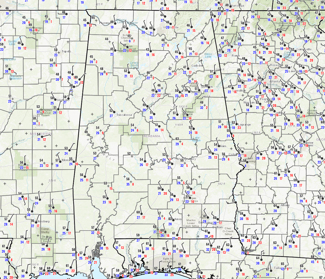
Do you have stats on Alabama's tornadoes? We have a lot of data! Check out the graphic below which shows tornado counts and intensities over
|
|
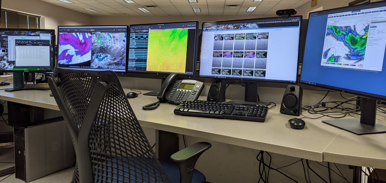
AWIPS (Advanced Weather Interactive Processing System)
Radar Primary radar sites utilized to serve the NWS Birmingham forecast area include: Supplementary radar sites include: Mobile, AL [KMOB], Echo, AL [KEOX, DoD owned],
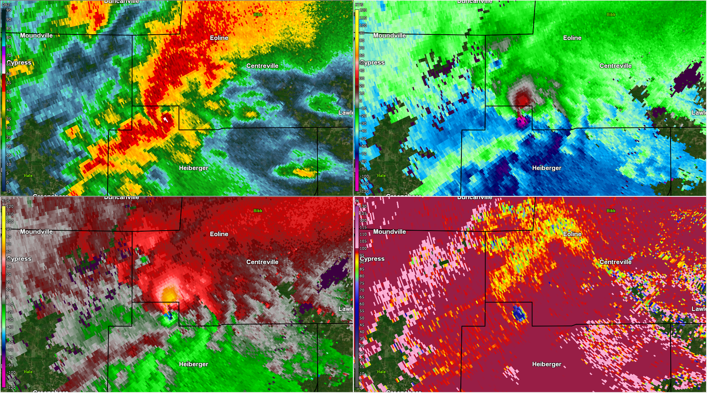
Shown is a tornado-producing supercell storm. Various radar products and radar sites allow NWS meteorologists to analyze a storm in a multitude of ways. In this example, radar helps reveal heavy rainfall and a hook echo (top left), very strong rotation (top right / velocity and bottom left / storm-relative velocity), and debris lofted by an ongoing tornado (bottom right).
Satellite
Weather Stations
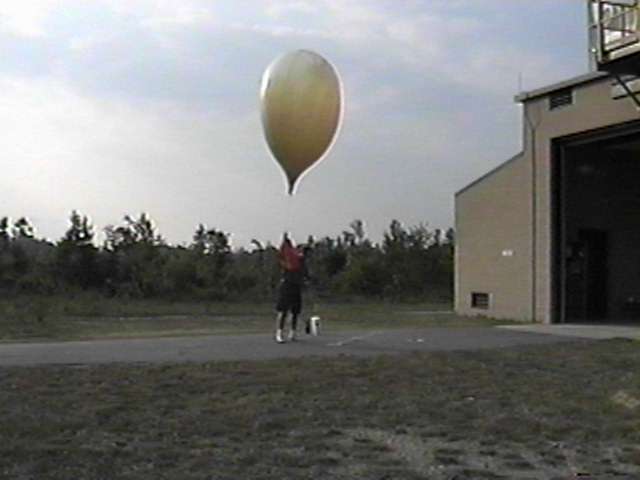
Weather Balloons
|
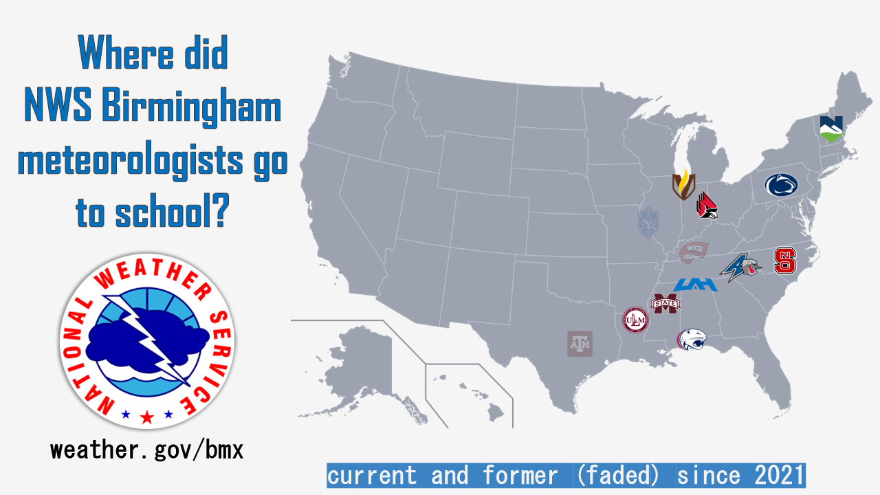
Schools of Current (color) and Former (faded) NWS Birmingham Meteorologists since 2021
Represented: University of Louisiana-Monroe, University of South Alabama, University of Alabama-Huntsville, Mississippi State University, Ball State University, NC State University, University of North Carolina-Asheville, West Kentucky University, St. Louis University, Valparaiso University, Penn State University, Vermont State University-Lyndon, and Texas A&M University.
|
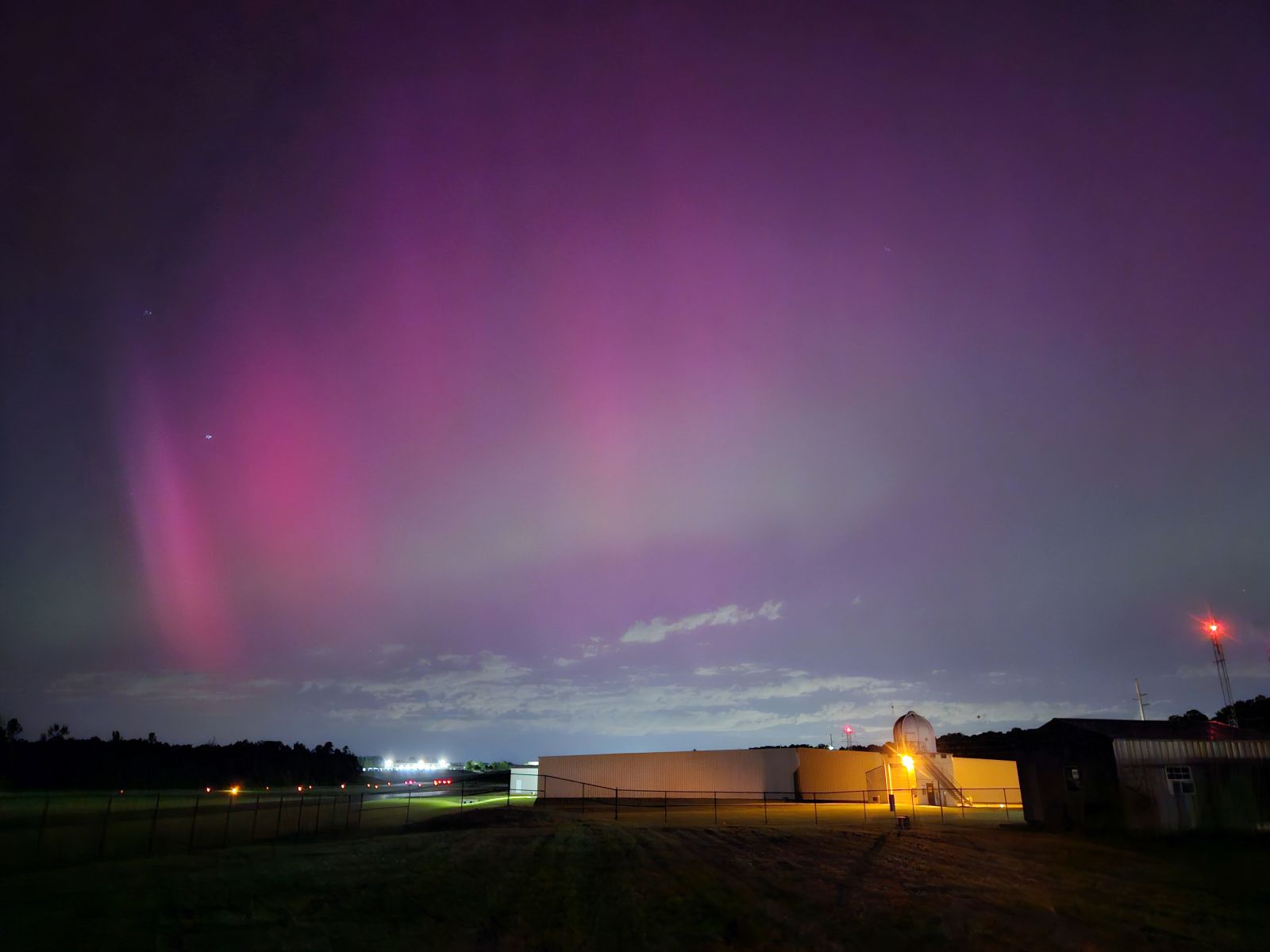
Painted Sky In a very rare occurrence, the Aurora Borealis was visible from NWS Birmingham, and points south, during the 9 pm CT hour on May 10, 2024 (photo #1). Red/pink and even green (!) was visible! NASA: "During the first full week of May, a barrage of large solar flares and coronal mass ejections (CMEs) launched clouds of charged particles and magnetic fields toward Earth, creating the strongest solar storm to reach Earth in two decades — and possibly one of the strongest displays of auroras on record in the past 500 years."
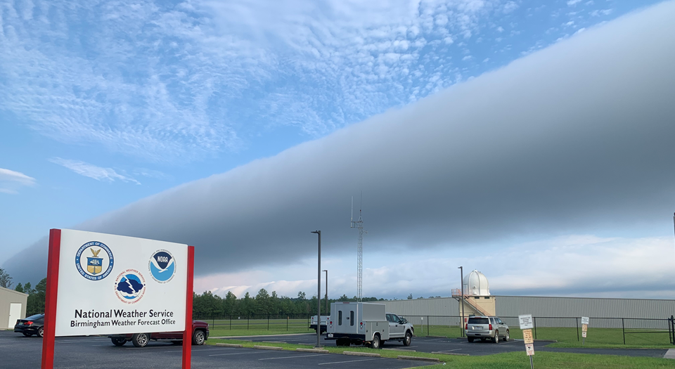
Rollin' Along A roll cloud / undular bore passed over the NWS Birmingham weather office during the morning hours of August 11, 2020, captured by NWS Birmingham meteorologist Gary Goggins.
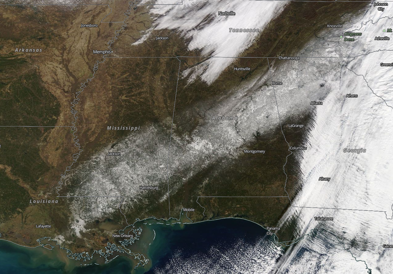
Every Snow Often A strip of snow blanketed the ground from southeast Louisiana northeastward to the Appalachians after a snowstorm on December 7th, 2017. In Central Alabama, totals of 4-8 inches were common, with some locations accumulating around a foot of snow toward the Georgia state line.
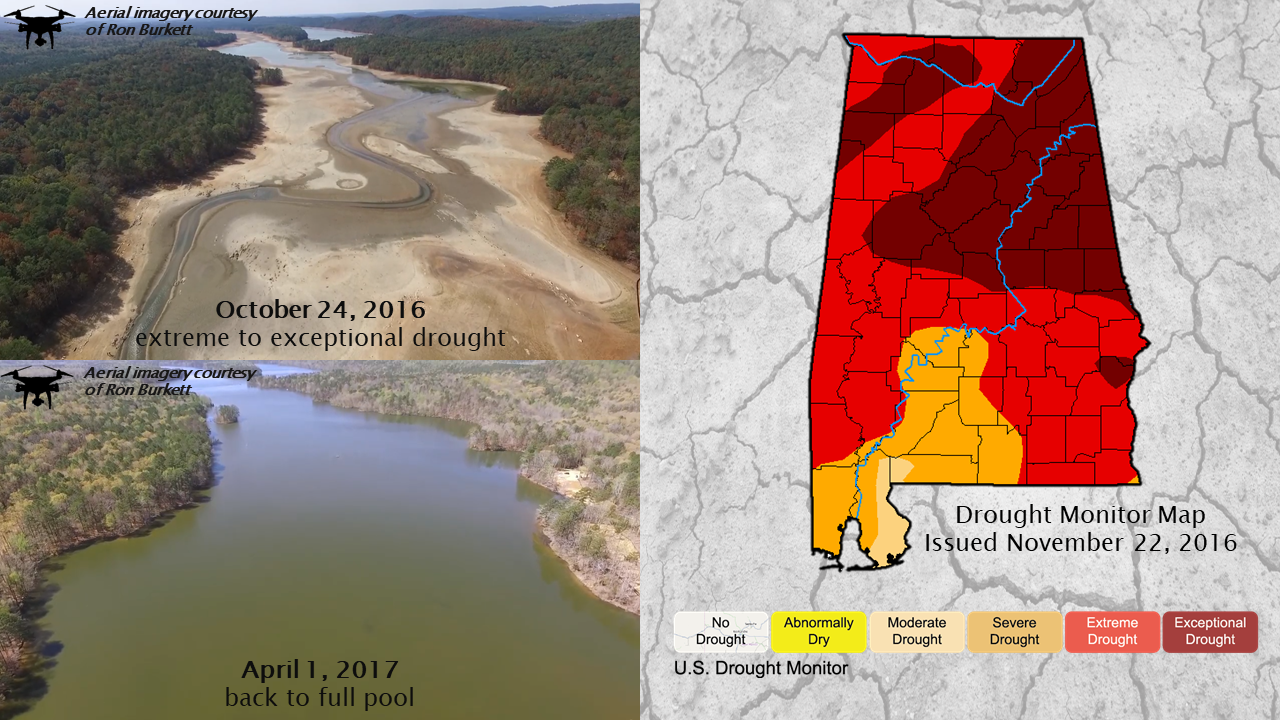
Parched Earth Extreme to exceptional drought conditions plagued much of the state in 2016. Water levels on Lake Purdy, a major water source for Birmingham, shown below, fell at least 20 feet below normal. Many other bodies of water had significant drops in water levels, thousands of trees died, and
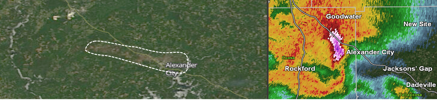
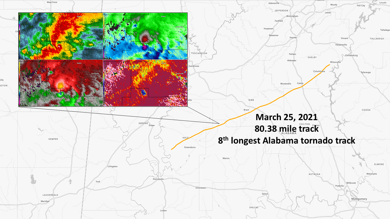
A Long-track Supercell A long-track tornado with a maximum rating of EF-3 carved an 80.38 mile path of destruction across five counties on March 25, 2021. This was part of a potent spring weather system that spawned multiple long-track tornadoes with a tornado count including: 4 EF-3, 3 EF-2, and 3 EF-1.
Timber Annihilation Thousands of trees were snapped and uprooted by a tornado along the Cahaba River shortly after midnight on February 6th, 2020. A convergence pattern is clearly seen in the tree fall pattern, indicative of a tornado.
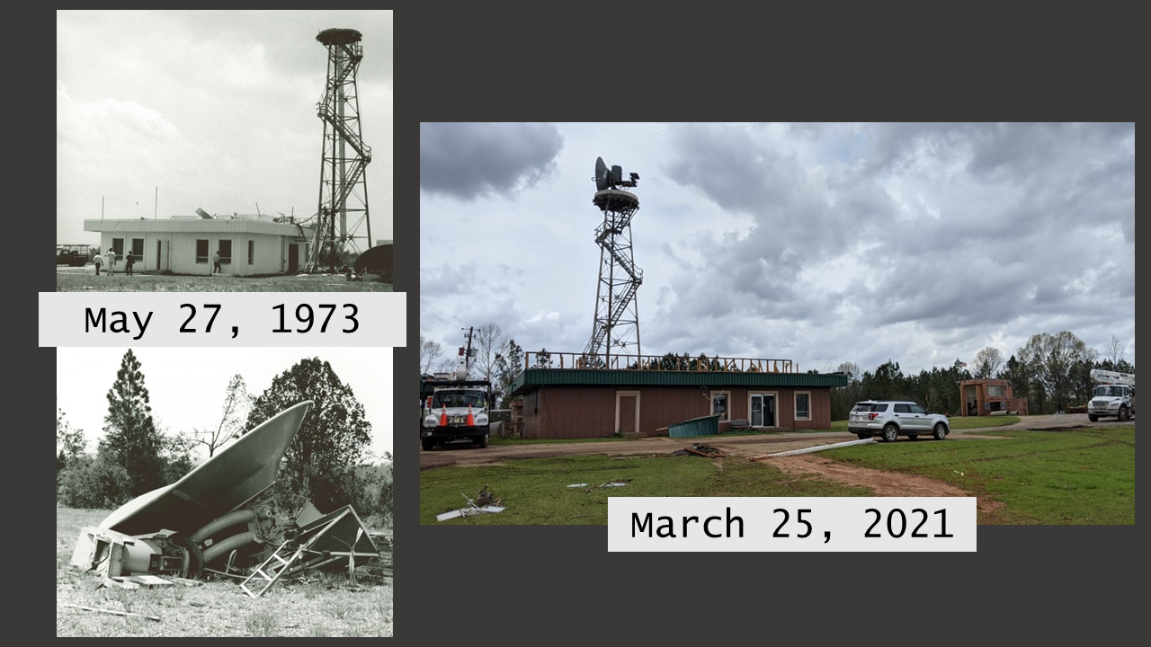
Might it be Possible? In a seemingly improbable feat, the previous weather office in Centreville was hit twice by a tornado. The first time occurred during a long-track tornado on May 27, 1973 when the office was in operations. No longer in operations at this point, the second strike took place on March 25, 2021 during another long-track tornado that took a similar path.
Wounded An early morning severe thunderstorm on April 19th, 2020, packing straight-line winds of 80 mph and hail to around golf ball size, caused a swath of significant damage across portions of Chilton, Coosa, and Tallapoosa counties. Unexpectedly, satellite imagery in the days after showed a strip of brown vegetation in the affected areas. A survey from the ground revealed the source: a countless number of pine trees that remained standing along the storm's path turned brown. This was likely due to stress and subsequent factors caused by wind-driven hail in a process that has been documented elsewhere in the country.
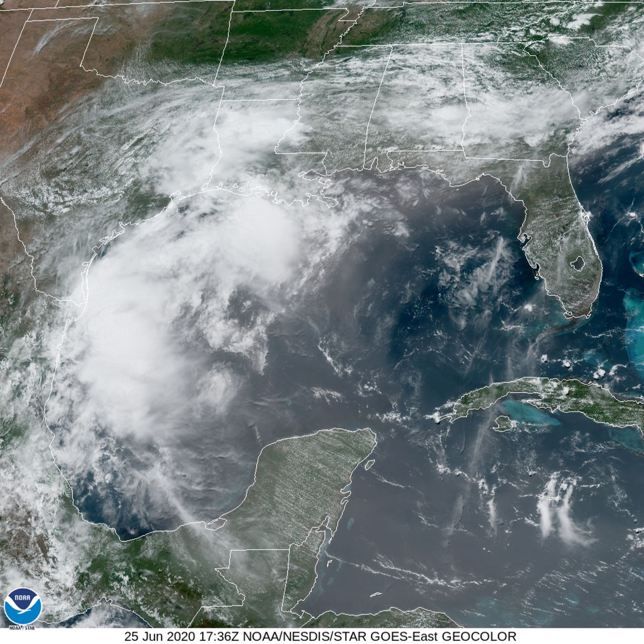
A Long Excursion Dust kicked up from the Sahara Desert in Africa made a 5,000+ mile trek, arriving in Alabama during June 2020. The wispy, gray-colored areas on the below satellite image show areas of dust stretching from the Caribbean Sea to the Gulf Coast region. Such occurrences can negatively affect air quality but make for A+ sunsets.
|
|
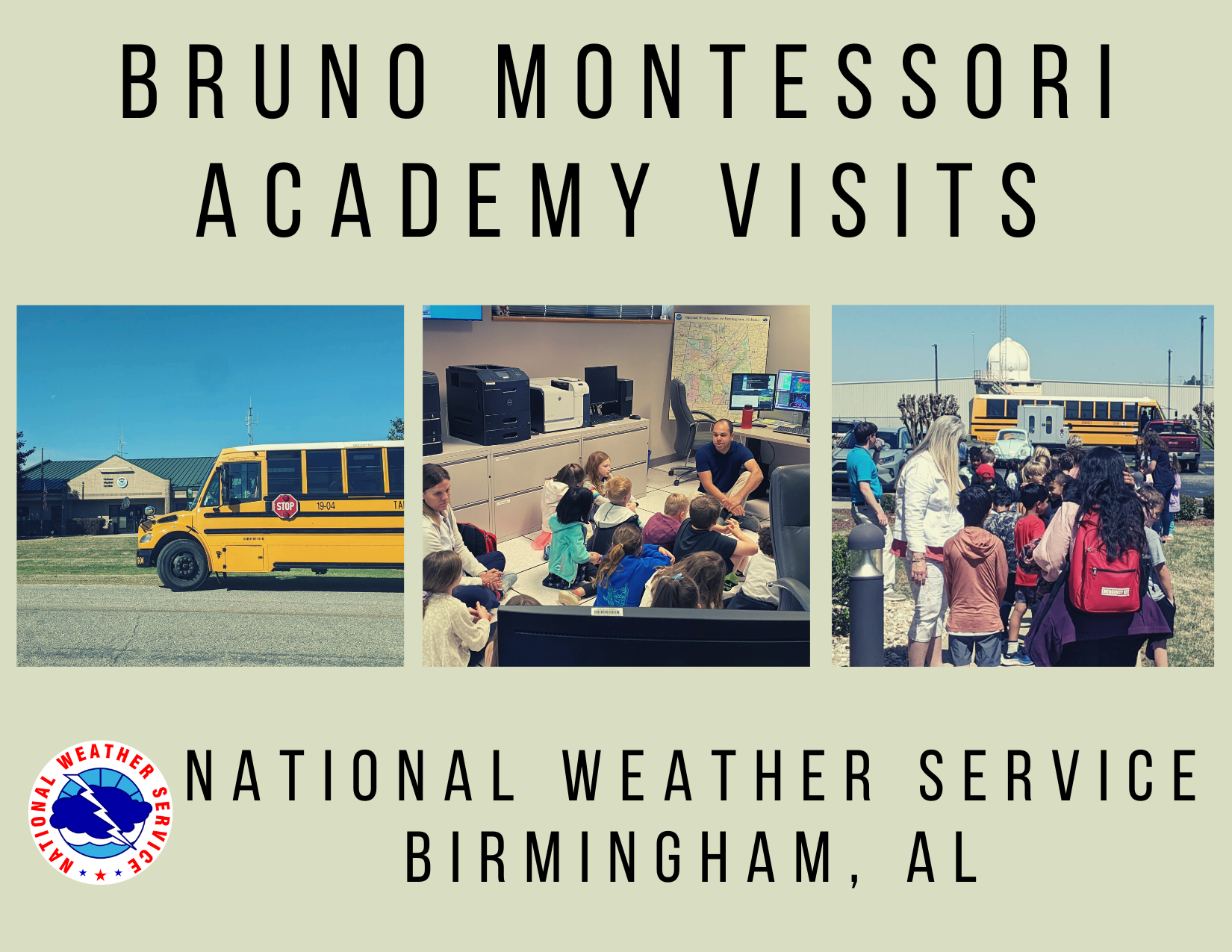
Can a group of students or interested individuals see the office in person? Yes! We offer tours of our office at no charge. A tour consist of a short talk / presentation about the NWS and its duties, followed by a viewing and demonstration of the weather operations area, taking around 45 minutes to one hour. Informational handouts and/or activity sheets may be offered as well. Please note that a tour may be cancelled and rescheduled due to weather and workload considerations. To schedule a tour, send an email to sr-bmx.webmaster@noaa.gov. Be sure to include a list of preferred dates and times, group size and age range, and the nature of your group (students, club, etc.).
Tour guidelines:
Can a NWS meteorologist speak to my class remotely / online or in-person? Absolutely! We can talk to your students about weather 101, seasonal severe weather, and preparedness / safety. Informational handouts and/or activity sheets may be offered for in-person classroom visits.
I hear your office launches weather balloons. Can we watch a launch? 🎈 Weather balloons are launched each morning and evening from our office. The launch times are 5 am and 5 pm when in CST & 6 am and 6 pm when in CDT. In some cases, we can allow groups to watch a weather balloon launch. This may be fulfilled in conjunction with an office tour or as a stand-alone experience. |
|
The National Weather Service, formerly known as the Weather Bureau, has a long history in Birmingham, Alabama, dating from the very late 1800s to present day. Special thanks to former Warning Coordination Meteorologist Brian E. Peters of NWS Birmingham for compiling most of the history outlined on this page.
The Birmingham Weather Bureau was located at 1171 13th Street North, in the hilly terrain just north of the city proper, from November 30, 1907 to December 1, 1945 (left). Following, a consolidation of the Weather Bureau Office and the Weather Bureau Airport Station was made at the Birmingham Municipal Airport.
During World War II, the Weather Bureau established an airways observation post at the Birmingham Airport. This meant there were two offices in Birmingham. In 1945, the Weather Bureau consolidated the two offices at the airport; however, due to an initial lack of space, some functions were kept at the Weather Bureau city location, though the length of time this continued or the functions involved were not specified. On October 3, 1965, the FAA and Weather Bureau dedicated a new building (right) at the Birmingham Airport. The facility, built entirely with city funds at a cost of $170,000, housed the FAA Flight Service Station, General Aviation District Office, and the Weather Bureau.
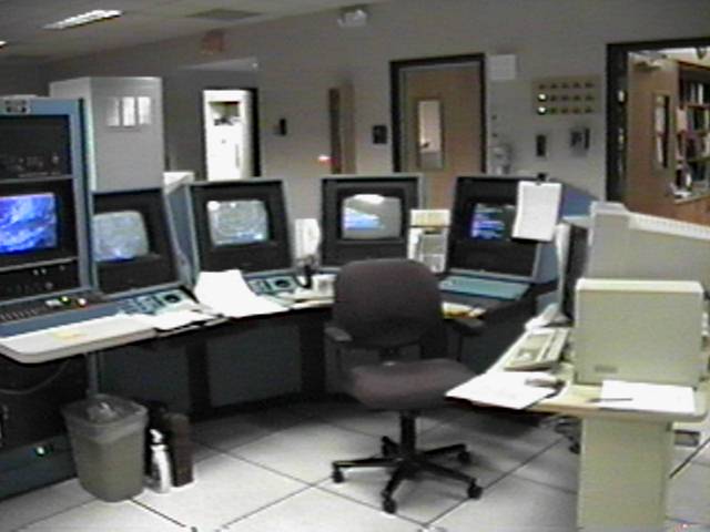
In 1971, the observation and forecast programs of the Weather Bureau were split when the forecast office moved from the Birmingham Airport to West Oxmoor Tower (left). The offices occupied the southwest corner of the fourth floor. Upper-air and radar observations were conducted at a separate office located in Centreville.
See a more in-depth history of the office here: https://www.weather.gov/bmx/bmxhistory
A Look Into the Past at NWS Birmingham
|


.JPG)