National Weather Service United States Department of Commerce

Troy Highway Tornado - Montgomery County
April 19, 2009


EF-1
Estimated Maximum Wind:
100 mph
Injuries/Fatalities:
None
Damage Path Length:
0.20 miles
Maximum Path Width:
50 yards
Approximate Start Point/Time:
32.1136/-86.0693
at 820 pm
Approximate End Point/Time:
32.1147/-86.0659
at 820 pm

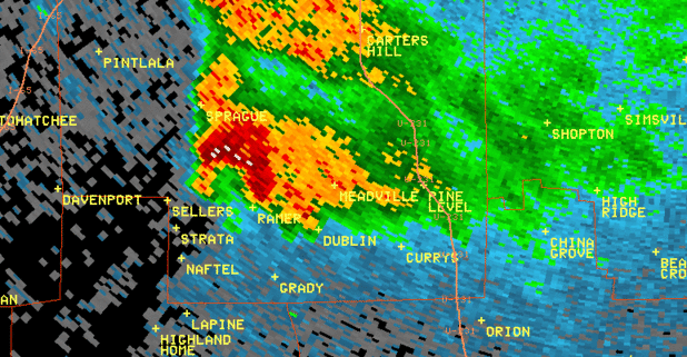
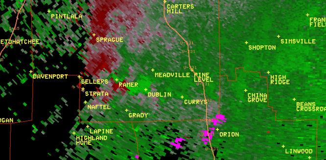
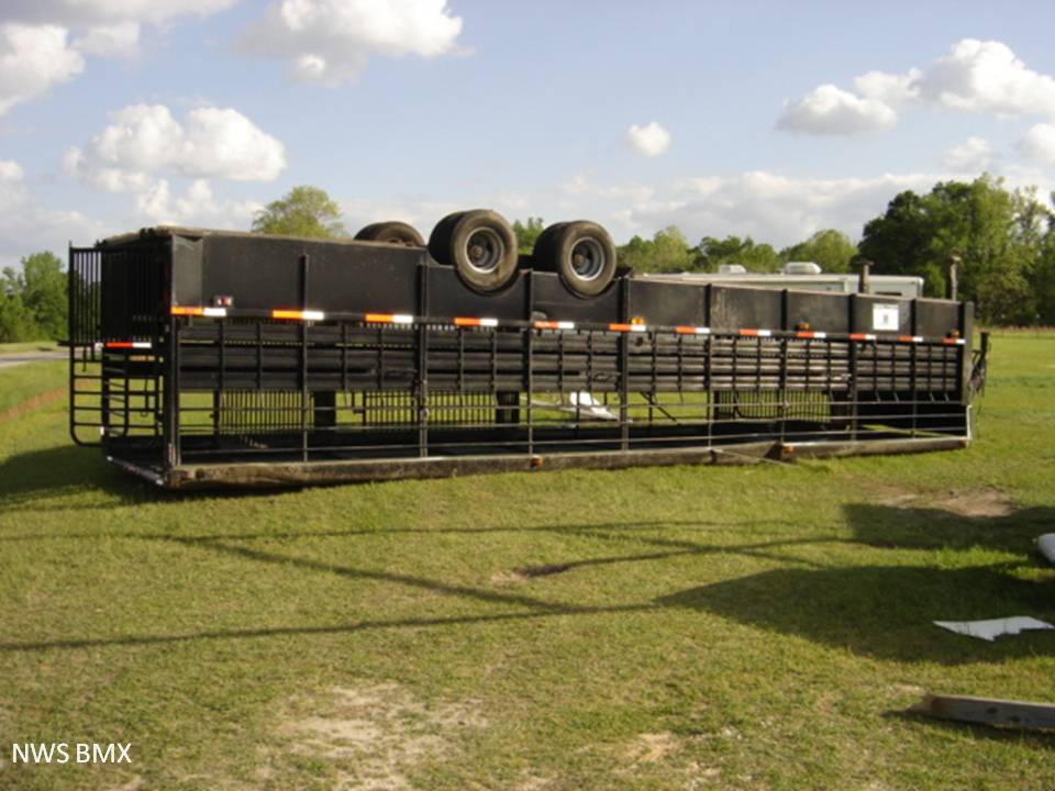
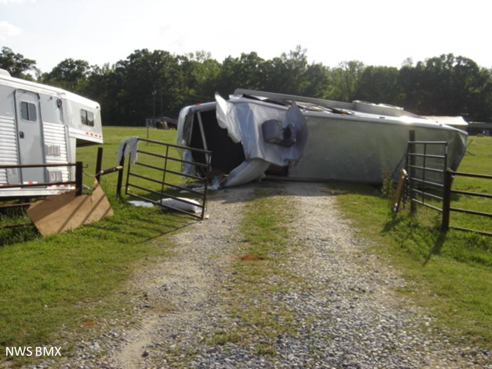
A National Weather Service Damage Assessment Team has surveyed the storm damage in Montgomery County. It has been determined the damage was the result of a tornado. The tornado has been rated an EF-1 on the Enhanced Fujita Scale. Damage estimates were consistent with winds around 100 mph.

A tornado touched down briefly just west of US Highway 231 across from Old Barnes Road. Along the path, damage included three horse trailers being tossed over 50 feet, one of which weighed over 10,000 lbs. The length of the path was 0.20 miles and at the widest point, the tornado was 50 yards wide.


radar


radar
The top image is a KMXX 0.5 degree reflectivity loop. The bottom image is a KMXX 0.5 degree storm relative velocity loop. The green indicates wind blowing toward the radar while red indicates wind blowing away from the radar. This storm exhibited gate-to-gate rotation and a pronounced hook echo at times.

Damage
Overturned Horse Trailer

Damage
Overturned Horse Trailer