| Main Page | Details on the Flooding | Why did it occur? | Other Mississippi River Floods |
| Media Accounts | Personal Accounts | Flooding Pictures | Acknowledgements |
If you have your own pictures of the Mississippi River Flood of 1965, and/or its aftermath and would like them added to this webpage, please send them to the National Weather Service via e-mail at Jeff.Boyne@noaa.gov or via regular mail at N2788 County Rd. FA, La Crosse, WI 54601-3038.
Lake City, MN
 |
 |
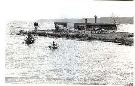 |
| Lake City Point - Picture was taken from the Mississippi River looking toward the city on April 28, 1965 - Source: NWS La Crosse Archive | Pump house at Roschen Park, which is on the south end of Lake City. Source: Dean Schumacher, Lake City Graphic & Shopper | Pump house at Roschen Park, which is on the south end of Lake City. Source: Dean Schumacher, Lake City Graphic & Shopper |
 |
||
| Central Point on the north end of Lake City - Source: Dean Schumacher, Lake City Graphic & Shopper |
Wabasha, MN
 |
 |
 |
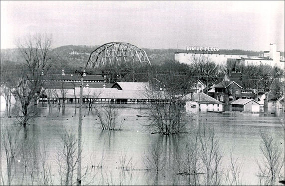
| On April 16th, the rising waters of the Mississippi River nearly split Wabasha, MN in two. As the main channel on the left rose higher it followed an old river channel through the town until it nearly rejoined the flooding backwaters visible at the top of the picture. When this picture was taken during the afternoon, the water was already over Highways 60 and 61. Source - Chicago Sun Times | This is an aerial view of Wabasha, MN on April 16th. The bridge in the background crosses the Mississippi River and connects Wabasha, MN with Nelson, WI. Source: Chicago Sun Times | Wabasha, MN flooding on April 23, 1965 - Source: NWS La Crosse Archive |
 |
 |
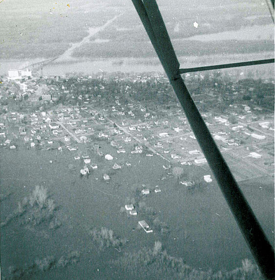 |
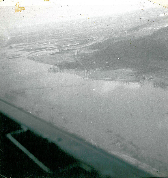
| Wabasha, Minnesota surrounded by floodwater on April 18th. Source: United Press International | Flooding between Wabasha, MN and Nelson, WI on April 30, 1965 - Source: NWS La Crosse Archive | This is the first of six pictures that Walter Christian took from the front seat of a Piper Cub piloted by Harry Sparks (John Deere dealer from Plainview, MN). These pictures are of the city of Wabasha, MN and Sand Prairie (just south of Wabasha). |
 |
 |
 |
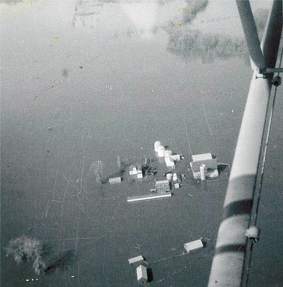
| This is the second of six pictures that Walter Christian took from the front seat of a Piper Cub piloted by Harry Sparks (John Deere dealer from Plainview, MN). These pictures are of the city of Wabasha, MN and Sand Prairie (just south of Wabasha). | This is the third of six pictures that Walter Christian took from the front seat of a Piper Cub piloted by Harry Sparks (John Deere dealer from Plainview, MN). These pictures are of the city of Wabasha, MN and Sand Prairie (just south of Wabasha). | This is the fourth of six pictures that Walter Christian took from the front seat of a Piper Cub piloted by Harry Sparks (John Deere dealer from Plainview, MN). These pictures are of the city of Wabasha, MN and Sand Prairie (just south of Wabasha). |
 |
 |
|
| This is the fifth of six pictures that Walter Christian took from the front seat of a Piper Cub piloted by Harry Sparks (John Deere dealer from Plainview, MN). These pictures are of the city of Wabasha, MN and Sand Prairie (just south of Wabasha). | This is the sixth of six pictures that Walter Christian took from the front seat of a Piper Cub piloted by Harry Sparks (John Deere dealer from Plainview, MN). These pictures are of the city of Wabasha, MN and Sand Prairie (just south of Wabasha). |
Winona, MN
 |
 |
 |
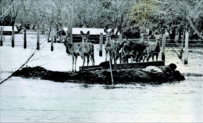
| On April 16th, flood waters advance on Winona, MN. An elaborate nine-mile dike system was built to protect the major businesses and residential areas of the city. Source: Chicago Sun Times | Deer huddled together on a small piece of high ground surrounded by the floodwaters of Mississippi River on April 20th. These deer were located at the Winona, MN Deer Farm. Feed was taken to them daily by boat. Source: Associated Press | Burlington Railroad washout along the route from Winona, MN to Trempealeau, WI - Source: NWS La Crosse Archive |
 |
||
| Minnesota Boat Harbor in Winona, MN on April 27, 1965 - Source: NWS La Crosse Archive |
La Crosse, WI
 |
 |
 |
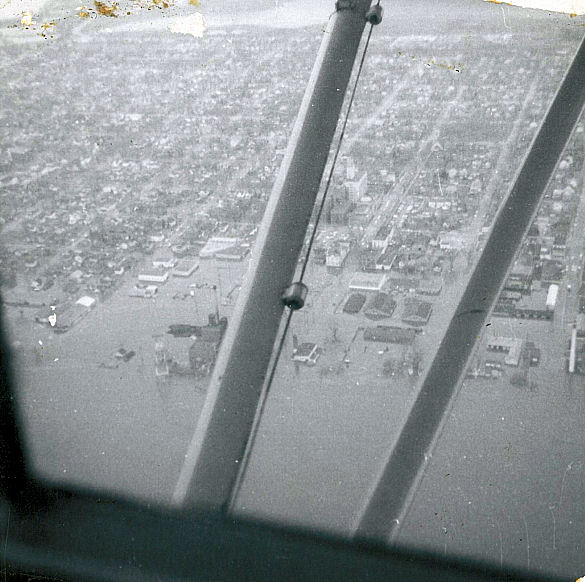
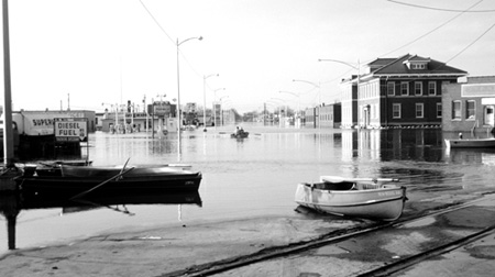
| Flooded Causeway - Importance of the dike across Monitor and Bantam Streets is evidenced in this view facing south across the Causeway. Eight inches of water covered the Causeway on April 17th. Source: Edward M. Huebner - La Crosse Tribune | Mississippi River flooding near La Crosse from Grandad's Bluff - April 1965 - Source: Google Images | House flooded by the Mississippi River near La Crosse - April 1965 - Source: Google Images |
 |
||
| Flooding near the Causeway in La Crosse, WI - April 1965 - Source Google Images |


 Weather Story
 Weather Map
 Local Radar