Overview
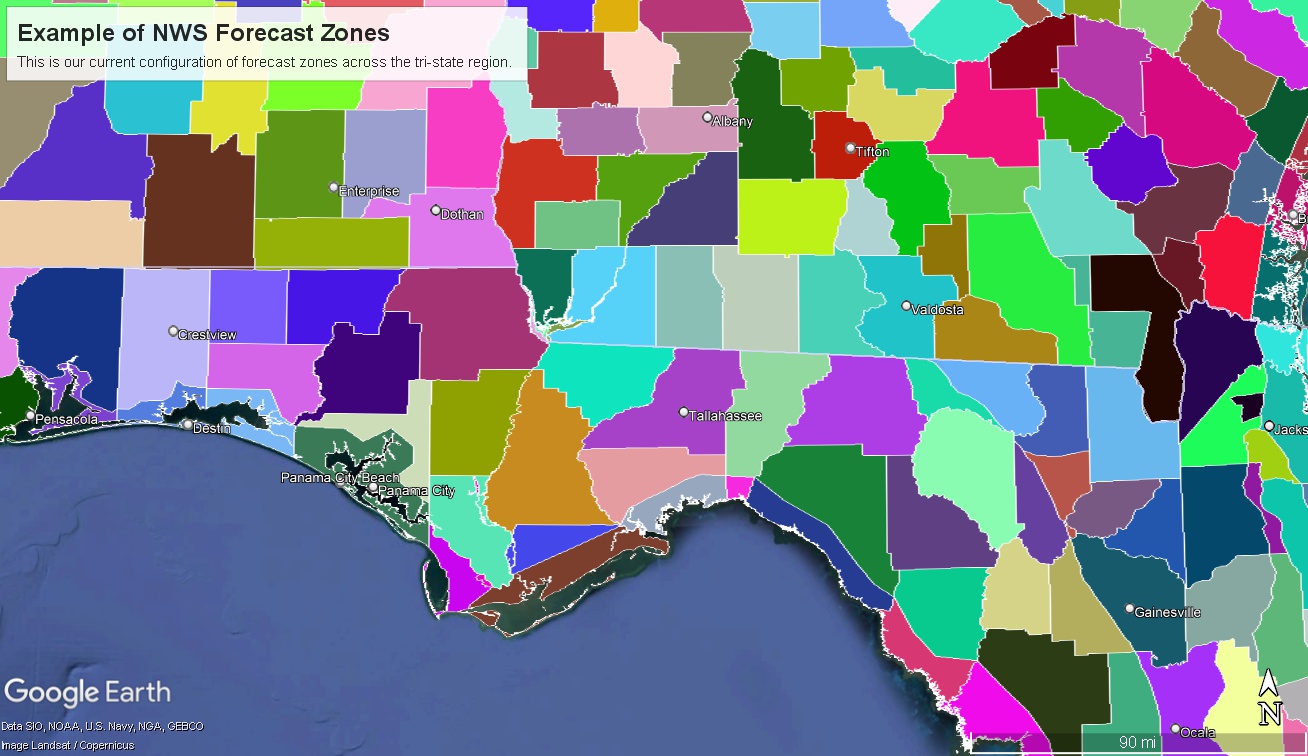
Each NWS office in the country divides its forecast area into specific forecast 'zones' (see Figure 1 below). While these zones are often based on county borders, complex meteorological, geographical, and social-science considerations can affect the boundaries of a forecast zone. This approach ensures that watches, warnings, and other products are better tailored to serve the public as well as city, state, federal, and tribal partners. Several forecast zones will be updated by the NWS office in Tallahassee and these changes are set to take effect March 18, 2025.
 |
| Figure 1. Image showing the different forecast zones across NWS Tallahassee's forecast area. Also pictured are forecast zones for NWS Mobile, Birmingham, Peachtree City, Jacksonville, and Tampa. |
Change #1
NWS Tallahassee will separate the St Andrews Bay from marine zone GMZ750 (waters from Okaloosa/Walton County Line out to 20 nm) into its own marine zone.
Forecast conditions can vary significantly between St. Andrews Bay and the larger marine zone in the Gulf of America. This contrast is especially noticeable during large weather events such as tropical storms, hurricanes, and winter severe weather events. For example, during tropical conditions, it is common for the Gulf-side marine zones to experience tropical or hurricane-force winds, while the Bay experiences less severe conditions. This distinction allows the NWS in Tallahassee to issue tropical warnings for the offshore zones without including the Bay when conditions warrant. Such an approach can help reduce confusion during future tropical systems, as has been observed during past storms.
Change #2
NWS Tallahassee will separate Liberty County into two forecast zones. North and South Liberty. The Liberty County forecast zone would be split by a line that extends from the Wakulla/Leon/Liberty county line to the Calhoun, Gulf, and Liberty county line.
Many meteorological impacts during weather events in our forecast area are influenced by proximity to the coast. Liberty County, one of the largest north-south counties in our region, can experience different conditions in its southern and northern areas. In some events, heavy rainfall events can concentrate near the coast, while having a much lower risk for significant flooding inland across northern portions of Liberty county. In the current zone paradigm For example, if a coastal rain event raises flood concerns for parts of our inland counties, we would need to issue flood watches for all of Liberty County—even if the risk is much lower in the northern area, where the population is greater. Dividing the county into separate forecast zones will provide the flexibility to address these differences more accurately.
Additionally, the southern part of Liberty County is heavily forested, and the Apalachicola National Forest frequently conducts prescribed burns in the area. These burns can be influenced by the seabreeze, and fire weather variables can vary significantly between the northern and southern portions of the county. These variations have a significant impact on the operations of our fire management partners, making accurate forecasting crucial.
For questions ABOUT THESE CHANGES EMAIL sr-tae.webmaster@noaa.gov