Overview
During the March 3, 2019 severe weather event, 12 tornadoes were confirmed through field surveys within the NWS Tallahassee area of responsibility. The strongest tornado was rated EF-3 in Leon/Jefferson County, Florida. This was only the second F3 or EF-3 to affect Leon County since 1945. The National Weather Service in Tallahassee would like to extend our appreciation to the many emergency management, law enforcement, and fire rescue personnel that assisted in these field surveys over the last three days.
 |
 |
 |
| GOES-16 Geocolor Imagery (with streetlight map background at night) of the March 3rd Tornado Outbreak |
Region wide overview of the tornadoes that struck portions of the Tallahassee National Weather Service Forecast Area. |
GOES-16 Infrared Imagery of the March 3rd Tornado Outbreak |
Tornado Information
For the radar data in the summaries below, all radar data is assumed to be base (0.5 degree) data unless otherwise noted.
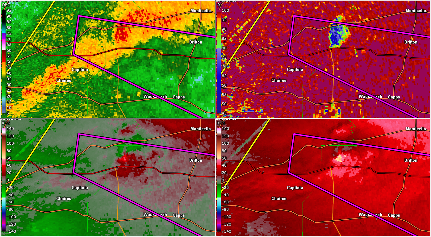
Tornado - Baum Rd, FL
Leon/Jefferson County
| Date |
March 3, 2019 |
| Time |
08:18 PM EST |
| EF Rating (Max) |
3 |
| Est. Peak Winds |
140 mph |
| Path Length |
6.5 miles |
| Max Width |
700 yards |
| Injuries/Deaths |
2 injuries |
|
Summary:
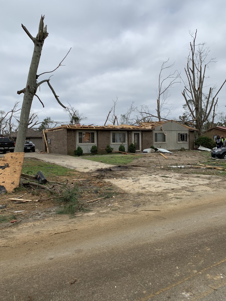
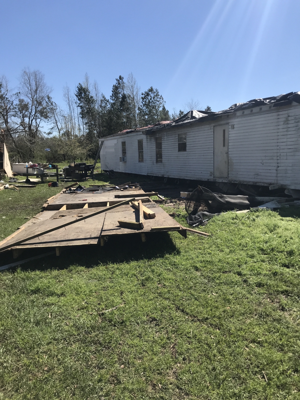
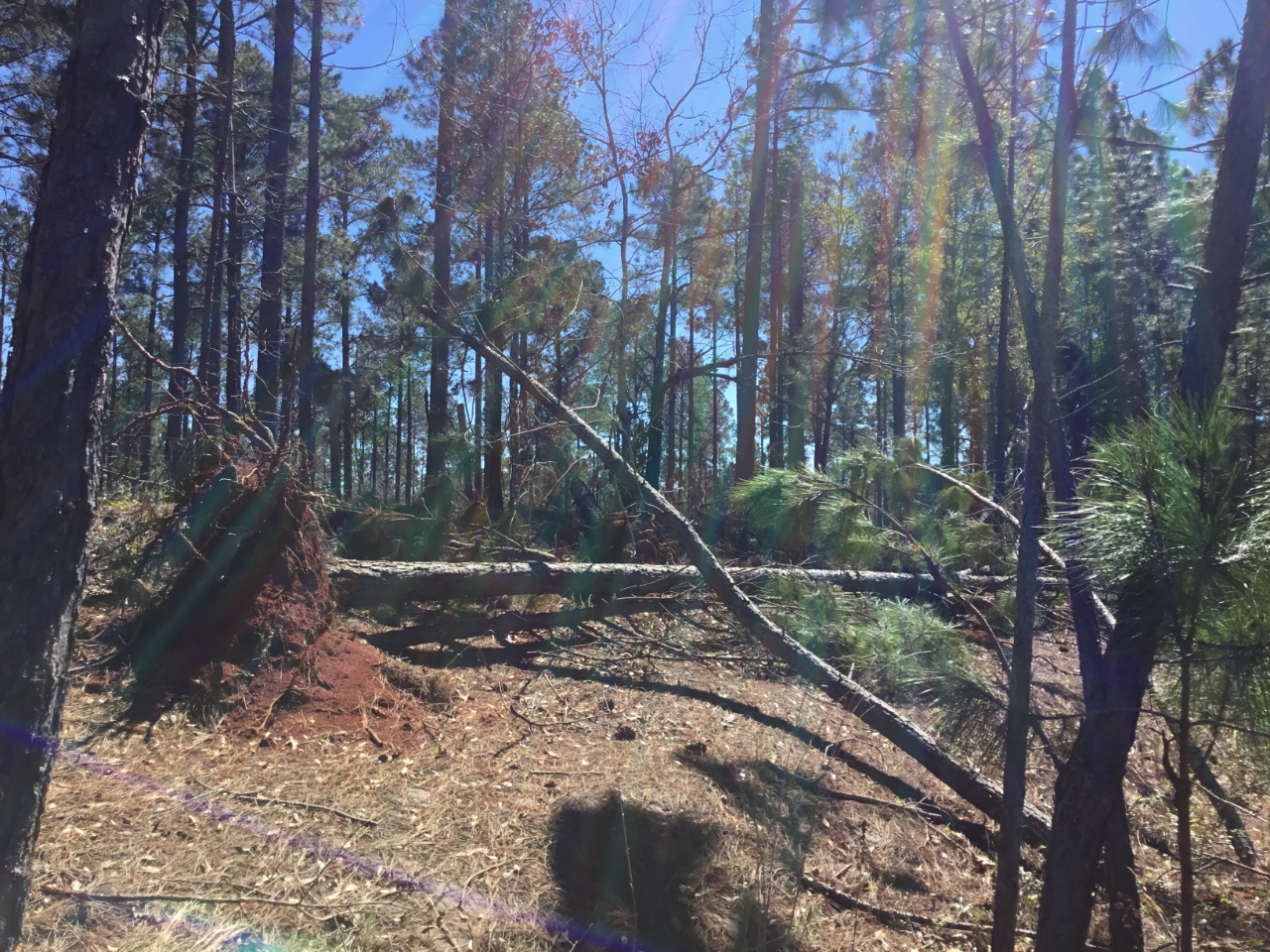
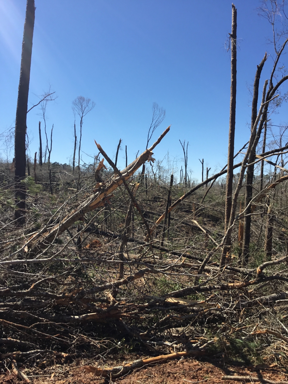
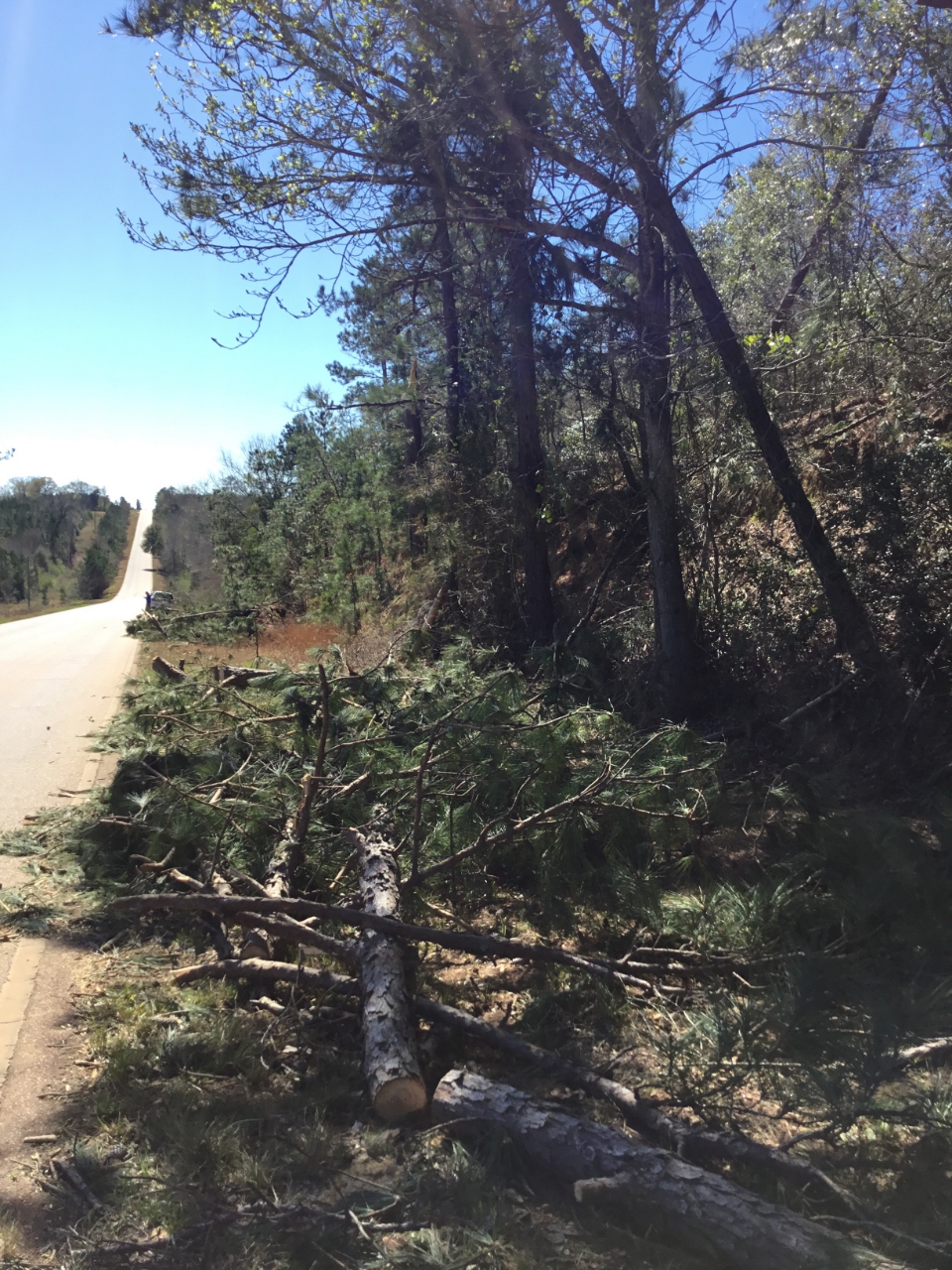
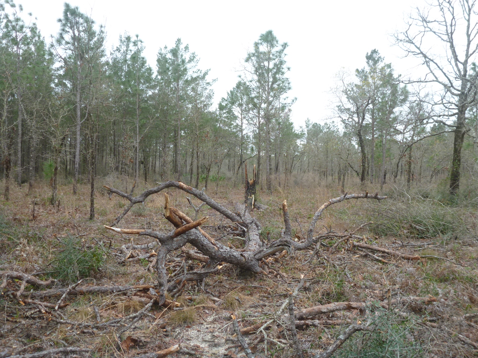
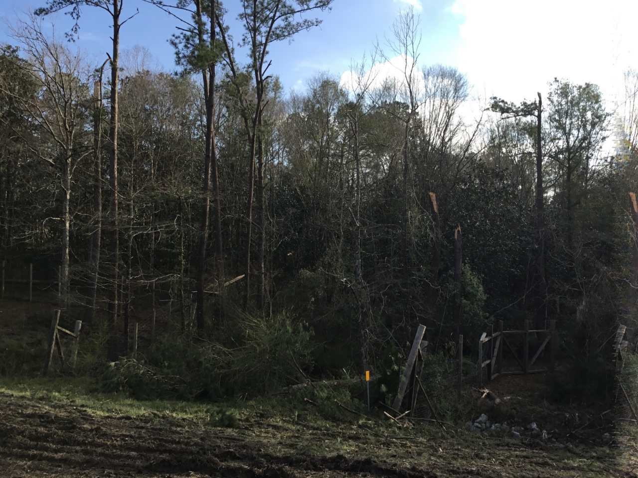
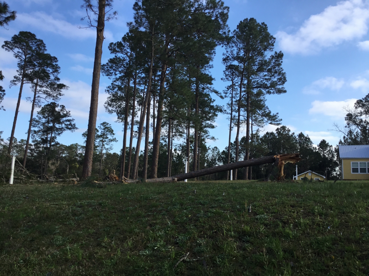
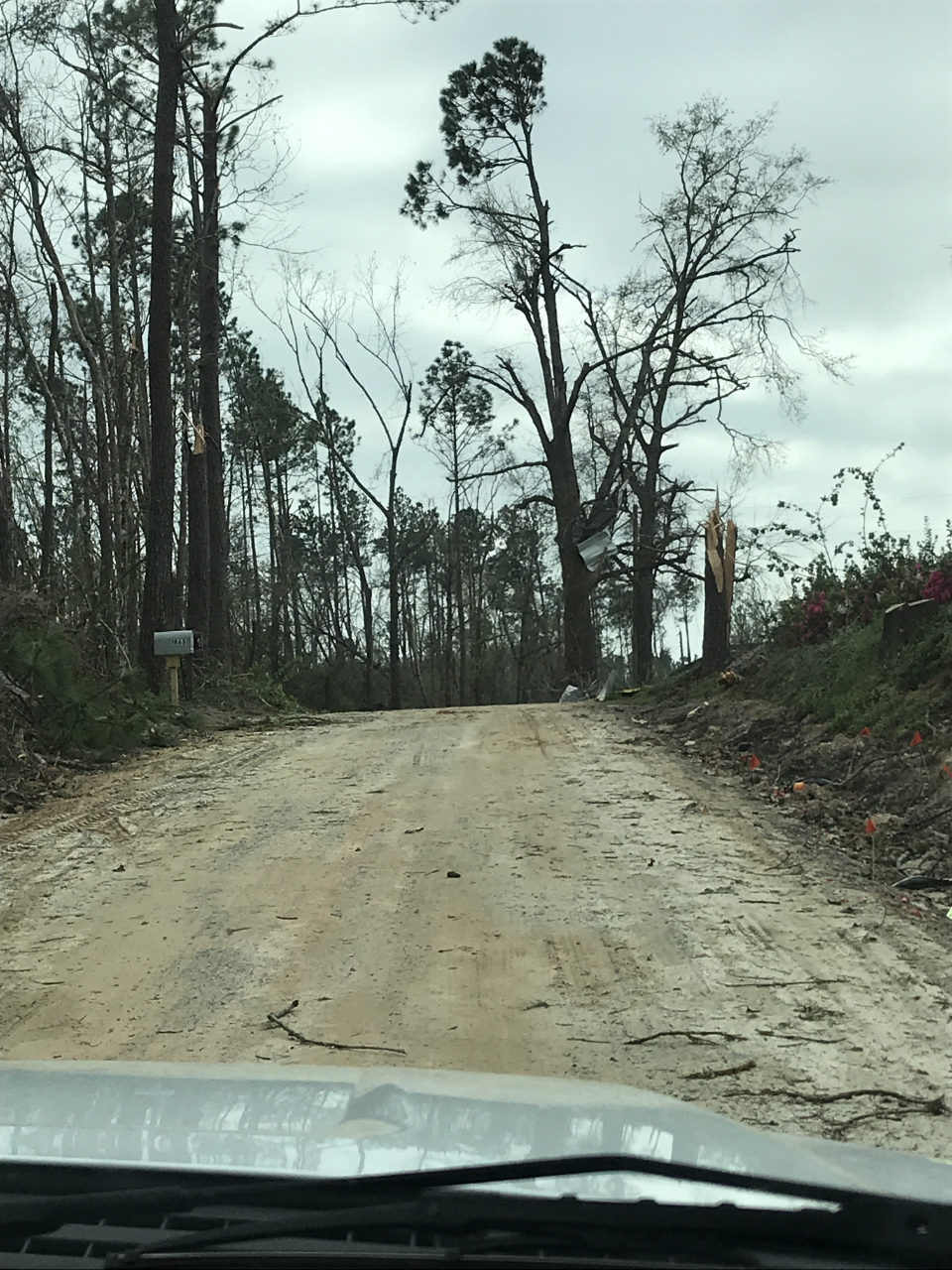
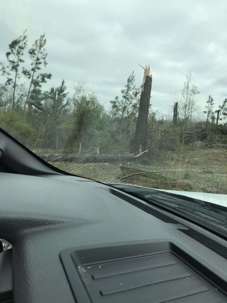
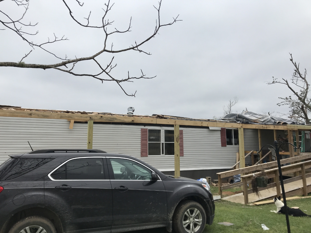
A EF-3 tornado, with maximum winds of 140 mph, that tracked 6.5 miles across far Eastern Leon County and into extreme Western Jefferson County. This tornado initially touched down near the intersection of US-90 and Crump Road in eastern Leon County. After crossing Baum Road, the tornado reached peak intensity in the vicinity of Steeds Run. In this area two homes were destroyed. Damage with both homes was consistent with a low-end EF-3 tornado.
From a historical perspective, this is the second tornado rated F3 or EF3 in Leon County since 1945. Accordingly, this makes the March 3rd tornado the 2nd strongest tornado to affect Leon County since 1945.
|
Track Map
 
Downloadable KMZ File
|
 |
 |
 |
 |
| 8:18PM EST |
8:21PM EST |
8:26PM EST |
8:30PM EST |
| Top left of each radar image contains reflectivity data, top right contains correlation coefficient data, the bottom left image contains storm relative velocity data and the bottom right image contains velocity data. |
|
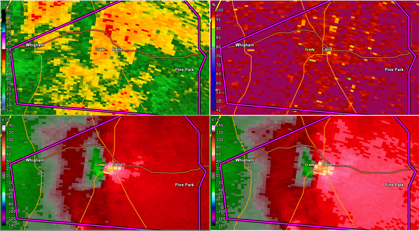
Tornado - Cairo, GA
Grady County
| Date |
March 03, 2019 |
| Time |
7:54 PM EST |
| EF Rating (Max) |
2 |
| Est. Peak Winds |
120 mph |
| Path Length |
2.69 miles |
| Max Width |
800 yards |
| Injuries/Deaths |
2 injuries |
|
Summary:
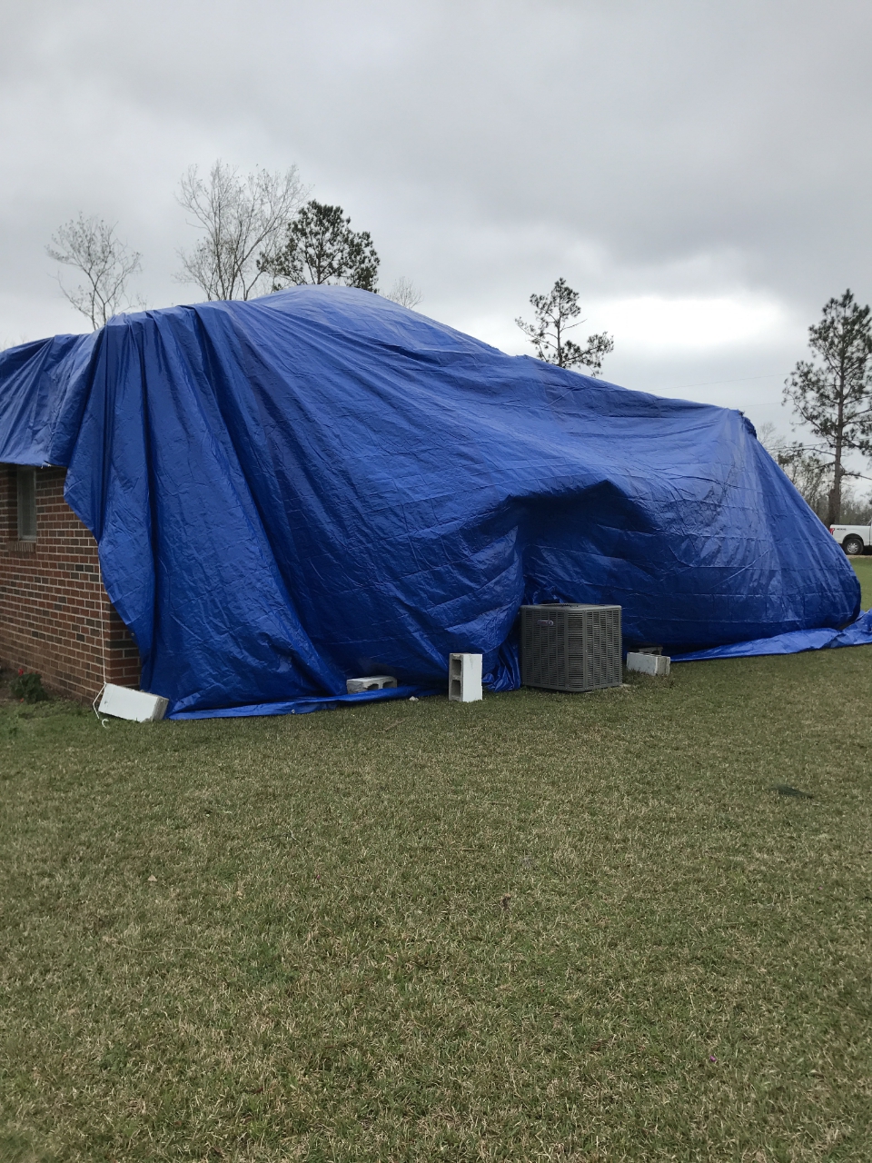
An EF-2 tornado, with maximum winds of 120 mph, tracked 2.7 miles across Grady County in the Cairo area. The tornado touched down on Monrovia Nursery, downing 100s of potted plants and numerous trees in the forest. The tornado continued to track northeastward, downing numerous trees, many of which fell on homes causing structural damage. In one of the harder hit areas, the roof was torn off of a single family home and a carport was destroyed. The tornado eventually lifted northeast of Hwy 84. Two injuries were sustained from the storm.
|
Track Map

Downloadable KMZ File
|
 |
 |
 |
 |
| 7:51PM EST |
7:53PM EST |
7:55PM EST |
7:57PM EST |
| Top left of each radar image contains reflectivity data, top right contains correlation coefficient data, the bottom left image contains storm relative velocity data and the bottom right image contains velocity data. |
|
Tornado - Geneva County near Slocomb, AL
Geneva County
| Date |
March 3, 2019 |
| Time |
4:51 PM CST |
| EF Rating (Max) |
1 |
| Est. Peak Winds |
110 mph |
| Path Length |
5.23 miles |
| Max Width |
300 yards |
| Injuries/Deaths |
1 injury |
|
Summary:
An EF-1 tornado traveled just over 5 miles across portions of Geneva County, Alabama. The tornado was approximately 300 yards at it's widest point. The most significant damage with this tornado occurred at a house just off Mozell road as the tornado passed over a house and ripped off portions of a roof after gaining access to a garage port. The tornado lifted just east of County Rd 49.
|
Track Map

Downloadable KMZ File
|
 |
 |
 |
 |
| 4:51PM CST |
4:53PM CST |
4:57PM CST |
5:03PM CST |
| Top left of each radar image contains reflectivity data, top right contains correlation coefficient data, the bottom left image contains storm relative velocity data and the bottom right image contains velocity data. |
|
Tornado - Apalachicola National Forest, FL
Wakulla County
| Date |
March 3, 2019 |
| Time |
8:05 PM EST |
| EF Rating (Max) |
0 |
| Est. Peak Winds |
75 mph |
| Path Length |
18.41 miles |
| Max Width |
300 yards |
| Injuries/Deaths |
0 |
|
Summary:
An EF-0 tornado touched down in the Apalachicola National Forest in far western Wakulla County producing a TDS on the TLH radar. Aerial survey confirmed that damaged was isolated to a few trees. The tornado did flip a small shed-sized metal canopy on Revadee Spears Road. There was some minor damage to a commercial sign on U.S. Route 319 just north of Linzy Store Road. Across the highway, a lone tree was snapped on the south end of the Walmart parking lot. No damage was found any further east.
|
Track Map

Downloadable KMZ File
|
 |
 |
 |
| 8:06PM EST |
8:08PM EST |
8:18PM EST |
| Top left of each radar image contains reflectivity data, top right contains correlation coefficient data, the bottom left image contains storm relative velocity data and the bottom right image contains velocity data. |
|
Tornado - Fort Gaines, GA
Henry/Clay County
| Date |
March 3, 2019 |
| Time |
5:39 PM EST |
| EF Rating (Max) |
0 |
| Est. Peak Winds |
80 mph |
| Path Length |
9.59 miles |
| Max Width |
75 yards |
| Injuries/Deaths |
0 |
|
Summary:
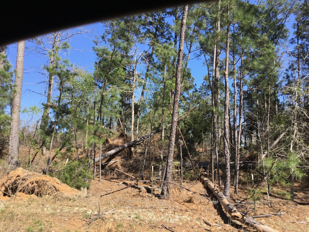
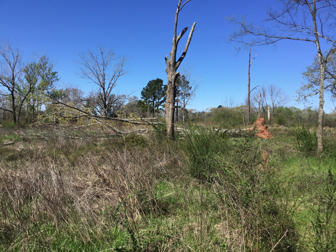
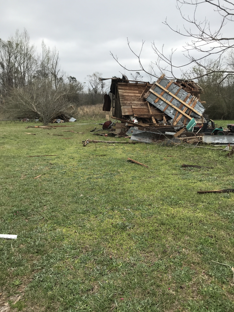
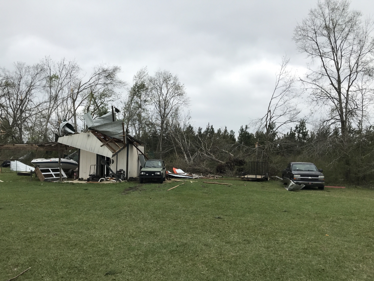
The tornado touched down in Henry County Alabama just south of Shorterville on Henry County Route 47 between Bennett Mill Creek and Route 188 and quickly moved northeast. Most of the damage along the path was confined to uprooted softwood trees along with some roof damage to individual homes near the intersection of Blakely and Blufton highways. Additional softwood trees were uprooted at several points between the aforementioned intersection to a point just north of Route 37/ Edison Highway along Wesely Chapel Road. In addition, Center Line Irrigation was also downed near this location.
|
Track Map

Downloadable KMZ File
|
 |
| 5:45PM EST |
| Top left of each radar image contains reflectivity data, top right contains correlation coefficient data, the bottom left image contains storm relative velocity data and the bottom right image contains velocity data. |
|
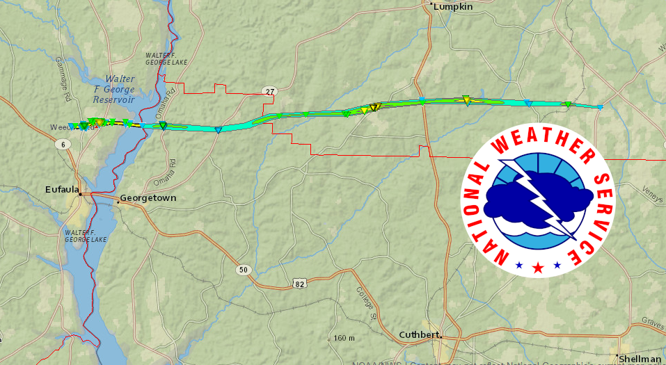
Tornado - Eufaula Ave, AL
Barbour/Quitman/Stewart County
| Date |
March 3, 2019 |
| Time |
5:03 PM EST |
| EF Rating (Max) |
2 |
| Est. Peak Winds |
125 mph |
| Path Length |
26.8 miles |
| Max Width |
860 yards |
| Injuries/Deaths |
0 |
|
Summary:
A strong/cycling tornado crossed into Georgia along the Chattahoochee River, about 2-3 miles south of Lakepoint Resort State Park, causing considerable tree damage along State Hwy 39 in northern Quitman county. The tornado raced east with more trees snapped or uprooted along Hwy 27, just south of CR 10. Based on the surveyable damage (mainly trees), EF-0 to EF-1 damage was noted with max wind speeds estimated around 100 mph. The tornado appeared to briefly weaken near Hwy 27, but quickly re-intensified as it crossed the Quitman/Stewart county line. Please refer to the complete NWS Peachtree City report and the NWS Birmingham Office report for further information on this tornado in their counties of responsibility.
|
Track Map
Downloadable KMZ File
|
 |
 |
 |
 |
| 4:55PM EST |
5:02PM EST |
5:06PM EST |
5:10PM EST |
| Top left of each radar image contains reflectivity data, top right contains correlation coefficient data, the bottom left image contains storm relative velocity data and the bottom right image contains velocity data. |
|
Tornado - Eglin AFB, FL
Walton County
| Date |
March 3, 2019 |
| Time |
4:41 PM CST |
| EF Rating (Max) |
0 |
| Est. Peak Winds |
85 mph |
| Path Length |
12.12 miles |
| Max Width |
400 yards |
| Injuries/Deaths |
0 |
|
Summary:
An EF-0 tornado touched down on Eglin AFB property in Walton County. The tornado produced scattered tree damage before exiting the base near Pleasant Ridge Road. The tornado continued northeast, crossing I-10 just west of the U.S. 331 exit, and then dissipating just southwest of Defuniak Springs. Damage was primarily confined to trees.
|
Track Map

Downloadable KMZ File
|
 |
 |
 |
| 4:24PM CST |
4:30PM CST |
4:34PM CST |
| Top left of each radar image contains reflectivity data, top right contains correlation coefficient data, the bottom left image contains storm relative velocity data and the bottom right image contains velocity data. |
The NWS Office in Tallahassee appreciates the support of the officials at Eglin Air Force Base for their support in surveying the damage that occurred on their portions of the base.
|
Tornado - Alford, FL
Washington/Jackson County
| Date |
March 3, 2019 |
| Time |
5:33 PM CST |
| EF Rating (Max) |
1 |
| Est. Peak Winds |
100 mph |
| Path Length |
5.27 miles |
| Max Width |
300 yards |
| Injuries/Deaths |
0 |
|
Summary:
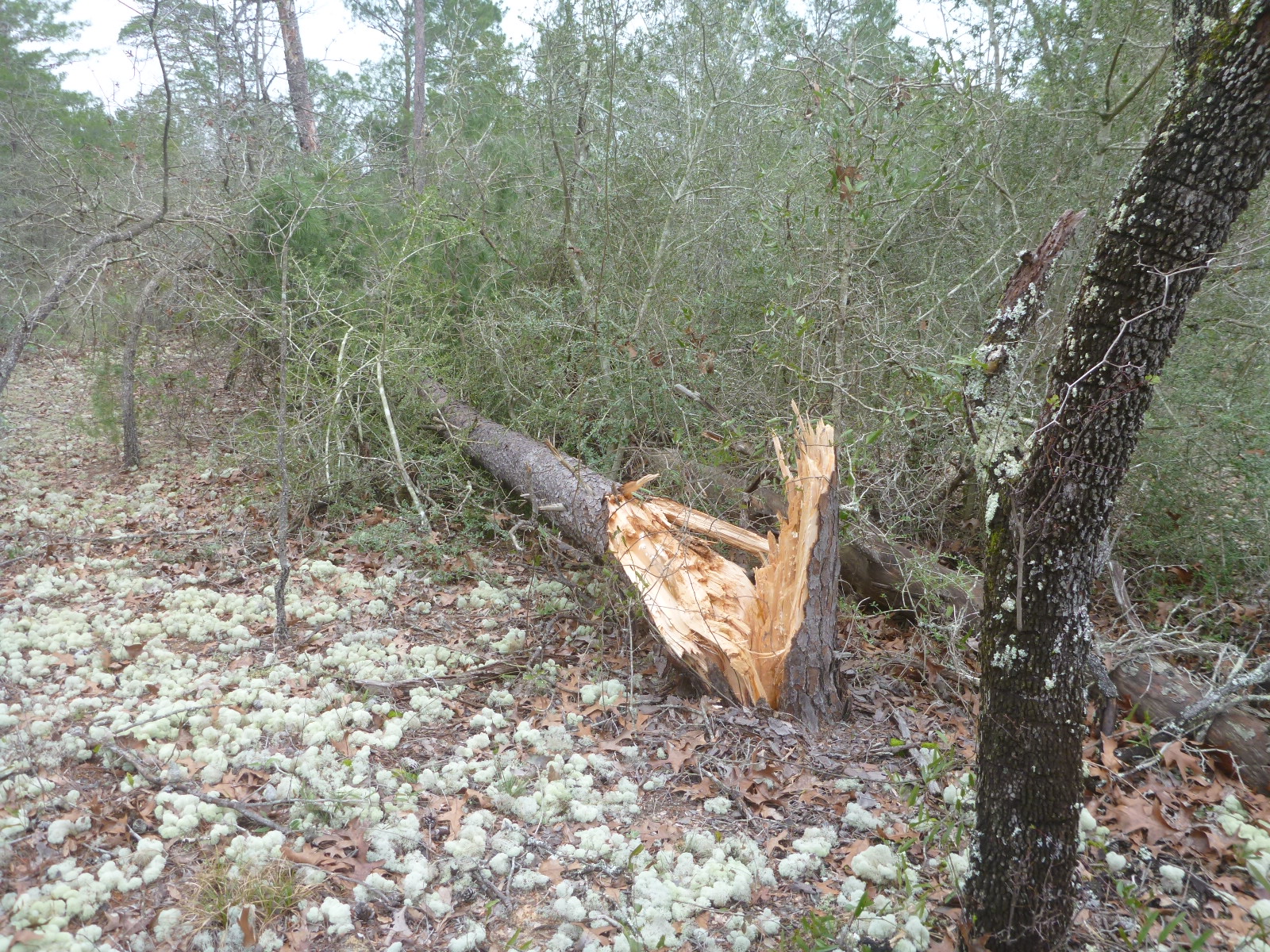
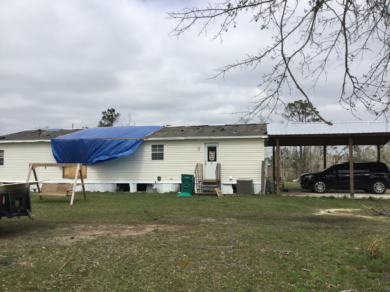
An EF-1 tornado touched down about 5 miles to the west of Alford, FL in Washington County. The highest degree of damage was at a house near the county border with Jackson County where much of the tin was ripped from the roof, a small barn tumbled about 50 feet to the northeast as well as a metal canopy moving about 75 feet to the northeast. The tornado continued to move into Jackson County, FL where the main damage was also to tin roofing material with at least one double wide seeing all of the wood, shingles and tin removed from a quarter of the house. At another residence, a small outbuilding was lifted, flipped over and landed up against the house, completely destroyed. A few snapped and uprooted trees were also noted in Jackson county. The tornado lifted about 1.5 miles north of Alford, FL.
|
Track Map

Downloadable KMZ File
|
 |
| 5:34PM CST |
| Top left of each radar image contains reflectivity data, top right contains correlation coefficient data, the bottom left image contains storm relative velocity data and the bottom right image contains velocity data. |
|
Tornado - Brinson Road, GA
Miller County
| Date |
March 3, 2019 |
| Time (Local) |
7:04 PM EST |
| EF Rating (Max) |
1 |
| Est. Peak Winds |
100 |
| Path Length |
4.26 miles |
| Max Width |
150 |
| Injuries/Deaths |
1 injury |
|
Summary:
An EF1 tornado with maximum winds of 100 mph touched down west of US-27 in Miller County near Brinson Road. Damage west of US-27 included a center pivot irrigation system overturned. One home in the area was blown off cinder blocks. Another home had roof damage where a corner of the roof was peeled off along where a portion of he wall was blown out. The tornado crossed US-27 and east of the highway destroyed a small modular home seriously injuring the occupant. As the tornado continued moving eastward, several trees were snapped or uprooted, with another pivot irrigation system overturned. The tornado lifted before Babcock Lake Road.
|
Track Map

Downloadable KMZ File
|
 |
| 7:06PM EST |
| Top left of each radar image contains reflectivity data, top right contains correlation coefficient data, the bottom left image contains storm relative velocity data and the bottom right image contains velocity data. |
|
Tornado - Spring Creek Road, GA
Decatur County
| Date |
March 3, 2019 |
| Time |
7:18 PM EST |
| EF Rating (Max) |
1 |
| Est. Peak Winds |
90 mph |
| Path Length |
4.59 miles |
| Max Width |
150 yards |
| Injuries/Deaths |
0 |
|
Summary:
An EF1 tornado with maximum winds of 90 mph initially touched down southwest of Bainbridge along GA-253, or Spring Creek Road. Damage in the area was mainly limited to large snapped pines. A tree fell on a home along the road. The tornado lifted before reaching the Flint River with straight-line wind damage observed south of Bainbridge.
|
Track Map

Downloadable KMZ File
|
 |
 |
| 7:12PM EST |
7:24PM EST |
| Top left of each radar image contains reflectivity data, top right contains correlation coefficient data, the bottom left image contains storm relative velocity data and the bottom right image contains velocity data. |
|
Tornado - Quincy, FL
Gadsden County
| Date |
March 3, 2019 |
| Time |
7:41 PM EST |
| EF Rating (Max) |
1 |
| Est. Peak Winds |
100 mph |
| Path Length |
2.12 miles |
| Max Width |
275 yards |
| Injuries/Deaths |
0 |
|
Summary:
This EF-1 tornado touched down just west of Pat Thomas Highway, FL Route 267, and just north of Cox Lane. The tornado flipped a single-wide mobile home upside down. On the opposite side of the highway, a couple of large pine trees snapped, one of which crashed through the roof of a home narrowly crushing a couple that were in bed at the time. The tornado continued east-southeast roughly paralleling the CSX tracks. A aerial survey showed trees snapped along the route. Ground surveys showed damage to homes along Jim Williams road. The tornado reached its greatest strength at this point, snapping a few small utility poles, removing about half the roof of one home along with damaging a couple of others. The tornado lifted just beyond the end of this road.
|
Track Map

Downloadable KMZ File
|
 |
| 7:44PM EST |
| Top left of each radar image contains reflectivity data, top right contains correlation coefficient data, the bottom left image contains storm relative velocity data and the bottom right image contains velocity data. |
|
Tornado - Urbana Road, GA
Tift County
| Date |
March 3, 2019 |
| Time |
7:45 PM EST |
| EF Rating (Max) |
1 |
| Est. Peak Winds |
95 mph |
| Path Length |
0.72 miles |
| Max Width |
180 yards |
| Injuries/Deaths |
0 |
|
Summary:
An EF-1 tornado briefly touched down at the edge of a farm damaging snapping and uprooting trees along the path. Some were peach trees. When the tornado crossed Urbana Road, it blew out part of the foundation of a large garage causing the associated wall to bow outward. There was significant shingle damage to the roof of this building. A bit further from the road, the tornado moved a large 3.5 ton trailer, filled with air conditioning roughly 3 feet. The metal roof of the structure sheltering this and other vehicles was partially uplifted. The tornado lifted just beyond the edge of the property line.
|
Track Map

Downloadable KMZ File
|
 |
 |
| 7:44PM EST |
7:49PM EST |
| Top left of each radar image contains reflectivity data, top right contains correlation coefficient data, the bottom left image contains storm relative velocity data and the bottom right image contains velocity data. |
|
The Enhanced Fujita (EF) Scale classifies tornadoes into the following categories:
EF0
Weak
65-85 mph |
EF1
Moderate
86-110 mph |
EF2
Significant
111-135 mph |
EF3
Severe
136-165 mph |
EF4
Extreme
166-200 mph |
EF5
Catastrophic
200+ mph |
 |
Photos & Video (Photos will be added as they become available)
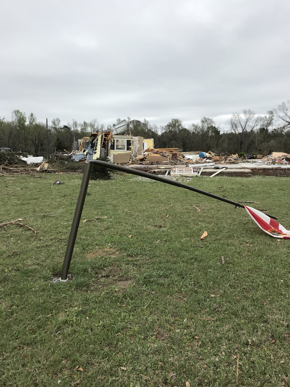
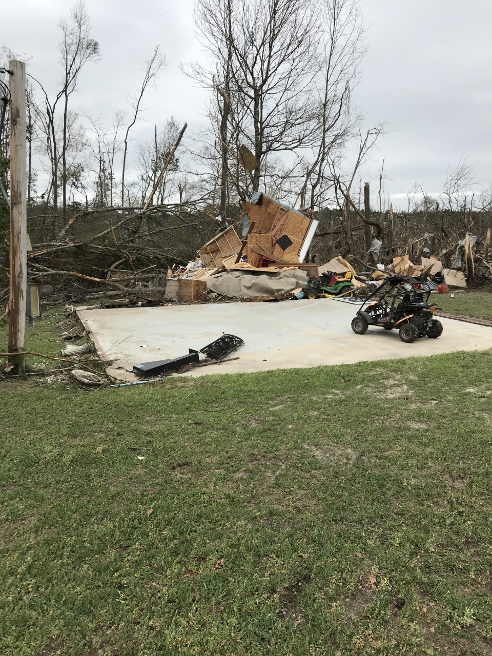
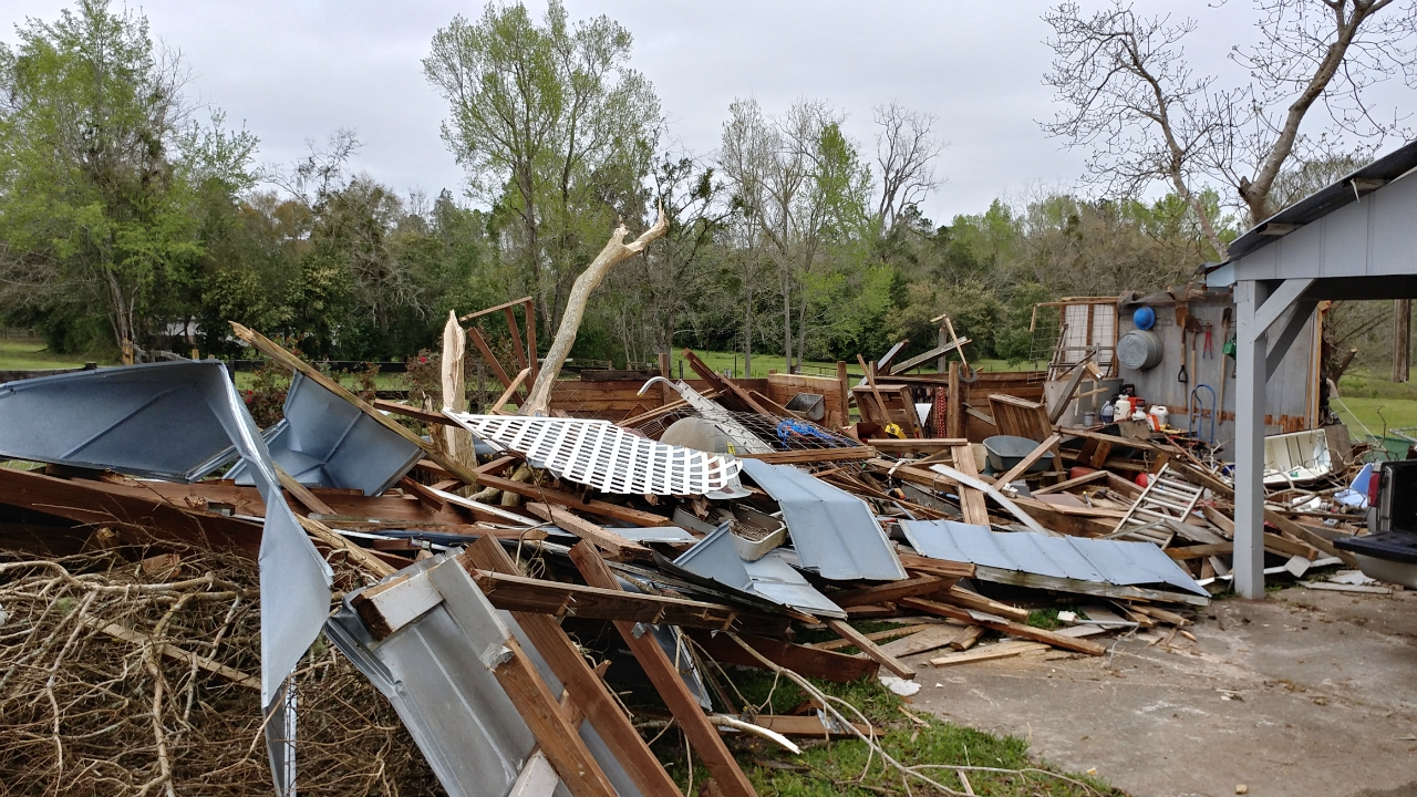
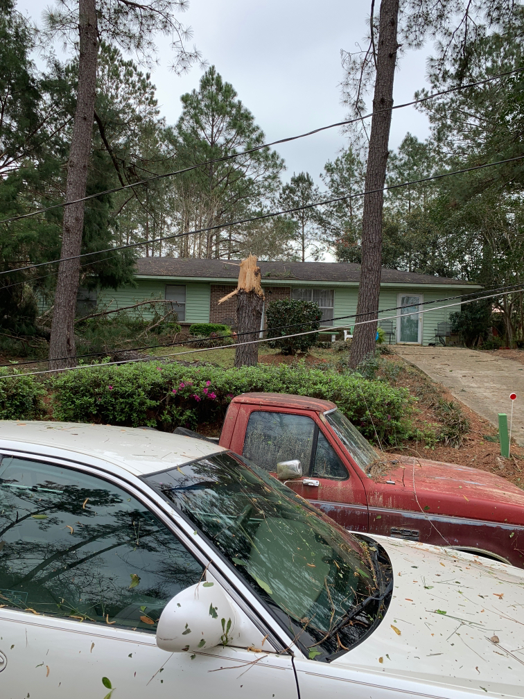
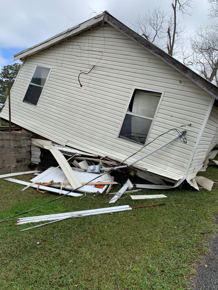
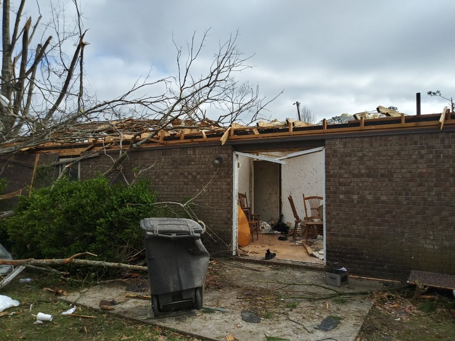
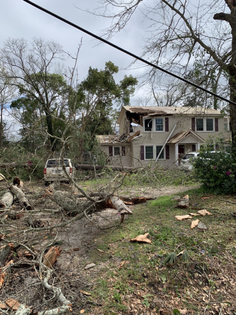
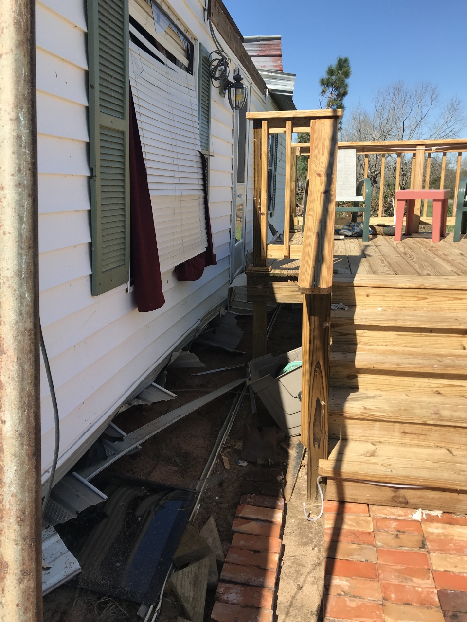
Baum Rd, FL Tornado - Leon County
 |
 |
 |
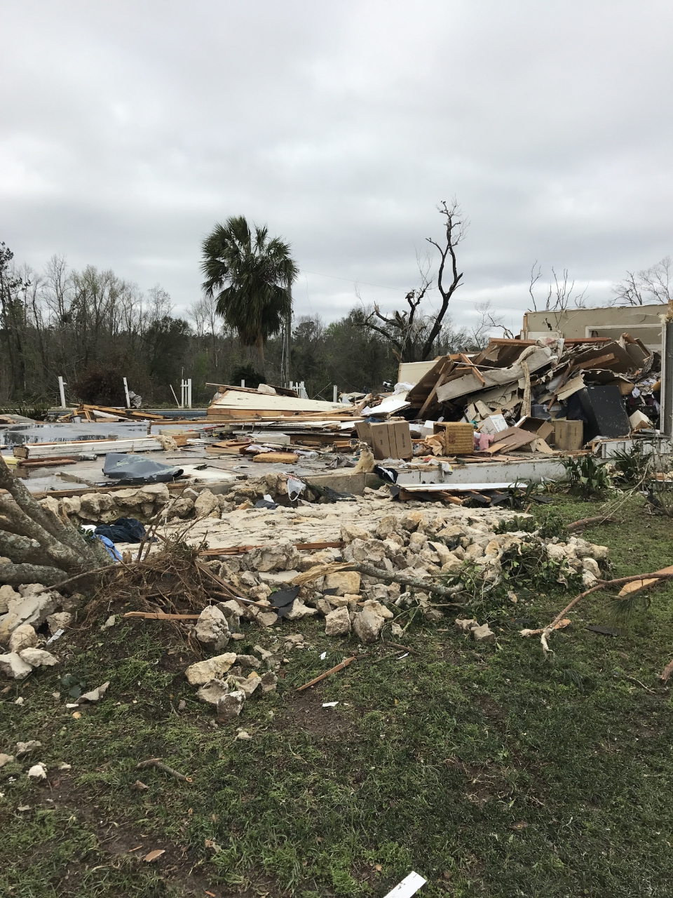 |
| Home with EF-3 damage at the tornado's strongest point which occurred west |
Additional damage near Steeds Run |
Additional damage along Steeds Run |
Additional damage along Steeds Run |
 |
 |
 |
 |
| Additional EF-3 damage just east of those above. |
Additional damage |
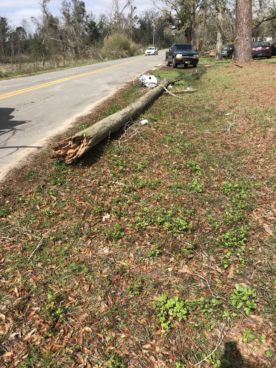
Electrical transmission lines snapped off Jefferson Rd. |
Home damage near Mahan Rd. |
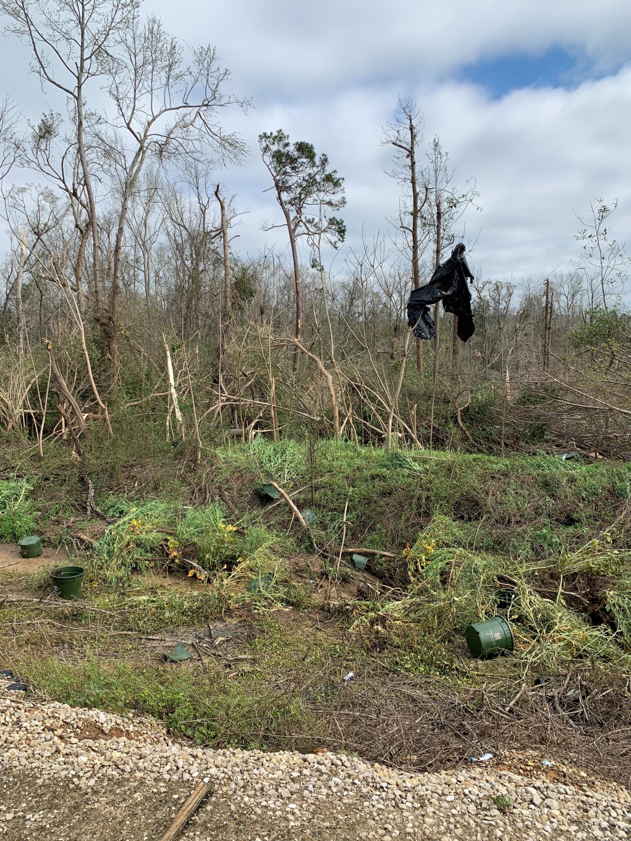
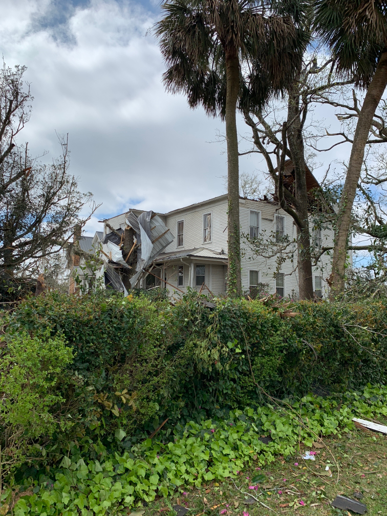
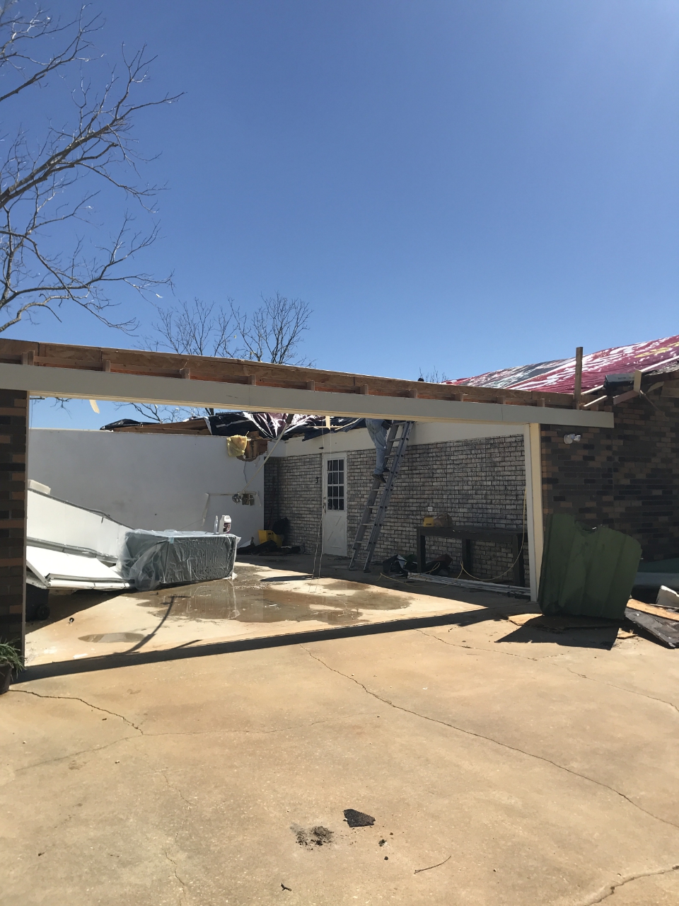
Cairo, GA Tornado
 |
 |
 |
 |
| East side of Monrovia Nursery as tornado moved northeast into Cairo |
Damage southeast side of Cairo as tornado moved into town. |
Manufactured home slid off its foundation as tornado neared heaviest part of the damage in town. |
Roof completely gone. Center of the EF-2 damage and strongest point in the Cairo tornado |
 |
 |
 |
 |
| Destroyed car port next to house with missing roof. |
Back of home with strongest damage |
A common sight in the town of Cairo. A majority of the damage was trees and from trees falling into homes. |
Roof damage in Cairo northeast of strongest damage. |
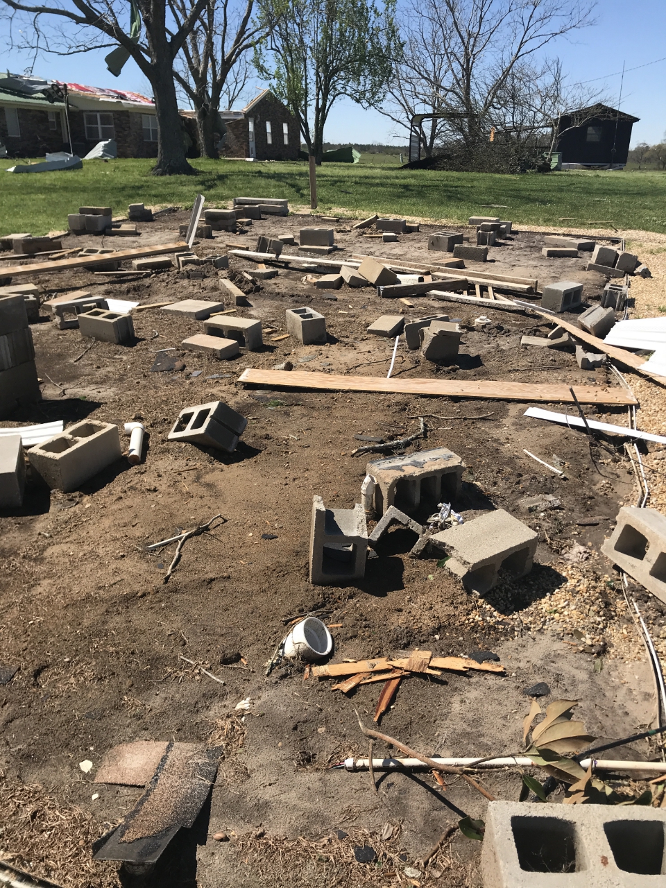
Geneva County, AL Tornado Near Slocomb, AL.
 |
 |
 |
 |
| Damage along New Teamon Rd near where the tornado is estimated to have formed. |
Damage to a manufactured home as it was shifted off its foundation. The stairway led to the home's original height. |
Same damage to back of manufactured home. Addition to home destroyed by the tornado. Damage occurred just north of Mozell Rd. |
Strongest point of damage along Mozell Rd and the tornado. Winds blew out garage door and gained easy access to garage to lift roof off house. |
 |
 |
 |
 |
| Manufactured home next to damaged house lifted off foundation, rotated, and displaced intact (mostly) 10 to 20 feet away. |
Manufactured home displaced off its foundation. |
Part of metal roof (very sharp) thrown 18 inches into the ground. A reminder flying debris is extremely dangerous in tornadoes. |
Another manufactured home further east lifted off foundation and displaced 5 feet. Extensive roof damage. Just off State Rd 103. |
Fort Gaines, GA Tornado
 |
 |
 |
| Trees uprooted off County Rd. 49 where tornado is estimated to have formed. |
More uprooted trees east of Fort Gaines, GA. |
More uprooted trees near the end point of the tornado just northeast of Zetto. |
Eufaula Ave, AL Tornado
 |
 |
| Trees snapped as tornado crossed State Road 39. East of the Walter F George Reservoir |
Tree damage as the tornado crossed just south of the intersection of State Road 27 and Graddy Rd. |
Eglin AFB, FL Tornado
| Damage pictures below were provided courtesy of Sandy Williams at the Eglin Air Force Base Natural Resources Department. |
 |
 |
 |
 |
| Tree snapped on Eglin Air Force Base. |
More tree damage on Eglin Air Force Base |
More tree damage as the tornado crossed Interstate 10 near exit 85. |
Minor tree damage just southwest of Defuniak Springs where the tornado is estimated to have dissipated. |
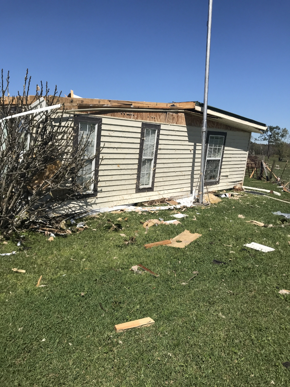
Alford, FL Tornado
 |
 |
 |
 |
| Trees snapped around the estimated starting location of the tornado. Damage occurred along Kent Rd. |
Additional trees snapped along Kent Rd. |
Damage to manufactured home along Alford Rd. |
Structure damage along Vickery Rd north of Alford/Cypress Creek Rd. |
 |
 |
 |
 |
| Structure damage along Family Ct. north of Cypress Creek Rd. |
Roof torn off manufactured home just off Seay Rd north of Syfrett Rd. |
|
Roof turn off structure around the estimated end point of the tornado. |


