Overview
A powerful storm system moved across the southeast portions of the United States January 8 and 9th, 2024. The system brought widespread damaging winds overnight and into the morning hours of January 9th. Additionally, a powerful squall line traversed the area bringing another round of damaging winds and several tornadoes during the morning of January 9th. Information is preliminary but several injuries and one fatality occurred as a result of the tornado outbreak.
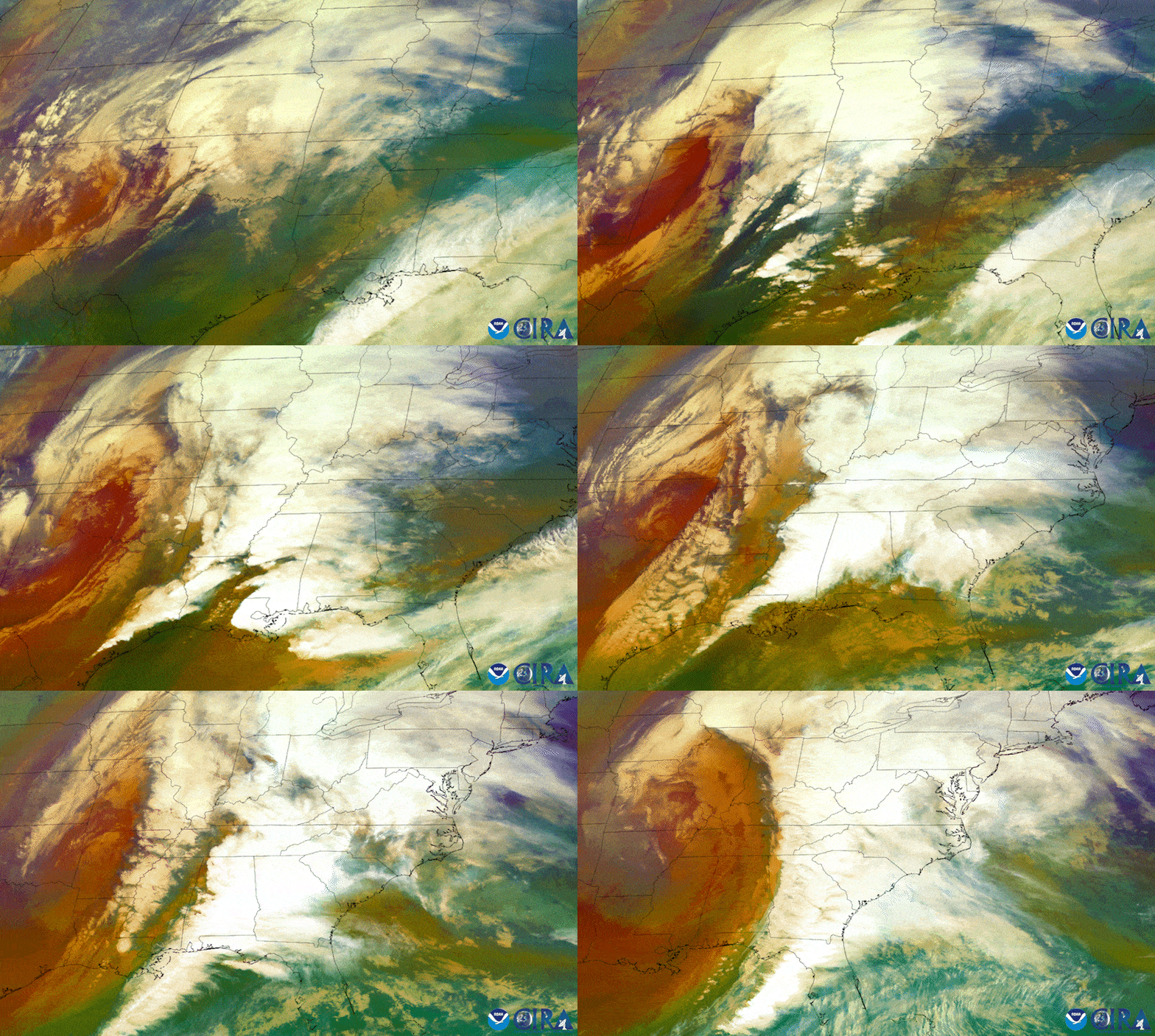 |
| Region wide overview of the powerful storm system that moved through the region the second week of January. It brought widespread damaging winds and an out of tornadoes across the Florida Panhandle and southeast Alabama |
Tornado Information
|
Lynn Haven, Bayou George Bay County, Florida
Track Map
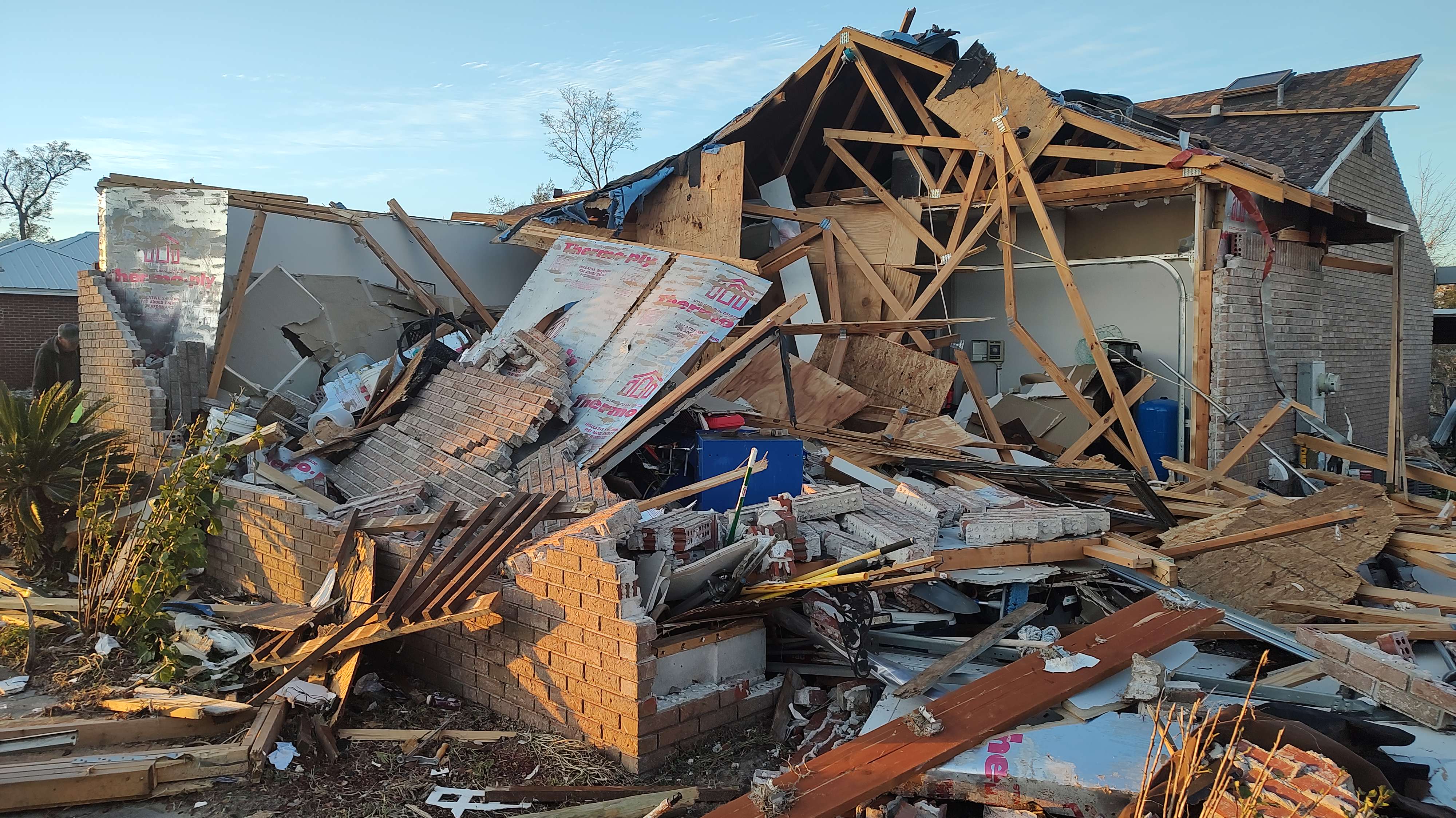
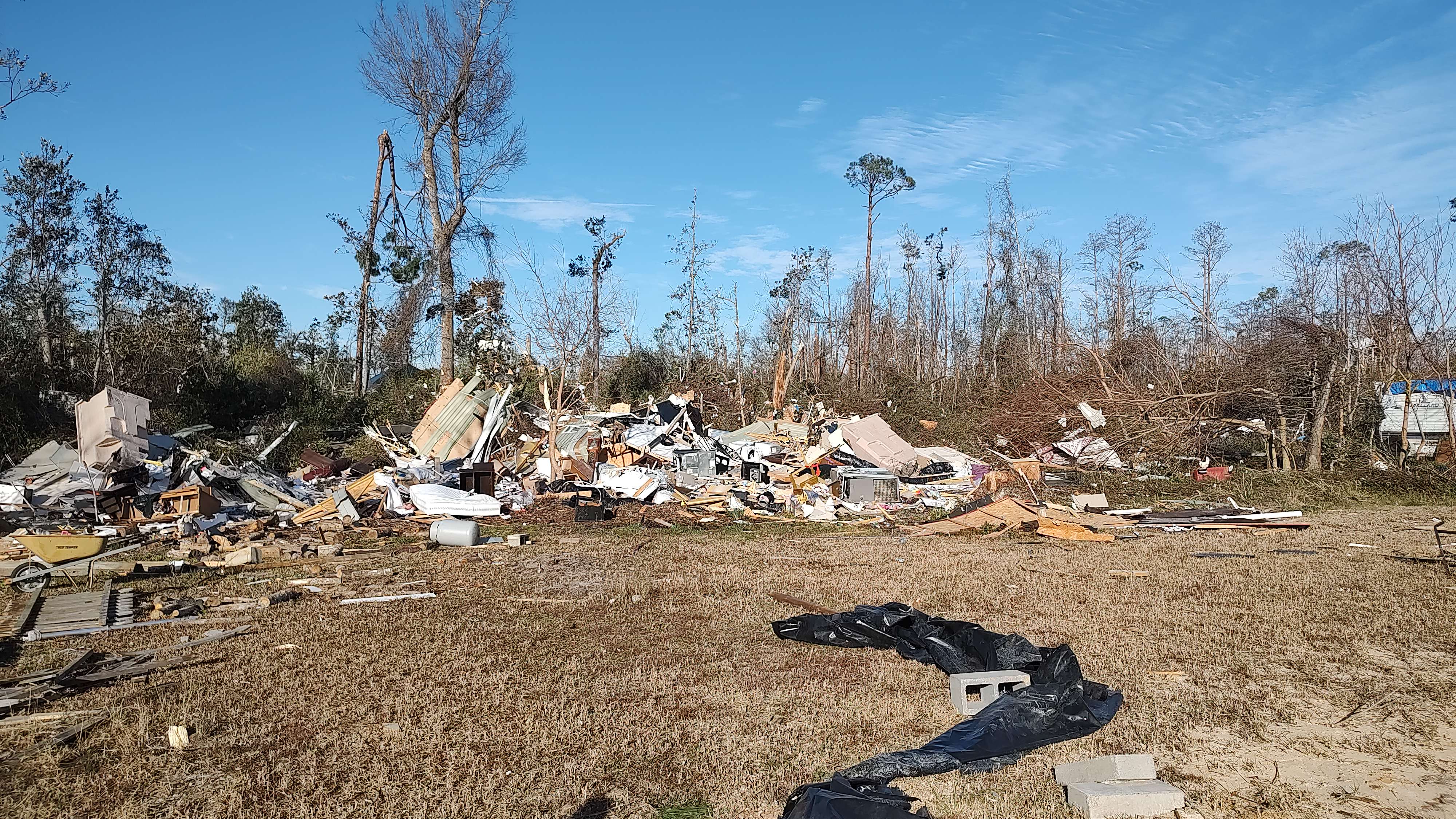
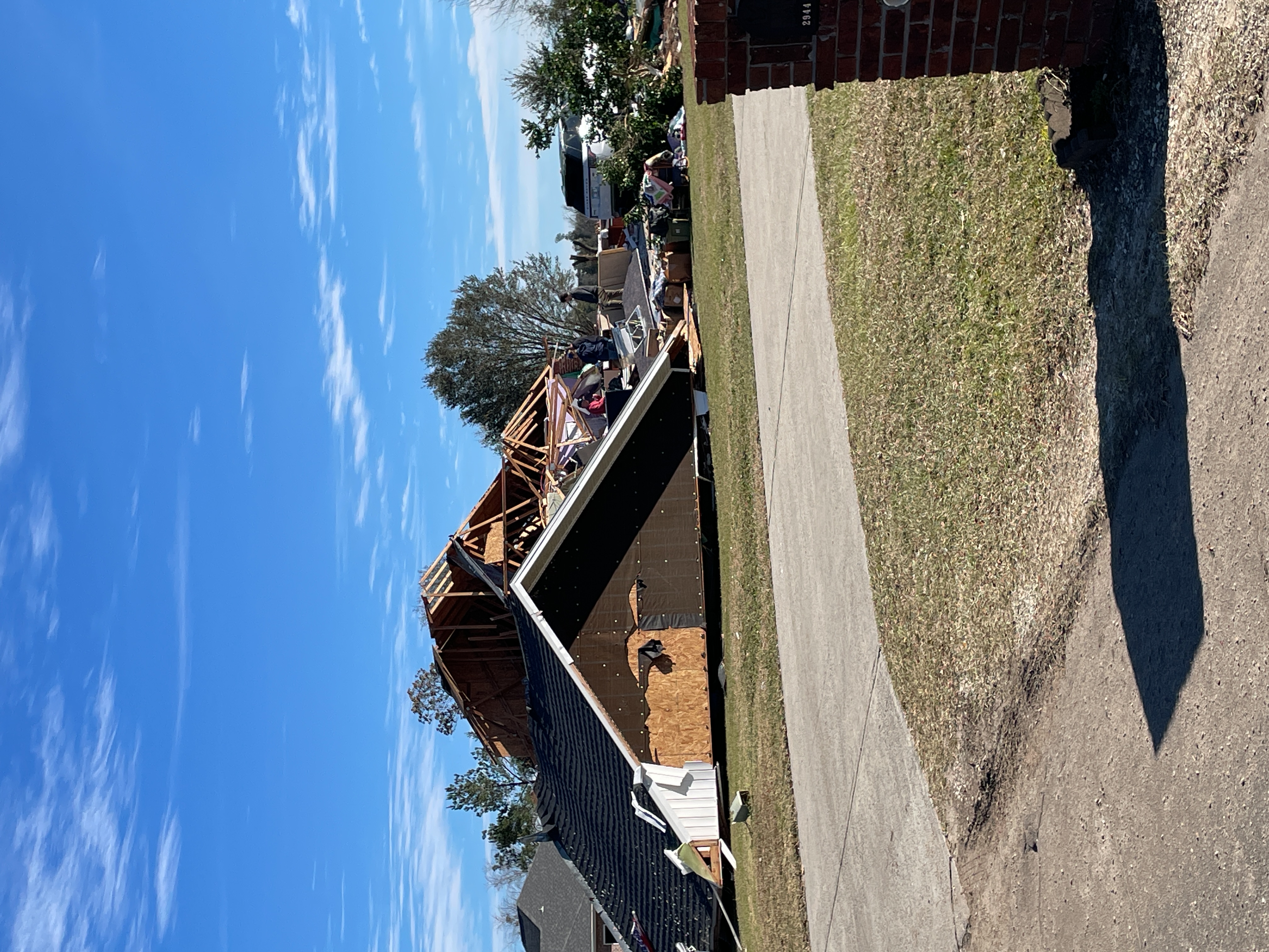
The same supercell that spawned the Grand Lagoon tornado dropped another in Lynn Haven where some trees were snapped and one home had some minor roof damage. The tornado then traveled northeast across the eastern portion of North Bay before causing damage in the Resota Beach area on the west shore of Deer Point Lake, destroying one double-wide manufactured home and significantly damaging another. The most significant damage in this area was to a single family home on Joanna Lane where large sections of the roof were removed and the garage was destroyed. This was consistent with EF-2 damage. After crossing Deer Point Lake, the tornado tracked through the Bay Head neighborhood where it caused the most extensive damage. One manufactured home on Magnolia Avenue was ripped from its moorings and tossed against the tree line at the back of the property. Fortunately, the two people inside suffered only minor injuries. A single family home at the intersection of Magnolia and Seminole St. had a large portion of its roof removed. Similar damage occurred to a home on Palm Avenue where substantial tree damage also occurred. Four homes in the vicinity of Cherokee St. and Deerwood Avenue sustained similar damage. A brick home on Sunshine Drive not only had about half of its roof removed, but also saw collapse of walls on one corner of the house. All of these homes mentioned thus far in Bay Head suffered EF-2 damage, but this last one was the most severely damaged with winds estimated at 130 mph. As the tornado continued northeast, additional roof damage to homes occurred on Indian Bluff Drive, Indian Bluff Road, Piza Circle, and Miller Circle. On CR 2301 near Vickery Lane, one mobile home was shifted off its support blocks with a third of the structure destroyed. Damage northeast of this point became more sporadic and mainly to trees. The tornado appeared to lift as it cross Mocassin Creek. |
|
Fountain, Econfina Creek Bay, Calhoun, Jackson County, Florida
Track Map
The tornado began in northeastern Bay/ northwestern Calhoun counties where it touched down in a wooded area between US 231 and NW County road 274 snapping several trees. Multiple trees along NW County road 167 were snapped or uprooted. The track continued to the northeast into Jackson county where it crossed through forested land before crossing freeman road. The tornado continued through another wooded area before moving parallel with Grand Mesa Avenue where several trees were uprooted or snapped. The tornado then continued through another wooded area before crossing varsey lane where it damaged some small outbuilding sheds as well as snapped a few trees. The tornado continued to track parallel to Varsey lane to the northeast before snapping tree tops along its path before lifting just beyond Celestial lane in another wooded area. The tornado reached its maximum width of approximately 450 yards as well as its maximum intensity as it crossed NW county road 167 with the most widespread tree damage observed at this point. |
|
Callaway, Florida Bay County, Florida
Track Map
A tornado touched down in Callaway near the intersection of South Tyndall Parkway and North Lakewood Drive. The roofs of two homes were heavily damaged in this location, consistent with an EF-2 tornado. Damage was sporadic along the track as the tornado continued northeast until the roof of another home was removed along Chipewa Street. A manufactured home was also damaged along Chipewa Street. The tornado appears to have dissipated near Cherry Street, where debris from the damaged roof was scattered. Thanks to area media and Emergency Management for assistance with this survey. |
|
Lower Lagoon Bay County, Florida
Track Map
Likely satellite vortex of parent EF-3 tornado just to the west made landfall at the western edge of St. Andrews State Park. Only very minor damage to a few tree limbs and an antenna were reported by park management. The tornado was confirmed via videos on social media. |
|
Lower Lagoon, Panama City Bay County, Florida
Track Map
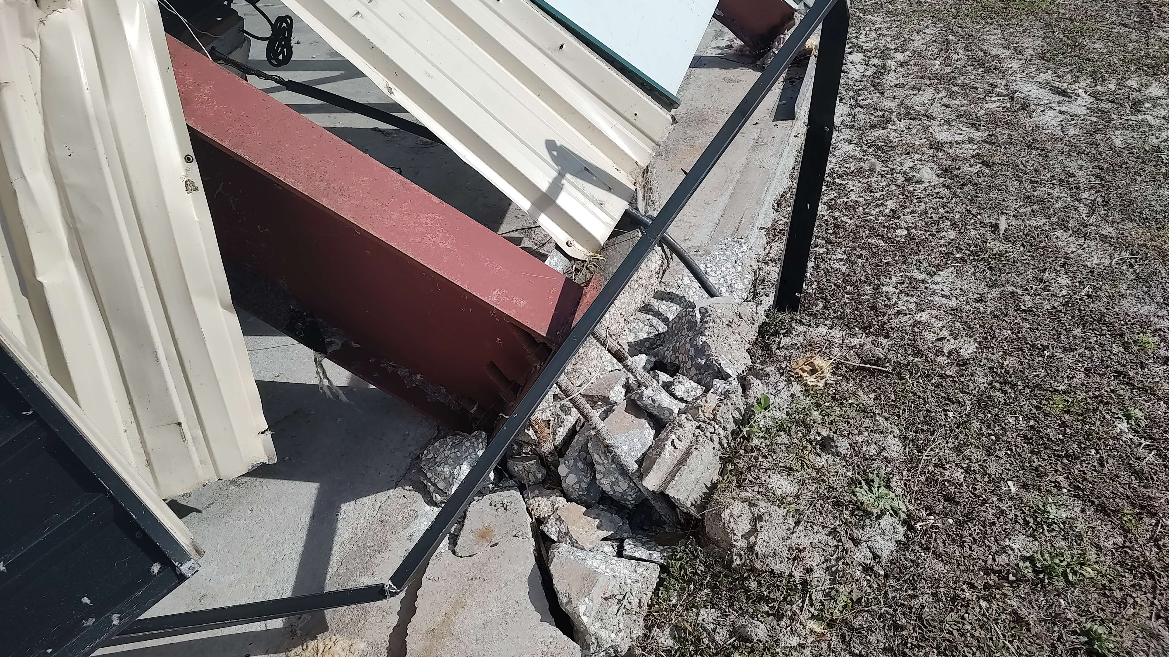
A tornado moved onshore Panama City Beach in the Lower Grand Lagoon area along Spyglass Drive. Significant damage occurred to several homes, including the complete destruction of one beachfront home. The damage at this location was determined to support an EF-3 rating. Significant damage to homes and businesses continued as the tornado moved northeast across and along Thomas Drive where two apartment building were heavily damaged. EF-3 damage was again noted at a large boat storage facility which suffered significant structural failure. The tornado continued northeastward across Grand Lagoon and through the Bay Point Golf Club, causing additional damage to homes, before crossing Saint Andrew Bay. The damage in Panama City, after crossing the bay was more sporadic and less intense, supportive of EF-1 intensity. The tornado appears to have dissipated shortly after crossing West 23rd Street. Additional adjustments may be made to the track as more data is gathered and analyzed. Thanks to Bay County Emergency Management for assistance with the damage survey. |
|
Arlington, Morgan Early, Calhoun County, Georgia
Track Map
The tornado touched down in a heavily wooded area along Daniels road in Early County causing minor damage to trees. The tornado travelled north and intensified as it crossed agricultural fields and Clower Road where it toppled several center pivot irrigation systems. An unreinforced concrete block home was also destroyed along this road, consistent with an EF-2 rating. EF-2 damage was also noted just to the northeast along Highway 45 where two homes were badly damaged. An older two story home was shifted off its foundation several feet. Another newer brick home suffered significant roof damage. The intensity peaked at this location with an estimated maximum wind speed of 120 mph. Tree damage continued along the track to the northeast across Highway 216 and Nantze Spring Road before the tornado moved into Calhoun County. The tornado continued through wooded portions of Calhoun County, causing EF-1 consistent damage to trees. Damage was also noted to a railroad crossing gate along State Road 82. The tornado continued northeast through Calhoun County across Boggy Creek Road and Highway 37. The tornado crossed Highway 234 causing roof damage to a home before damaging a double-wide manufactured home on County Road 120. The tornado dissipated in a rural area just northeast of Highway 55 Thanks to Early and Calhoun County Emergency Management for assistance with this survey |
|
Ponce De Leon Holmes County, Florida
Track Map
A tornado touched down along R.M. Ward Road in western Holmes County. The tornado knocked down numerous trees, which caused damage to several structures, including one home and at least one vehicle. The tornado continued northeast before dissipating in a heavily wooded area northeast of Jessie Hall Lane. Thanks to Holmes County Emergency Management for assistance with this survey. |
|
Memphis, Wilson Quarters Houston County, Alabama
Track Map
A tornado touched down near Sowell Road west of Willie Varnum Road, causing damage to trees and a farm building. The tornado continue northeast, crossing Willie Varnum Road, causing significant tree damage, supportive of an EF-1 rating. The tornado also damaged the roofs of several homes along Willie Varnum Road before dissipating before reaching Cottonwood Road. Thanks to Houston County, Alabama Emergency Management for assistance with this survey. |
|
Graceville, Cottonwood Jackson County, Florida. Houston County, Alabama
Track Map
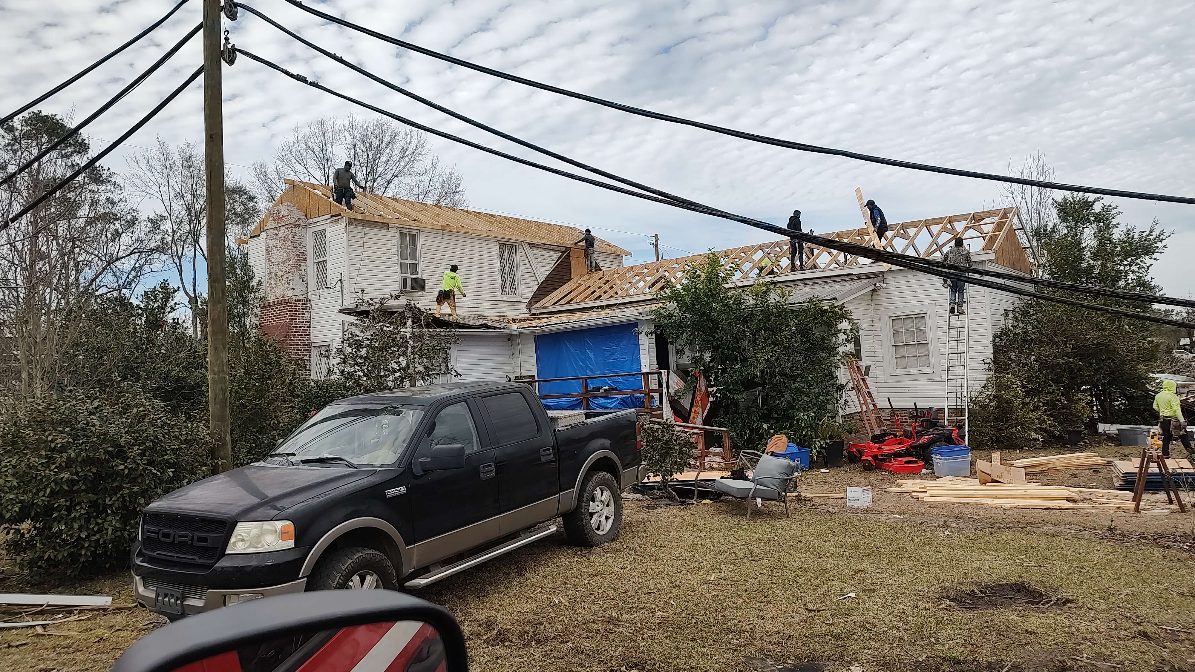
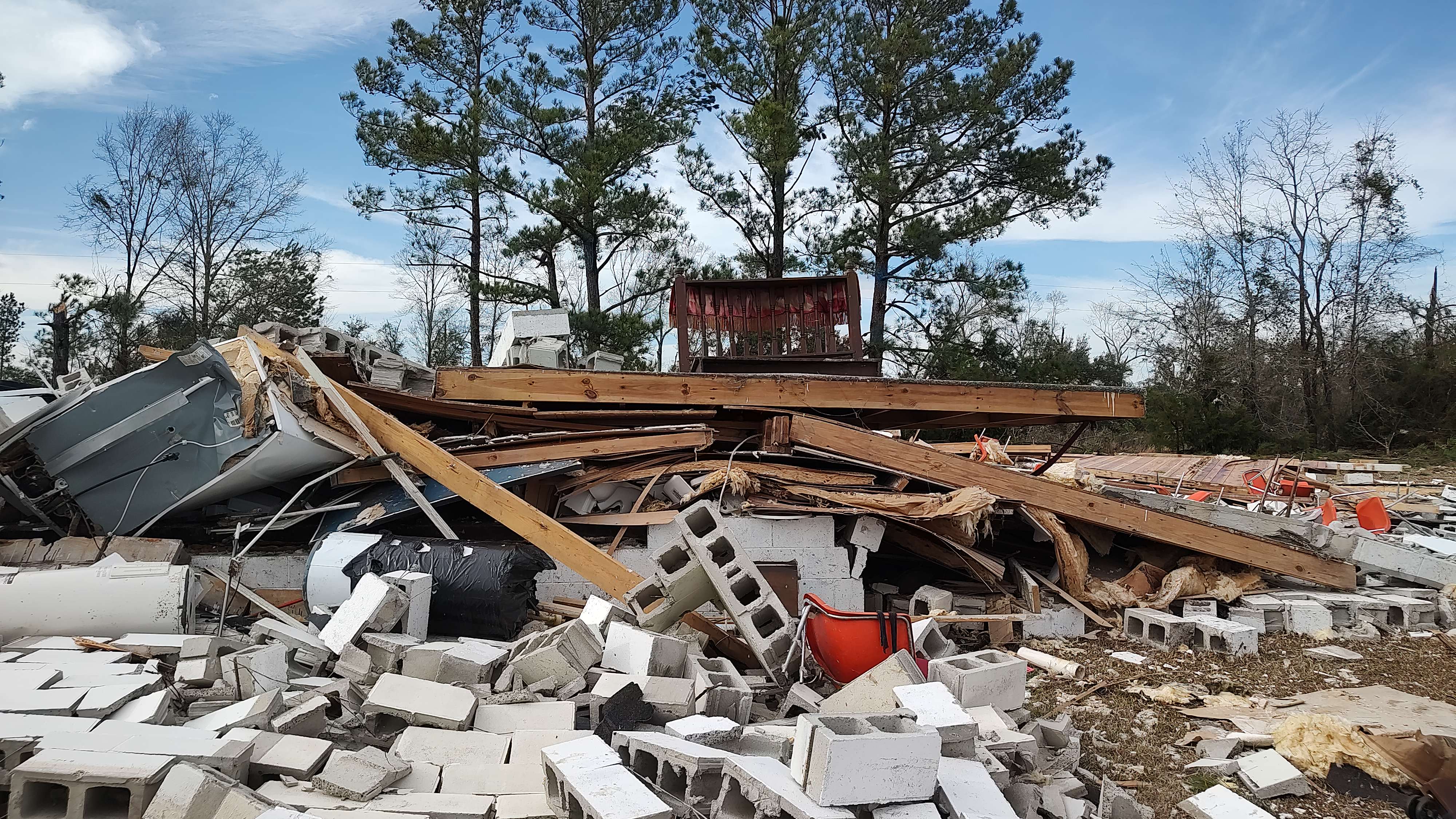
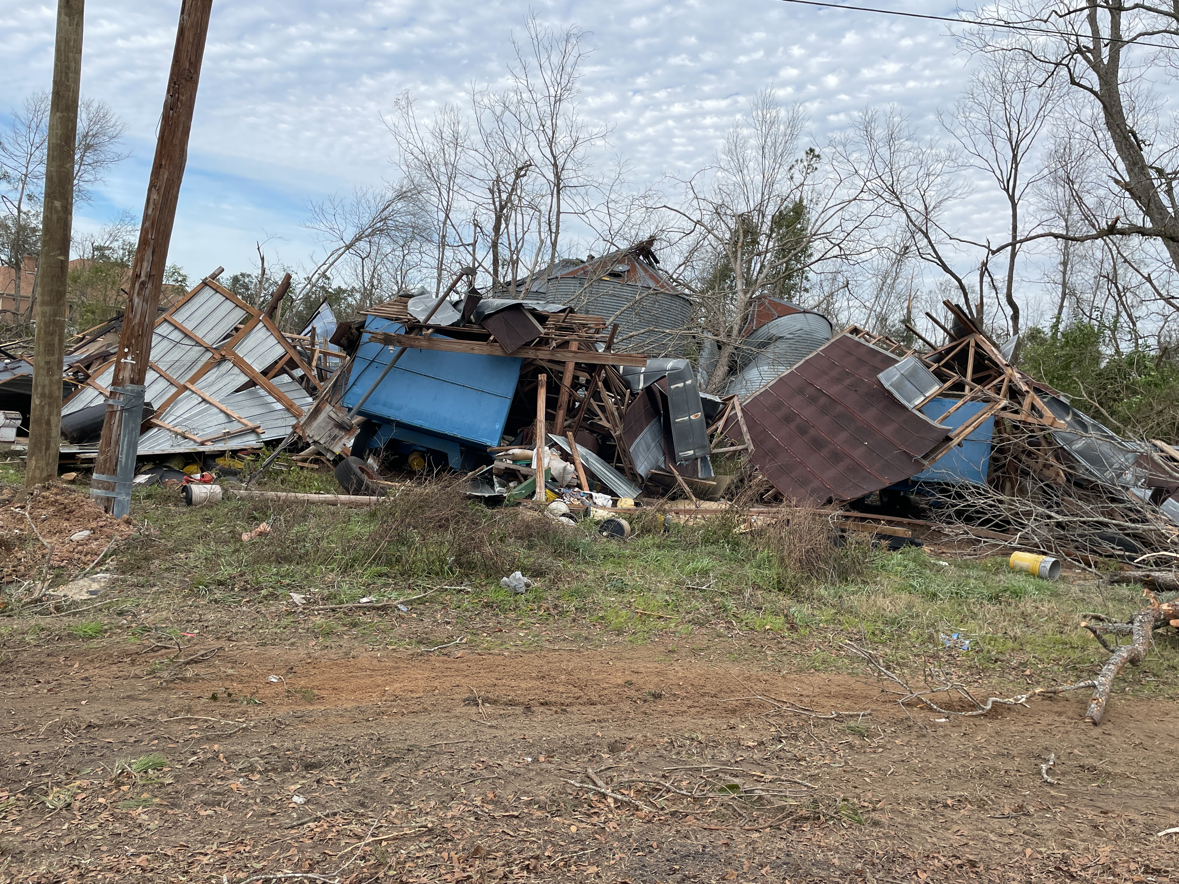
This tornado touched down in a swampy area, just east of Holmes Creek in northwest Jackson County. The tornado initially uprooted and snapped several softwood and hardwood trees, along Hickshill Road and in addition, it damaged an outbuilding there. The tornado continued northeast, damaging more hardwood and softwood trees along Piano Road. The first structure to be impacted by this tornado was a double-wide manufactured home on the northern side of Piano Road. Additional softwood and hardwood trees were snapped and uprooted along Danford Bay Road. Tree damage continued along Orchid Road, Demascus Church Road and Layton Road as the tornado continued to progress northeastward. An outbuilding was damaged along Orchid Road, and a single-family home suffered significant roof damage along Layton Road. The tornado then destroyed two ninety foot, seventy-year-old concrete silos. Damage was found along the entire length of Everett Road which was composed of the snapping and uprooting of trees, along with damage to an outbuilding and a mobile home succumbing to window damage. More trees were damaged along Heislar Road and Peanut Road as the tornado continued its northeastward trek. A single-family home on Peanut Road suffered significant roof damage. When the tornado reached Shiloh Church Loop, a single-family home suffered significant roof damage. The tornado continued to move northeast across Highway 2 where more softwood and hardwood trees were uprooted and snapped. Most of the damage to this point is classified as EF-1. Before the tornado crossed into Alabama, it damaged the roof of a small business on US-231. After crossing into Houston County Alabama, the tornado produced a continuous swath of damage on either side of State Line Road all the way towards the city of Cottonwood. This is also consistent of EF-1 damage. The first instance of EF-2 damage was when the tornado approached Cottonwood proper, along Ramer Loop rolling a single-wide mobile home, destroying it, despite it being well strapped. As the tornado moved through downtown Cottonwood, numerous small businesses sustained damage, ranging from blown out windows, roof damage and in one case the failure of the front-facing brick facade. Additional EF-2 damage occurred when the tornado removed the entire roof of a large two-story home. The tornado continued its northeastward jog, leaving Cottonwood proper, and commenced to destroy a two-story Moose Lodge that was composed of cinder-blocks resulting in another instance of EF-2 damage. The most significant tree damage noted on this survey occurred when the tornado paralleled Dyers Road, thus snapping numerous hardwood and softwood trees. The most significant damage along this northeastward path occurred on September Road where a double-wide home was completely destroyed, and resulted in one fatality. As the tornado continued to move northeast to across Whitaker Road and Creek Church Road, EF-1 tree damage was noted. The tornado caused mainly EF-0 damage to softwood and hardwood trees along Green Frog Road and Ed Tolar Road. One last structural damage occurred to a single-family home where it caused significant roof damage before lifting near the Chattahoochee River. In summary, while most damage was EF-1, there were instances of EF-2 damage with the max wind of 130 mph. Thanks to Houston County and Jackson County Emergency Management for assistance with this damage survey. |
|
Southeast Marianna Jackson County, Florida
Track Map
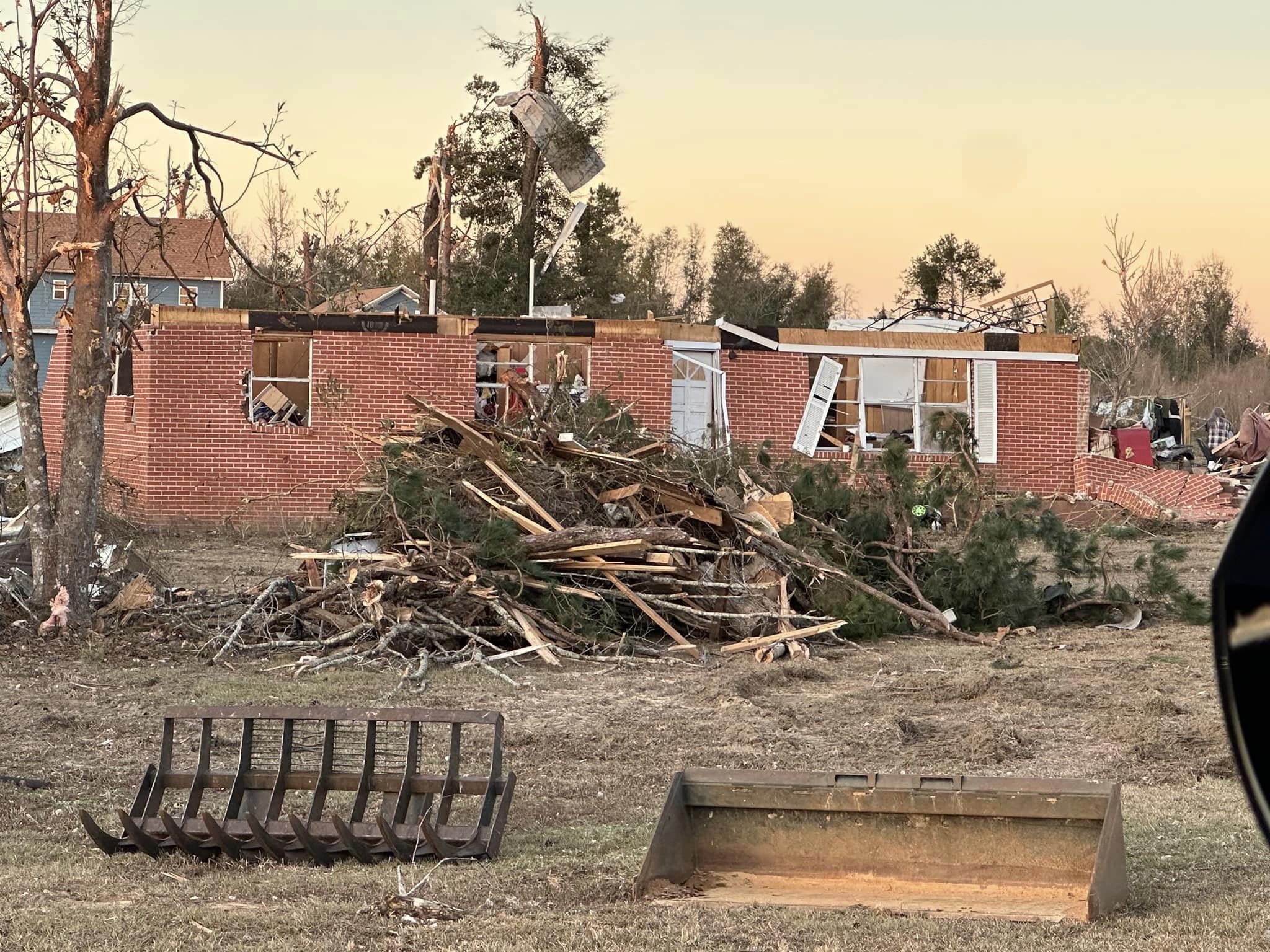
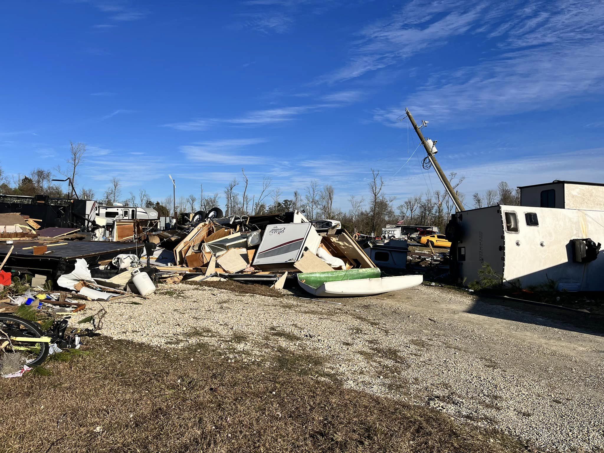
The tornado began in an open field that paralleled highway 73 in central Jackson county. The tornado continued to the northeast before crossing Pandora road where it uprooted a couple large pine trees, one of which fell on an older single wide trailer, which was completely destroyed. Another slightly newer single wide trailer had half of its roof peel back and blown into the woods behind it to the northeast. The tornado continued to the northeast where it crossed Magnolia road. Several trees were uprooted and snapped along the road. A brand new manufactured home had half of its roof blown off. A trailer park along Mark lane had several large trees snapped or uprooted, and a few roofs were peeled back on some of the single wide homes in the subdivision. The tornado then went on to cross I-10 where an 18 wheeler was knocked over. After crossing I-10, the tornado paralleled Spring Creek road where it snapped and uprooted several large hardwood trees as well as peeled back part of the roof of a shed. The tornado continued to the northeast where it crossed U.S. Highway 90 where a majority of the damage and seven injuries occurred in an RV Park and neighborhood. Several mobile homes where significantly damaged or flipped upside down while being displaced several hundred feet. Several large pine trees where snapped at the base as well. In the subdivision just to the northeast of the RV Park on Rooks Drive, two residential family homes had their roofs completely blown off. A church just across the street from the homes off Merritts Mill road had a cinder block outbuilding collapse. The church building sustained some damage to the gable. The tornado continued to the northeast where several homes off of Janette Drive had partial roof damage as well as sporadic tree damage. The tornado continued to the northeast again through a wooded area before moving through Blue Spring subdivision where extensive damage was observed to the roofs and siding of a majority of the homes. Two homes off of Spring Chase Lane had their roofs blown off along with several large mature hardwoods being snapped at their base. The tornado reached its maximum and intensity and width through this stretch just beyond U.S. Highway 90. The maximum width is estimated to be around 600 yards. From the Blue Springs Road subdivision, the tornado continued to the northeast parallel to Blue Springs Road where it snapped and uprooted several trees. The tornado continued along Blue Springs road where it damaged the roofs of several single wide manufactured homes. The tornado continued to the northeast where it collapsed the roof of another church outbuilding along Polar Springs road while also uprooting and snapping several trees on the church property. The tornado crossed Fort road to the northeast of the church where several trees were snapped and uprooted before continuing through a wooded area. The tornado crossed Wintergreen road where a few trees were uprooted along the road, before it dissipated over the field to the northeast of the road. |
|
Bloxham Cutoff Leon County, Florida
Track Map
A brief tornado touched touch along Bloxham Cutoff, damaging several trees. The tornado moved into a wooded area south of Blountstown highway where it dissipated. No other damage was found. The tree damage was consistent with an EF-0 tornado. |
|
DeFuniak Springs Airport Walton County, Florida
Track Map
A brief tornado touched down at the Defuniak Springs airport, damaging two hangars before crossing U.S. 90. The tornado then damaged the roof of a business, as well as numerous trees in the surrounding area. The damage at the airport and the business was consistent with an EF-1 tornado. Thanks to Walton County Emergency Management for assistance with this damage survey. |
|
Central Walton County, Florida
Track Map
A tornado, associated with the same cell which produced a tornado in southern Walton County, touched down south of Rock Hill Road. A large concentration of tree damage and damage to a manufactured home were then observed off Rock Hill Rd. consistent with an EF-1 rating. The tornado continued north, dissipated in a wooded area between McKinnon Bridge Road and Walton Bridge Road. Additional tree damage just to the east of the track along Rock Hill road. may have been associated with very strong rear flank downdraft winds associated with this cell. Thanks to Walton County Emergency Management for assistance with this damage survey. |
|
Santa Rosa Beach, Choctawhatchee Bay Walton County, Florida
Track Map
The tornado initially moved onshore with damage to trees and buildings at the intersection of W County Highway 30A and Laura Hamilton blvd consistent with an EF-1 rating. It would then proceed to continue moving off to the northeast sporadically damaging trees and roofs of houses across the area. The tornado would then cross through a majority wooded area before crossing US Highway 98 before entering the woods once again. A high concentration of damage to homes and trees consistent with an EF-1 rating was found off of Chat Holly Rd. before the tornado crossed Choctawhatchee Bay. The tornado would then parallel US Highway 331 as it crossed the bay before making landfall once again at Bay Grove Rd. where numerous manufactured homes were damaged along with tree damage consistent with an EF-1 rating. EF-1 damage had been observed leading up to US 331 where the tornado appears to have dissipated. Thanks to Walton County Emergency Management for assistance with this damage survey. |
The Enhanced Fujita (EF) Scale classifies tornadoes into the following categories:
| EF0 Weak 65-85 mph |
EF1 Moderate 86-110 mph |
EF2 Significant 111-135 mph |
EF3 Severe 136-165 mph |
EF4 Extreme 166-200 mph |
EF5 Catastrophic 200+ mph |
 |
|||||
Photos from the stronger tornadoes in this outbreak.
Bay County, FL → Panama City Beach, Lower Grand Lagoon
 |
 |
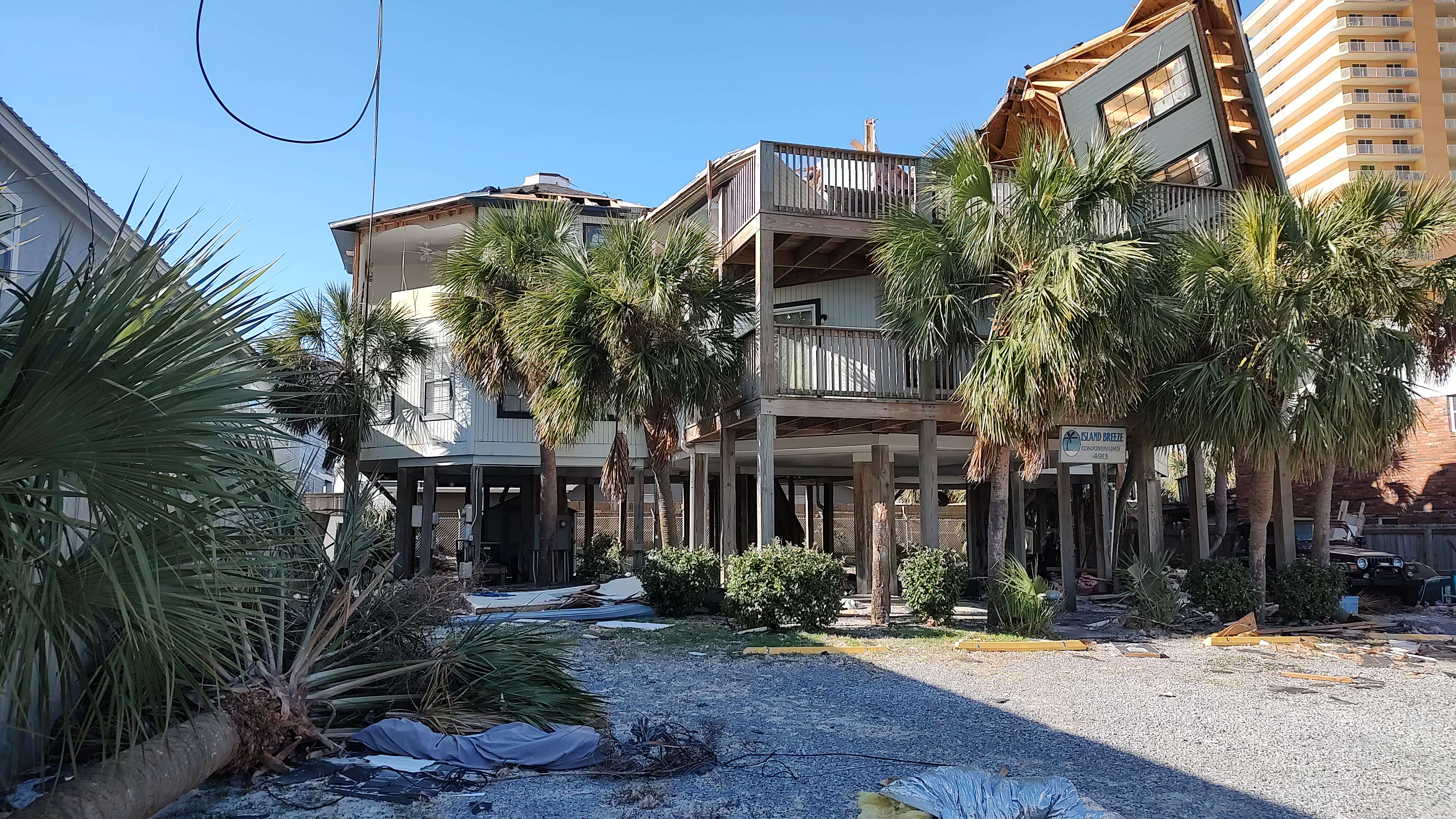 |
| Pirates Cove Boat Storage Facility Damage | Pirates Cove Boat Storage Facility Damage | Damage in Lower Grand Lagoon |
Houston County, AL → Cottonwood
 |
 |
 |
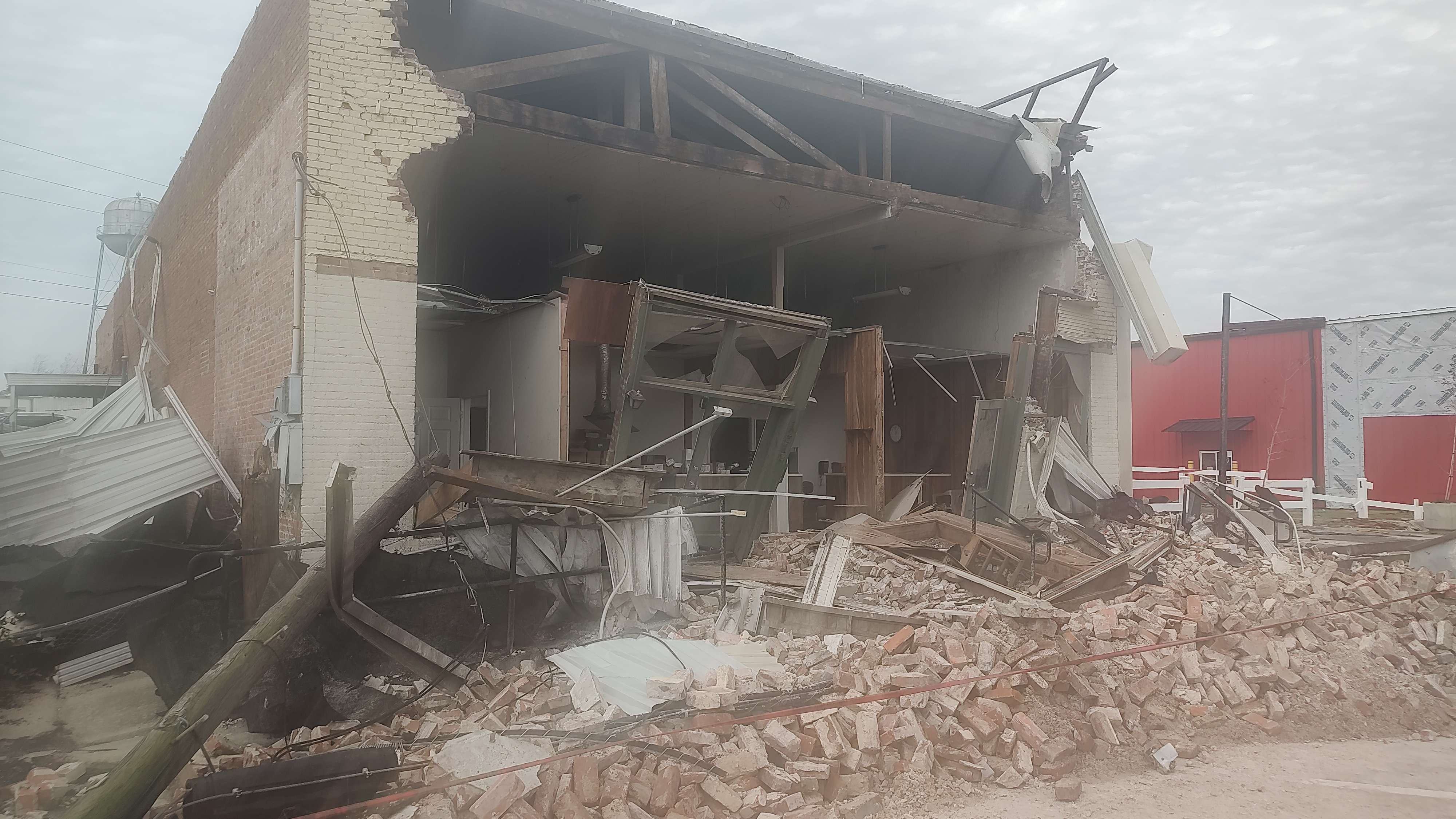 |
| Damage near Cottonwood | Damage near Cottonwood | Damage near Cottonwood | Damage in downtown Cottonwood |
Bay County, FL → Lynn Haven, Deer Point Lake, Bayou George, Bayhead
 |
 |
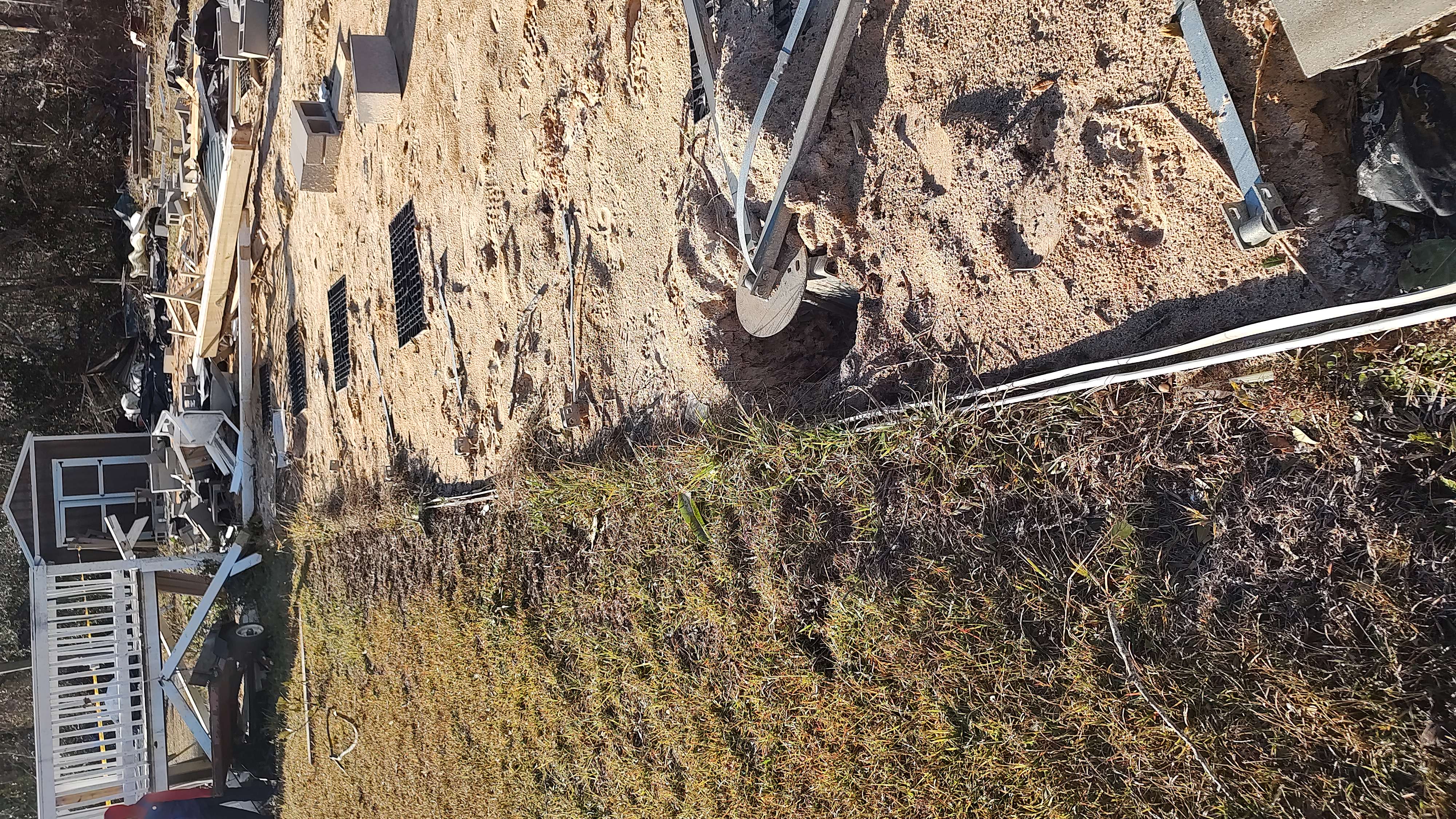 |
| Damage in the Bayhead Neighborhood in northern Bay County, Florida | Manufactured home completely destroyed and blown into nearby tree line | Same manufactured home and associated anchor points along with residual staircase to the residence. |
Jackson County, FL → Southeast Marianna
 |
 |
 |
 |
| Damage in southeast Marianna. Photo: Congressman Neil Dunn | Damage at Florida Caverns RV Park in southeast Marianna. Photo: Congressman Neil Dunn | Gas station damage in southeast Marianna. | Home damage east of Marianna near Merritts Mill Pond |
 |
Media use of NWS Web News Stories is encouraged! Please acknowledge the NWS as the source of any news information accessed from this site. |
 |