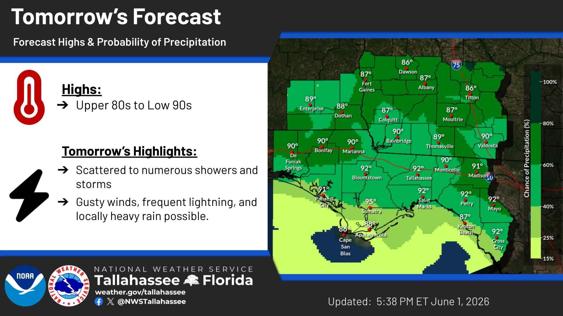
High temperatures will be in the upper 90s to around 100° today with corresponding heat indices up to 115 degrees for portions of the Florida panhandle and western Big Bend within the warning area. Elsewhere, heat indices will range from 108-112F.
Drink plenty of fluids, stay in an air-conditioned room, stay out of
the sunshine, and check up on relatives and neighbors.
Take extra precautions if you work or spend time outside. When
possible reschedule strenuous activities to early morning or
evening. Know the signs and symptoms of heat exhaustion and heat
stroke. Wear lightweight and loose fitting clothing when possible.


 Florida Radar (EVX)
 Florida Radar (TLH)
 Georgia Radar (VAX)
 Satellite Imagery
 Weather Map (Interactive)
 7 Day Tropical Weather Outlook