Salt Lake City, UT
Weather Forecast Office
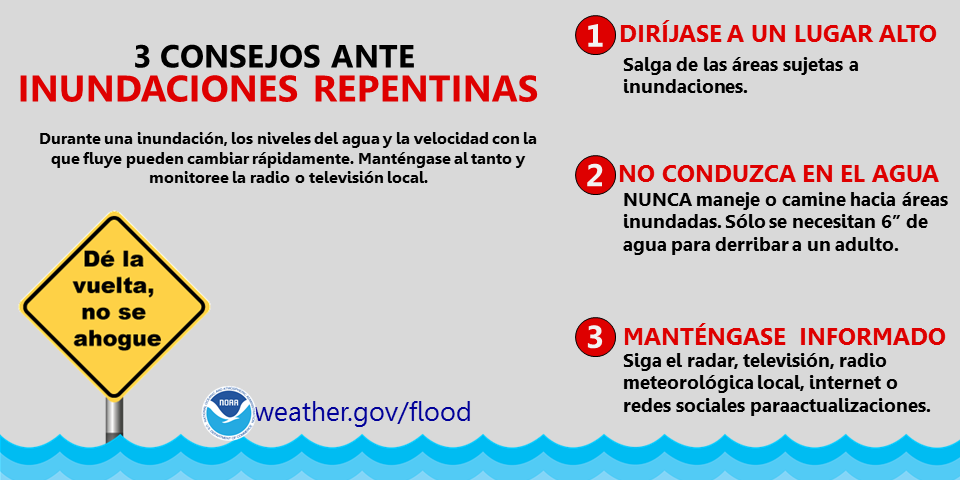
| Clasificación de inundaciones repentinas en el sur de Utah Haga clic aquí para ver clasificaciónes anteriores (en inglés) |
Utah RADAR |
 RADAR: Salt Lake City | Cedar City | Grand Junction |
Arches N.P. Visitor Center
Balanced Rock
Devil's Garden
Bryce Canyon N.P. Visitor Center
Rainbow Point
Canyonlands N.P. Visitor Center
Hans Flat Ranger Station
Island in the Sky Visitor Center
Needles Visitor Center
Capitol Reef N.P. Visitor Center
Cathedral Valley Campground
Halls Creek Overlook
Antelope Point
Bullfrog Basin
Dangling Rope
Coyote Gulch
Halls Crossing
Hans Flat
Hite
Wahweap
Big Water Visitor Center
Buckskin Gulch/Wire Pass
Cannonville Visitor Center
Escalante Interagency Visitor Center
Kanab Visitor Center
Paria Contact Station
Peek-A-Boo Gulch/Spooky Gulch
Goblin Valley State Park
Little Wildhorse/Bell Canyon Trailhead
Timpanogos Cave System Entrance
Timpanogos Cave Visitor Center
Zion N.P. Visitor Center
Zion Canyon
Zion Headwaters
Zion Plateau
US Dept of Commerce
National Oceanic and Atmospheric Administration
National Weather Service
Salt Lake City, UT
2242 W. North Temple
Salt Lake City, UT 84116
801-524-5133
Comments? Questions? Please Contact Us.

