 |
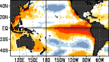
El Niño |
Warming of the Pacific Waters
| La Niña | 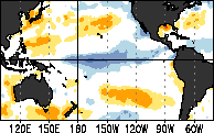
Cooling of the Pacific Waters |
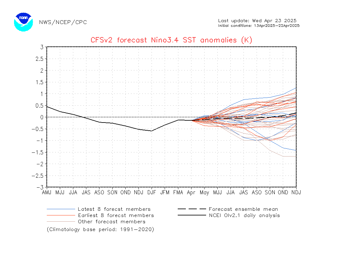
For a Weak El Nino, the difference in the average water temp in the Central Pacific needs to be at least +0.5C, A moderate El Nino the difference in water temp needs to be between +1.0C and +1.5C, and a Strong El Nino the difference in water temp needs to be above +1.5C. For a weak La Nina condition, the difference in the average water temp needs to be at least -0.5C, for a moderate La Nina the difference in water temp needs to be between -1.0C and -1.5C, and for a strong La Nina the difference in water temp needs to be below -1.5C. Here is the link to Climate Prediction Center outlook for the ENSO Conditions. http://www.cpc.ncep.noaa.gov/products/CFSv2/imagesInd3/nino34Sea.gif
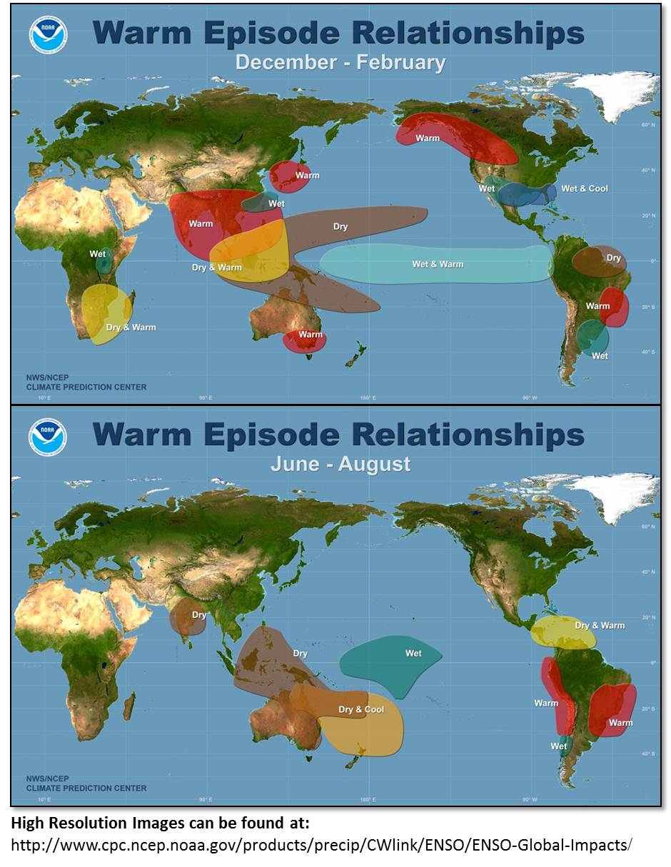
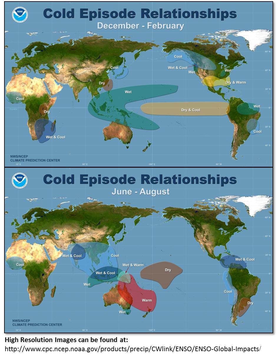
South Florida winters are usually dry and warm during La Niña conditions, while El Niño conditions usually bring cool and wet conditions to our region. ENSO effects on South Florida are rather minimal during the summer months, with the exception of tropical cyclone activity in the Atlantic Basin.
For more information on La Nina/El Nino click here.
The affects on South Florida Weather from the ENSO Conditions (El Nino, La Nina)
La NIna Conditions El Nino Conditions
|
|
 |
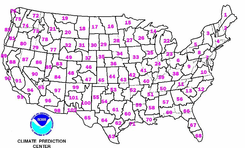
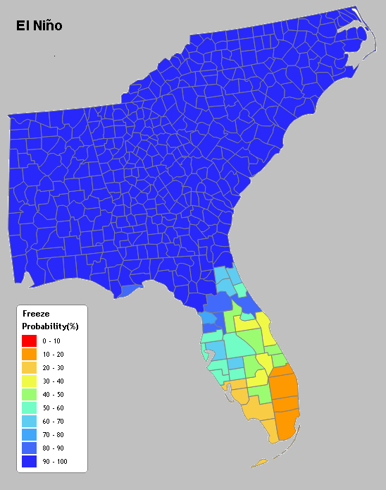
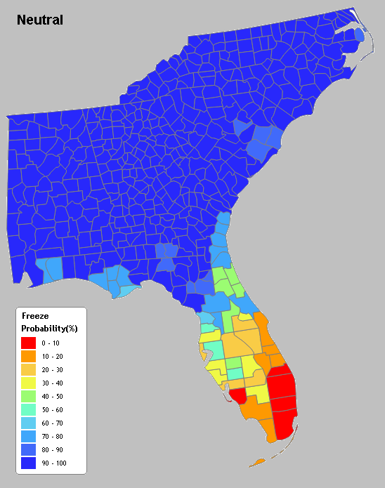
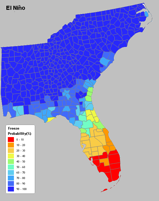
You can also obtain historical distributions of 3-month temperature and precipitation associated with 3 different ENSO categories - El Nino, La Nina, and Neutral events for a climate division. For South Florida, please click on number 68.
Average Possibility of Freeze
|
|
Average Possibility of Hard Freeze
|
|
|
North American Oscillation (NAO)
While ENSO (El Niño-Southern Oscillation) plays a key role in winter weather conditions over most of the globe, including South Florida, other regional oscillations can also influence winter temperatures and precipitation over South Florida. One of these oscillations is the North Atlantic Oscillation, or NAO.
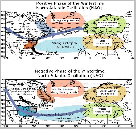
When the wintertime NAO is in a positive phase, South Florida typically experiences near to above normal temperatures due to the jet stream being located far to the north over the Great Lakes and Northeast United States, which allows for the Atlantic subtropical high to position itself near or over the Southeastern United States. This usually causes east and southeast winds from the warm Atlantic waters to blow across South Florida, with the subtropical high blocking the southward movement of any Arctic or Polar air masses.
When the wintertime NAO is in a negative phase, South Florida usually has below normal temperatures due to the jet stream shifting farther to the south over the southeastern United States. This jet stream configuration allows for cold air outbreaks of Arctic or Polar origin to plunge south and deep into the Southeast United States, including Florida.
A strong NAO phase can either override or enhance the overlying ENSO pattern. An example of this was the winter of 2010 when a strongly negative NAO phased with a strong El Niño to produce colder and wetter than normal conditions across South Florida.
(*The NAO is usually forecast for two weeks ahead for the Jet Stream position*)
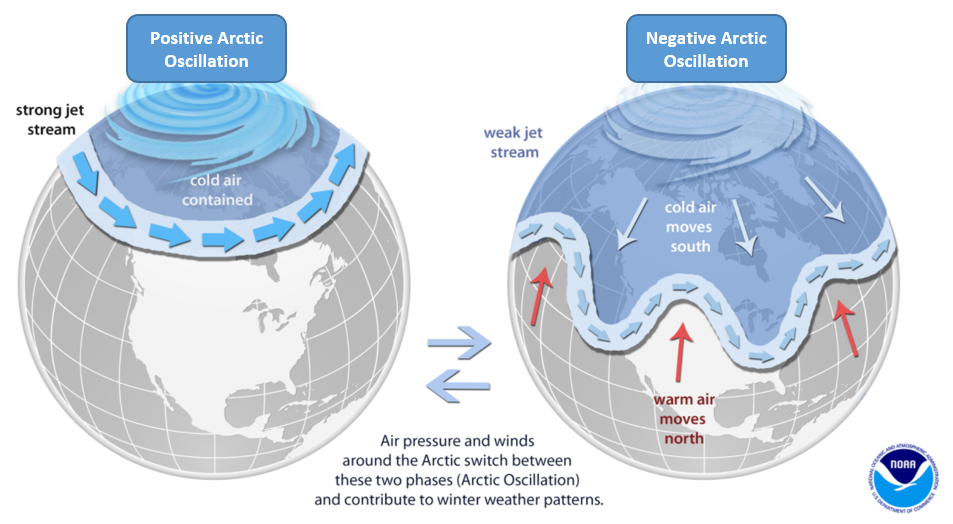
The Arctic Oscillation (AO) is a climate index of the state of the atmospheric circulation over the Arctic. It consists of a negative phase, featuring below average geopotential heights, which are also referred to as negative geopotential height anomalies, and a positive phase in which the opposite is true. In the negative phase, the polar low pressure system (also known as the polar vortex) over the Arctic is weaker, which results in weaker upper level winds (the westerlies). The result of the weaker westerlies is that cold, Arctic air is able to push farther south into the U.S., while the storm track also remains farther south. The opposite is true when the AO is positive: the polar circulation is stronger which forces cold air and storms to remain farther north. The Arctic Oscillation often shares phase with the North Atlantic Oscillation (NAO), and its phases directly correlate with the phases of the NAO concerning implications on weather across the U.S.
 |
FREEZE DATES FOR SOUTH FLORIDA
|
LOCATION
|
EARLIEST FREEZE
|
AVG FIRST FREEZE
|
AVG LAST FREEZE
|
LATEST FREEZE
|
|
BELLE GLADE
|
NOVEMBER 16
|
DECEMBER 21-31
|
JANUARY 21-31
|
MARCH 15
|
|
CLEWISTON
|
DECEMBER 11
|
DECEMBER 11-20
|
FEBRUARY 1-10
|
MARCH 4
|
|
EVERGLADES CITY
|
DECEMBER 12
|
DECEMBER 21-31
|
JANUARY 21-31
|
FEBRUARY 26
|
|
FORT LAUDERDALE
|
DECEMBER 10
|
DECEMBER 21-31
|
JANUARY 21-31
|
MARCH 3
|
|
HIALEAH
|
DECEMBER 15
|
DECEMBER 21-31
|
JANUARY 21-31
|
MARCH 3
|
|
HOMESTEAD
|
DECEMBER 28
|
DECEMBER 21-31
|
JANUARY 21-31
|
JANUARY 31
|
|
MIAMI BEACH
|
DECEMBER 24
|
DECEMBER 21-31
|
JANUARY 21-31
|
MARCH 3
|
|
MIAMI
|
DECEMBER 11
|
DECEMBER 21-31
|
JANUARY 21-31
|
MARCH 3
|
|
MOORE HAVEN
|
NOVEMBER 16
|
DECEMBER 11-20
|
FEBRUARY 1-10
|
MARCH 14
|
|
NAPLES
|
NOVEMBER 25
|
DECEMBER 21-31
|
JANUARY 21-31
|
FEBRUARY 26
|
|
40-MILE BEND
|
DECEMBER 24
|
DECEMBER 21-31
|
JANUARY 21-31
|
FEBRUARY 16
|
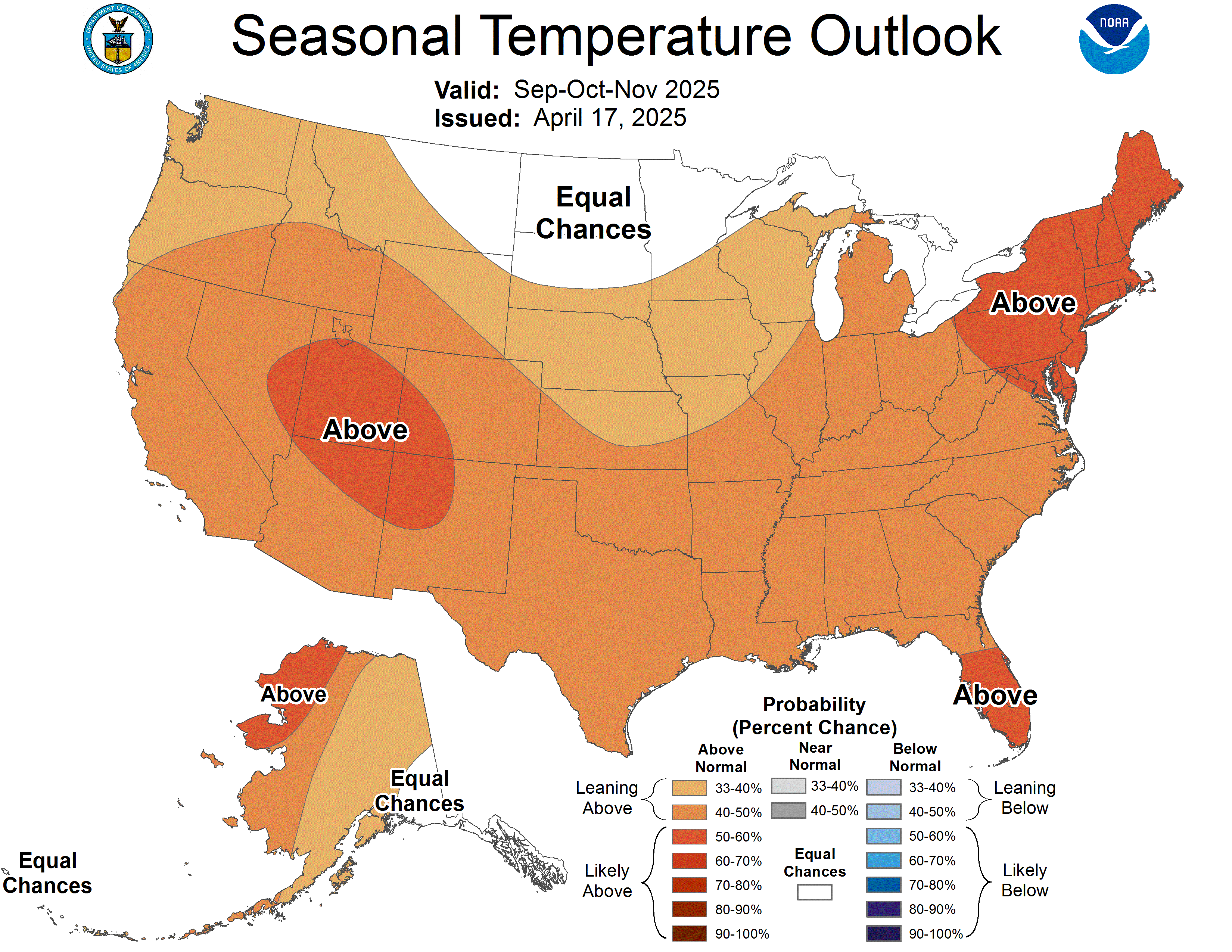
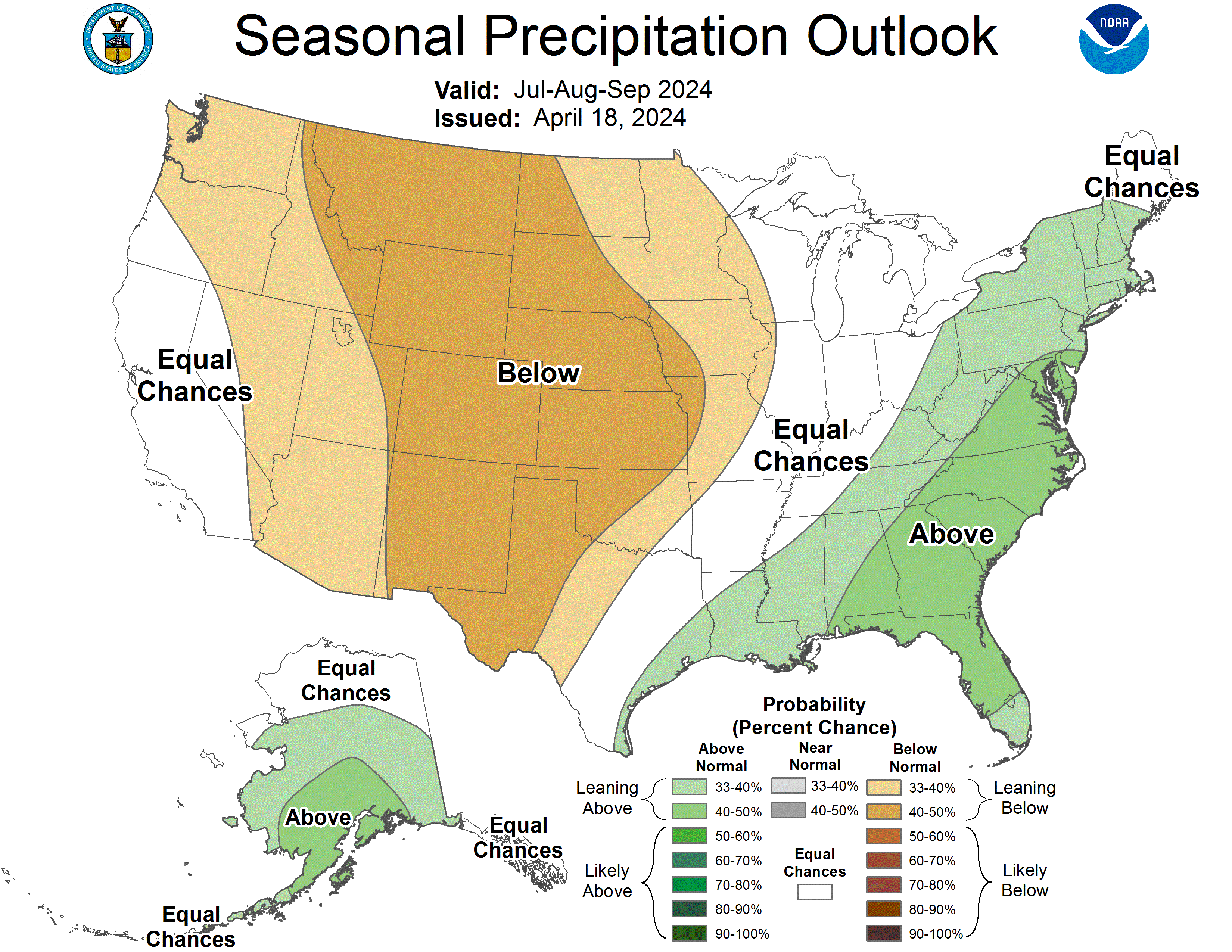
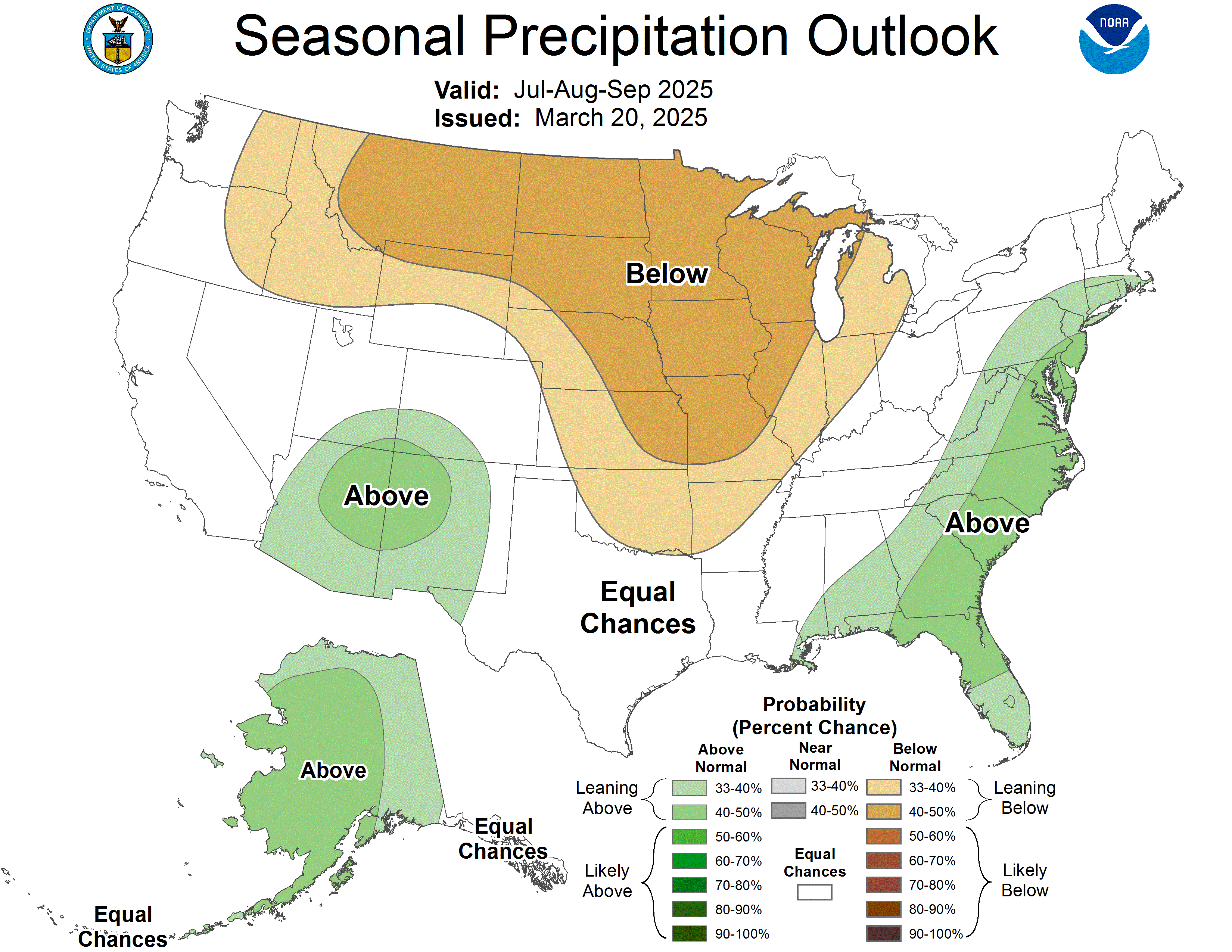
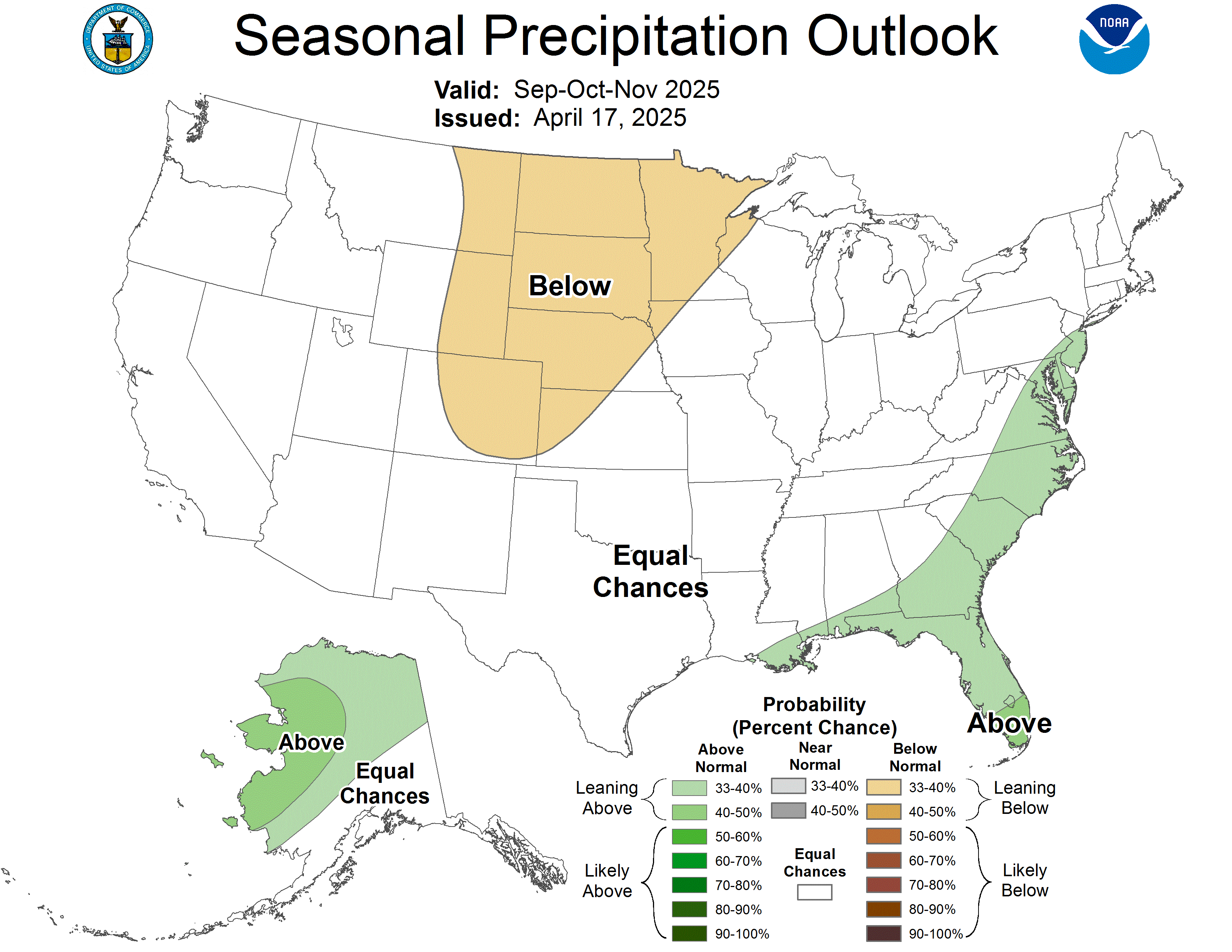
OUTLOOKS FOR SOUTH FLORIDA
|
|
 |
 |
 |
|
|
 |
 |
 |

Here is a link to historical surface, 500 MB, and precipitation maps: NOAA Central Library U.S. Daily Weather Maps Project


