National Weather Service United States Department of Commerce

Showers and Cooler Temperatures in the East; Multi-Day Rain Event in the Southwest

A cold front in the East will bring showers and thunderstorms and much cooler temperatures from the Northeast into the Southeast. The Southwest, centered around New Mexico, will continue to see showers and thunderstorms, where there maybe isolated flash flooding. Tropical moisture will bring a multi-day period of thunderstorms and locally heavy rainfall across the Southwest beginning Thursday. Read More >


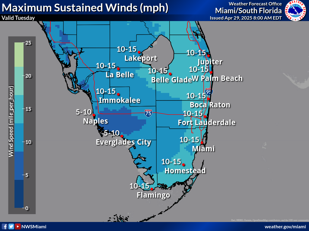
Forecast Maximum Sustained Winds (MPH)


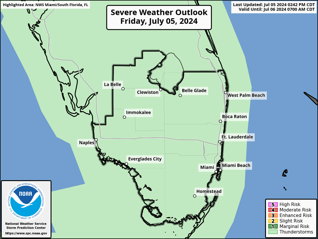
SPC Thunderstorm Outlooks


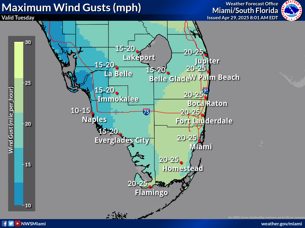
Forecast Maximum Wind Gusts (MPH)


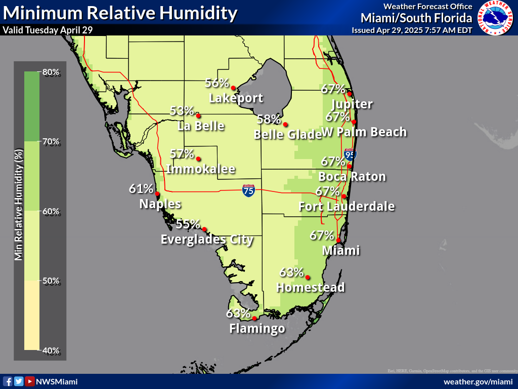
Forecast Minimum RH (%)
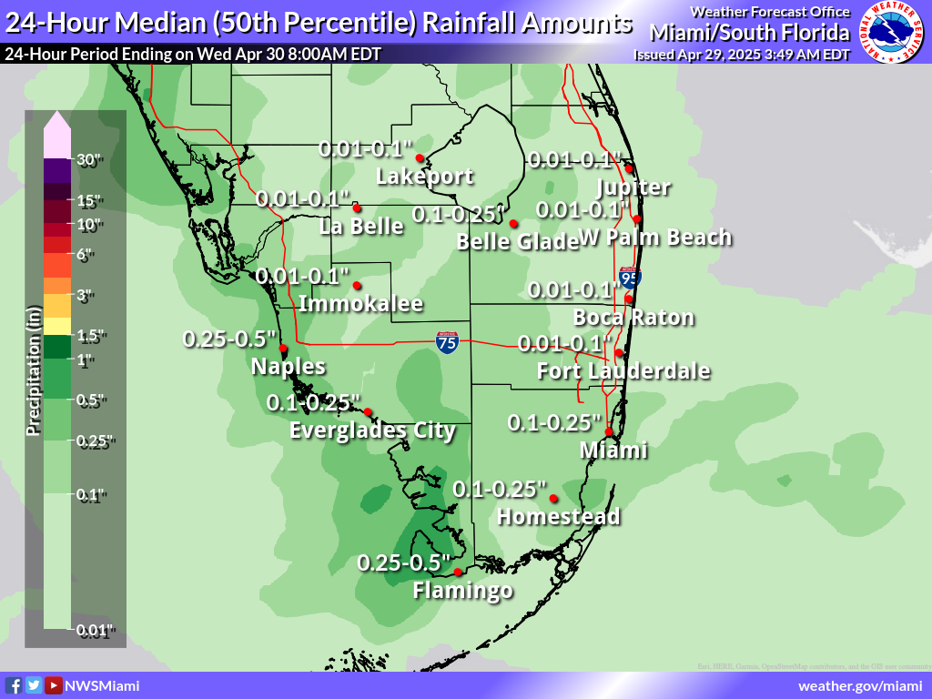


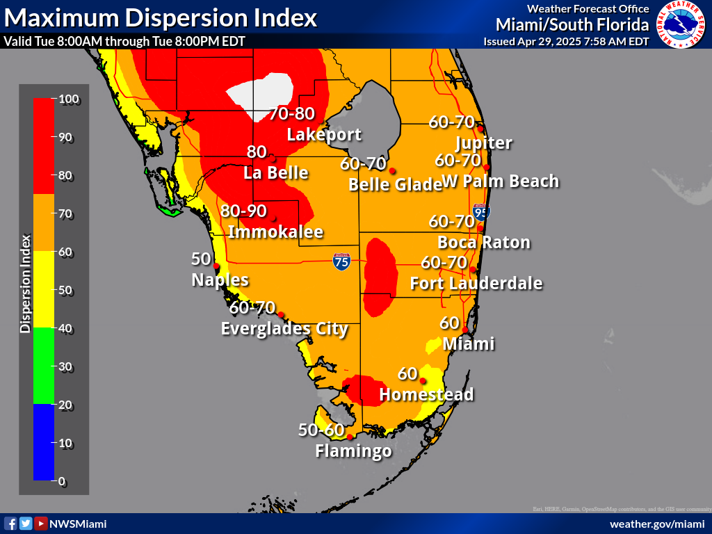
Forecast Maximum Dispersion Index


SPC Fire Weather Outloooks


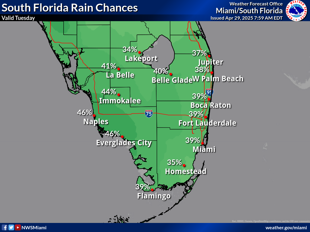
Probability of Precipitation


Click anywhere to return

 
Local Fire Weather Forecast Products
Red Flag Watch/Warning (RFW) Miami | Keys | Jacksonville | Melbourne | Mobile | Tallahassee | Tampa
Fire Weather Forecast (FWF) Miami | Keys | Jacksonville | Melbourne | Mobile | Tallahassee | Tampa
Fire Danger Rating Fcst (WIMS) Miami | Keys | Jacksonville | Melbourne | Mobile | Tallahassee | Tampa
Spot Forecast Request Spot Forecast (for official government use only)
   
Graphical Forecasts/Outlooks
  SPC Day 1 Wildfire Threat Outlook
National Day 1 Outlook
SPC Day 2 Wildfire Threat Outlook
National Day 2 Outlook
Observations Links

Florida Agricultural Weather Network (FAWN)

Florida RAWS Observations

Florida Active Wildfire Mapping

Florida Forest Service

National Drought Monitor

National Observed Fire Danger