Miami - South Florida
Weather Forecast Office
 |
|||
| EF0 (65-85 mph) | EF1 (86-110 mph) | EF2 (111-135)* | Disclaimer |
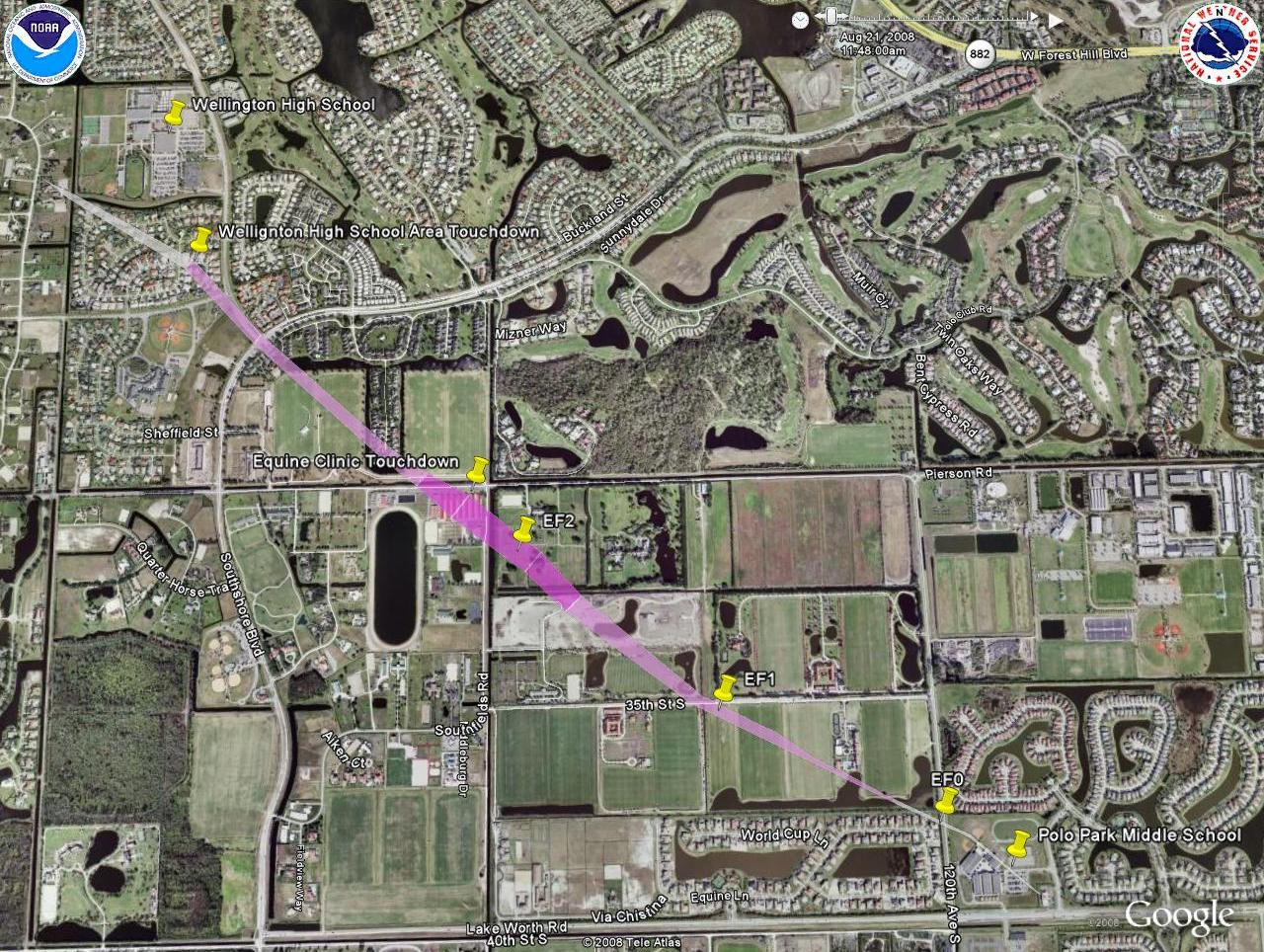
* Maximum estimated winds with tornado approx. 115 mph making this a low end EF2 tornado. Color along swath indicates estimated max intensity somewhere along that segment of the swath. The width of the swath indicates approximate width of main tornadic circulation. There is no necessarily a one to one corelation between the depicted swath width and debris field observed during the survey or actual damage experienced. Again it is an approximation. Swath approximately depicts areas where most damage was observed. Damage was also possible around the periphery of the depicted swath but not necessarily observed during the survey.

Click to download KML file for view in your favorite GIS Application.
CURRENT HAZARDS
Submit a Storm Report
Outlooks
Graphical Hazardous Weather Outlook
Self Briefing Page
National Hazards
Tropics / Hurricanes
Local Storm Reports
CURRENT WEATHER
Surface Observations
Satellite
Observed Precipitation
MesoAnalysis
Rivers / Lakes
Latest Sounding
Lake Okeechobee
PAST WEATHER
Past Events
Recent Rainfall
Tropical Cyclone Reports
FORECASTS
Forecast Discussion
Tropical Weather
Probabilistic Page
Heat Page
Cold Weather Page
Marine Weather
Fire Weather
Beach Forecast
Aviation Weather
Probabilistic QPF
Hourly Forecasts
Activity Planner
Graphical Forecast
International Weather
RADAR IMAGERY
National
Miami Radar
Key West Radar
Across Florida
CLIMATE
Local Climate Info
More Local Climate Info
Climate Graphs
US Dept of Commerce
National Oceanic and Atmospheric Administration
National Weather Service
Miami - South Florida
11691 SW 17th Street
Miami, FL 33165
305-229-4522
Comments? Questions? Please Contact Us.

