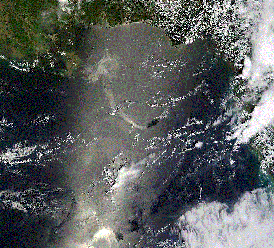
SURFACE OIL NOT A THREAT TO SOUTH FLORIDA (Released 7/30/10)
TRAJECTORY FORECASTSFor trajectory forecasts of the oil spill for the next 3 days visit the NOAA National Ocean Service Response and Restoration Site.
| Gulf Currents | NASA MODIS | Satellite |
 |
 |
 |
| Graphicasts | Hazardous Wx Outlook |
 |
 |
| Miami | Key West | Tampa | Melbourne |
 |
|
 |
 |
Point Forecasts below are valid for a radius of nearly 5 km around the specified point. Zone forecaster are valid for a much larger zone spanning 20 nautical miles from the coast and for area wide conditions is more representative.
Point |
Zone |
3NM ESE Fort Lauderdale2NM NE West Palm Beach4NM West of Naples |
Nearshore BrowardNearshore Palm BeachNearshore Naples |
00HR |
06HR |
12HR |
18HR |
24HR |
30HR |
36HR |
42HR |
48HR |
72HR |
00HR |
06HR |
12HR |
18HR |
24HR |
30HR |
36HR |
42HR |
48HR |
72HR |

These forecasts are produced by WFO Miami using the Simulating WAves Nearshore (SWAN) wave model and the Real Time Ocean Forecast System Gulf Stream Forecasts. For additional Ouput Visit the SWAN Model Page.
12HR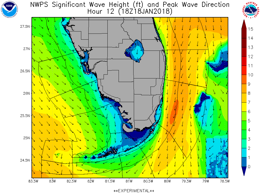 |
18HR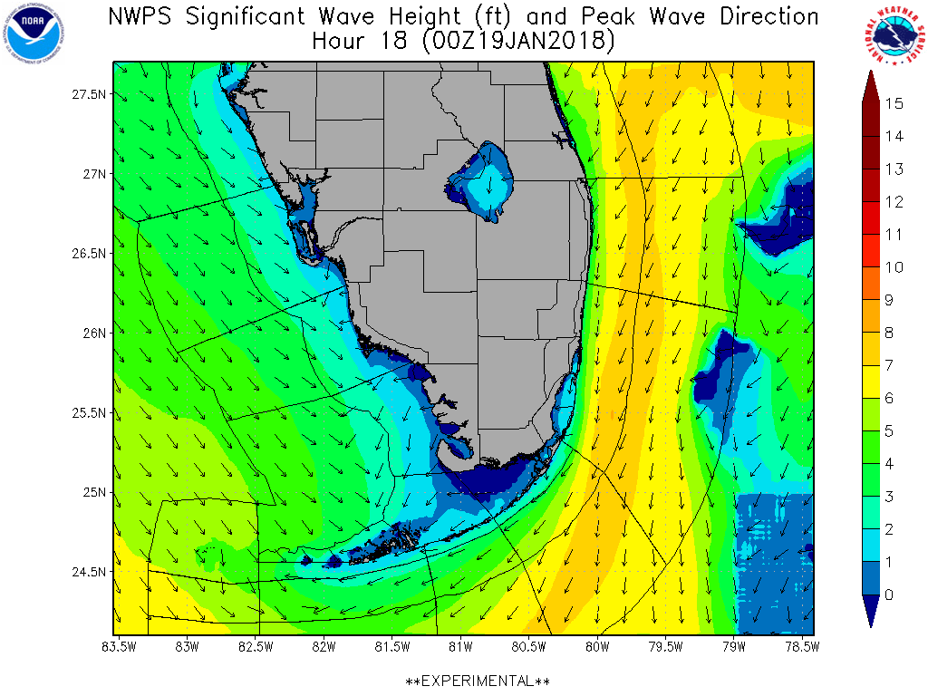 |
24HR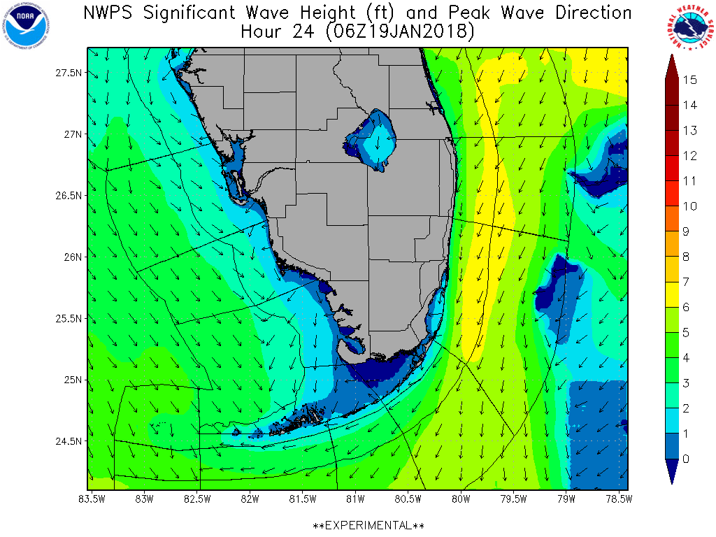 |
30HR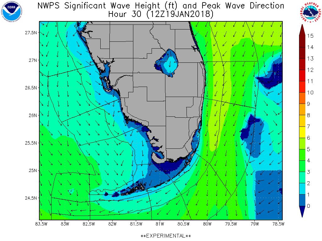 |
36HR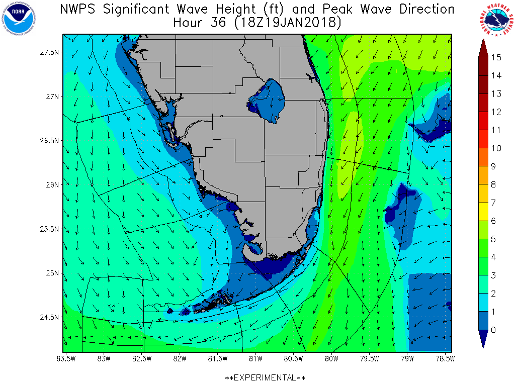 |
42HR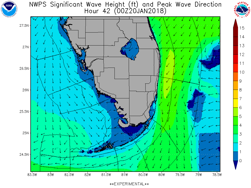 |
48HR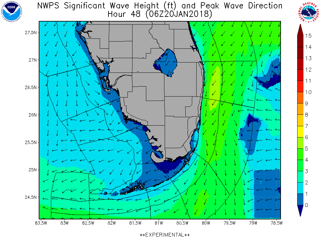 |
54HR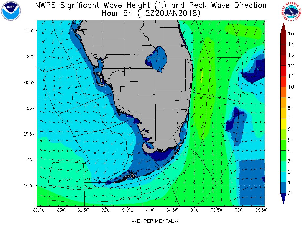 |
60HR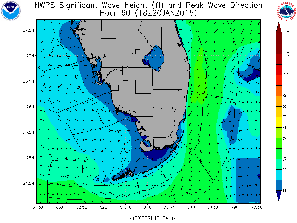 |
84HR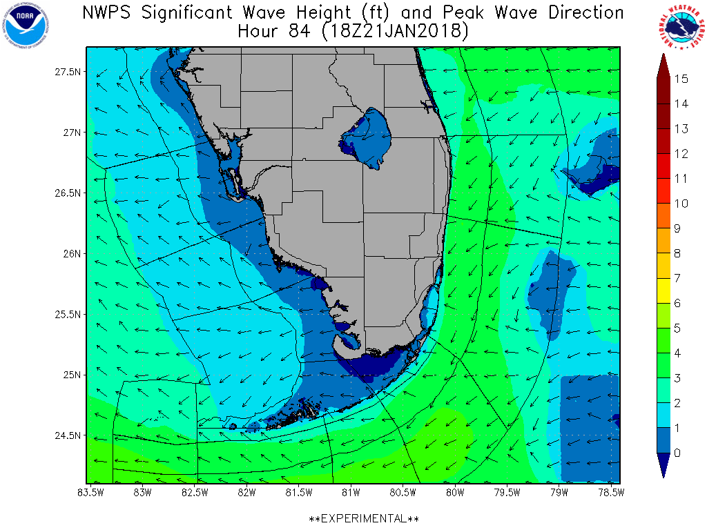 |
12HR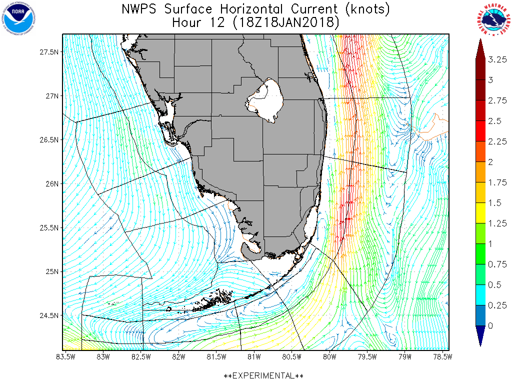 |
18HR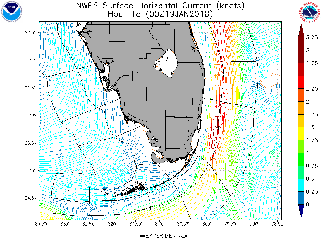 |
24HR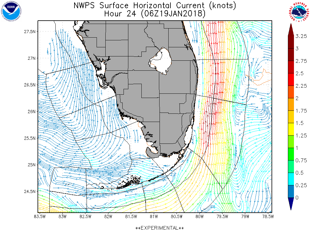 |
30HR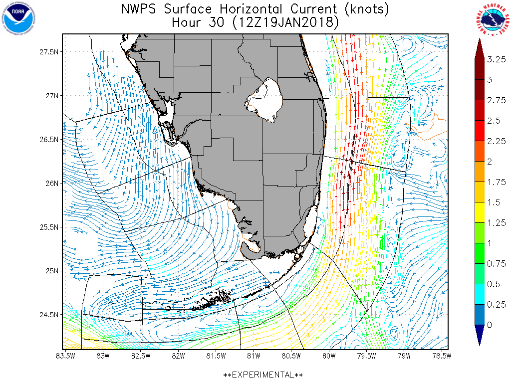 |
36HR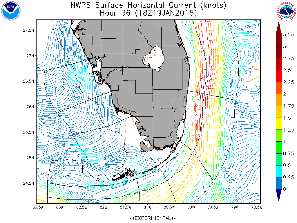 |
42HR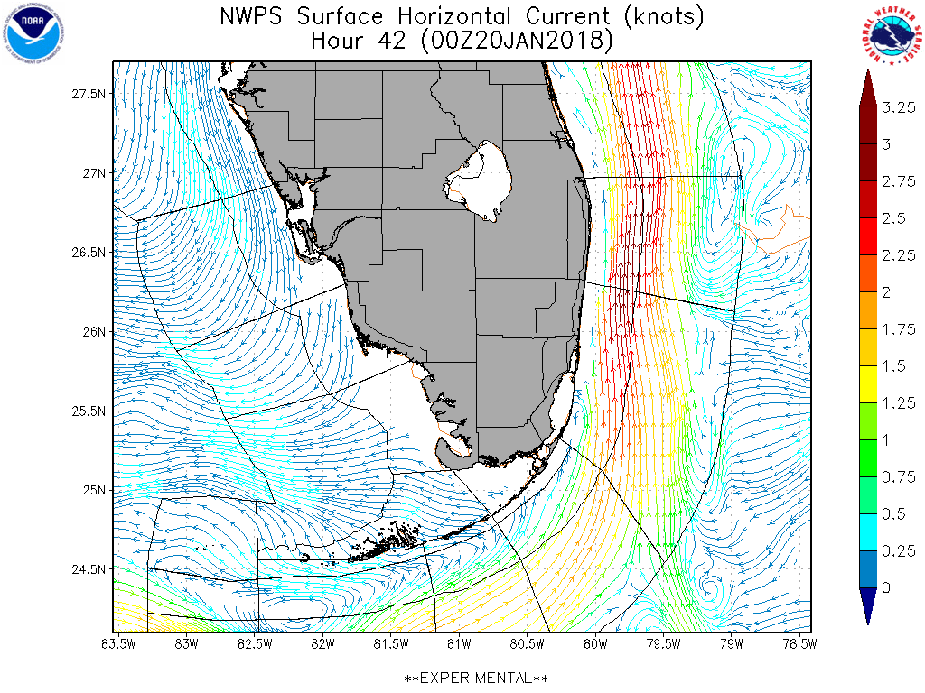 |
48HR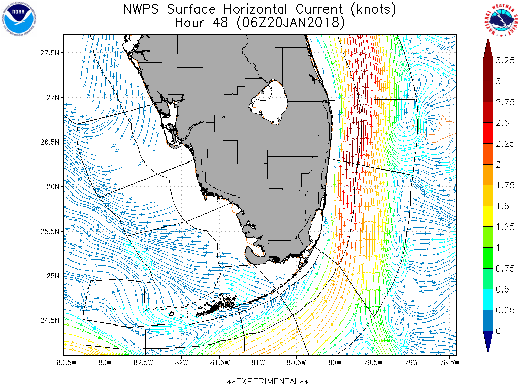 |
54HR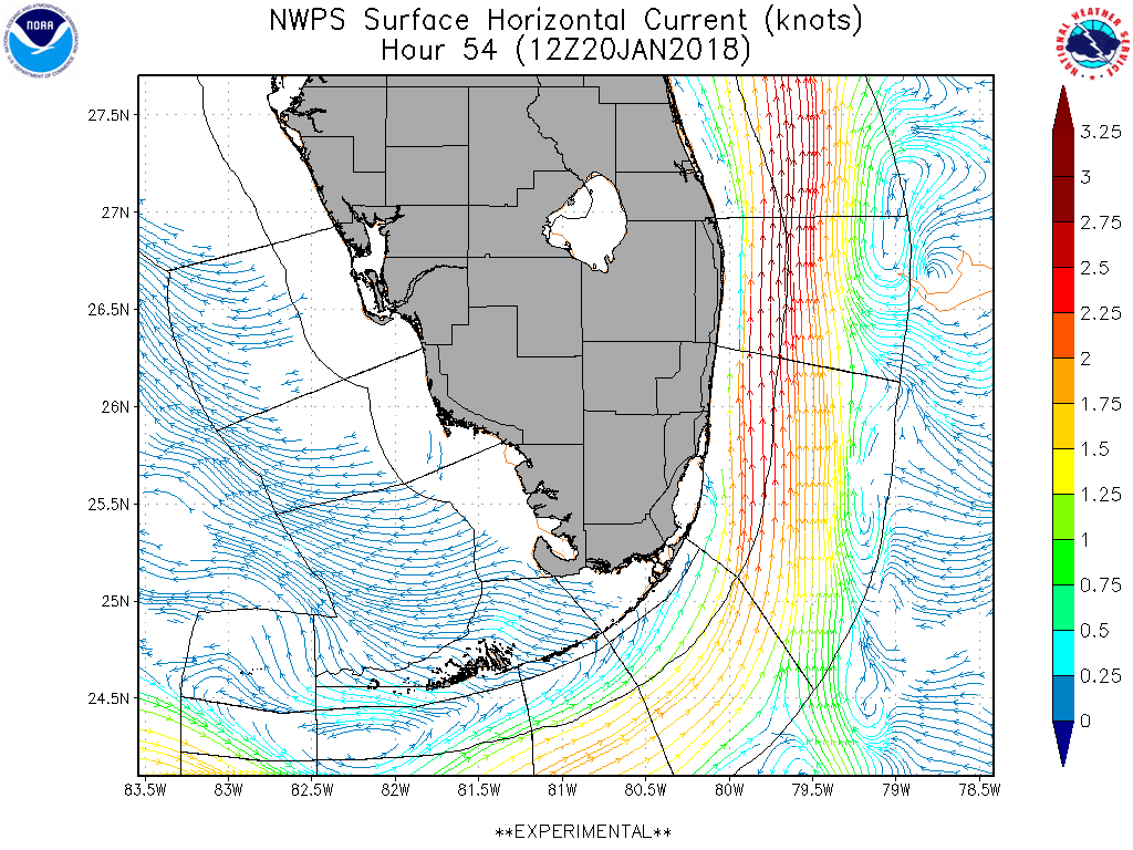 |
60HR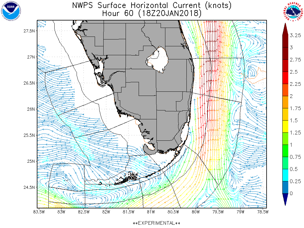 |
84HR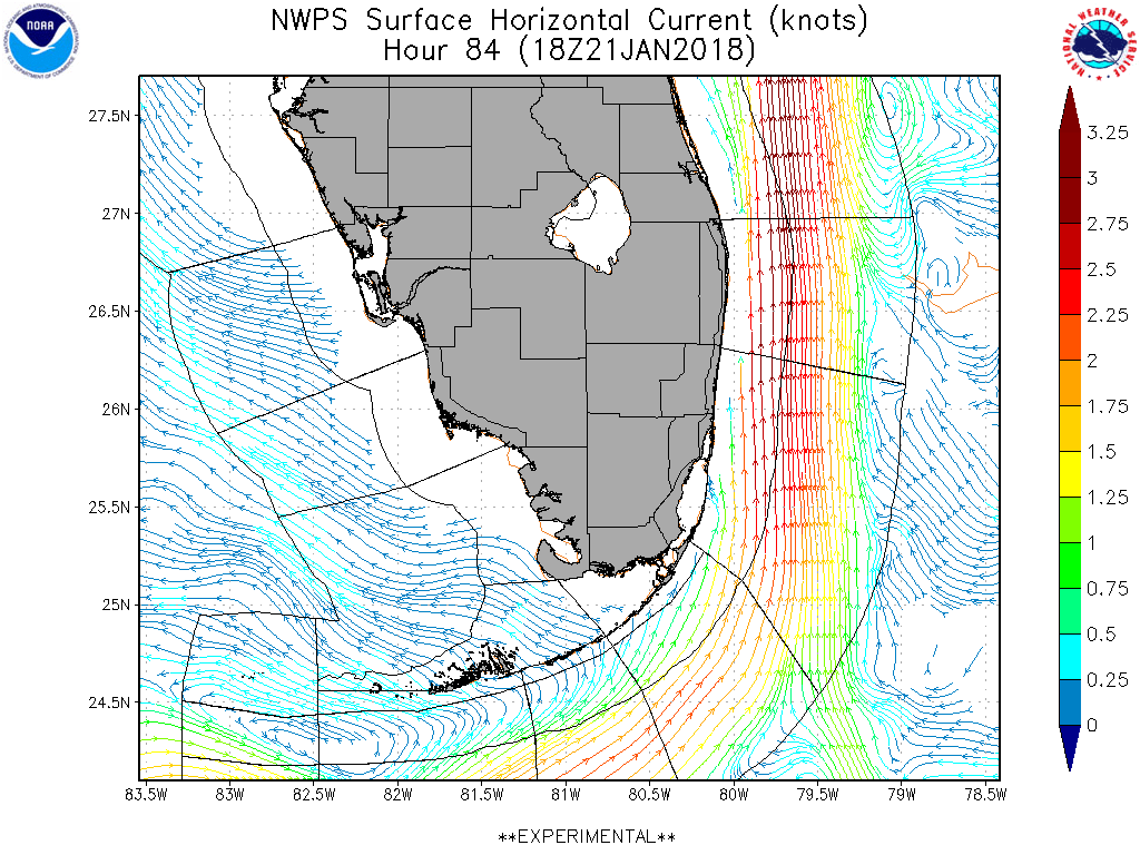 |
12HR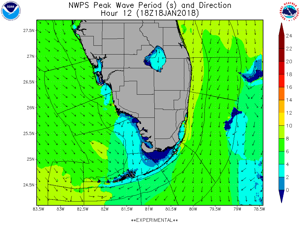 |
18HR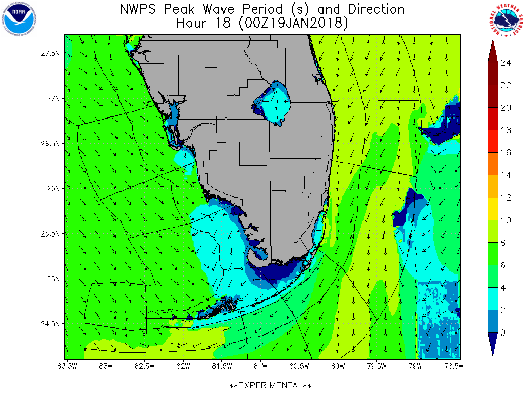 |
24HR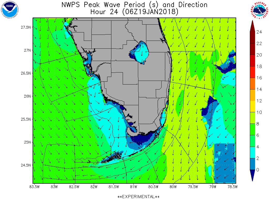 |
30HR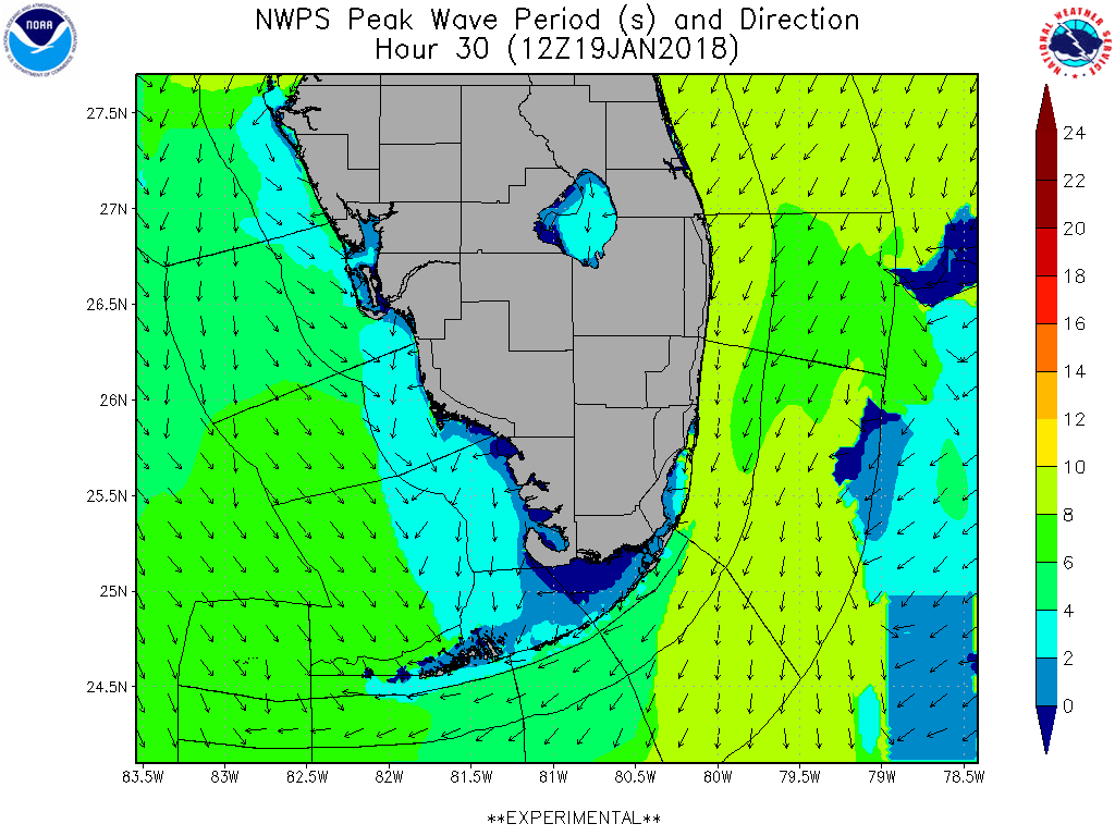 |
36HR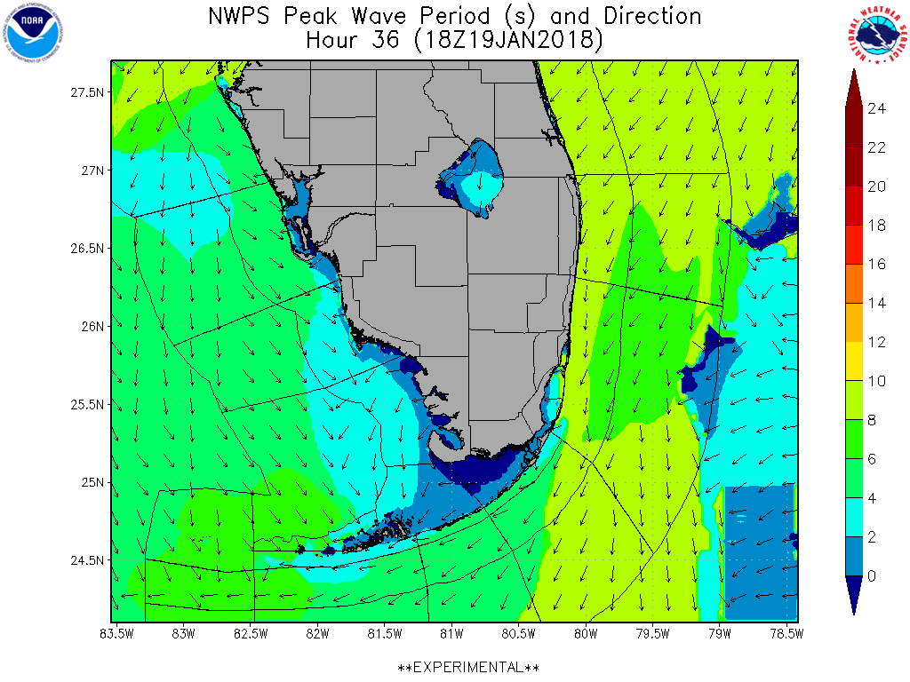 |
42HR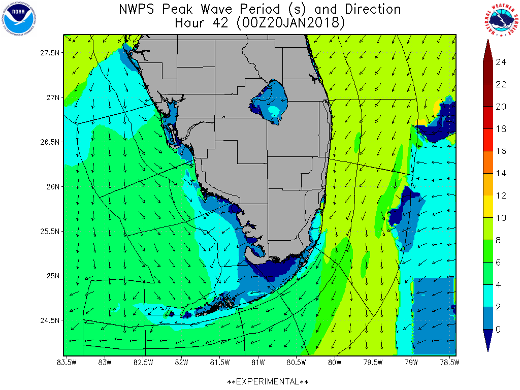 |
48HR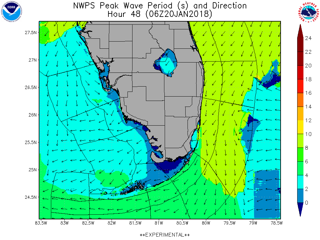 |
54HR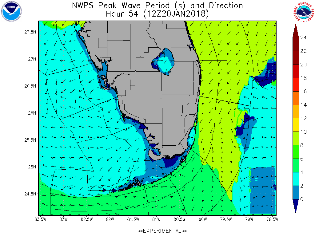 |
60HR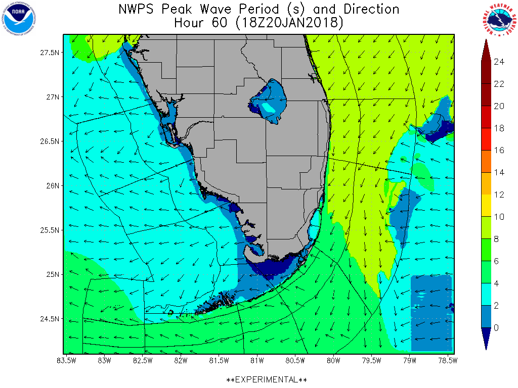 |
84HR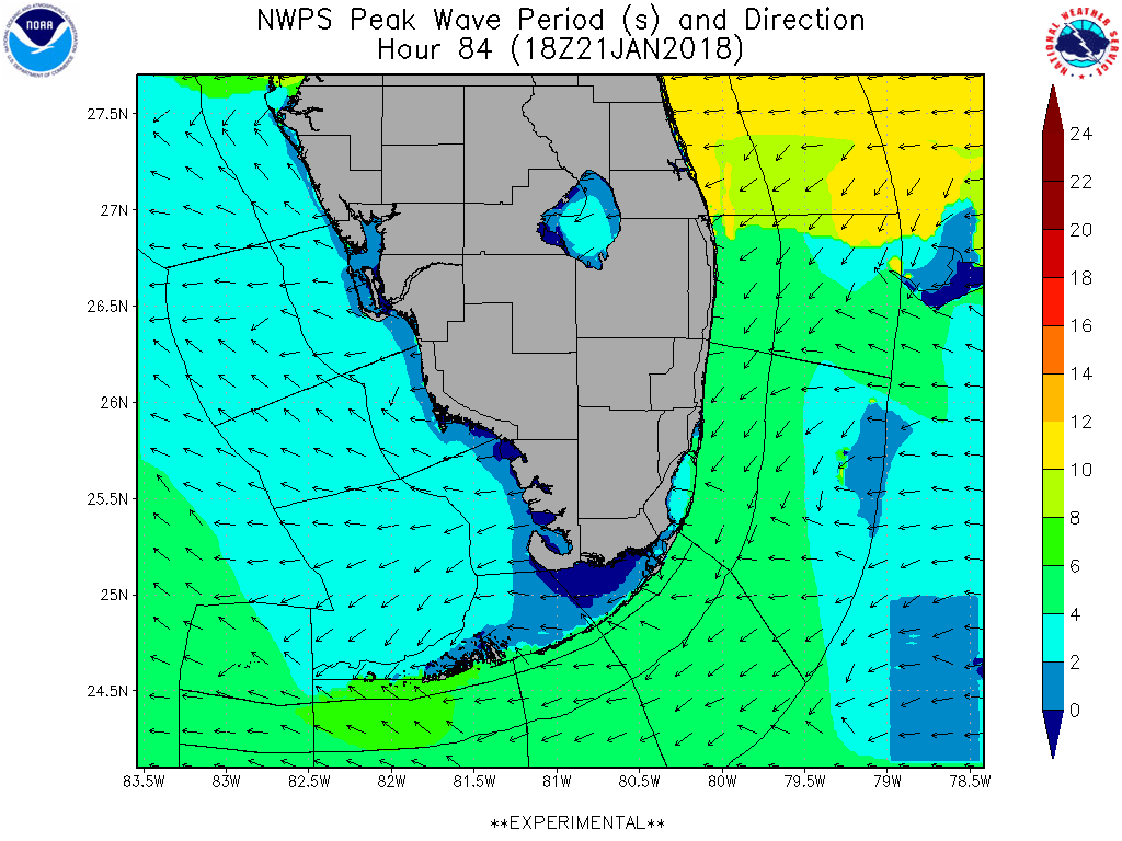 |
Wavelength
12HR |
18HR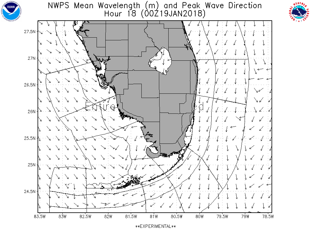 |
24HR |
30HR |
36HR |
42HR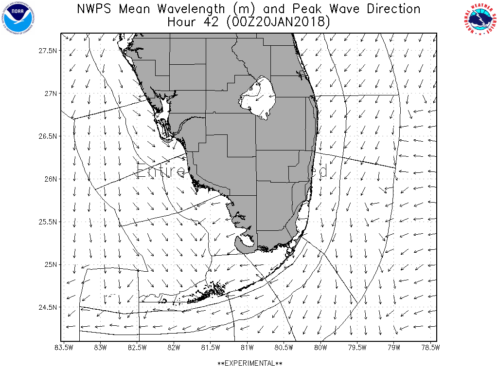 |
48HR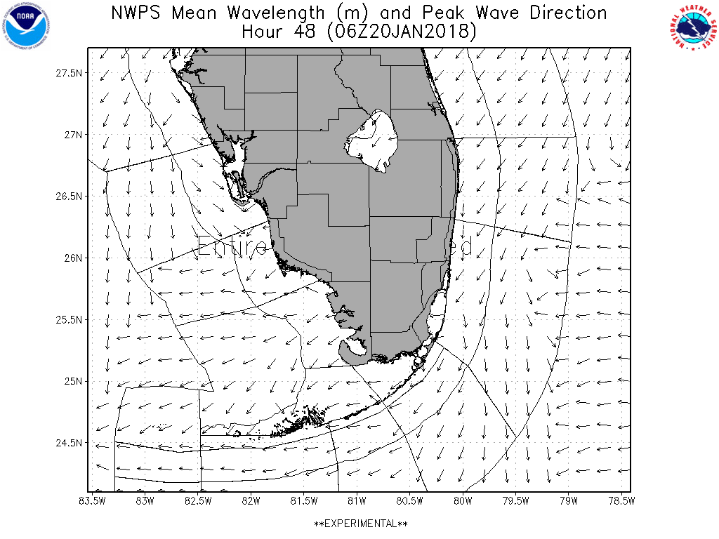 |
54HR |
60HR |
84HR |
TIDE PREDICITIONS FOR SOUTH FLORIDA


