Midland/Odessa
Weather Forecast Office
During the afternoon of Saturday, April 13, thunderstorms developed over portions of southwest Texas. The following provides details regarding a funnel cloud that developed east of Marfa in Presidio County, and then became a tornado between Paisano Pass and Ranger Peak in Brewster County. The following map can be used for reference.
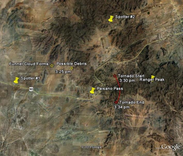
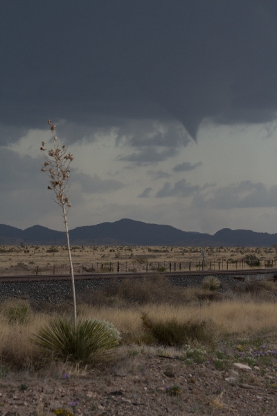
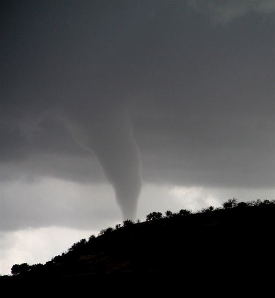
At 3:21 pm CDT, a trained spotter positioned along Highway 90 between Marfa and Alpine witnessed the development of a funnel cloud. The spotter (Spotter #1 on the image) slowly followed the funnel cloud eastward along Highway 90. See the image below.
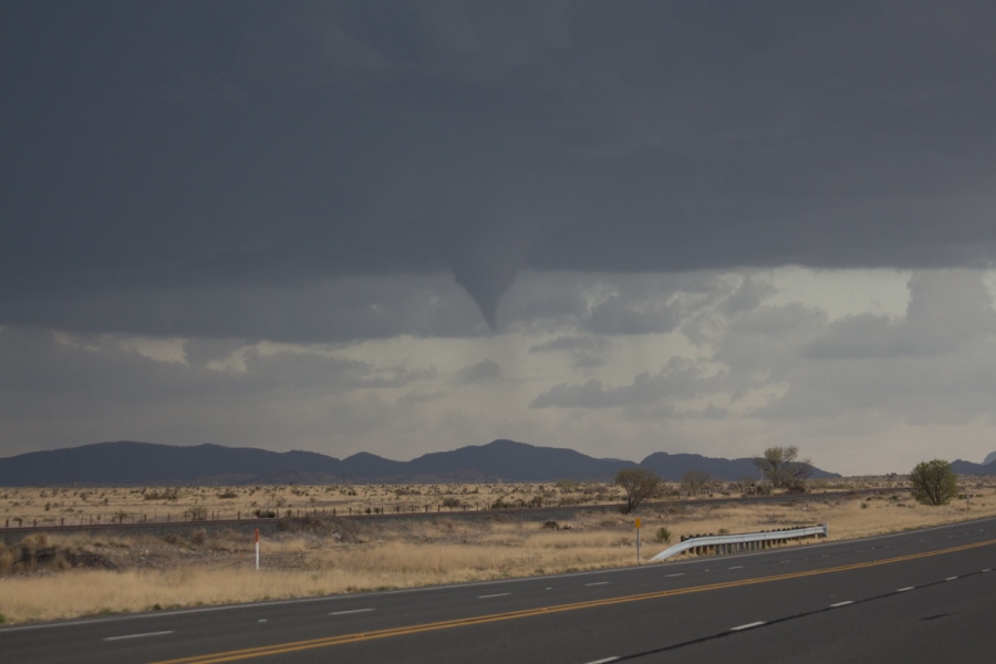
At 3:24 pm CDT, the funnel appears to develop a wall cloud. Concurrently, images suggest the possibility of debris at the ground level. However, confidence it not great enough to call this a tornado at this point. See the image below.
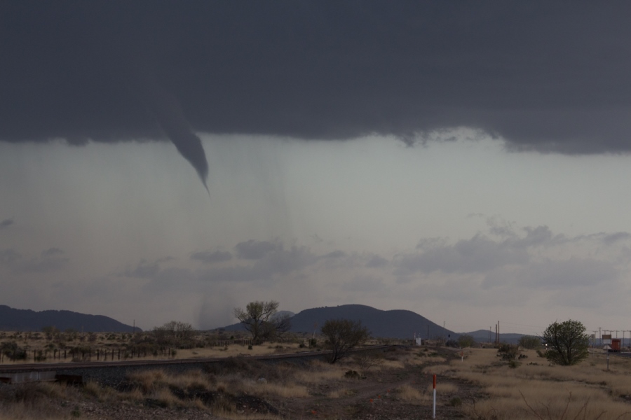
The funnel cloud continues to move eastward. At 3:30 PM CDT, there is a clear indication of debris extending east of Paisano Pass. By definition, this would be considered a tornado since the violent air is now at ground level. Please see the image below.
The funnel and tornado were seen by many residents of both Presidio and Brewster Counties. Another spotter (Spotter #2) located to the west northwest of Alpine is able to view the condensation funnel as he looks southeastward. Because terrain features are blocking his view of the ground, he can not confirm that he is looking at a tornado. He can only indicate the presence of a funnel cloud. From Spotter #2, we are able to gain the perspective that the feature in question moved toward the southwest during its life cycle. It appears from all available images that the tornado never extended east than Ranger Peak. While the positioning of the tornado is difficult to determine, primary indications are that the tornado lasted no longer than 4 minutes before dissipating at approxmately 3:34 pm CDT.
The tornado will be rated as an EF-0 weak tornado.
This event serves as a great example of why Skywarn spotters are so important to a community. The National Weather Service in Midland expresses its appreciation to those who provided critical weather information during the April 13, 2013 severe weather episode. Thank you!
Hazards
Spotter Briefing
Outlook
Current Hazards
Storm Report
Severe Weather
Drought
Storm Prediction Center
Weather Prediction Center
National Hurricane Center
Active Alerts
Winter Weather
Past Weather
Cooperative Observations
Local Climate Data
National Climate
Current Weather
Observations
Satellite
Upper Air
West Texas Mesonet
Radar
Forecasts
Activity Planner
Aviation
Climate Prediction Center
Fire
Forecast Discussion
Graphical
Local
Space Weather Center
Information Center
Weather Trivia
Forecast Models
GIS
International Weather
Glossary
Road Conditions
Water
Hydrology
Precipitation Estimates
Quantitative Precipitation Forecasts
US Dept of Commerce
National Oceanic and Atmospheric Administration
National Weather Service
Midland/Odessa
2500 Challenger Dr.
Midland, TX 79706-2606
(432) 563-5006
Comments? Questions? Please Contact Us.

