Midland/Odessa
Weather Forecast Office
On Tuesday, June 15, National Weather Service meteorologists conducted a damage survey across portions of West Odessa that experienced significant wind damage the late Monday afternoon.
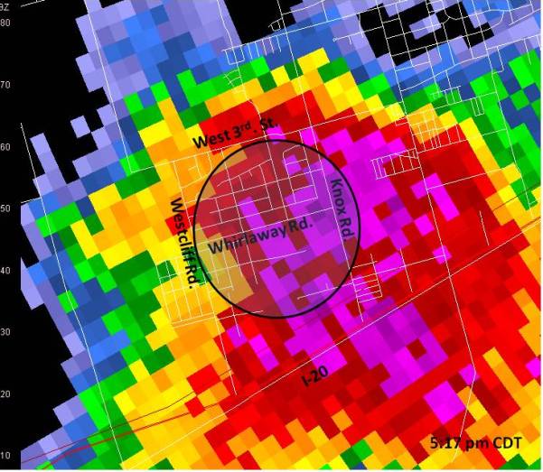
Based on the damage and corresponding radar imagery, it was determined that the damage across West Odessa was indicative of a straight line wind event. The following image from 5:17 pm CDT shows the primary area of damage and the severe thunderstorm that impacted the area.

Within this outlined area, a broad swath of damaging south winds (winds from the south) produced a large spectrum of different damage results. Structures more susceptible to damage due to orientation normal to the wind, and also those homes constructed of less protective materials, sustained more significant wind damage. Two mobile homes were completely destroyed. Other homes sustained a total loss of their roof structure. In these cases, based on the sustained damage and the type of construction, localized wind speeds of 75 to 85 mph likely occurred.
However, much of the outlined area experienced winds in the 60-70 mph range. Tree damage – which was not widespread and “relatively minor” compared to some wind events seen in the past across West Texas – supported these lower wind speed estimates, as does the damage seen on well constructed composite-type roofs. With these structures, shingle loss was generally minimal.
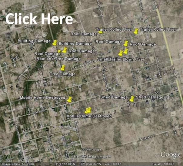
The following clickable Google image shows some of the damage from this event.
Hazards
Spotter Briefing
Outlook
Current Hazards
Storm Report
Severe Weather
Drought
Storm Prediction Center
Weather Prediction Center
National Hurricane Center
Active Alerts
Winter Weather
Past Weather
Cooperative Observations
Local Climate Data
National Climate
Current Weather
Observations
Satellite
Upper Air
West Texas Mesonet
Radar
Forecasts
Activity Planner
Aviation
Climate Prediction Center
Fire
Forecast Discussion
Graphical
Local
Space Weather Center
Information Center
Weather Trivia
Forecast Models
GIS
International Weather
Glossary
Road Conditions
Water
Hydrology
Precipitation Estimates
Quantitative Precipitation Forecasts
US Dept of Commerce
National Oceanic and Atmospheric Administration
National Weather Service
Midland/Odessa
2500 Challenger Dr.
Midland, TX 79706-2606
(432) 563-5006
Comments? Questions? Please Contact Us.


