
Severe thunderstorms will be possible from the central Plains to the Mid-Atlantic and Northeast on Monday. Hazardous heat will linger across the southern U.S. and build across the West through mid-week. Hot and dry conditions will fuel fire weather concerns for Interior Alaska and the Four Corners region through Monday. Read More >
On Tuesday June 16th, 2009, National Weather Service meteorologists traveled to Jal, New Mexico to perform a damage assessment in response to a supercell thunderstorm that moved through the area Sunday afternoon.
The following image shows both the general area where most of the damaged occurred (red) and also the area where the most significant damage was found (white).

Based on an extensive survey and additional follow-up calls in the months following, the National Weather Service in Midland has determined that the combination of very large hail and straight line winds - estimated at 80 to 100 mph - led to the significant damage across the city of Jal Sunday afternoon, June 14.
The most extensive damage was confined to eastern portions of the city. At the Lea County/Jal Airport, a small single-engine plane was flipped over. Also, numerous aircraft hanger doors were blown in due to the high winds, which resulted in extensive damage to several aircraft storage buildings. Along State Highway 128, 28 power poles stretched along the southern edge of the highway were blown over into the eastbound lane of traffic. These power poles were all oriented in the same direction, from south to north, consistent with straight-line wind damage. In all, 60 poles were damaged in the storm. Other damage signatures across the southern and eastern portions of the Jal also suggest that the event was a straight line wind event.
The determination of the source of the straight -line winds is not clear cut. Two possible conclusions are that rear-flank downdraft winds descended to the ground - wrapping around the southern and east side of the storm as it moved rapidly northeastward. This could have caused the enhanced areas of damage seens in southeastern portions of Jal and near the airport. The presence of strong winds along the leading edge of the forward flank downdraft of the supercell thunderstorm also could have contributed to the damage. Radar imagery and additional information gathered through first-hand accounts of the storm seem to suggest that both conclusions are possible.
Farther west of Highway 18, numerous residental structures received roof damage, mainly in the form of lost roof shingles. Some hail damage was also noted in these areas. Several trees were downed near the Jal Lake Receational Area, all downed facing to the north, and again consistent with straight line wind damage.

Radar reflectivity from the Midland, Texas (KMAF) WSR-88D radar site depicting the supercell thunderstorm that moved over the Jal, New Mexico area Sunday afternoon (June 14th). Notice the large "hail spike" extending northwestward from the storm beginning on the 2211 UTC image. Hail spikes are a classic indicator of severe hail within a strong thunderstorm.
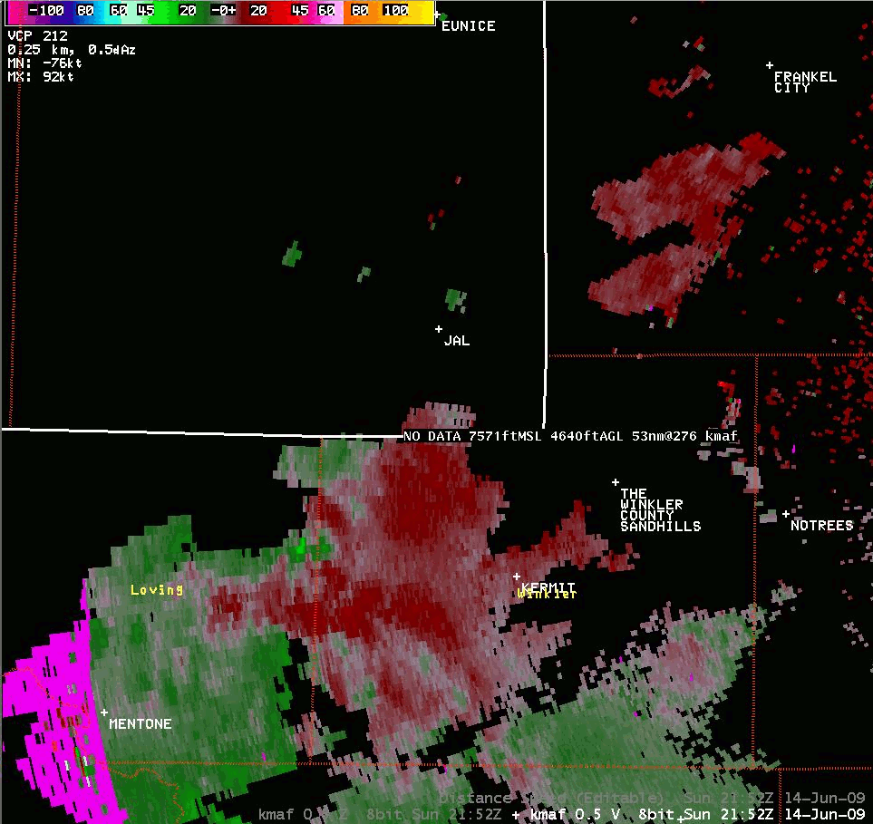
Radial velocity from the Midland, Texas (KMAF) WSR-88D radar site depicting strong low-level convergence (bright green) along the northern periphery of the storm. This data suggests inflow winds in excess of 60 mph were being fed into the storm.
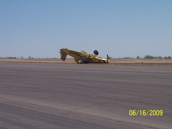
A plane flipped over at the Lea County/Jal, New Mexico Airport.

Damaged power poles along State Highway 128 east of Jal in close vicinity to the Lea County/Jal Airport. All poles were sprawled across SH-128 from south to north consistant with straight line wind damage.

Hail damage to the Jal, New Mexico Fire Chief's vehicle. Hail reports from Jal on Sunday afternoon ranged from baseball to grapefruit size.

A large metal storage building was destroyed on the southern part of town. Debris from this building was blown as far as 2 to 3 tenths of a mile northward into an adjacent baseball field.
The National Weather Service wishes to thank the numerous Jal, New Mexico city employees who assisted in the damage assessment efforts.

