
Severe thunderstorms are forecast through this weekend along a slow moving cold front and secondary storm system that will impact areas from the southern Plains to the Great Lakes. Large hail and isolated damaging wind gusts are the main threats with these storms along with a risk for heavy to excessive rainfall which could bring flooding. Read More >
Midland/Odessa
Weather Forecast Office
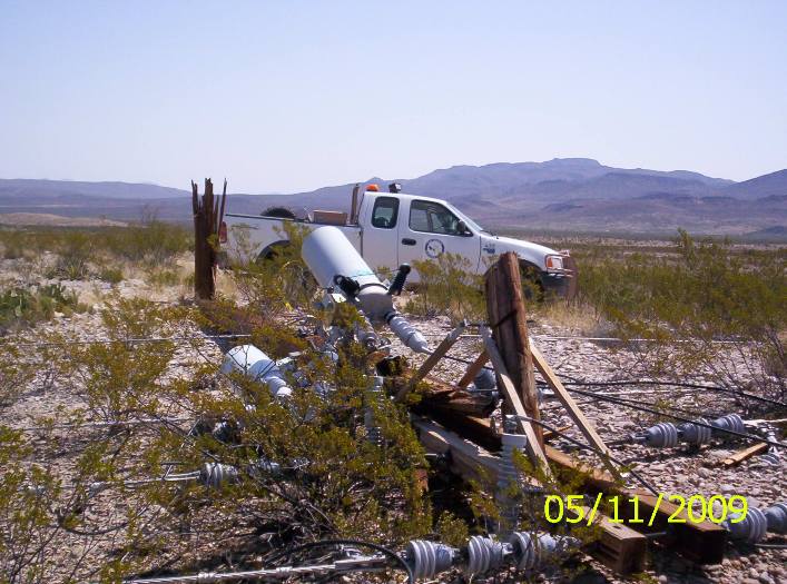
On the evening of Sunday, May 10, supercell thunderstorms developed over portions of Brewster County. Thunderstorms both north and south of the community of Marathon exhibited rotation and produced large hail. Significant damage was reported east of Highway 385 and north of Farm to Market Road 2627.
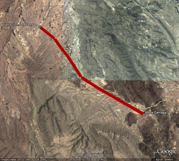
In total, 44 distribution poles across a six mile area were damaged in this event. Poles along western stretch of damage were snapped 3 to 5 feet above the ground. This type of damage was seen for approximately four miles. Lesser pole damage - poles snapped higher off the ground and then only crossbar damage - was seen in the remaining two miles farther to the east. We would like to provide a special thank you to Dave Lassanske from Rio Grande Electric, who provided the following images and other key information contained within this damage survey writeup.
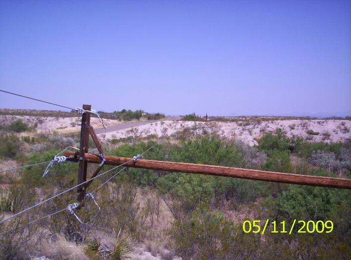
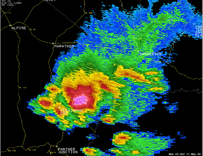
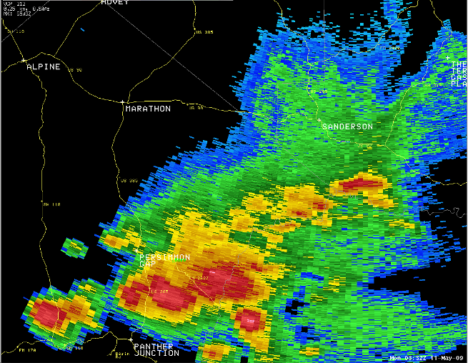
Based on radar imagery, and pole orientation the WFO Midland survey team determined that the damage was not indicative of tornado damage. The damage was likely produced by severe downburst winds as the supercell thunderstorm began to "collapse" or weaken. The following radar imagery shows an elevated reflectivity core aloft at 0300Z on 5/11/09. The second image shows the weakening storm several scans later.
Winds were estimated to be 90-100 mph with this straight line wind event. Click the following Google Earth map to see the location of the damage area. The entire six mile stretch remained within the Black Gap Wildlife Management Area, with the last damage noted just southeast of the Texas Parks and Wildlife Black Gap headquarters.
Hazards
Spotter Briefing
Outlook
Current Hazards
Storm Report
Severe Weather
Drought
Storm Prediction Center
Weather Prediction Center
National Hurricane Center
Active Alerts
Winter Weather
Past Weather
Cooperative Observations
Local Climate Data
National Climate
Current Weather
Observations
Satellite
Upper Air
West Texas Mesonet
Radar
Forecasts
Activity Planner
Aviation
Climate Prediction Center
Fire
Forecast Discussion
Graphical
Local
Space Weather Center
Information Center
Weather Trivia
Forecast Models
GIS
International Weather
Glossary
Road Conditions
Water
Hydrology
Precipitation Estimates
Quantitative Precipitation Forecasts
US Dept of Commerce
National Oceanic and Atmospheric Administration
National Weather Service
Midland/Odessa
2500 Challenger Dr.
Midland, TX 79706-2606
(432) 563-5006
Comments? Questions? Please Contact Us.

