
Severe thunderstorms will be possible from the central Plains to the Mid-Atlantic and Northeast on Monday. Hazardous heat will linger across the southern U.S. and build across the West through mid-week. Hot and dry conditions will fuel fire weather concerns for Interior Alaska and the Four Corners region through Monday. Read More >
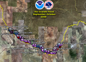
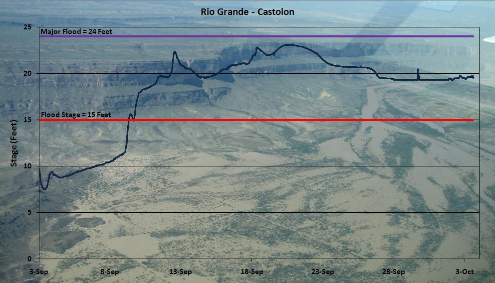
During the summer of 2008, monsoon rainfall filled reservoirs across northern Mexico. In late August 2008, releases out of La Boquilla, Frank Madera, and Luis Leon Reservoirs were increased to lower water levels in those reservoirs. By mid-September the Rio Grande and it's people were experiencing record flooding. This page is dedicated to those people and that event to record what went right, learn what went wrong, and what can be done in the future to prepare for the next one.
We also would like to thank: The International Boundary and Water Commission (IBWC), Comision Internacional de Limites y Aguas (CILA), The United States Geological Survey (USGS), The United States Customs and Border Patrol, The National Park Service (NPS) and Big Bend National Park, Big Bend Ranch State Park, Texas Department of Transportation (TXDOT), The US Army, The US Army Corps of Engineers, Texas Division of Emergency Management, The Civil Air Patrol and Texas Wing Group I, The University of Texas Center for Space Research, National Weather Service West Gulf River Forecast Center, National Weather Service Southern Region Headquarters, Presidio County, Brewster County, and the countless individuals for all their hard work, help, and support during this record event.
NOTE: All information and data on this page are preliminary at this time.
KMZ file with pictures from NWS MAF Civil Air Patrol flight (09/20/08) and other important locations.
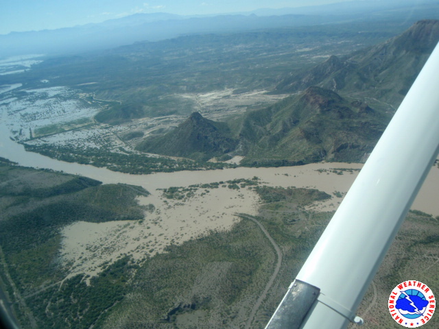
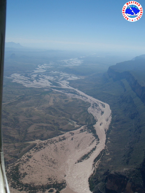
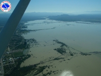
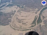
The two images below will take you to two separate PDF files (5MB each) with images of the Civil Air Patrol taken on September 20, 2008.


For questions or information about this page, the data, or the Rio Grande Flood Event, please contact: Jim DeBerry.

