
Dangerous heat will expand from the Gulf Coast into the Southern Plains and Desert Southwest through week's end. Additional extreme heat impacting the Pacific Northwest will shift to the northern Plains by the weekend. Tropical Storm Bertha is expected to continue to impact portions of the northern Gulf Coast from the western Florida Panhandle to southeastern Louisiana through tonight. Read More >
Midland/Odessa
Weather Forecast Office
May 1, 2008 High Winds and Wildfires
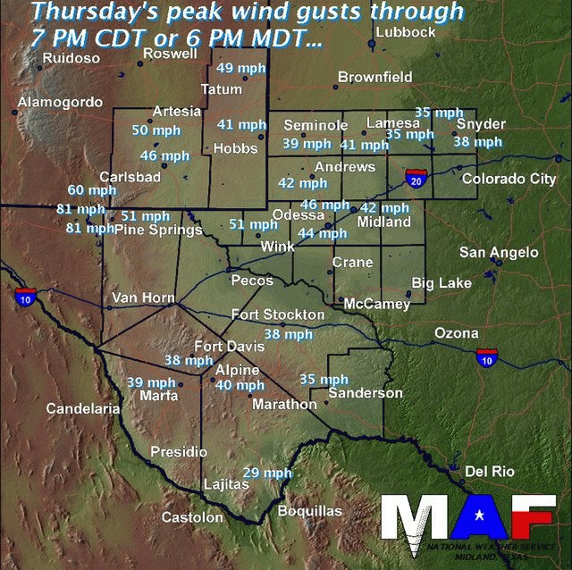
An upper level low pressure system deepening over the central plains along with surface low pressure over the southern plains provided another day of very windy conditions to all of west Texas and southeastern New Mexico Thursday afternoon and evening. The graphic below shows peak wind gusts for selected locations across the area.
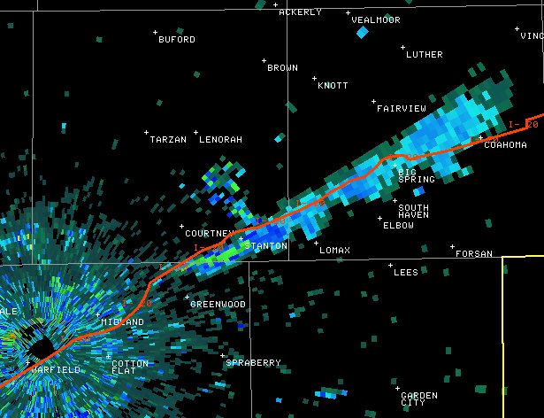
West winds and a dry atmosphere allowed temperatures to rise well above normal. Weather conditions along with extreme fire danger were conducive for the development of wildfires. National Weather Service Doppler Radar was able to detect several smoke plumes across the region. The image below was taken at 5:01 PM CDT and shows a smoke plume over northeast Midland county. As of late Thursday evening...this fire is estimated to have burned 2000 acres.
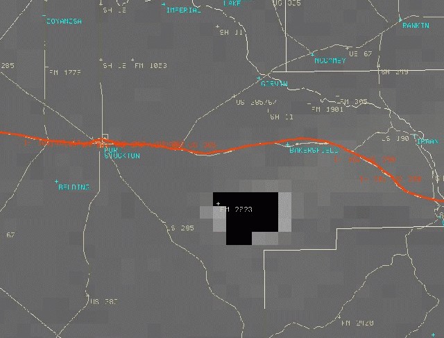
Elsewhere...a fire that began on Wednesday in Pecos county continued to burn actively. The image below was taken at 5:10 PM and shows the satellite detected "hot spot" associated with this wildfire.
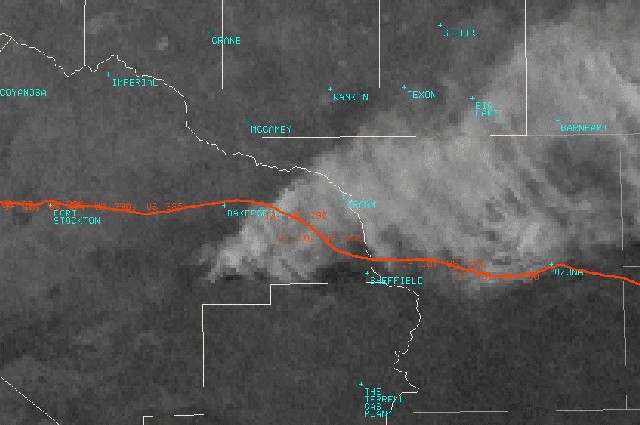
This visible satellite image was taken at 5:45 PM CDT and shows a large smoke plume spreading east across Pecos county.
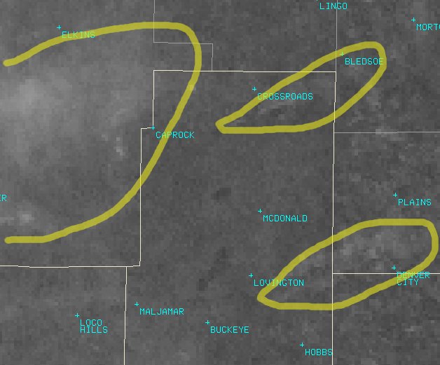
The following image shows smoke plumes associated with 2 fires in northern Lea county. A large smoke plume can also be seen spreading across southern Chaves county.
Hazards
Spotter Briefing
Outlook
Current Hazards
Storm Report
Severe Weather
Drought
Storm Prediction Center
Weather Prediction Center
National Hurricane Center
Active Alerts
Winter Weather
Past Weather
Cooperative Observations
Local Climate Data
National Climate
Current Weather
Observations
Satellite
Upper Air
West Texas Mesonet
Radar
Forecasts
Activity Planner
Aviation
Climate Prediction Center
Fire
Forecast Discussion
Graphical
Local
Space Weather Center
Information Center
Weather Trivia
Forecast Models
GIS
International Weather
Glossary
Road Conditions
Water
Hydrology
Precipitation Estimates
Quantitative Precipitation Forecasts
US Dept of Commerce
National Oceanic and Atmospheric Administration
National Weather Service
Midland/Odessa
2500 Challenger Dr.
Midland, TX 79706-2606
(432) 563-5006
Comments? Questions? Please Contact Us.

