
Severe thunderstorms are forecast through this weekend along a slow moving cold front and secondary storm system that will impact areas from the southern Plains to the Great Lakes. Large hail and isolated damaging wind gusts are the main threats with these storms along with a risk for heavy to excessive rainfall which could bring flooding. Read More >
Mitchell County Severe Weather May 2
The National Weather Service in Midland conducted a survey in Mitchell county to investigate damages that occurred from severe weather during the early evening of May 2, 2006. The survey team initially met with Mr. Jim Baum of KVMC/KAUM radio in Colorado City and received a detailed overview of reports that the radio station had received during the storm. Upon investigation of the reports provided by Mr. Baum, the team identified four key areas of damage.
The first area of damage was found at Lake Colorado City, where predominantly golfball to baseball sized hail produced minor window and vehicle damage. The most significant damage in this area was to a residential structure, where the roof was blown off due to severe straight-line winds estimated at 60-70 mph. Other structures surrounding this residence suffered little, if any wind damage.
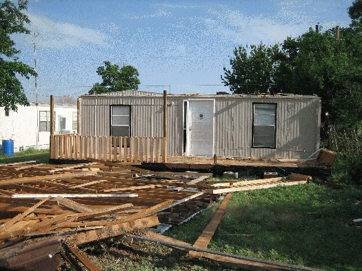
Severe straight-line winds caused roof damage to this structure in Lake Colorado City.
The second area observed was located 9 miles southwest of Colorado City along state highway 163. Extensive tree and structural damage was found at a residence on the west side of the road. Several large trees were uprooted or heavily damaged. A grass seeder weighing approximately 150 pounds was carried a distance of 50 feet. Also, extensive damage to a barn and storage shed were found at the residence. The survey team concluded that a brief tornado was responsible for the damage. The tornado damage was estimated to be F1 in strength. The width of the tornado was estimated to be approximately 30 yards, with a path length of approximately 150 yards. The general movement of the tornado was estimated to be to the south-southeast.
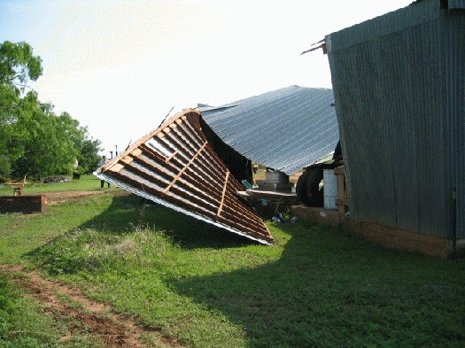
Damage to a barn caused by a brief tornado touchdown just to the west of this residence 9 miles southwest of Colorado City.
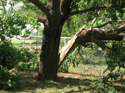
A large tree is split by tornadic winds at a residence 9 miles southwest of Colorado City.
Two other areas of tornadic damage were found along farm-to-market road 670 southeast of Westbrook. The first tornado along this route was approximately 5 miles southeast of Westbrook. A large hay baler (weighing approximately a ton) was rolled a distance of 100 feet by tornadic winds across FM 670, leaving numerous scar marks along the pavement. This lead the damage survey team to believe that the tornado was F1 in intensity. The width of this tornado was estimated to be 30 yards, with a path length of 100 yards. The third tornado was located about 2 miles southeast of Westbrook. Several mesquite trees were found to be sheared off and damaged near the top. Also, two power poles were found on the ground, split about 6 feet from the bottom. A large water trough was displaced by the tornadic inflow winds, and rolled for just over one mile. This tornado was estimated to be F0 in strength, with a width of less than 30 yards, with a path length of about 100 yards.
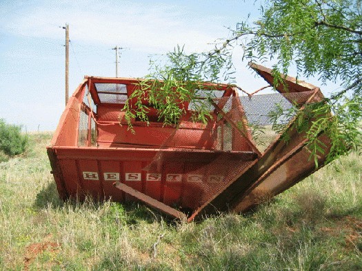
This hay baler was rolled a distance of 100 feet by tornadic winds 5 miles southeast of Westbrook along FM 670.
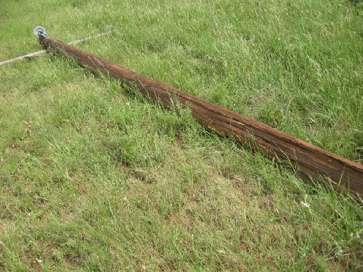
This power pole was split by tornadic winds 2 miles southeast of Westbrook along FM 670.
Doppler radar imagery from both Midland and San Angelo support the presence of tornadoes in the three aforementioned areas. Other damage received in the Colorado City and Westbrook area were due to large hail and severe winds associated with the supercell thunderstorm that affected the area. Preliminary damage estimates totaled around $200,000 for the entire event.
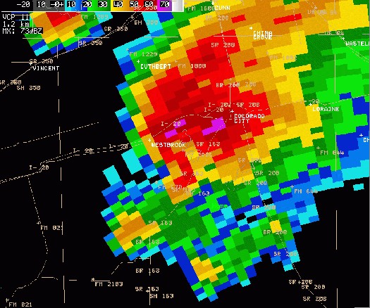
NWS radar image showing a "hook echo" type feature around the time the tornadoes occurred southeast of Westbrook. Radar image at 5:22 pm CDT.
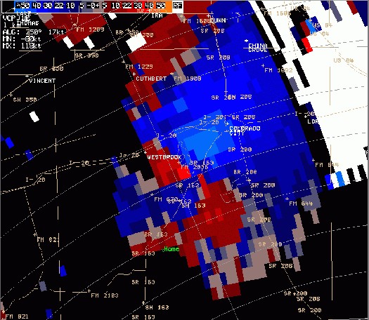
Velocity image showing rotation southeast of Westbrook at 5:22 pm CDT.
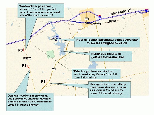
Map of tornado paths, damage areas, and descriptions.

