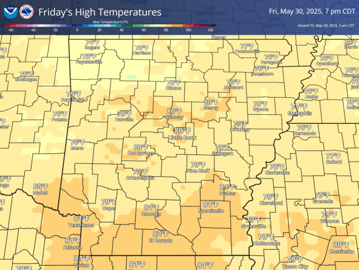
A warm front will continue to move slowly to the north during your Thursday. As it does, there will be continued chances for drizzle and some showers. The best chances for seeing rainfall will be across far northeast sections of the state.
The next seven days will feature possible record breaking warmth on Saturday, much colder air behind a strong cold frontal passage Saturday night and maybe some winter weather over the north. Rain is expected elsewhere.
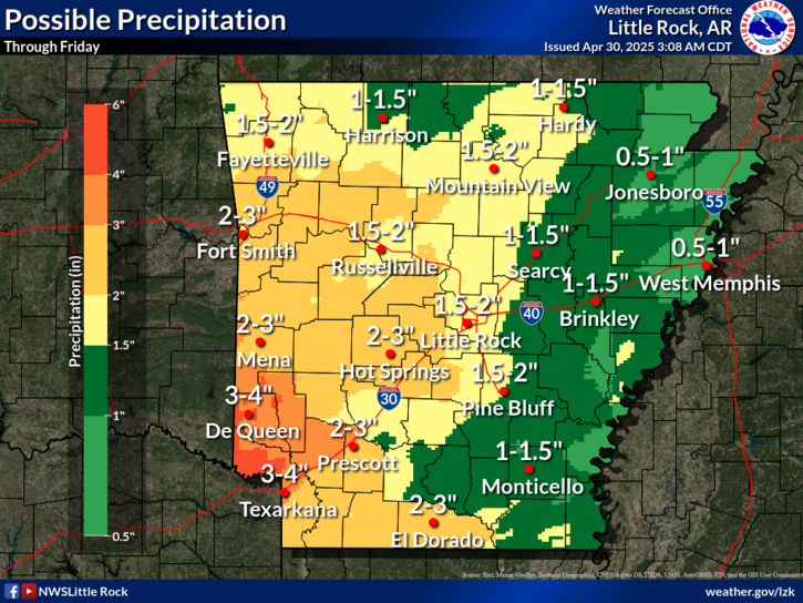
Several storm systems will be moving across the region Sunday through Thursday of next week. The highest amounts of rain will be over the south and southeast, where amounts exceeding 3 inches could be seen.
On this day in Arkansas weather history, heavy snow impacted a large part of the state in 1979. Some spots saw as much as 10 to 11 inches of snow over a three day span.
Note: "N/A" or "MISG" will be displayed if values are not available. In the LOCATION column, click on links for a list of recent observations at sites of interest. In the WIND column, VRB is "variable" and G is "gust". Wind speeds are in MPH. In the BARO (pressure) column, values are in inches. In the REMARKS column, HX is "heat index", WCI is "wind chill index", and VSB is "visibility" (if shown).


 Regional Radar
 Weather Map
 Social Media Dashboard