Severe thunderstorms are expected later this afternoon and evening across the mid-Mississippi and Ohio Valley's. Large hail, damaging winds and a few tornadoes are all possible. Meanwhile, record warmth across the southern tier of the country continues; This will enhance fire weather conditions for the Plains. The cold front will head south on Friday with cooler temperatures east of the Rockies. Read More >
|
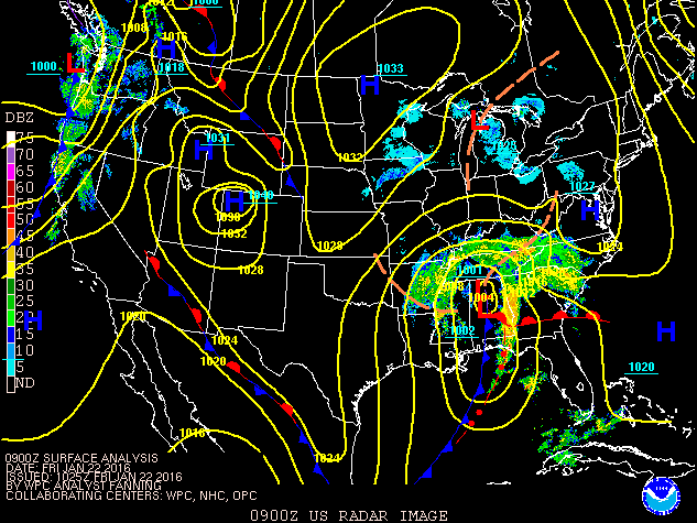
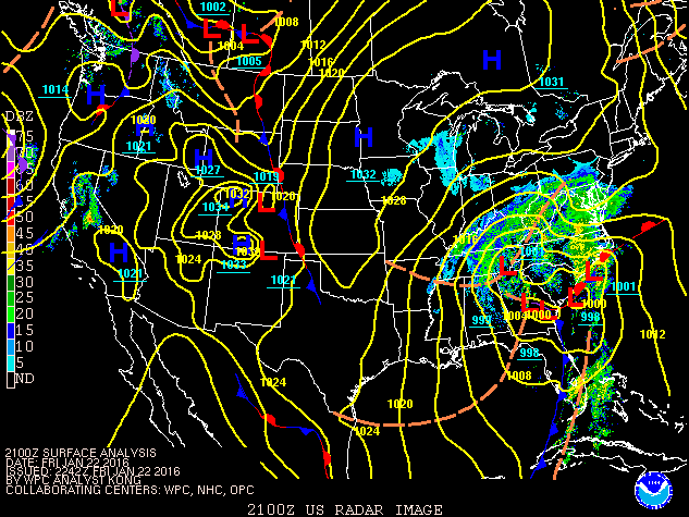
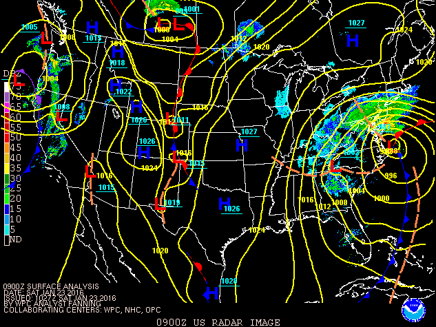
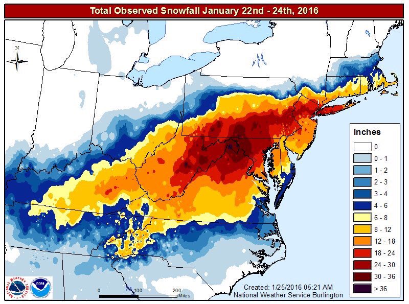
A paralyzing winter storm dumped up to 20 inches of snow across parts of eastern Kentucky from the early morning hours of Friday January 22nd through the day on Saturday January 23rd. The snow accumulated at a rate of 2 inches per hour at times. The snowfall produced by the storm was the heaviest to fall across eastern Kentucky since the Blizzard of March 1993.
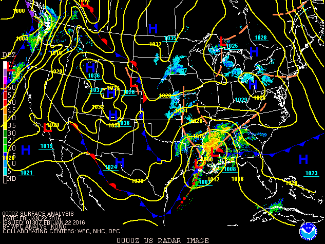
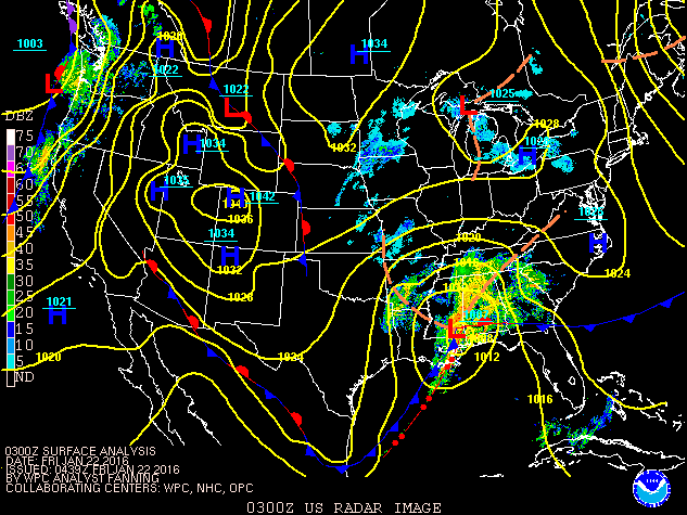
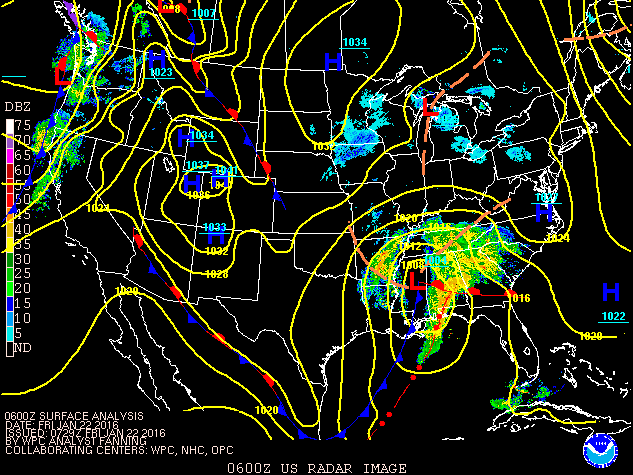
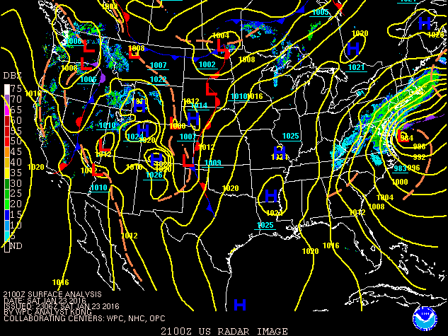
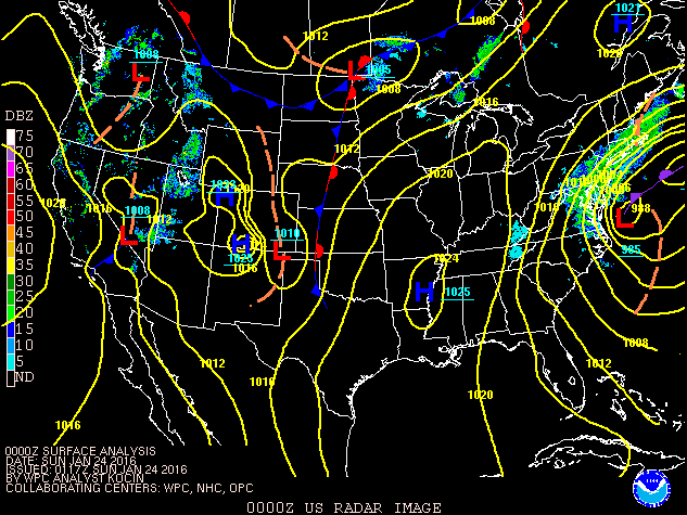
The storm system responsible for the east Kentucky snow orginated over Texas, tracked across the Deep South and Carolinas, and finally up the East Coast. |
||
|
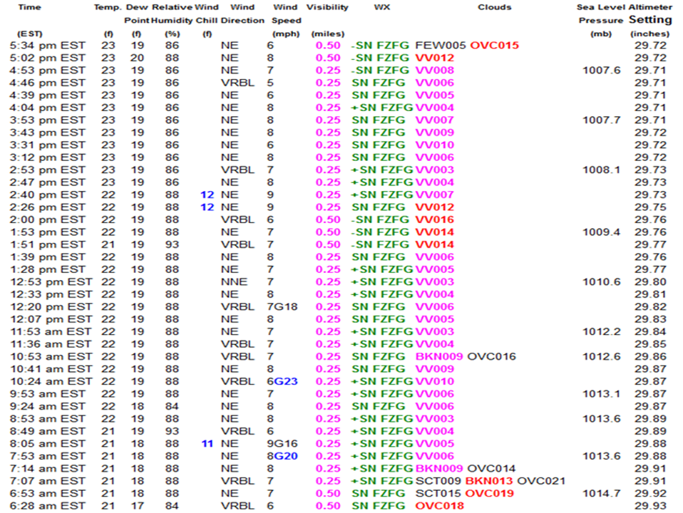
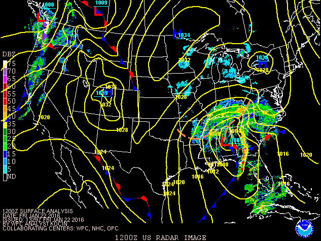
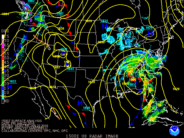
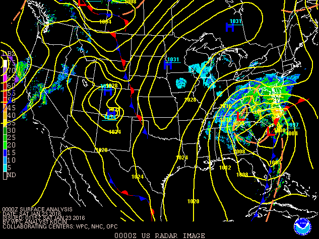
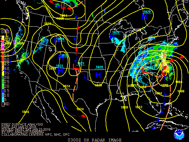
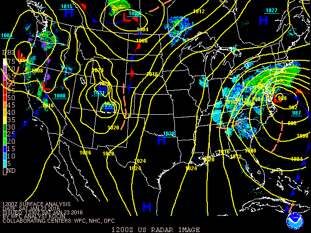
Precipitation overspread east Kentucky during the early morning hours of Friday January 22nd. The precipitation fell as a mix of freezing rain, sleet and snow over southeast Kentucky through the morning and into the midday hours on Friday, before changing to snow Friday afternoon. The precipitation fell as mostly snow for the remainder of the area throughout the event. The snow fell very heavy at times during the morning and early afternoon hours on Friday, with snowfall rates of 2" or more common as a heavy snow band set up across the heart of eastern Kentucky.
Another 2" of snow fell last hour, 4.5" has fallen in the past 3 hours here at NWS Jackson. #kywx #WinterStorm pic.twitter.com/HFafY0WF1R
— NWS Jackson, KY (@NWSJacksonKY) January 22, 2016
Snowfall rates in the 1 to 2 inch per hour range within the heaviest bands. #winterstorm pic.twitter.com/uSxuntBJtk
— NWS Jackson, KY (@NWSJacksonKY) January 22, 2016
The Automated Surface Observing System located at the Jackson, KY National Weather Service office reported 11 hours of continuous moderate to heavy snow with visibility of 1/2 mile or less. Snowfall rates were 1 to 2 inches per hour during this time.
|
|
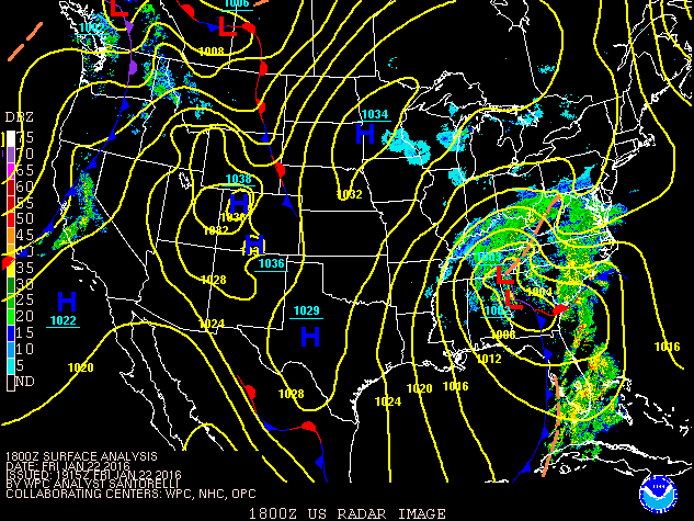
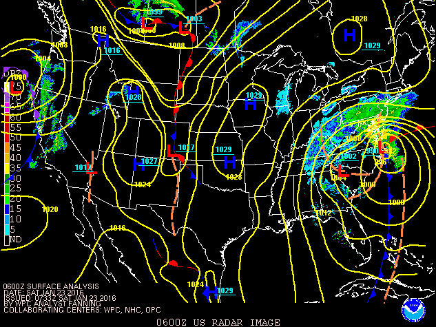
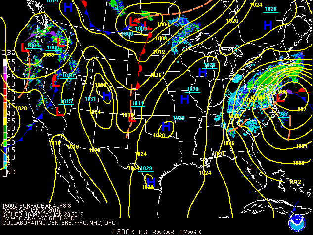
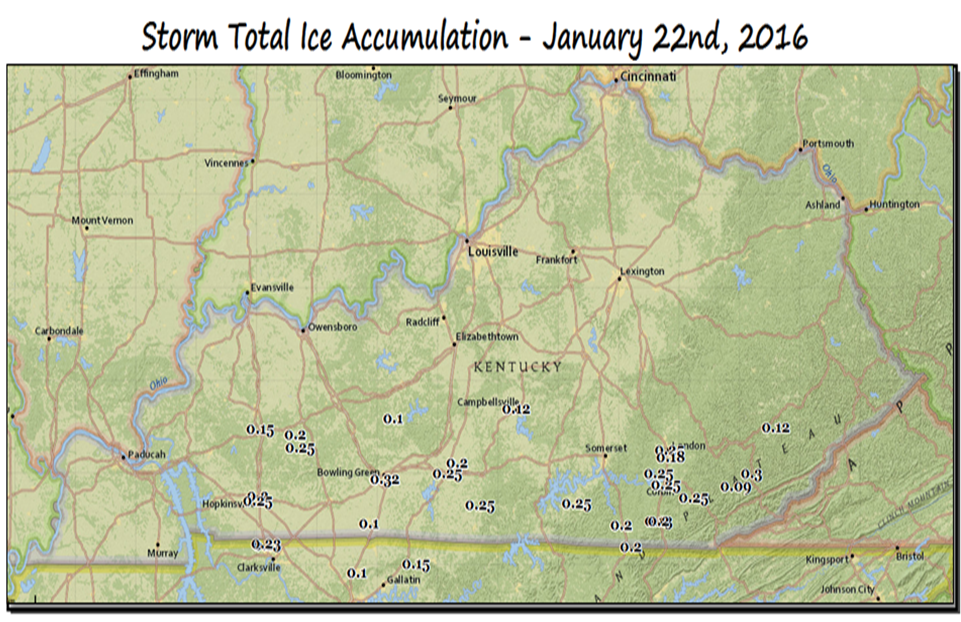
The snow gradually diminished in intensity Friday night into Saturday morning, with the last of the snow pulling east out of the area late Saturday afternoon. Final snowfall totals ranged from 4 to 8 inches in Knox, Bell and Harlan counties, with up to 12 to 20 inches in a strip from Hart County in central Kentucky eastward through the heart of eastern Kentucky into central West Virginia. Freezing rain accumulated up to 3/10 inch in places near the Tennessee border Friday morning, before the changeover to snow occurred.
|
|
|
|
 |
 |
 |
| High resolution satellite imagery of snow cover stretching from Kentucky and Tennessee up the U.S. East Coast. Courtesy NASA Worldview |
The storm total snowfall of 18.5" from this winter storm at the National Weather Service office near Jackson, KY is the greatest January snowstorm since records began at this station in 1981. In fact, this winter storm is 2nd only to the Blizzard of March 1993 in the station's record books as far as snowfall goes.

The storm caused major impacts across eastern Kentucky, especially with travel. Interstate 75 was shut down in Rockcastle County at times Friday afternoon through Saturday morning due to multiple crashes leaving 3,000 people stranded in their vehicles at one time.
KSP: 3,000 motorists stranded on I-75 due to winter storm. https://t.co/M54H65kcQo
— WYMT (@WYMT) January 23, 2016
Power was also knocked out for thousands of customers during the peak of the storm. The hardest hit areas were the counties close to the Tennessee border, which experienced up to a quarter inch of ice accumulation before the changeover to snow occurred.
This is what we have dealt with across our system. Photo from SK employee. pic.twitter.com/9AkFemk7xR
— SouthKentucky RECC (@skrecc) January 24, 2016
The weight of the snow and ice also caused some roof collapses. This included boat docks on Lake Cumberland and Paintsville Lake.
The roof of a dock has collapsed at Paintsville Lake Marina. Several boats are underneath.@WYMT pic.twitter.com/sCVhwASkZd
— Chandler Markie (@ChandlerWYMT) January 23, 2016
Finally, despite the impacts noted above, the heavy amounts of snow made for some amazing pictures. Here are a few examples...
 |
 |
 |
 |
| Hwy 468, northern Pike Co (courtesy Mary Reed Runyon) |
Talbert, KY (courtesy Tina Edwards) |
NWS Jackson, KY station vehicle | Talbert, KY (courtesy Tony Edwards) |
 |
|
|
 |
||||||||
| Jackson, KY (courtesy Jane Marie Wix) |
Jackson, KY (courtesy Jane Marie Wix) |
 |
| Hatfield, KY (courtesy Mary Reed Runyon) |