
Severe thunderstorms are forecast through this weekend along a slow moving cold front and secondary storm system that will impact areas from the southern Plains to the Great Lakes. Large hail and isolated damaging wind gusts are the main threats with these storms along with a risk for heavy to excessive rainfall which could bring flooding. Read More >

When it comes to severe weather preparedness, it is important to know what threats you may face in your community. As the Churchill quote above aptly states, a look at the past many times can prepare you for what may come in the future. The following resources can be used to identify the severe weather threats your community has faced in the past, and may face again in the future.
Tornadoes...
 |
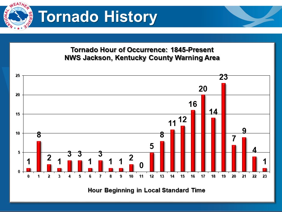
East Kentucky Tornado Database A comprehensible, sortable database of all documented tornadoes that have occurred since 1845 in the 33 counties covered by the NWS Jackson, KY office. |
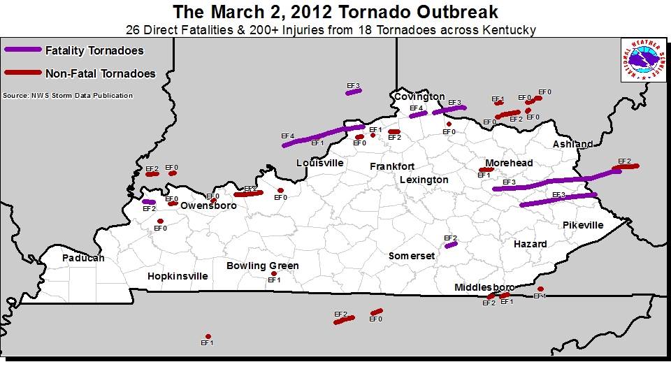 |
Summary of the March 2nd, 2012 Tornadoes A deadly tornado outbreak devastated the towns of West Liberty and Salyersville on March 2nd, 2012. This article details the outbreak and includes statistics for east tornado to affect the NWS Jackson, KY forecast area that day. |
 |
 |
 |
 |
| Tornado Counts by County | Documented Deadly Tornadoes | Tornado Occurence by Month | Tornado Occurrence by Hour |
Damaging Winds & Hail...
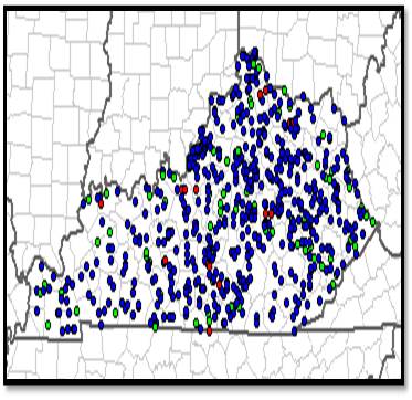 |
Storm Prediction Center Monthly & Annual Severe Weather Summaries Monthly and annual statistics on severe weather occurrences, including damaging wind and hail, for the U.S. and individual states back to 2000. |
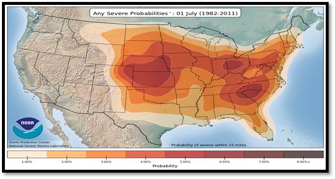 |
Storm Prediction Center Severe Weather Climatology Maps of the probability of severe weather across the country from a 30-year period of severe weather reports from 1982-2011. |
 |
Searchable database of severe weather reports from the official NOAA Storm Data Publication with data back to 1950. |
Floods and Flash Floods...
 |
Kentucky Flood Death History and Statistics Even though Kentucky accounts for only a little over 1% of the U.S. population, between 1996 and 2019, flood deaths in the state accounted for greater than 4% of the total flood deaths that occurred in the United States. |
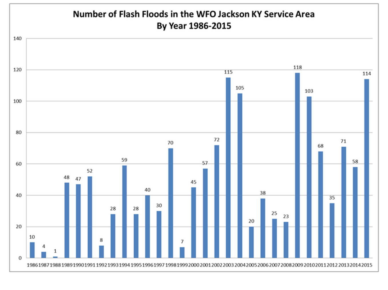 |
East Kentucky Flash Flood Climatology A collection of charts showing the flash flood frequency and climatology for the NWS Jackson, KY forecast area for the years ranging from 1986 through 2015. |
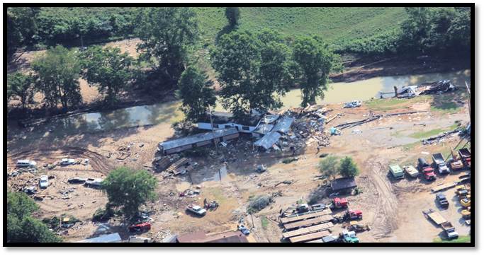 |
Summary of the Deadly July 13th & 14th, 2015 Flash Floods Multiple rounds of severe weather affected east Kentucky over a two day period. In addition to widespread wind damage and a couple tornadoes, deadly flash flooding occurred in the Redbush and Flatgap Communities of Johnson County. |
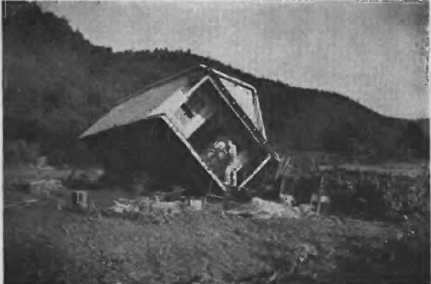 |
The Flash Flood Disaster of July 1939 Catastrophic flash flooding occurred during the overnight hours of July 4th to July 5th 1939. The Red Cross reported that the flooding affected 21 east Kentucky counties and 79 people lost their lives, including 52 in Breathitt County, 25 in Rowan County, and 2 in Lewis County. |
 |
Advanced Hydrologic Prediction Service (AHPS) Historic Crests and Impacts River flooding has been a repeating and devastating occurrence for many east Kentucky communities. View historic river crests and what impacts you can expect at certain river levels by visiting the AHPS pages for river points near your community. |