Severe thunderstorms are forecast through this weekend along a slow moving cold front and secondary storm system that will impact areas from the southern Plains to the Great Lakes. Large hail and isolated damaging wind gusts are the main threats with these storms along with a risk for heavy to excessive rainfall which could bring flooding. Read More >
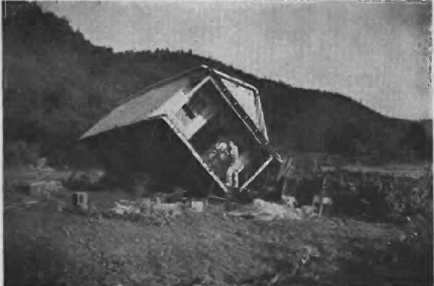
In Morehead in Rowan County, it was reported that the water rose 10 to 15 feet in less than 30 minutes, and Triplett Creek crested at a record 21.34 feet. The official Red Cross report indicated 25 lives were lost in Rowan County. Water on Railroad Street in Morehead varied from 4 to 10 feet in depth at the height of the flood and it was reported 200 structures were damaged or destroyed in Morehead.
An excellent detailed analysis of the event can be found in the publication Dep. of Interior, Geological Survey, Water Supply Paper 967-B Notable Floods of 1939, Part 2. Flood of July 5, 1939 in Eastern Kentucky.
 |
 |
| Home Overturned from Triplett Creek Flood, Rowan County (photo taken from Dep. of Interior, Geological Survey, Water Supply Paper 967-B Notable Floods of 1939, Part 2. Flood of July 5, 1939 in Eastern Kentucky) |
Car washed down Frozen Creek, Breathitt County (photo courtesy of the former breathittcounty.com) |
References: Jackson Times Newspaper; Lexington Leader Newspaper; The Kentucky Mountain Bible College website; Eastern Kentucky Floods of 1939 – Official Report of Relief Operations – American Red Cross; Dep. of Interior, Geological Survey, Water Supply Paper 967-B Notable Floods of 1939, Part 2. Flood of July 5, 1939 in Eastern Kentucky