CoCoRaHS (the Community Collaborative Rain, Hail, and Snow network) is a grassroots volunteer network of backyard weather observers of all ages and backgrounds working together to measure and map precipitation (rain, hail and snow) in their local communities. By using low-cost measurement tools, stressing training and education, and utilizing an interactive website, the goal is to provide the highest quality data for natural resource, education and research applications.
Who can participate?
- Weather enthusiasts
- Farmers/gardeners/naturalists
- Teachers/students - CoCoRaHS can be a fun and effective learning tool
- Lake/reservoir managers
- Construction workers and other outdoor occupations impacted by precipitation
- Everyone! Anyone who is willing to check their rain gauge each day
Why do you need to know how much precipitation fell in my backyard?
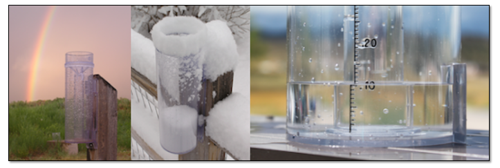
Even in the day and age in which we live with Doppler Radar scanning the skies and automated weather observing equipment in many communities, we still need humans manually measuring the precipitation in their backyards. Rainfall amounts can vary tremendously over a distance of just a few miles. Manual CoCoRaHS observations serve as ground truth for the precipitation estimates we get from Doppler Radar and automated station measurements. Manual observations also fill in gaps where automated equipment doesn’t exist. Plus, there are no automated instruments in our region that measure the snow. So, we rely heavily on manual human observations to know how much snow fell.
Here’s an example of the snowfall observations received following a snow storm in January 2024:
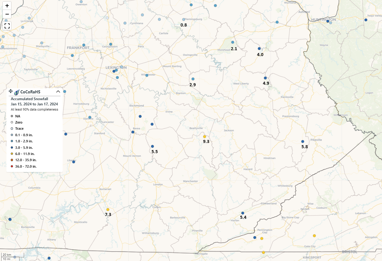
There are a handful of CoCoRaHS observers in eastern Kentucky. However, many counties, including Pike County, have no observers at all. We need more observers in order to accurately map the precipitation across our region.
How will my observation be used?
CoCoRaHS observations are used for...
River level forecasting: Rainfall data helps us forecast water levels along rivers, creeks, and lakes.
Flood warnings and forecasts: Rainfall amount data aids in the warning process by giving us an idea of how saturated the soil is and how much rain it would take to cause flooding in a particular area.
Verification: Rainfall data gives us an idea of how accurately our radar is estimating precipitation amounts.
Drought: Rainfall data over an extended period of time can help pinpoint areas being most affected by drought.
Research: Rainfall data can be used by scientists to better understand the way the atmosphere works, which can lead to better forecasts and warnings.
Other users: Farmers, gardeners, pest control, airports, emergency managers, city utilities, insurance adjusters, engineers, outdoor & recreation interests, teachers, students and many more!
You can always view the latest CoCoRaHs data each morning in CoCoRaHS Maps.
How do I become a CoCoRaHS observer?
Contributing your precipitation measurements each day takes less than 5 minutes (there’s even an app for that!) and it’s a fun way to learn about the wonderful natural resource that falls from the sky. Here’s how to join and start sharing your precipitation measurements:
- Obtain a high capacity 4” diameter rain gauge and place it in a convenient to access and unobstructed location.
- Take online training.
- Start taking precipitation measurements each day, preferably around 7 AM and entering your measurements either via the website or mobile app.
- You may be wondering why we ask you to take your precipitation measurements at 7 AM? That’s the time when forecasters compile all of the precipitation measurements received over the prior 24 hour period from human-read and automated gauges. Among it’s many uses, this data is analyzed and used to quality control radar precipitation estimates, helps forecasters understand which areas are more or less prone to flooding if additional rain is expected, and assists hydrologists with river forecasting. If 7 AM doesn’t work for you, you can still participate and enter your precipitation measurements when it’s more convenient for you.
Have additional questions or want to learn more?
The CoCoRaHS website is a great resource to visit in order to learn more about the network and to look at precipitation measurements being collected right now across our region. Each state has coordinators that can also help answer any questions you may have. A link to the contacts for Kentucky is included below:

