
Severe thunderstorms are expected later this afternoon and evening across the mid-Mississippi and Ohio Valley's. Large hail, damaging winds and a few tornadoes are all possible. Meanwhile, record warmth across the southern tier of the country continues; This will enhance fire weather conditions for the Plains. The cold front will head south on Friday with cooler temperatures east of the Rockies. Read More >
Jackson, KY
Weather Forecast Office
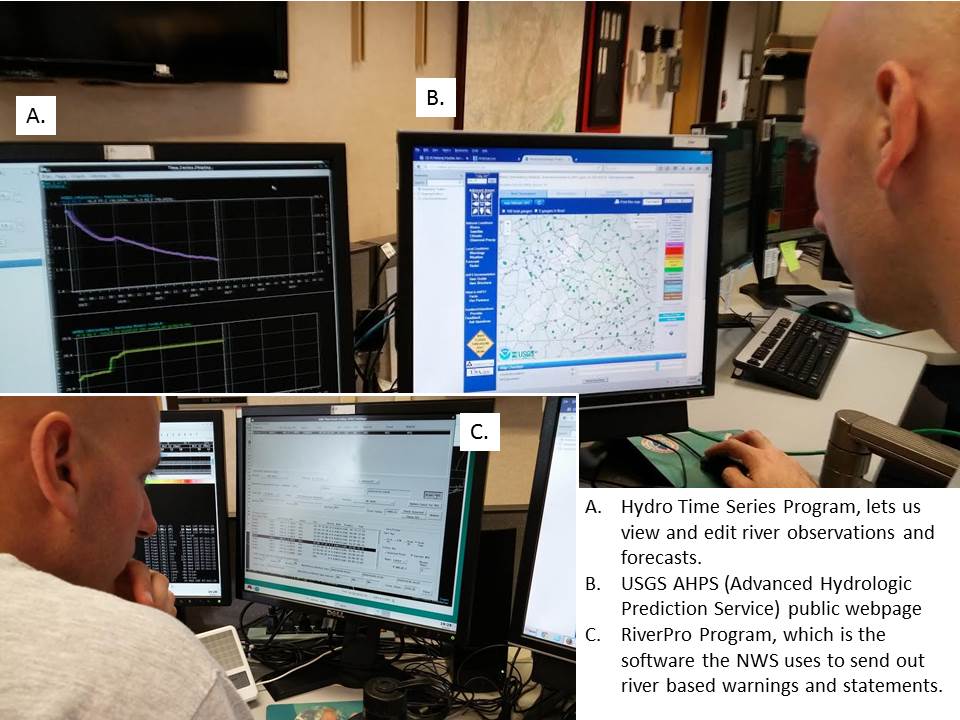
Flooding (especially flash flooding) is a large concern across eastern Kentucky due to the vast amounts of creeks and streams, as well as susceptible steep and variable terrain. As a result, we have numerous automated river and stream gauges set up across eastern Kentucky that send back real-time data on river stages. We also have automated weather stations that send in rainfall data in near real time as well. The forecasters (Lead Forecaster Pete in this case) will monitor the rivers and precipitation gauges using several software programs, making sure we note any changes in river levels or notice any potential bad data or gauge malfunctions. If necessary, this data can be used to issue river flood advisories and warnings. Find the latest river forecasts below: https://water.weather.gov/ahps2/index.php?wfo=JKL
Warnings/Hazards
Decision Support - Outlooks
Current Weather Hazards
Hazards Criteria
Weather Story Graphic
Recent Storm Reports
Submit a Report
Forecasts
Decision Support - Forecast
Aviation Forecasts
Fire Weather Forecasts
Hourly Weather Forecast
Activity Planner
River Forecasts
Forecast Discussion
Current Conditions
Regional Radar
Decision Support - Current
Rivers and Lakes
Hourly Airport Weather
Local Radar
Satellite
Kentucky Mesonet
Past Weather
Local Climate Info
Temp/Precip Summary
How Much Rain Fell?
How Much Snow Fell?
Past Weather Events
Drought Information
Local Coop Observers
US Dept of Commerce
National Oceanic and Atmospheric Administration
National Weather Service
Jackson, KY
1329 Airport Road
Jackson, KY 41339
606-666-8000
Comments? Questions? Please Contact Us.

