
A storm system will bring heavy rainfall, thunderstorms, and flooding threats to portions of the Southern Plains today, the Lower Mississippi Valley Saturday, and the Southeast into the Mid-Atlantic on Sunday. Another Bering system will impact the Alaskan West Coast and Central Interior through the weekend bringing moderate to heavy snow, high winds, and/or some blizzard conditions. Read More >
Overview
|
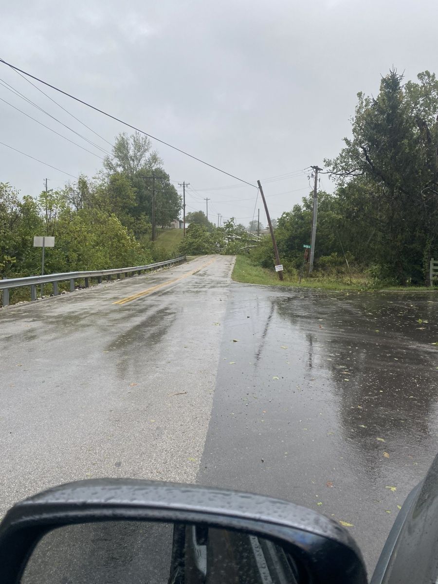
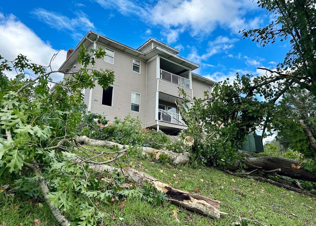
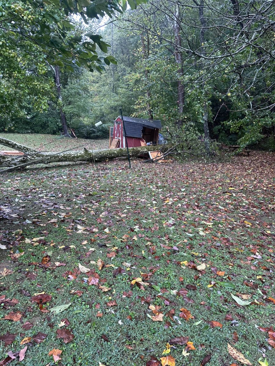
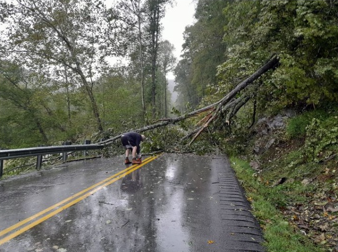
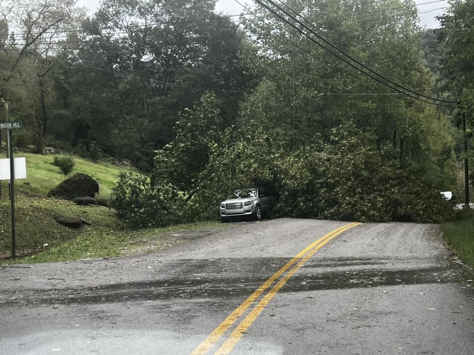
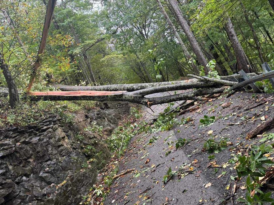
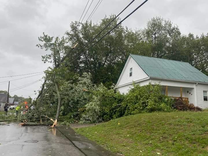
The remnants of Hurricane Helene brought widespread wind damage to much of Kentucky on Friday, September 27th. Helene initially made landfall along Florida's Big Bend region during the late evening of Thursday, September 26th as a fast-moving Category 4 hurricane. The hurricane's rapid forward movement did not give the system much time to weaken by the time the system's tropical rain bands spread across eastern Kentucky by early Friday morning. As the dissipating core of the hurricane approached, northeast to easterly winds intensified rapidly across eastern Kentucky between 6 AM and 10 AM EDT. Wind gusts peaked at around 12 PM, ranging from 35 to 60+ mph at most locations. The strongest wind gust in eastern Kentucky, 64 mph, was reported atop Koomer Ridge just west of Campton. The combination of full foliage on the trees, saturated soils, and an atypical wind direction led to many uprooted trees, resulting in blocked roads and extensive power line damage. Isolated instances of structural damage were also observed. Power outages across the Commonwealth numbered over 200,000 customers, the vast number of which were in eastern Kentucky, by the time the winds had diminished Friday afternoon. Kentucky Power alone reported at least 137 broken power poles and 734 spans of downed wire. Clark Energy reported over 100 broken poles in their service area. Jackson Energy reported 71 broken power poles and close to 400 spans of downed wire. Power restoration efforts continued for days after the storm, as some customers in the hardest hit locations did not see their power restored until October 3rd. There were also several reports received of trees falling on homes. Unfortunately, one injury was reported in eastern Kentucky, due to a tree falling on a home in the community of Cawood (Harlan County). The winds also put a damper on the festivities at the World Chicken Festival in Laurel County and the Sorghum Festival in Morgan County for most of the day. While 5-day rainfall amounts exceeded 5 inches across portions of far southeastern Kentucky (locally up to 7.74 inches atop Big Black Mountain), weeks of unusually dry weather had led to the development of abnormally dry to severe drought conditions across most of the Eastern Kentucky Coalfields. Consequently, when a sluggish frontal boundary and upper level low became quasi-stationary across the region earlier in the week (around September 23rd and 24th), the repeated rounds of rainfall were highly beneficial for alleviating the drought. In fact, the additional rainfall from Helene only led to minor instances of stream and street flooding. |
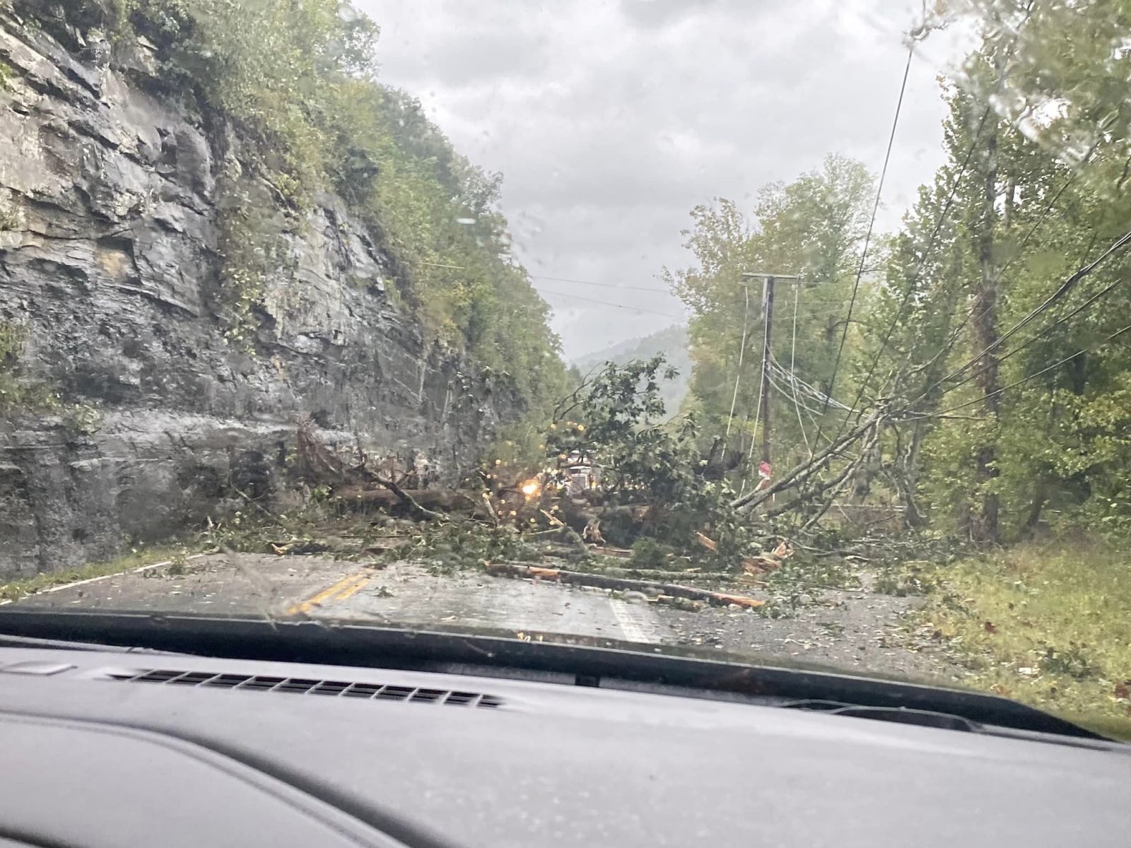 Tree Blown onto KY-38 (Harlan County) (Courtesy of Sam Dean) |
 |
 |
 |
 |
| Tree Blown Down on Hinkston Pike (Montgomery County) (Courtesy of Tyler Thomas) |
Trees Blown Down at Kentucky Mountain Bible College (Breathitt County) (Courtesy of Johnny Ray Feltner) |
Tree Blown Down onto a Shed (Rowan County) (Courtesy of S. Besselman) |
Tree on KY-987 near Calvin (Bell County) (Courtesy of Colleen Avery Swanson) |
 |
 |
 |
| Tree Blown Down on Laurel Hill Road (Bell County) (Courtesy of Shelby Lewis) |
Trees Blown Down KY-179 (Harlan County) (Courtesy of WRIL) |
Tree Blown Into Power Lines (Montgomery County) (Courtesy of Johnny Ray Feltner) |
 |
 |
 |
| Toppled Canopy at World Chicken Festival (Laurel County) (Courtesy of Phil Pendleton) |
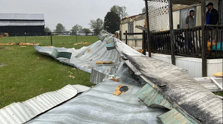
Roof Blown of Residence (Powell County) (Courtesy of Sierra Hale) |
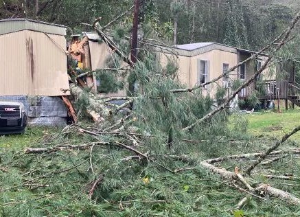
Tree Blown onto Residence in Cawood (Harlan County) (Courtesy of WRIL) |
 |
 |
 |
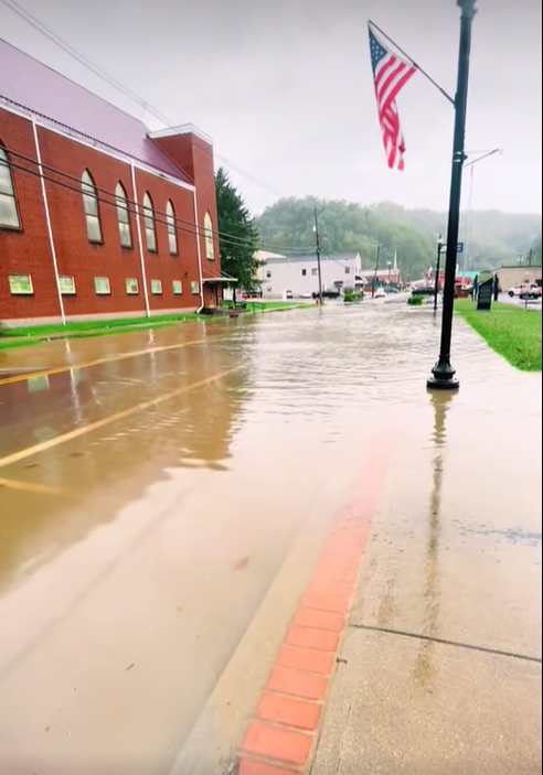
| Street Flooding at Jenkins (Letcher County) (Courtesy of Neil Collins) |
Siding Damage on The Bristlebuck Manor (Johnson County) (Courtesy of WYMT) |
Street Flooding at Jenkins (Letcher County) (Courtesy of Neil Collins) |
 |
|
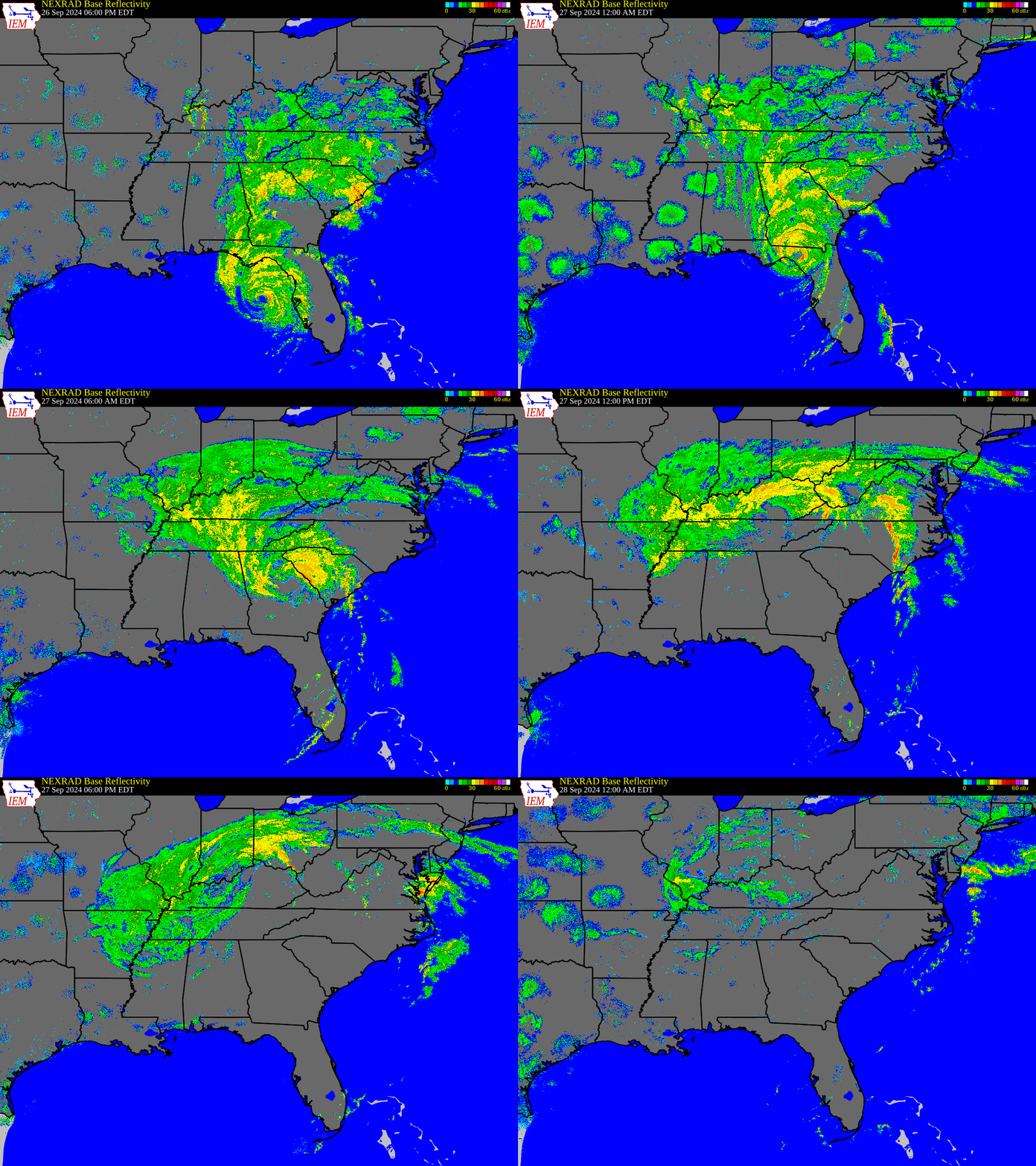
Hurricane Helene Making Landfall and Racing Northward toward Kentucky as it Weakens 6 PM EDT September 26th, 2024 to 12 AM EDT, September 28th, 2024 |
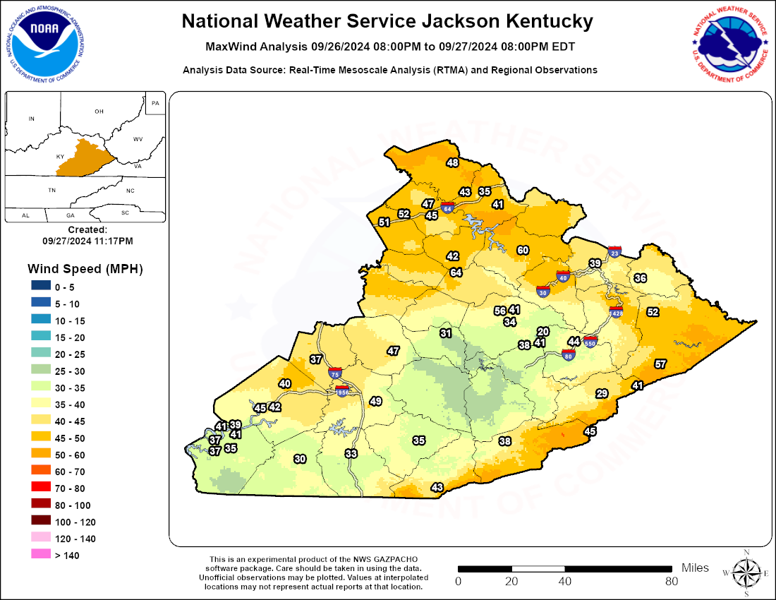
...HIGHEST WIND REPORTS ON SEPTEMBER 09/27/2024...

Location                     Speed     Time/Date       Provider

...Kentucky...

...Bath County...
Owingsville 2 MW             47 MPH    1149 AM 09/27   Public
Owingsville 4 S              45 MPH    0135 PM 09/27   KYMN2

...Bell County...
Middlesboro Apt              43 MPH    1035 AM 09/27   AWOS

...Breathitt County...
NWS Office/Julian Carroll Ai 56 MPH    0418 PM 09/27   ASOS
Jackson RAWS                 41 MPH    1056 AM 09/27   RAWS
Jackson 14 SE                41 MPH    0315 PM 09/27   KYMN2
Jackson 3 SE                 34 MPH    0410 PM 09/27   KYMN2
Jackson 14 ESE               20 MPH    1135 AM 09/27   KYMN2

...Fleming County...
Poplar Plains 2 NE           48 MPH    1214 PM 09/27   Public

...Harlan County...
Harlan 24 E                  45 MPH    1225 PM 09/27   KYMN2
Harlan Apt                   38 MPH    0935 AM 09/27   AWOS

...Jackson County...
McKee 5 S                    47 MPH    1030 AM 09/27   KYMN2

...Johnson County...
Paintsville 4 W              39 MPH    1130 AM 09/27   KYMN2

...Knott County...
Hindman 5 N                  44 MPH    1040 AM 09/27   KYMN2

...Knox County...
Barbourville 3 E             35 MPH    0340 PM 09/27   KYMN2

...Laurel County...
London-Corbin Apt            49 MPH    1027 AM 09/27   ASOS

...Letcher County...
Payne Gap 1 NE               41 MPH    1212 PM 09/27   Public
Whitesburg 2 NW              29 MPH    0945 AM 09/27   KYMN2

...Martin County...
Big Sandy Apt                36 MPH    1235 PM 09/27   AWOS

...McCreary County...
Whitley City 3 N             30 MPH    0325 PM 09/27   KYMN2

...Menifee County...
Frenchburg 6 SSW             42 MPH    1110 AM 09/27   KYMN2

...Montgomery County...
Ewington 1 NE                52 MPH    0104 PM 09/27   Public
Mount Sterling Apt           51 MPH    1235 PM 09/27   AWOS

...Morgan County...
West Liberty 2 SW            60 MPH    1230 PM 09/27   KYMN2

...Owsley County...
Booneville 2 S               31 MPH    1105 AM 09/27   KYMN2

...Perry County...
Hazard Apt                   38 MPH    0335 PM 09/27   AWOS

...Pike County...
Pikeville 13 S               57 MPH    0300 PM 09/27   KYMN2
Pike County Apt              52 MPH    1055 AM 09/27   AWOS

...Pulaski County...
Somerset Apt                 45 MPH    0915 AM 09/27   AWOS
Somerset RAWS                42 MPH    1101 AM 09/27   RAWS
Somerset 7 NNE               40 MPH    1020 AM 09/27   KYMN2

...Rockcastle County...
Wabo                         37 MPH    1109 AM 09/27   Public

...Rowan County...
Morehead Apt                 43 MPH    1015 AM 09/27   AWOS
Triangle Mtn RAWS            41 MPH    0202 PM 09/27   RAWS
Morehead 4 NE                35 MPH    1140 AM 09/27   KYMN2

...Wayne County...
Monticello                   41 MPH    0300 PM 09/27   CWOP
Mill Springs 3 WNW           41 MPH    0315 PM 09/27   Public
Monticello                   39 MPH    1045 AM 09/27   CWOP
Monticello 4 NW              37 MPH    0335 PM 09/27   KYMN2
Monticello Apt               35 MPH    0445 PM 09/27   AWOS

...Whitley County...
Williamsburg Apt             33 MPH    0335 PM 09/27   AWOS

...Wolfe County...
Koomer Ridge RAWS            64 MPH    1218 PM 09/27   RAWS
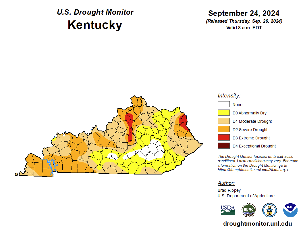
A slow-moving cold front (and an associated upper level low) became quasi-stationary over the Lower Ohio Valley/Central Appalachians in the days preceding the arrival of Hurricane Helene in Kentucky on September 27th. A feed of southerly moisture on the eastern side of the boundary produced multiple rounds of rainfall across portions of eastern Kentucky earlier in the week. The most significant rains fell in far southeast Kentucky, but occurred across locations that were experiencing abnormally dry to moderate drought conditions (Figure 2), which resulted in minimal impacts. This is a stark difference from the amount of rainfall and impacts that occurred in eastern Tennessee and western North Carolina. The analysis (Figure 1) shows Helene riding up the eastern side of the boundary where it made landfall as a major Category 4 hurricane on late Thursday, September 26th at Florida's Big Bend. After making landfall, the hurricane accelerated north and then northwest toward the upper level low over the Ohio Valley, and effectively merged with the low by late in the day on September 27th. Though the system began to rapidly weaken once onshore, the unusually fast movement of the system resulted in tropical storm force wind gusts reaching all the way into the Ohio River Valley. Once the remnants of Helene merged with the upper low, the lingering system continued to rotate over the region and bring periodic, mainly light, rainfall. The widespread soaking rainfall prior to and during the arrival of Helen's remnants was highly beneficial for Kentucky, as it terminated the drought conditions across nearly all of the Commonwealth (Figure 3). On the downside, the rainfall saturated the ground, which likely exacerbated the number of trees that were uprooted by the strong winds, and increased the resulting damage to structures and infrastructure.
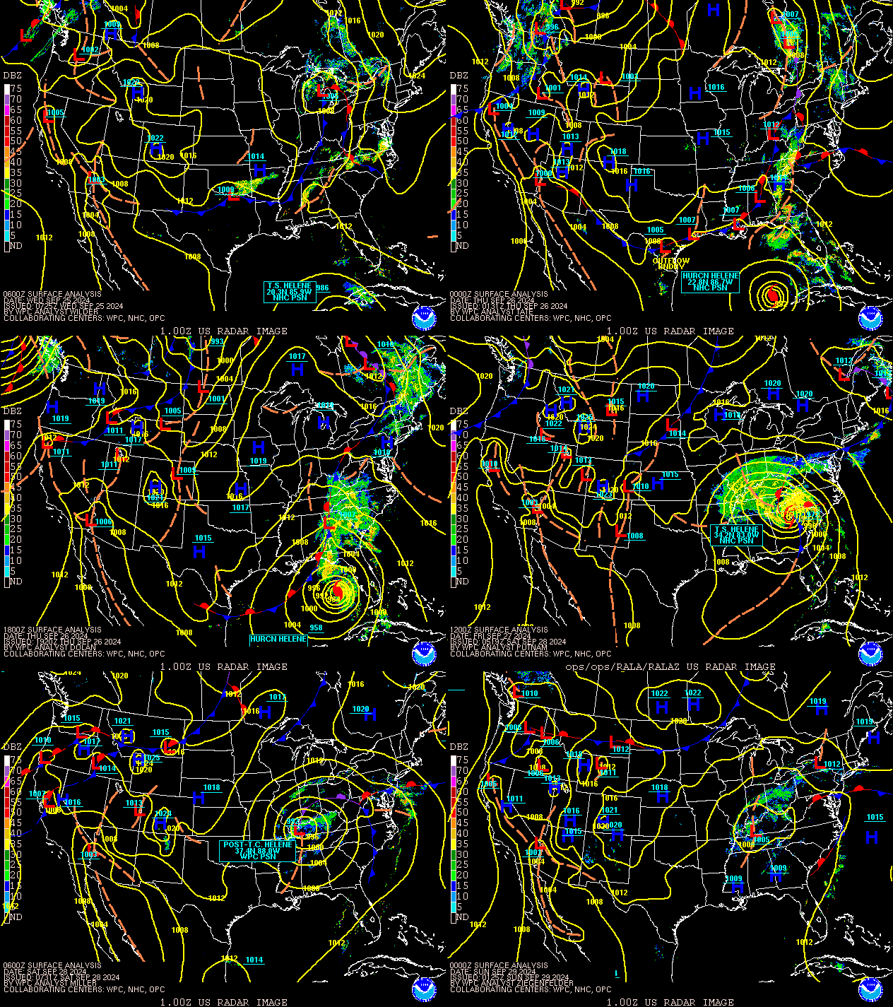 |
| Figure 1: Surface Analysis 2 AM EDT, September 25th, 2024 to 8 PM September 29th, 2024 EDT |
 |
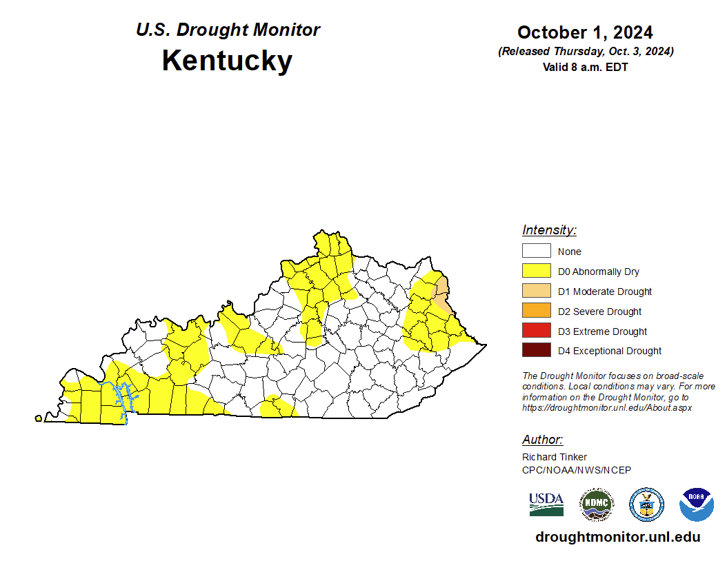 |
| Figure 2: U.S. Drought Monitor September 24, 2024 | Figure 3: U.S. Drought Monitor October 1, 2024 |
 |
Media use of NWS Web News Stories is encouraged! Please acknowledge the NWS as the source of any news information accessed from this site. |
 |