Overview
|
The coldest blast of arctic air in years and the most frigid Christmas weekend in decades enveloped eastern Kentucky from Friday, December 23rd through Christmas Day. On Thursday, December 22nd, eastern Kentucky was enjoying mild temperatures ranging from the mid 40s to lower 50s. Clouds were prevalent but peeks of sun shone through thin spots at some locations -- little indicated the arctic front and bitterly cold air mass rapidly encroaching on the Ohio Valley. The front reached the Lake Cumberland area between 10:30 and 11:00 PM and exited the far eastern tip of Pike County by around 2:00 AM Friday morning. Temperatures fell precipitously along the front, with rain changing to a heavy wet snow in a matter of minutes. Just behind the front, wind gusts of 30 to 50 mph blew the snow, leading to brief whiteouts at some locations. Temperatures continued to plummet after the front passed while snowfall rates were so intense that roads became slush and snow covered within an hour. By the time steadier snow ended one to two hours after the frontal passage, temperatures had fallen into the teens and many locations had been transformed into a wind-scoured snowy landscape. Light flurries continued into the daylight hours on Friday but the massive temperature drop and brutally cold winds were by far the bigger concern. Most locations saw air temperatures dipping to between 0 and -5 degrees after sunrise on Friday. Friday morning's temperatures were 50 to 55 degrees colder than what was experienced a mere 18 to 24 hours prior. To add insult to injury, strong winds made it feel more like -10 to -30 degrees at lower elevations. Wind chills at some of the highest elevations approached -40 degrees. The winds finally diminished by later Friday and Friday night but temperatures recovered only very slowly over Christmas weekend and would not rise back above freezing until Tuesday, December 27th. Though snowfall amounts with the cold front were generally 2 inches or less, the bitterly cold temperatures preserved the snow which had fallen, yielding an elusive White Christmas for many. The cold snap was the harshest in several years. Wind Chill Warnings were hoisted for dangerous cold across eastern Kentucky for the first time since February 2015. The extreme cold and strong winds led to numerous small to medium-sized power outages as electrical infrastructure struggled in the bitter temperatures. There were also many reports of frozen pipes leading to water damage in buildings and ruptured water mains. Some of the most severe water disruptions occurred in those counties which saw catastrophic flooding in July and were still repairing water distribution infrastructure. Some residences of Perry County remained without public water supply for more than 2 weeks. |
|
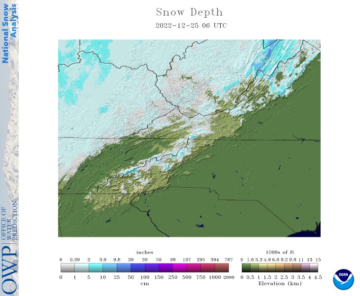 |
| Snow Depth 1 AM Christmas Morning |
Wind Chills
...MINIMUM WIND CHILL REPORTS...

Location                     WC Temp.  Time/Date       Elevation (ft.)
Harlan 24 E (Big Black Mtn.) -39 F     1140 PM 12/23   4031
Pikeville 13 S               -33 F     1035 PM 12/23   2774
Somerset 1 SSW               -32 F     0945 AM 12/23   868
Morehead Apt                 -30 F     0835 AM 12/23   1028
Triangle Mtn RAWS            -30 F     1002 AM 12/23   1359
Somerset 7 NNE               -30 F     0930 AM 12/23   1085
London-Corbin Apt            -30 F     0818 AM 12/23   1212
Owingsville 4 S              -30 F     0930 AM 12/23   829
Somerset Apt                 -29 F     0955 AM 12/23   927
Monticello 4 W               -28 F     0850 AM 12/23   1045
Morehead 4 NE                -28 F     0855 AM 12/23   851
West Liberty 2 SW            -28 F     0945 AM 12/23   1071
Hindman 5 N                  -28 F     1100 AM 12/23   1556
Wellington                   -26 F     0816 AM 12/23   1129
McKee 5 S                    -26 F     1120 AM 12/23   1319
Hazard Apt                   -25 F     0915 AM 12/23   1253
Whitley City 3 N             -25 F     1045 AM 12/23   1312
Irvine                       -25 F     1100 AM 12/23   850
Koomer Ridge RAWS            -24 F     0809 AM 12/23   1299
Campton                      -24 F     0115 PM 12/23   1371
Broadhead                    -24 F     0945 AM 12/23   1148
Ferguson                     -24 F     0825 AM 12/23   945
Jackson RAWS                 -24 F     0956 AM 12/23   1388
Williamsburg                 -23 F     1037 AM 12/23   1236
Monticello                   -23 F     1000 AM 12/23   1091
Eubank                       -23 F     0630 AM 12/23   1040
Jackson 14 SE                -22 F     1110 AM 12/23   1373
NWS Jackson                  -22 F     0950 AM 12/23   1382
Williamsburg Apt             -21 F     0755 AM 12/23   1178
Burnside                     -21 F     0850 AM 12/23   830
Big Sandy Apt                -21 F     0755 AM 12/23   1221
Big Sandy RAWS               -21 F     0756 AM 12/23   1180
Barbourville 3 E             -21 F     0740 AM 12/23   1016
Monticello                   -20 F     0846 AM 12/23   921
Somerset                     -20 F     0730 AM 12/23   1089
Booneville 2 S               -20 F     0825 AM 12/23   784
Middlesboro                  -20 F     0915 AM 12/23   2086
Pikeville                    -19 F     1220 PM 12/23   1209
Manchester                   -18 F     0856 AM 12/23   869
Peabody RAWS                 -17 F     0801 AM 12/23   1464
Jackson 14 ESE               -17 F     1220 PM 12/23   833
Whitesburg 2 NW              -14 F     1040 AM 12/23   1152
Paintsville 4 W              -14 F     1000 AM 12/23   755
Yellow Creek RAWS            -10 F     0726 AM 12/23   1089

Observations are collected from a variety of sources with varying
equipment and exposures. We thank all volunteer weather observers
for their dedication. Not all data listed are considered official.
Temperatures
...MINIMUM AIR TEMPERATURE REPORTS ON DECEMBER 23RD...

Location                     Min Temp.  Elevation (ft.)
Harlan 24 E (Big Black Mtn.) -14 F     	4031
Pikeville 13 S                -9 F      2774
Triangle Mtn RAWS             -7 F      1359
McKee 5 S                     -6 F      1319
Morehead Apt                  -6 F      1028
Somerset 7 NNE                -6 F      1085
Koomer Ridge RAWS             -5 F      1299
Morehead 4 NE                 -5 F      851
Owingsville 4 S               -5 F      829
West Liberty 2 SW             -5 F      1071
Hindman 5 N                   -4 F      1556
Jackson 14 SE                 -4 F      1373
Jackson RAWS                  -4 F      1388
London-Corbin Apt             -4 F      1212
Monticello 4 W                -4 F      1045
Somerset Apt                  -4 F      927
Whitley City 3 N              -4 F      1312
Booneville 2 S                -3 F      784
NWS Jackson                   -3 F      1382
Peabody RAWS                  -3 F      1464
Big Sandy RAWS                -2 F      1180
Hazard Apt                    -2 F      1253
Jackson 14 ESE                -2 F      833
Williamsburg Apt              -2 F      1178
Barbourville 3 E              -1 F      1016
Big Sandy Apt                 -1 F      1221
Paintsville 4 W               -1 F      755
Whitesburg 2 NW                0 F      1152
Yellow Creek RAWS              1 F      1089


...MAXIMUM AIR TEMPERATURE REPORTS FROM 7 AM DECEMBER 23RD TO 7 AM DECEMBER 24TH...

Location                     Max Temp.  Elevation (ft.)
Harlan 24 E (Big Black Mtn.)  -9 F     	4031
Koomer Ridge RAWS             -1 F      1299
Triangle Mtn RAWS             -1 F      1359
Hindman 5 N                    0 F      1556
Jackson 14 SE                  0 F      1373
Pikeville 13 S                 0 F      2774
Big Sandy RAWS                 1 F      1180
Jackson RAWS                   1 F      1388
London-Corbin Apt              1 F      1212
McKee 5 S                      1 F      1319
Morehead Apt                   1 F      1028
NWS Jackson                    1 F      1382
West Liberty 2 SW              1 F      1071
Whitley City 3 N               1 F      1312
Booneville 2 S                 2 F      784
Morehead 4 NE                  2 F      851
Owingsville 4 S                2 F      829
Somerset 7 NNE                 2 F      1085
Barbourville 3 E               3 F      1016
Jackson 14 ESE                 3 F      833
Monticello 4 W                 3 F      1045
Paintsville 4 W                3 F      755
Peabody RAWS                   3 F      1464
Williamsburg Apt               3 F      1178
Hazard Apt                     5 F      1253
Somerset Apt                   5 F      927
Big Sandy Apt                  6 F      1221
Whitesburg 2 NW                6 F      1152
Yellow Creek RAWS              6 F      1089

Observations are collected from a variety of sources with varying
equipment and exposures. We thank all volunteer weather observers
for their dedication. Not all data listed are considered official.
Photos
Header
 |
 |
 |
 |
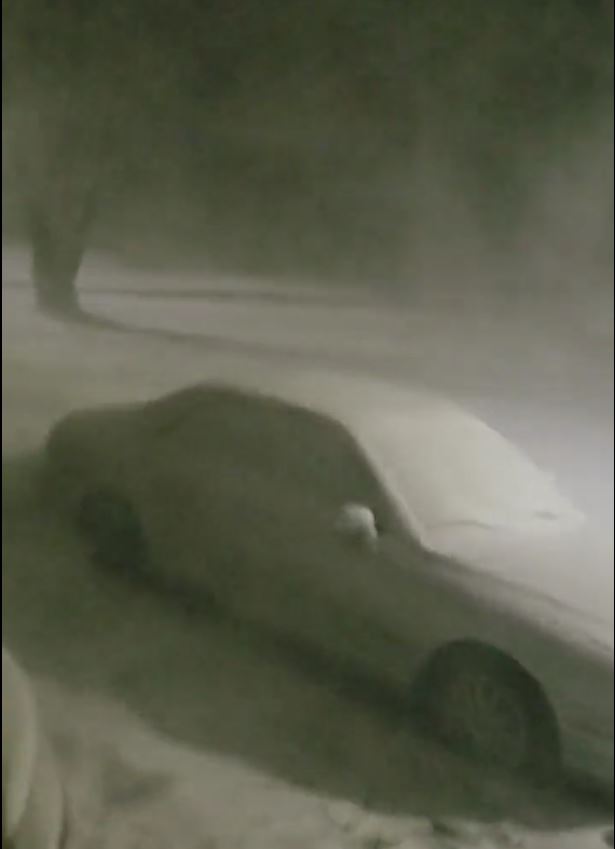
| Heavy Snow and Blowing Snow with Front in Menifee County (Courtesy of @WildchildTtv) |
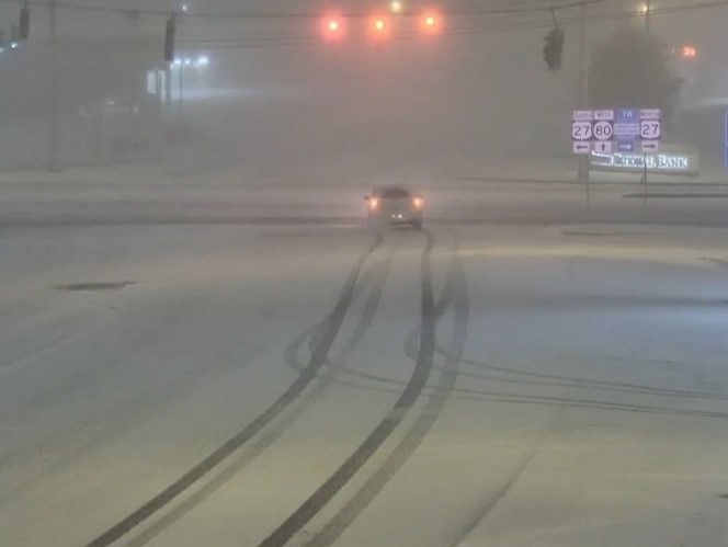
Heavy Snow Along Front Causing Poor Road Conditions in Somerset (Courtesy of Jonathan Edwards) |
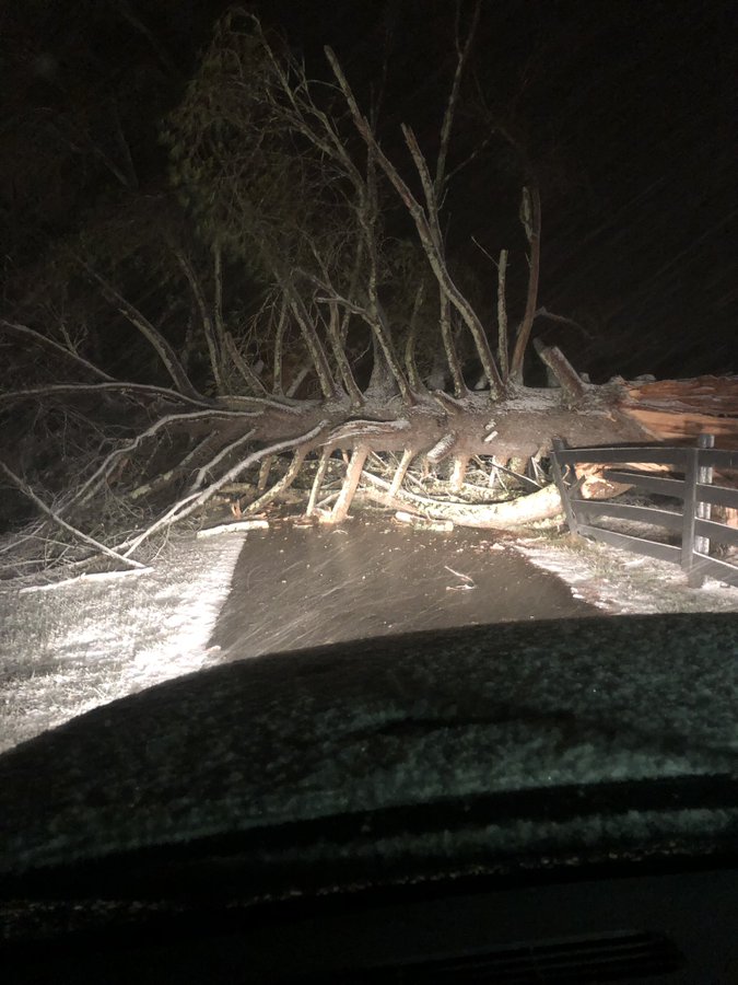
Tree Blown Down by Frontal Winds in Estill County (Courtesy of Andy Waddle) |
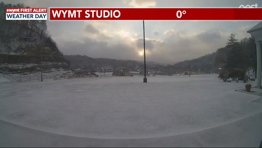
Bitter Friday Morning View from WYMT-TV Studio (Courtesy of WYMT) |
 |
 |
 |
 |
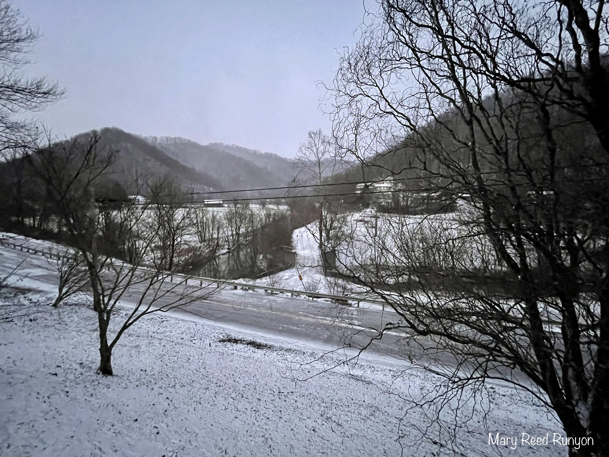
| Frigid Friday Morning View From Hatfield (Courtesy of Mary Reed Runyon) |
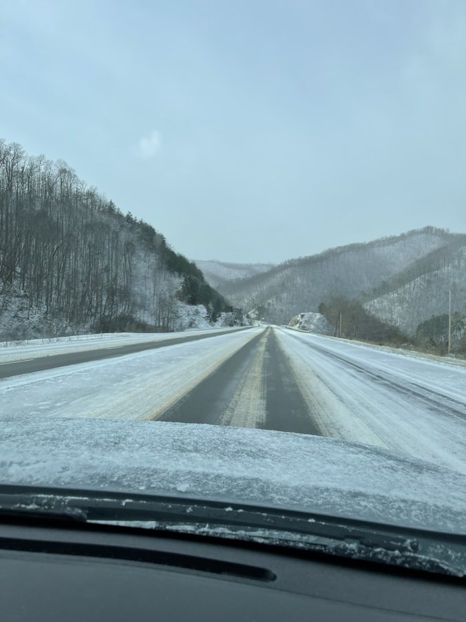
Poor Road Conditions on US-23 near Dorton around Midday Friday (Courtesy of Tiff Eversole) |
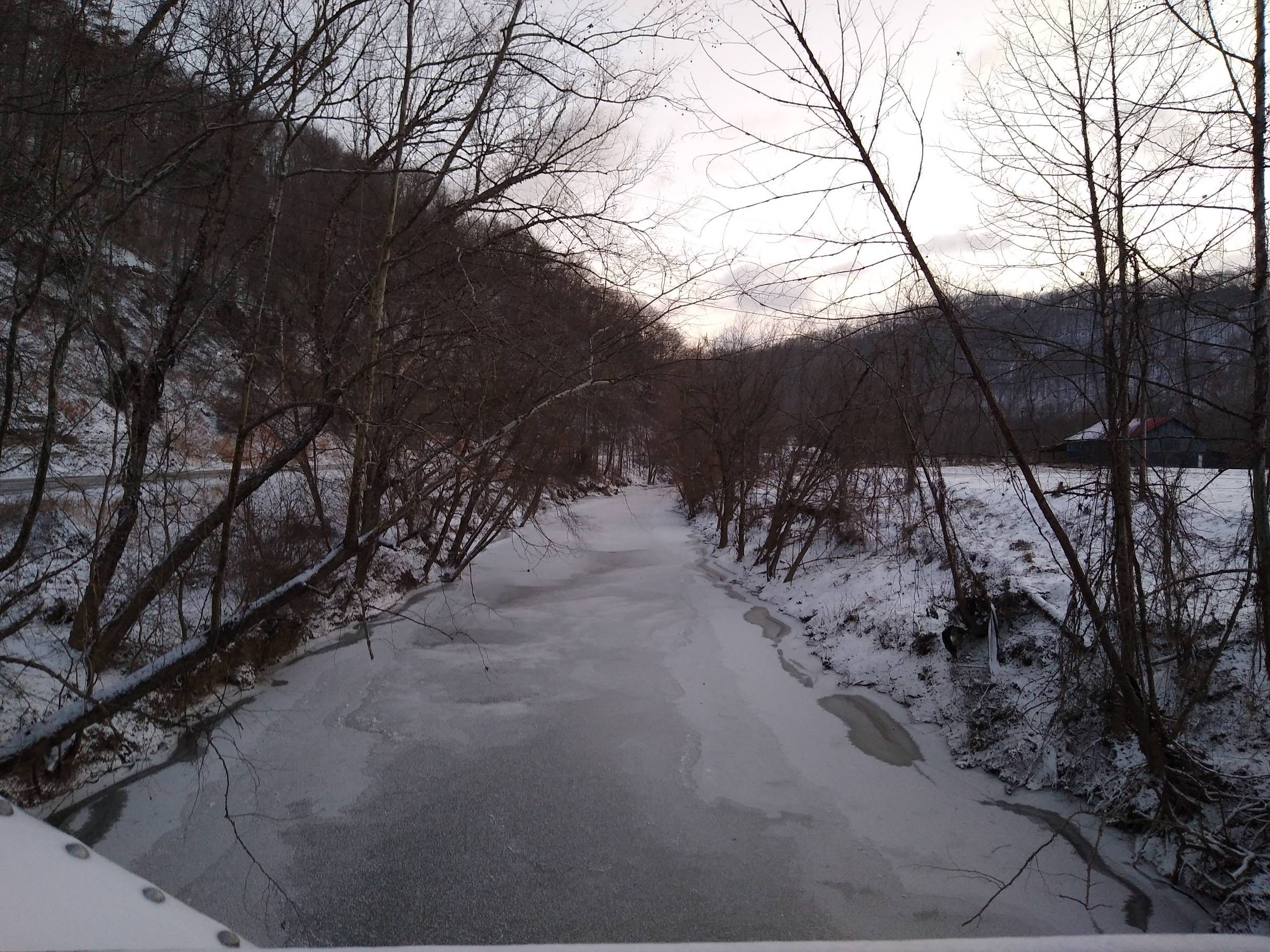
Quicksand Creek Near Noctor Frozen after 24 Hour of Near Zero Temperatures (Courtesy of NWS Jackson) |
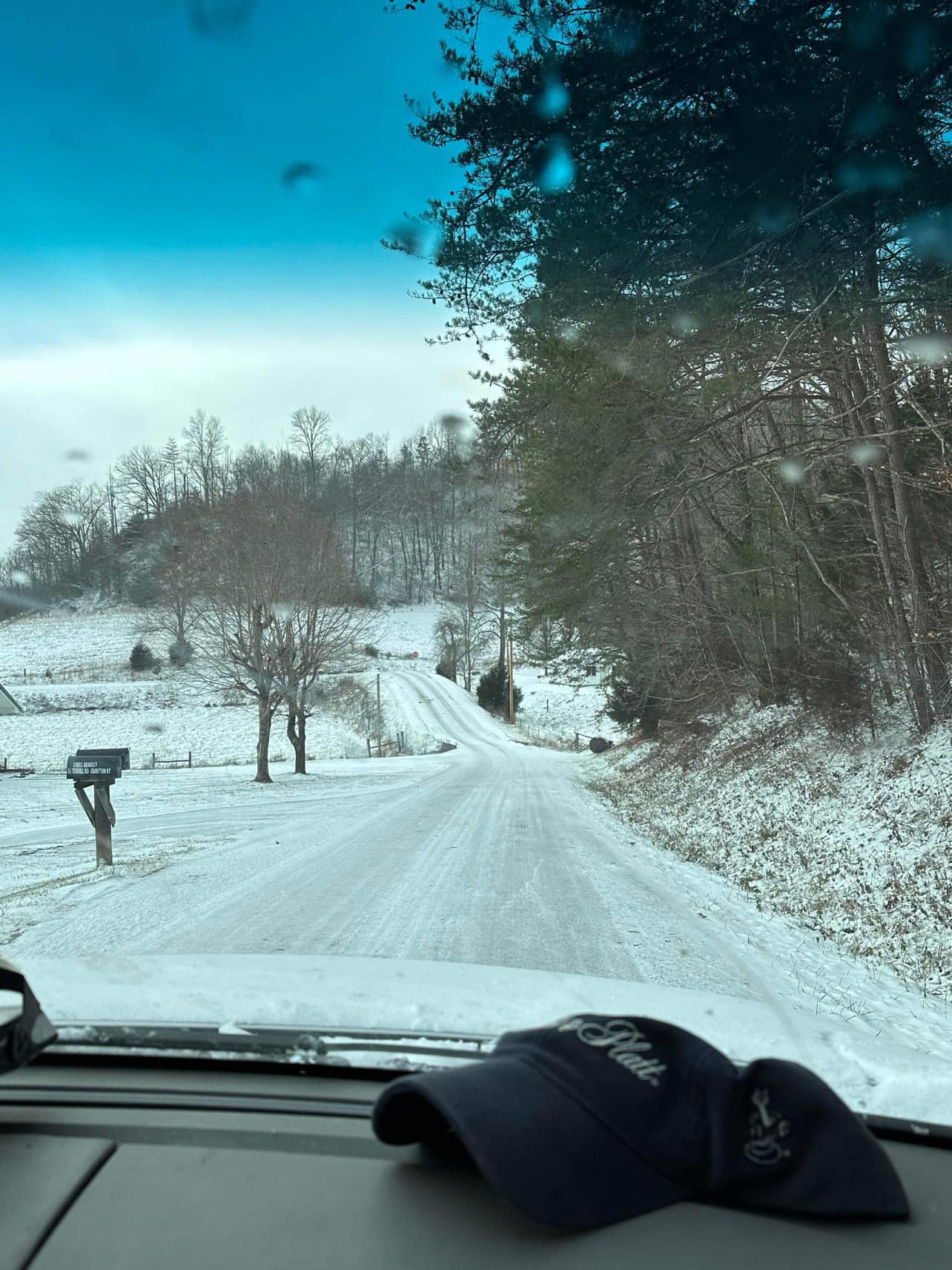
White Christmas Eve at Terrill Fork in Wolfe County (Courtesy of Johnny Feltner) |
Radar
Arctic Cold Frontal Passage
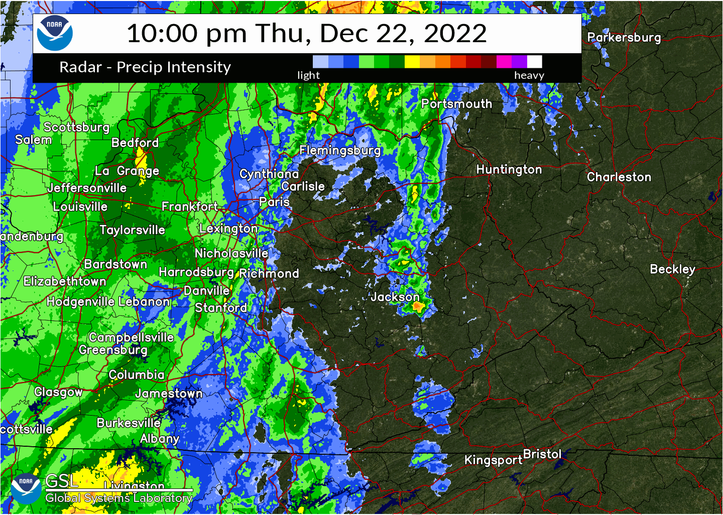 |
| Radar Loop from 10 PM Thursday, December, 23rd to 3 AM Friday, December, 24th The cold front is attended by the broken line of heavier showers that quickly moves eastward. This band also marked the changeover to heavy snow and blowing snow. An hour or two lighter precipitation followed the frontal passage at most locations. |
Wind Gusts
...HIGHEST WIND GUST REPORTS...

Location                     Speed     Time/Date       Elevation (ft.)
London-Corbin Apt            49 MPH    0136 AM 12/23   1212
NWS Jackson                  47 MPH    0215 AM 12/23   1382
Hindman 5 N                  44 MPH    0125 AM 12/23   1556
Koomer Ridge RAWS            43 MPH    0409 AM 12/23   1299
West Liberty 2 SW            43 MPH    0315 AM 12/23   1071
Big Sandy RAWS               43 MPH    0156 AM 12/23   1180
Harlan 24 E                  42 MPH    0200 AM 12/23   4031
Morehead 4 NE                42 MPH    0405 AM 12/23   851
Monticello                   41 MPH    0301 AM 12/23   921
Monticello 4 W               41 MPH    0205 AM 12/23   1045
Pikeville 13 S               41 MPH    0330 AM 12/23   2774
Hazard Apt                   41 MPH    1255 AM 12/23   1253
Owingsville 4 S              41 MPH    0425 AM 12/23   829
Williamsburg                 39 MPH    0347 AM 12/23   1236
Monticello Apt               39 MPH    0128 AM 12/23   963
Somerset Apt                 39 MPH    0215 AM 12/23   927
Big Sandy Apt                39 MPH    0155 AM 12/23   1221
Triangle Mtn RAWS            38 MPH    0202 AM 12/23   1359
Jackson RAWS                 37 MPH    0256 AM 12/23   1388
Somerset 7 NNE               36 MPH    1235 AM 12/23   1085
Whitley City 3 N             36 MPH    0425 AM 12/23   1312
Morehead Apt                 35 MPH    0355 AM 12/23   1028
Wellington                   35 MPH    0401 AM 12/23   1129
Booneville 2 S               34 MPH    1255 AM 12/23   784
Jackson 14 SE                34 MPH    0205 AM 12/23   1373
Williamsburg Apt             33 MPH    0355 AM 12/23   1178
Irvine                       31 MPH    0445 AM 12/23   850
Barbourville 3 E             30 MPH    0310 AM 12/23   1016
McKee 5 S                    30 MPH    0250 AM 12/23   1319
Manchester                   30 MPH    1215 AM 12/23   869
Yellow Creek RAWS            30 MPH    0126 AM 12/23   1089
Somerset 1 SSW               29 MPH    1255 AM 12/23   868
Middlesboro                  29 MPH    0110 AM 12/23   2086
Whitesburg 2 NW              28 MPH    0340 AM 12/23   1152
Pikeville                    23 MPH    0205 AM 12/23   1209
Paintsville 4 W              23 MPH    0130 AM 12/23   755
Jackson 14 ESE               22 MPH    1015 AM 12/23   833
Peabody RAWS                 18 MPH    0301 AM 12/23   1464

Observations are collected from a variety of sources with varying
equipment and exposures. We thank all volunteer weather observers
for their dedication. Not all data listed are considered official.
 |
Media use of NWS Web News Stories is encouraged! Please acknowledge the NWS as the source of any news information accessed from this site. |
|