Overview
|
Deceptively mild temperatures in the lower to middle 60s, plentiful sunshine, and a southerly breeze on the afternoon of Friday the 11th gave little warning of the late-season heavy snowfall that would follow mere hours after sunset. A potent cold front reached locations west of the Cumberland/Pottsville Escarpment by 8 PM and pushed eastward through the remainder of the evening. Temperatures dropped sharply behind the boundary, quickly falling to near or below freezing at most locations by midnight to 2 AM. With this particular system, most of the precipitation followed the frontal passage, a rather unusual setup compared to most cold fronts experienced in this region, and thus quickly changed over to snow. The snow continued to fall heavily through the early morning hours, reaching 1 to 2 inches per hour at times. Even with road temperatures starting at above 50F during the evening, the intense snowfall rates combined with temperatures falling into and through the 20s and northwest winds gusting up to 25 mph led to snow-covered roads and considerable drifting. The degraded road conditions led to the closure of I-75 in Rockcastle County for a time early on the morning of Saturday, the 12th. Webcams from both I-75 and I-64 showed snow/slush covered roads and significant visibility reductions. The shield of heavy snow quickly exited to the east after sunrise, but a frigid northwest wind continued to force orographic snow bands into the afternoon hours across much of Southeast Kentucky. Once the steadier snow came to an end, most locations were measuring 4 to 8 inches of snow. Across and near the higher elevations of Southeast Kentucky, the orographic snow showers led to additional light to moderate accumulations during the daylight hours on Saturday. Elsewhere, the bitter breeze and temperatures in the 20s were no match for the warm ground temperatures and peeks of strong March sunshine which caused snow on area roadways to rapidly melt. This reduced the storm's overall impact on travel once the snowfall ended. Furthermore, the atypically dry, fluffy nature of the snow resulted in minimal impacts on power lines and trees. Once the lingering snow showers ended, high pressure brought a mostly clear and very cold Saturday night with temperatures tumbling to around 0F in the coldest sheltered valleys and into mid teens on the ridges and near the larger lakes. |
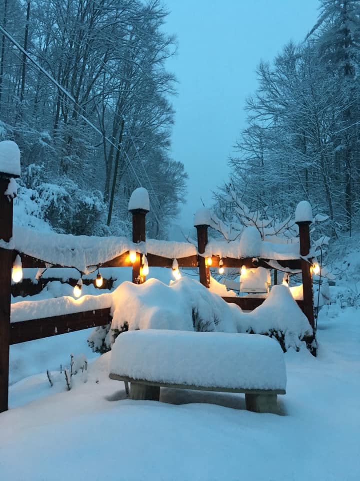 Cold, Snowy Morning from near Hazard Courtesy of Charmaine Blair |
Photos
 |
 |
 |
 |
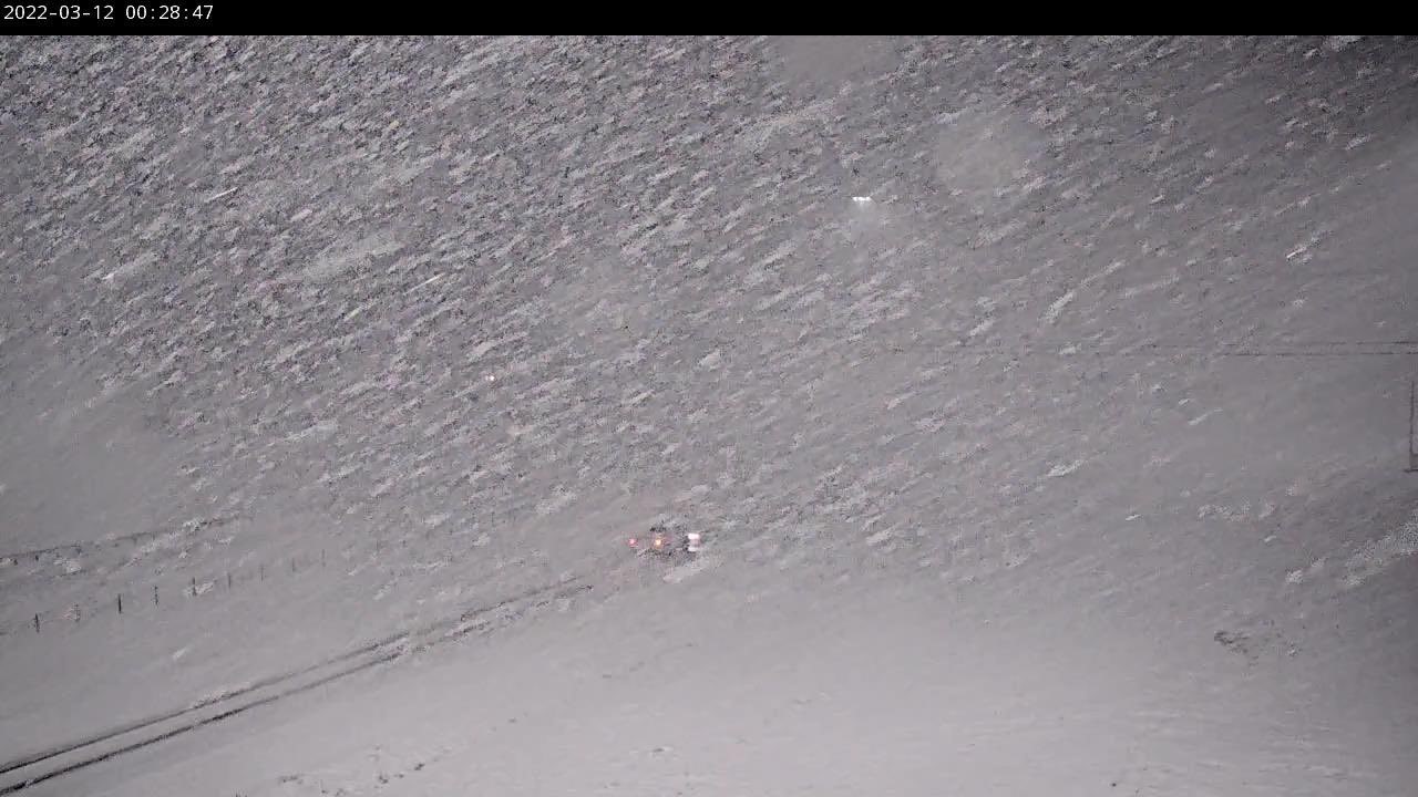
| Intense Snowfall Rates along I-64 (Morehead) (Courtesy of Chad Hedrick) |
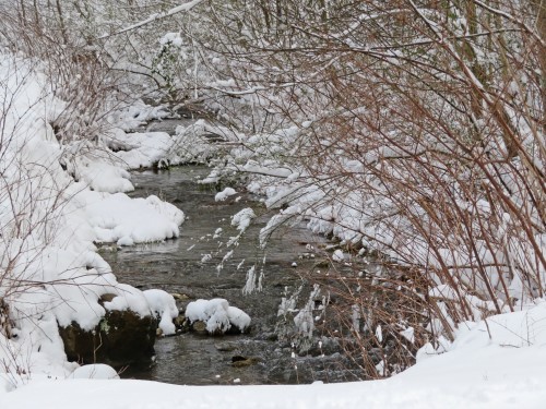
Snowy Stream in Harold (Courtesy of Greta Frasure) |
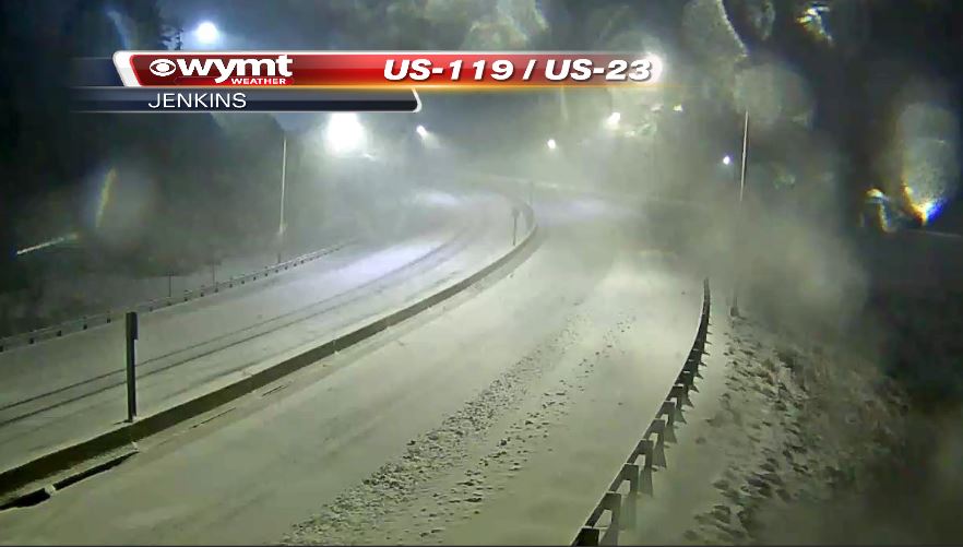
Poor Driving Conditions along US-23 (Jenkins) (Courtesy of WYMT) |
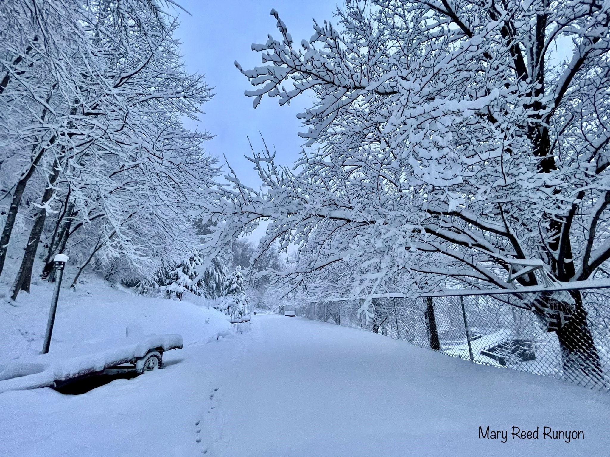
Wintry Blanket in Hatfield (Courtesy of Mary Reed Runyon) |
 |
 |
 |
 |
| Deep Blanket of Snow at Tenmile Creek (Courtesy of Hazel Jones Morris) |
Winter Barn Scene at Harold (Courtesy of Greta Frasure) |
Snowy Hills near West Liberty (Courtesy of Regina Thomas) |
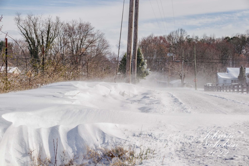
Blowing and Drifting Snow near London (Courtesy of Johnnie Nicholson) |
Radar
 |
|
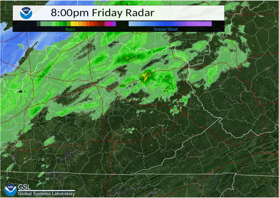
| Radar Loop from 8 PM March 11th to 6 PM Marth 12th (Rain to Snow Changeover was Faster than Depicted) | Caption |
Storm Reports
Storm Total Snowfall Reports

Location                     Amount    Time/Date       Lat/Lon

Bath County
1 NNW Owingsville            7.3 in    0800 AM 03/12   38.14N/83.76W
2 NNE Hope                   7.0 in    0550 AM 03/12   38.04N/83.76W

Bell County
2 SSW Beverly                8.0 in    0815 AM 03/12   36.91N/83.55W

Breathitt County
Quicksand                    6.7 in    1045 AM 03/12   37.53N/83.35W
9 SE Campton                 6.7 in    1200 PM 03/12   37.66N/83.41W
NWS Office/Julian Carrol     6.3 in    0200 PM 03/12   37.60N/83.32W
Dumont                       5.5 in    0840 AM 03/12   37.53N/83.36W

Clay County
Oneida                       6.8 in    0700 AM 03/12   37.27N/83.65W

Elliott County
9 SSE Olive Hill             7.0 in    1050 AM 03/12   38.20N/83.22W

Estill County
Cressy                       6.0 in    0800 AM 03/12   37.83N/84.04W

Fleming County
1 N Flemingsburg             7.0 in    1255 PM 03/12   38.43N/83.73W
Elizaville                   5.7 in    0700 AM 03/12   38.42N/83.83W

Floyd County
Grethel                      7.0 in    0730 AM 03/12   37.49N/82.65W
Hueysville                   7.0 in    0935 AM 03/12   37.54N/82.83W
3 WSW Prestonsburg           6.5 in    0700 AM 03/12   37.66N/82.83W
Prestonsburg                 5.8 in    0840 AM 03/12   37.67N/82.77W
Minnie                       5.5 in    0543 AM 03/12   37.47N/82.75W
Dotson                       4.5 in    0455 AM 03/12   37.65N/82.86W

Harlan County
3 N Harlan                   7.3 in    0806 AM 03/13   36.88N/83.31W
Coldiron                     7.0 in    0852 AM 03/12   36.83N/83.45W

Jackson County
8 W McKee                    5.1 in    0800 AM 03/12   37.43N/84.14W

Johnson County
1 E Paintsville              6.0 in    0700 AM 03/12   37.82N/82.79W

Knott County
Cordia                       7.5 in    0626 AM 03/12   37.28N/83.12W

Knox County
Barbourville                 5.8 in    0557 AM 03/12   36.87N/83.88W
Bimble                       4.3 in    0356 AM 03/12   36.88N/83.82W

Laurel County
Keavy                        5.0 in    1030 AM 03/12   37.00N/84.16W
London                       5.0 in    1245 PM 03/12   37.13N/84.08W

Lee County
Tallega                      6.1 in    1045 AM 03/12   37.56N/83.59W

Leslie County
Essie                        8.5 in    0555 AM 03/12   37.07N/83.45W
Thousandsticks               6.0 in    0835 AM 03/12   37.19N/83.43W

Letcher County
2 SE Whitesburg              10.0 in   0700 AM 03/13   37.10N/82.80W
Thornton                     7.8 in    1235 PM 03/12   37.16N/82.74W
Skyline                      7.1 in    0700 AM 03/12   37.09N/82.99W
1 SW Carcassonne             6.0 in    0900 AM 03/12   37.16N/83.00W

Magoffin County
Salyersville                 6.0 in    0533 AM 03/12   37.75N/83.06W
Salyersville Water Works     4.5 in    0800 AM 03/12   37.74N/83.07W

Martin County
Inez                         7.5 in    1130 AM 03/12   37.87N/82.54W
Mcclure                      7.1 in    0700 AM 03/12   37.76N/82.49W

McCreary County
Blue Heron                   5.0 in    0900 AM 03/12   36.67N/84.55W

Menifee County
Pomeroyton                   6.0 in    0615 AM 03/12   37.88N/83.52W

Montgomery County
1 SSE Oggs Station           5.8 in    0700 AM 03/12   38.01N/83.82W
2 ESE Grassy Lick            5.0 in    0730 AM 03/12   38.07N/83.99W
Mount Sterling               5.0 in    1200 PM 03/12   38.06N/83.95W
5 N Mount Sterling           3.0 in    0700 AM 03/12   38.13N/83.96W

Morgan County
1 NNE West Liberty           6.0 in    0730 AM 03/12   37.92N/83.26W

Owsley County
2 NNW Lerose                 6.7 in    0700 AM 03/12   37.50N/83.62W
Lerose                       6.0 in    1020 AM 03/12   37.48N/83.62W

Perry County
2 SSE Bulan                  8.2 in    0800 AM 03/12   37.27N/83.16W
1 ESE Hazard                 8.0 in    0700 AM 03/12   37.25N/83.18W
Hazard                       6.0 in    0553 AM 03/12   37.26N/83.20W

Pike County
2 WSW Mouthcard              6.0 in    0900 AM 03/12   37.38N/82.28W
Canada                       5.5 in    0527 AM 03/12   37.61N/82.33W
Regina                       3.8 in    0615 AM 03/12   37.37N/82.41W

Powell County
1 WNW Clay City              5.0 in    0700 AM 03/12   37.87N/83.93W
2 W Stanton                  3.3 in    0800 AM 03/12   37.86N/83.90W

Pulaski County
Science Hill                 5.0 in    0905 AM 03/12   37.18N/84.64W
2 WNW Rockcastle Springs     4.5 in    0700 PM 03/12   37.02N/84.34W

Rockcastle County
Mount Vernon                 3.5 in    0210 AM 03/12   37.36N/84.34W

Rowan County
1 ENE Gates                  8.1 in    0656 AM 03/12   38.24N/83.34W
1 W Haldeman                 8.0 in    0710 AM 03/12   38.25N/83.34W
Cave Run Lake                6.0 in    0700 AM 03/12   38.12N/83.53W

Wayne County
2 NNE Monticello             4.5 in    0700 AM 03/12   36.86N/84.84W

Whitley County
Williamsburg                 7.0 in    0620 AM 03/12   36.74N/84.17W
1 SSW Deering                6.1 in    0700 AM 03/12   36.87N/84.21W
2 S Walden                   5.3 in    0823 AM 03/12   36.82N/84.16W

Wolfe County
1 SSW Murphyfork             5.6 in    0937 AM 03/12   37.81N/83.43W
Observations are collected from a variety of sources with varying
equipment and exposures. We thank all volunteer weather observers
for their dedication. Not all data listed are considered official.
 |
Media use of NWS Web News Stories is encouraged! Please acknowledge the NWS as the source of any news information accessed from this site. |
|

