
Dangerous heat will expand from the Gulf Coast into the Southern Plains and Desert Southwest through week's end. Additional extreme heat impacting the Pacific Northwest will shift to the northern Plains by the weekend. Tropical Storm Bertha is expected to continue to impact portions of the northern Gulf Coast from the western Florida Panhandle to southeastern Louisiana through tonight. Read More >
Overview
|
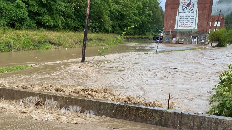
Hurricane Ida made landfall in Louisiana at 11:55am CDT on August 29th. From there it continued to slowly move inland and northward. By late morning on August 30th, it had reached southwest Mississippi. A large amount of moisture was pulled from the Gulf northward with this system and made its way to Kentucky. This was exacerbated by a frontal boundary that was stalled north of the Ohio River, keeping Kentucky in the warm and moist sector. Showers and thunderstorms developed across portions of the East Kentucky Coalfields by mid-morning. The most persistent and intense storms occurred over Pike County between 9 AM and 11 AM and had very little forward motion. Rainfall rates under the heaviest activity approached 3 inches for one hour at the peak of the event. This led to flash flooding which blocked multiple roadways. High water rescues were performed along Stonecoal Road as the flood waters rose. Fortunately, no fatalities were reported. When encountering water over the road, remember to TURN AROUND, DON'T DROWN! The Blackberry Fire Department chief also reported that flood waters entered one of their fire stations. |
 Water Rescue in Progress Along Stone Coal Rd. (Courtesy of Dillon Gaudett) |
Photos
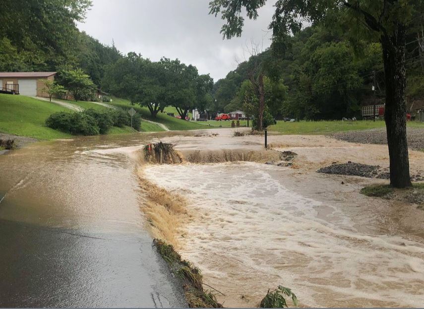
Photos of Flooding and Aftermath
 |
 |
 |
| Flood Damage at the Blackberry Fire Station 1 (Courtesy of WYMT) |
Raging Stream at the Base of Blackberry Mtn. (Courtesy of Spectrum News 1) |
Swollen Pond Creek in the Stone Community (Courtesy of Spectrum News 1) |
 |
 |
 |
| Flooding in the Cowpen Community (Courtesy of WYMT) |
Vehicle Caught in Floodwaters before Water Rescue (Courtesy of Chris Bailey) |
Flood Damage in the Blackberry Community (Courtesy of WYMT) |
Radar
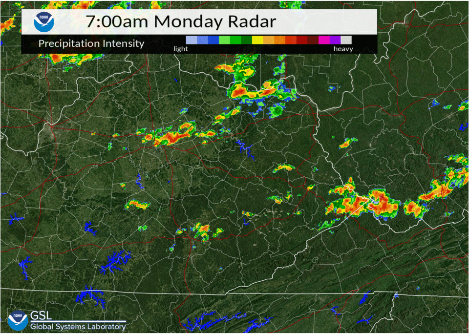
Radar Loop and Estimated Rainfall
 |
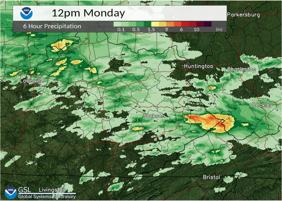 |
| Radar Loop from 7 AM to 12 PM | 6-Hour Rainfall Estimates from Radar |
Environment
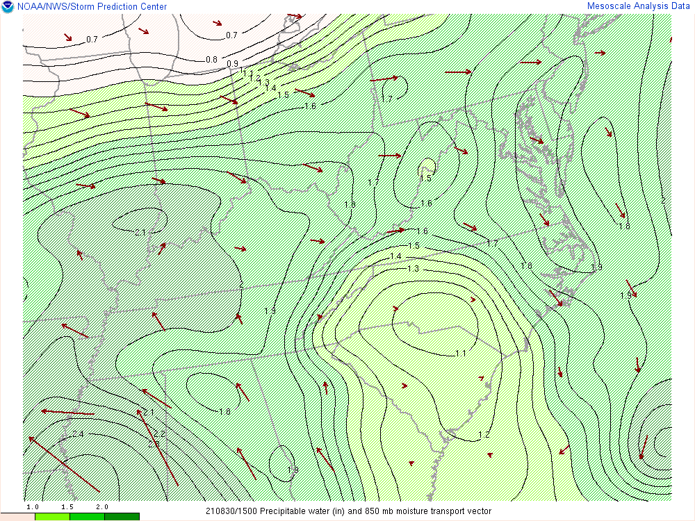
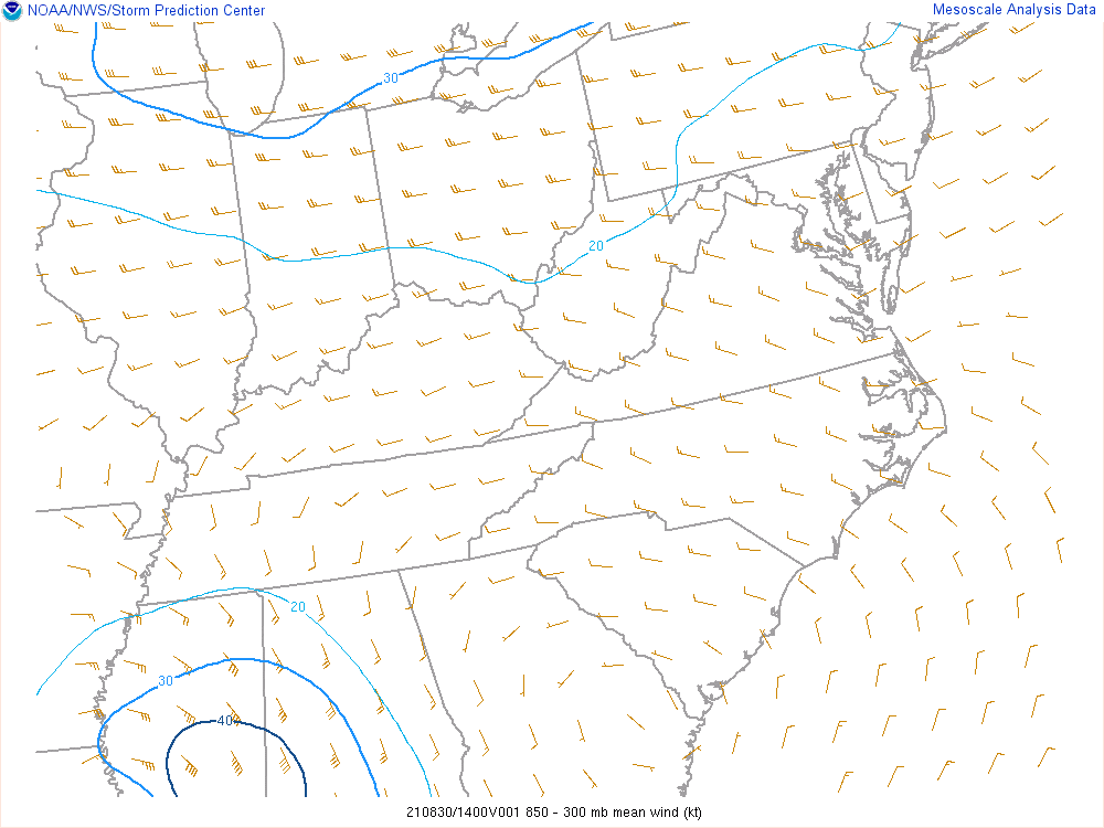
Figure 1 shows Hurricane Ida passing through the Lower Mississippi Valley through the early morning hours of August 30th while a nearly stationary front and convectively generated outflow meandered over the Ohio Valley. A very warm and moist tropical air mass was already in place over eastern Kentucky with dew points in the lower 70s at many locations. Figure 2 shows the moisture (shown as precipitable water) being pulled north to northwest ahead of the hurricane but then being diverted eastward across the Ohio Valley by westerly flow near the stationary frontal boundary. This set the stage for near record moisture levels in the lower atmosphere. In addition, high pressure over the southern Appalachians resulted in weak winds through the atmosphere. An analysis of figure 3 shows that these winds would only support a storm motion of about 10 to 15 knots. Finally, figure 3 shows that the MLCAPE (instability) was around or less than 1,000 J/kg which favors efficient rain drop formation. This combination of factors fostered the slow-moving cluster intense showers and flash flooding that was experienced in Pike County on August 30th.
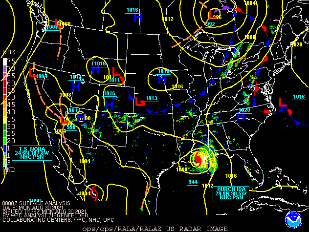 |
| Figure 1: Surface Analysis from 8 PM August 29th through 2 PM August 30th |
Near-storm environment around the period of heaviest rainfall.
 |
 |
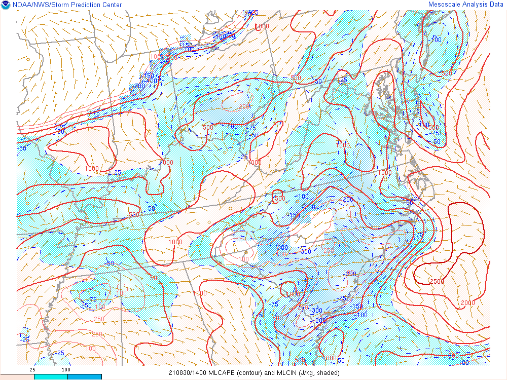 |
| Figure 2: Precipitable Water at 11 AM | Figure 3: 850-300mb Steering Flow at 10 AM | Figure 4: MLCAPE at 10 AM |
 |
Media use of NWS Web News Stories is encouraged! Please acknowledge the NWS as the source of any news information accessed from this site. |
|

