
High winds and very dry conditions will continue to produce elevated to critical fire weather conditions over portions of New Mexico and far western Texas through Saturday. Heavy snow will continue in the Central Rockies Heavy rain, flooding, and severe thunderstorm risks increase from the Southern Plains into the Lower Missouri Valley this weekend. Read More >
Overview
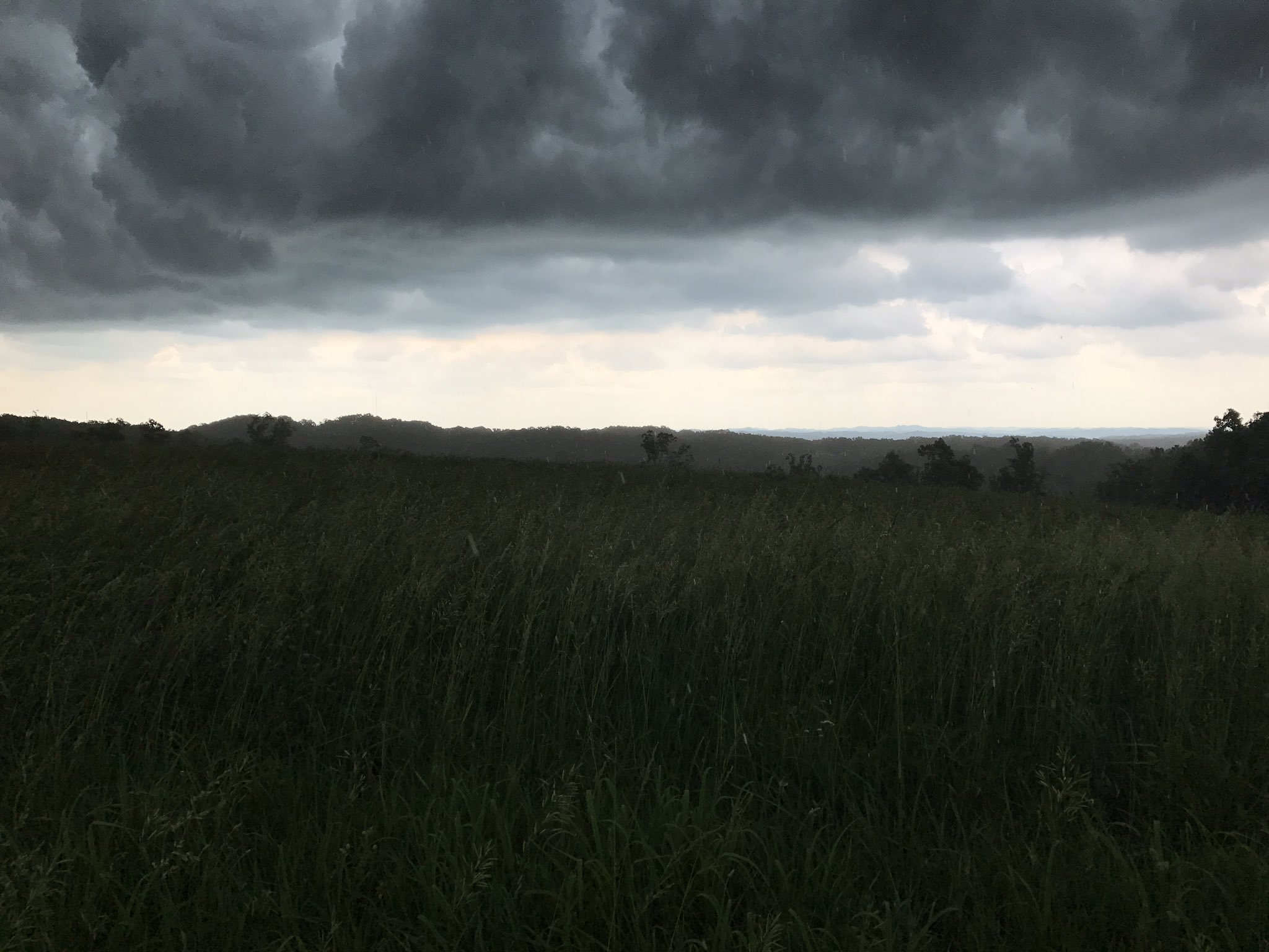
Two storm complexes, often referred to as mesoscale convective systems, moved through eastern Kentucky during the day. The first tracked through during the early to mid afternoon hours, while the second followed in its wake from mid afternoon through the evening. Strong to severe winds along the leading edge of each complex led to scattered damage throughout eastern Kentucky, mainly consisting of downed trees. Additionally, isolated flash flooding occurred in Jackson and Whitley Counties due to the multiple rounds of heavy rainfall. Clover Bottom in particular saw very heavy rainfall as over 3 inches of rain in a short period of time damaged a portion of U.S. Highway 421.Photos
 |
 |
 |
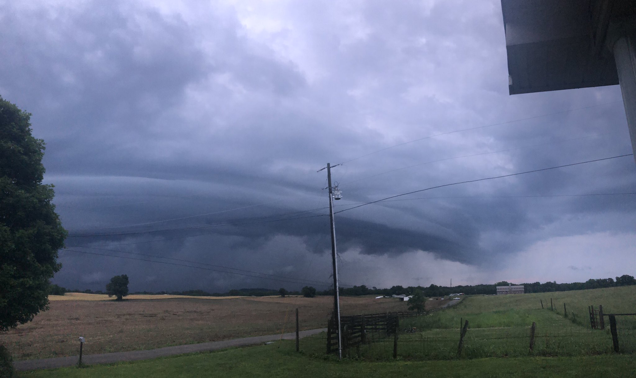
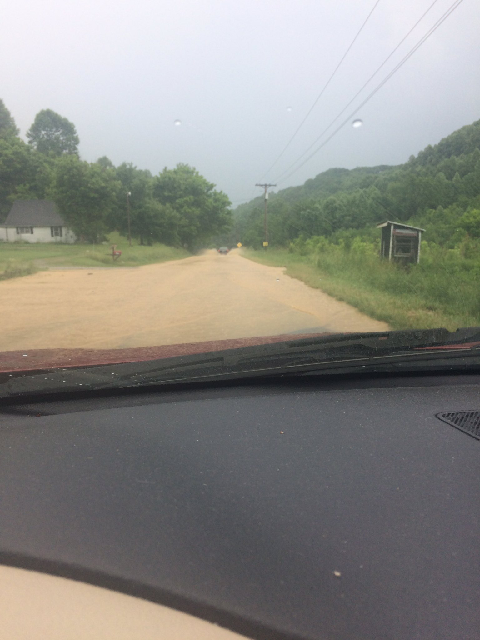
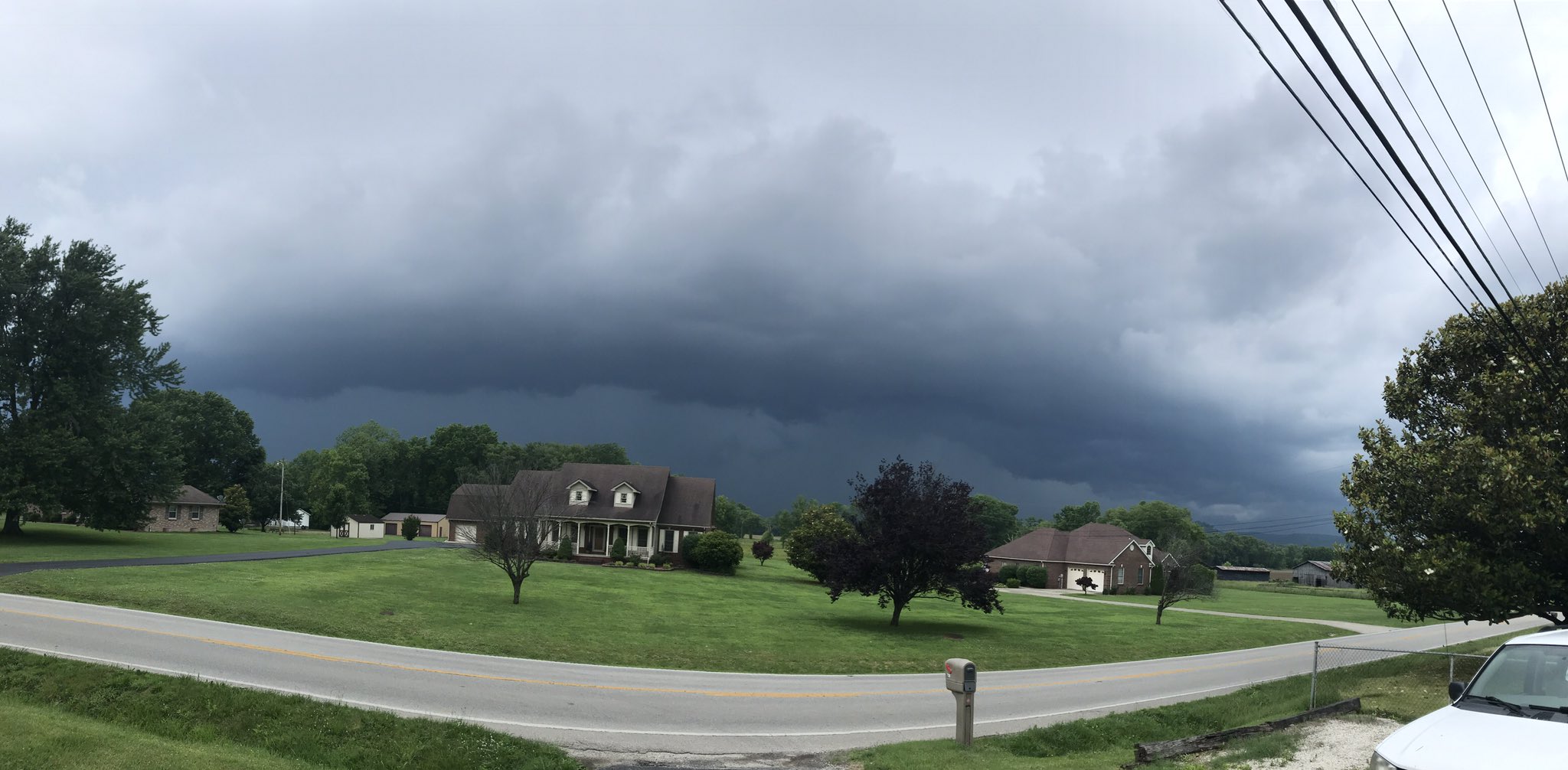
| Shelf cloud in Monticello. Courtesy Dakotah Harper. | Flash flooding in Clover Bottom. Courtesy Mrs. Gabbard. | Storms moving into Prestonsburg. Courtesy Allen Bolling. |
 |
 |
 |
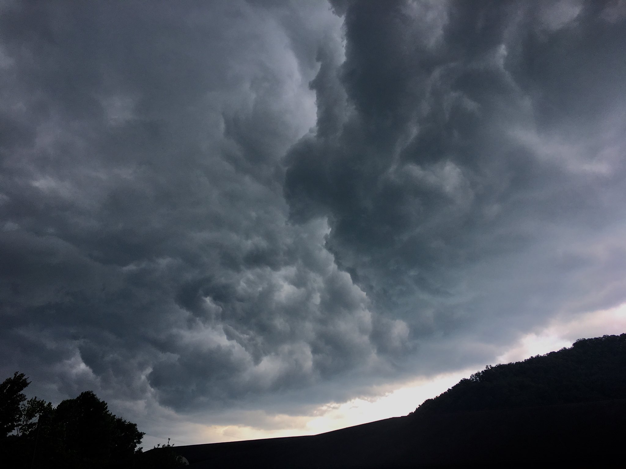
| Low-hanging scud cloud in Pikeville. Courtesy Julie via WYMT. | Shelf cloud approaching Stanton. Courtesy Dustin Jordan. | Storms in Beattyville. Courtesy Tiffany Jo Osborne. |
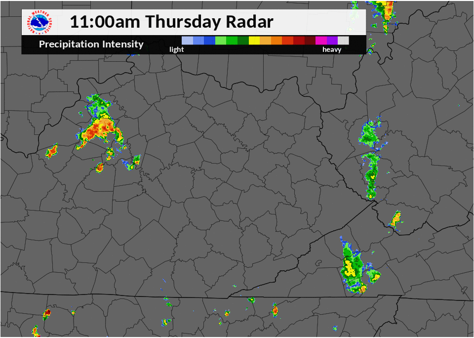
Radar
 |
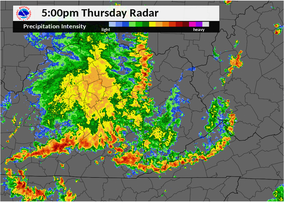 |
| Radar imagery from 11 a.m. to 5 p.m. on Thursday, May 31, 2018. | Radar imagery from 5 p.m. to 11 p.m. on Thursday, May 31, 2018. |
Storm Reports
| Local Storm Reports received from May 31, 2018 | ||
 |
||
 |
Media use of NWS Web News Stories is encouraged! Please acknowledge the NWS as the source of any news information accessed from this site. |
|

