
Tropical Storm Isaias is forecast to track toward the central Gulf Coast while strengthening into a hurricane on Thursday. There is an increasing risk of damaging hurricane-force winds and life-threatening storm surge impacts along portions of the northern Gulf Coast Friday into Saturday. Isaias will bring heavy rainfall to the central Gulf Coast and much of the Southeast Friday into the weekend. Read More >
Jackson, KY
Weather Forecast Office
Overview
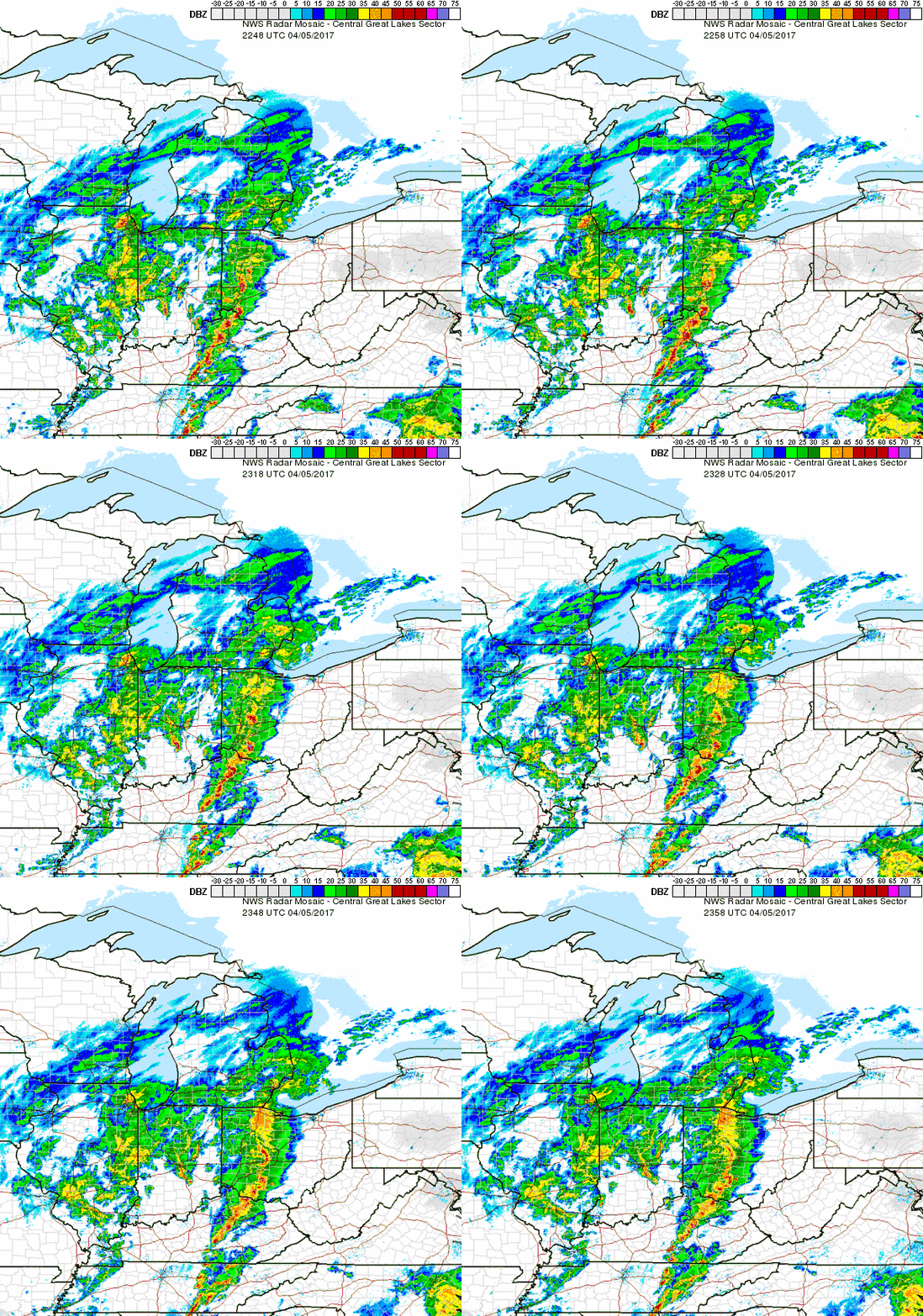
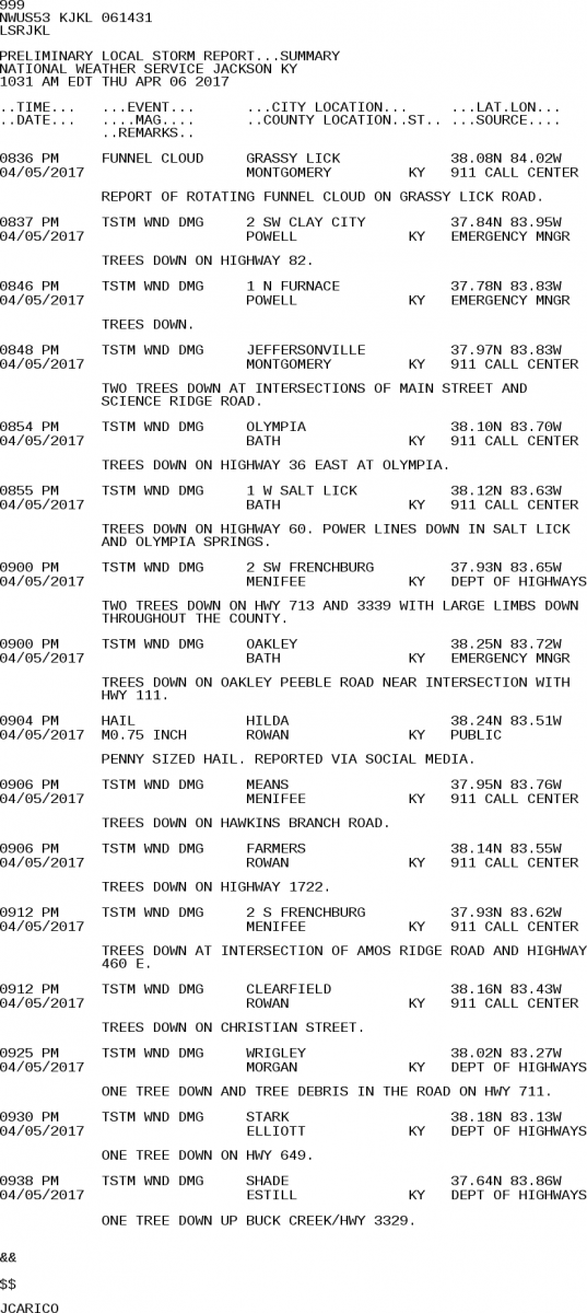
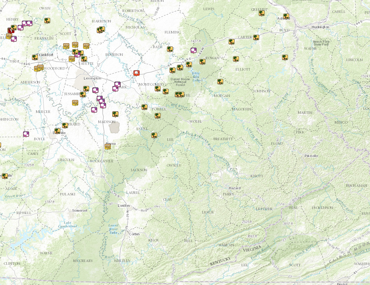
A line of thunderstorms moved into the Bluegrass region of eastern Kentucky this evening, producing damaging wind gusts generally between Interstate 64 and Mountain Parkway. Several trees and power lines were reported down as wind gusts of 60 to 70 mph occurred. One storm also produced a funnel cloud near Grassy Lick in Montgomery County.
Radar
 |
Storm Reports
|
|
 |
 |
Media use of NWS Web News Stories is encouraged! Please acknowledge the NWS as the source of any news information accessed from this site. |
|
Warnings/Hazards
Decision Support - Outlooks
Current Weather Hazards
Hazards Criteria
Weather Story Graphic
Recent Storm Reports
Submit a Report
Forecasts
Decision Support - Forecast
Aviation Forecasts
Fire Weather Forecasts
Hourly Weather Forecast
Activity Planner
River Forecasts
Forecast Discussion
Current Conditions
Regional Radar
Decision Support - Current
Rivers and Lakes
Hourly Airport Weather
Local Radar
Satellite
Kentucky Mesonet
Past Weather
Local Climate Info
Temp/Precip Summary
How Much Rain Fell?
How Much Snow Fell?
Past Weather Events
Drought Information
Local Coop Observers

US Dept of Commerce
National Oceanic and Atmospheric Administration
National Weather Service
Jackson, KY
1329 Airport Road
Jackson, KY 41339
606-666-8000
Comments? Questions? Please Contact Us.


 Follow us on X
 Follow us on Facebook
 Follow us on YouTube
 JKL RSS Feed