
Record-breaking heat expected in the Central and Western U.S. for the next several days. Gusty winds and low relative humidity will create elevated to critical fire weather conditions over portions of the Rockies and High Plains Wednesday and Thursday. Rain and mountain snow are possible across the Pacific Northwest into the Rockies through Wednesday. Read More >
Jackson, KY
Weather Forecast Office
Overview
|
Multiple rounds of showers and thunderstorms moved across eastern Kentucky between this morning and early evening. As a complex of storms moved east through central portions of Kentucky during the late morning and early afternoon hours, increasing moisture and daytime heating along with abundant lift present with this complex contributed to widespread showers and thunderstorms. Many locations received an additional 1 to 3 inches of rainfall on top of scattered rainfall over the past few days. With moist soil in place, much of this rainfall was converted to runoff and subsequently led to several instances of flash flooding across eastern Kentucky. Several reports of wind damage were also received in terms of downed trees. |
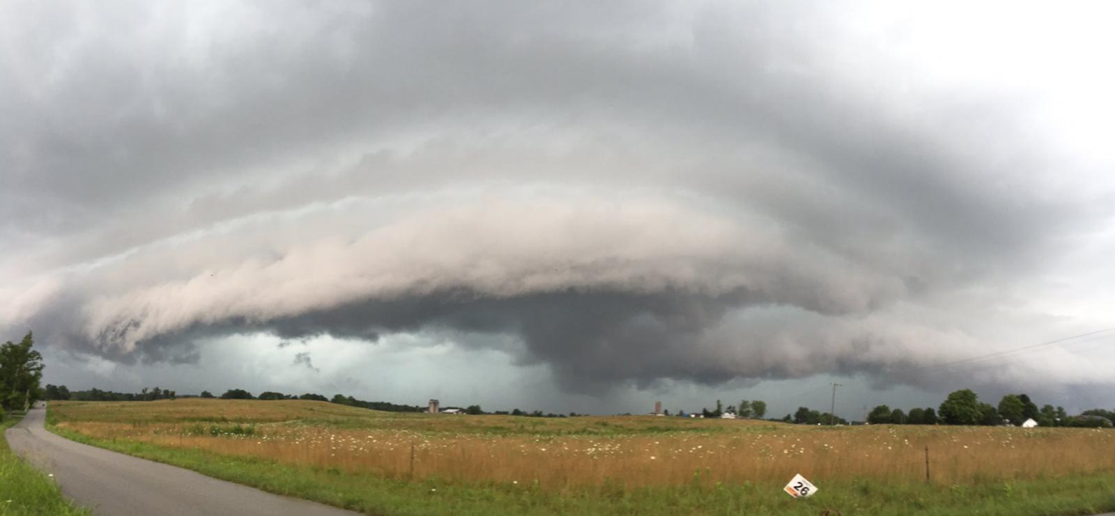 Shelf cloud south of London-Corbin Airport-Magee Field. Courtesy Johnnie Nicholson. |
 |
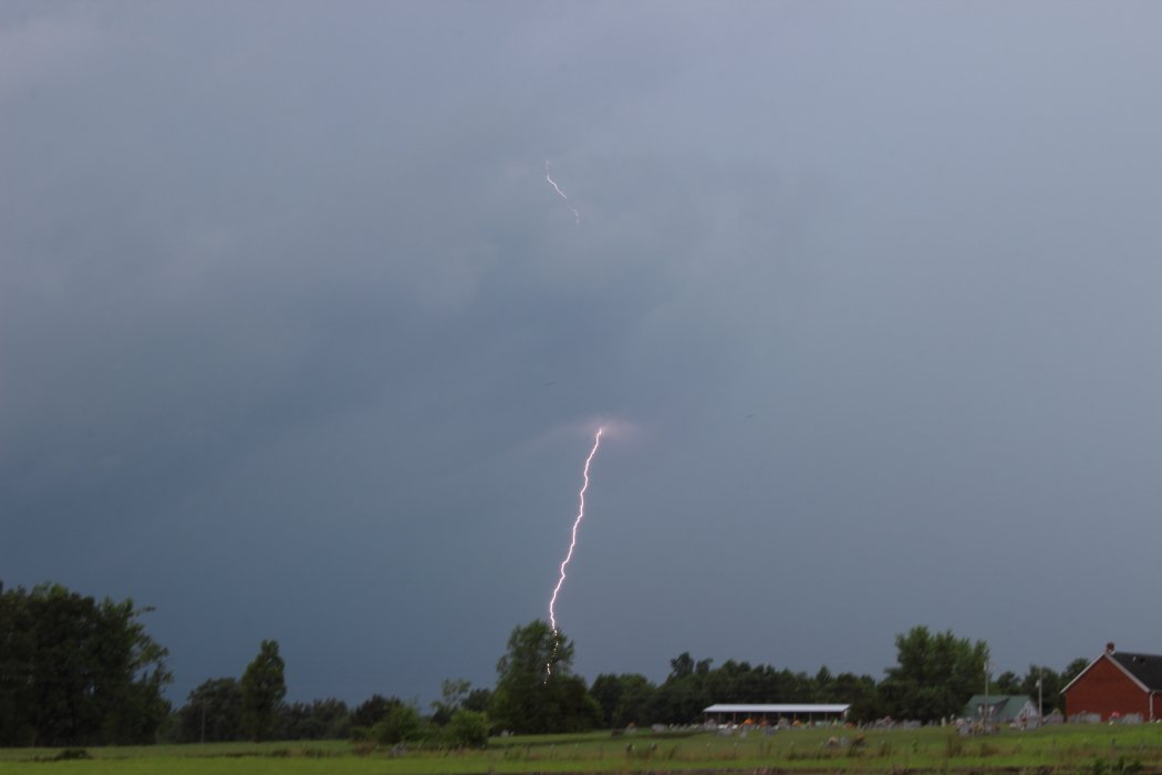 |
| Radar loop from late morning through early evening. | Cloud to ground lightning strike in Bee Lick, KY. Courtesy Greg Cundiff. |
 |
 |
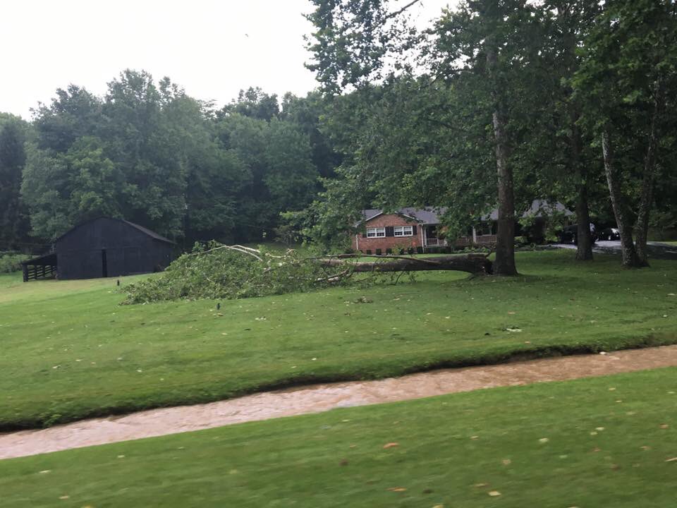 |
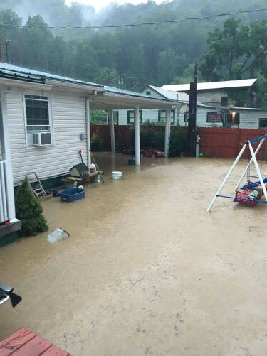
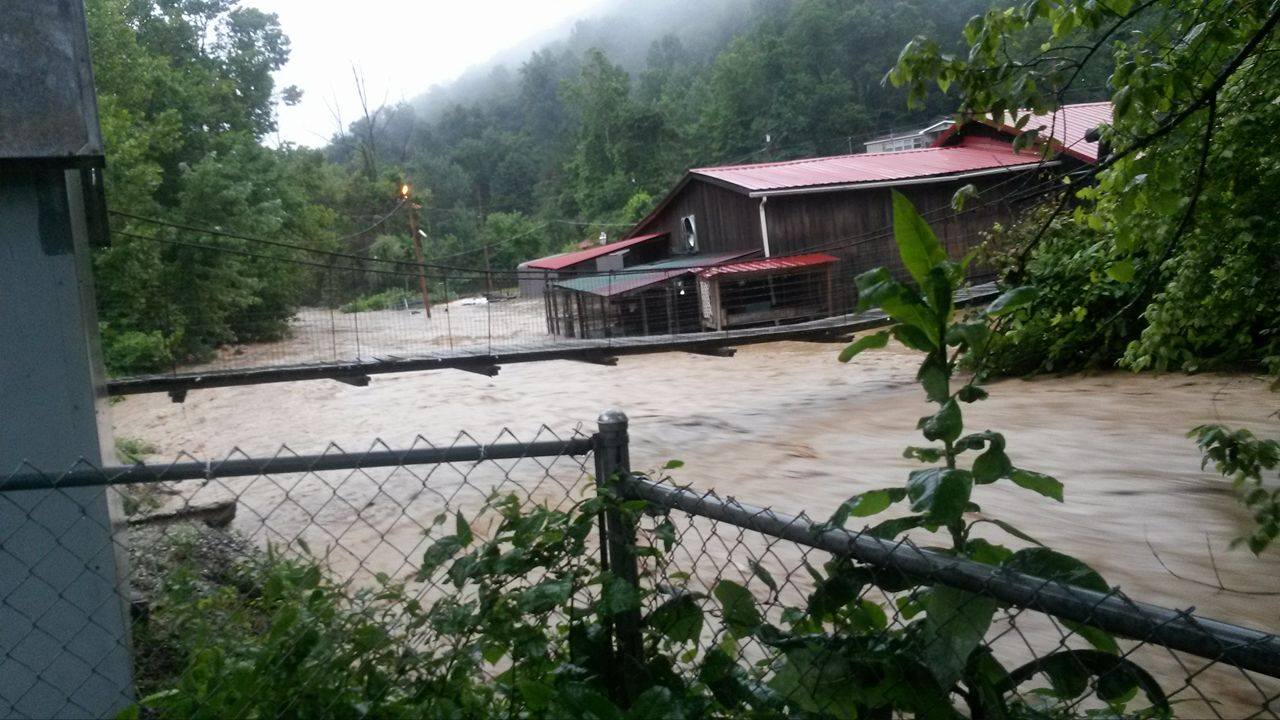
| Flooding in Big Fork, KY. Courtesy WYMT. | Flash flooding of Elk Creek in Manchester, KY. Courtesy WYMT. | Tree damage in Brodhead, KY. Courtesy Jordan Smith. |
Storm Reports
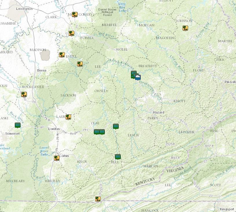 |
| Storm reports from July 8. |
Rainfall
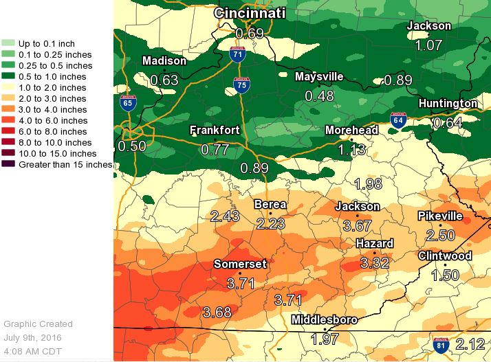 |
| Radar estimated rainfall amounts from July 5 through July 8. |
 |
Media use of NWS Web News Stories is encouraged! Please acknowledge the NWS as the source of any news information accessed from this site. |
|
Warnings/Hazards
Decision Support - Outlooks
Current Weather Hazards
Hazards Criteria
Weather Story Graphic
Recent Storm Reports
Submit a Report
Forecasts
Decision Support - Forecast
Aviation Forecasts
Fire Weather Forecasts
Hourly Weather Forecast
Activity Planner
River Forecasts
Forecast Discussion
Current Conditions
Regional Radar
Decision Support - Current
Rivers and Lakes
Hourly Airport Weather
Local Radar
Satellite
Kentucky Mesonet
Past Weather
Local Climate Info
Temp/Precip Summary
How Much Rain Fell?
How Much Snow Fell?
Past Weather Events
Drought Information
Local Coop Observers
US Dept of Commerce
National Oceanic and Atmospheric Administration
National Weather Service
Jackson, KY
1329 Airport Road
Jackson, KY 41339
606-666-8000
Comments? Questions? Please Contact Us.

