Thunderstorms, some severe, may produce heavy to excessive rainfall and isolated flooding over portions of the Southern Plains today and Saturday. Dry conditions, combined with gusty winds and low relative humidities will continue to support an elevated to critical fire weather threat in the Desert Southwest into to early next week. Read More >
Jackson, KY
Weather Forecast Office
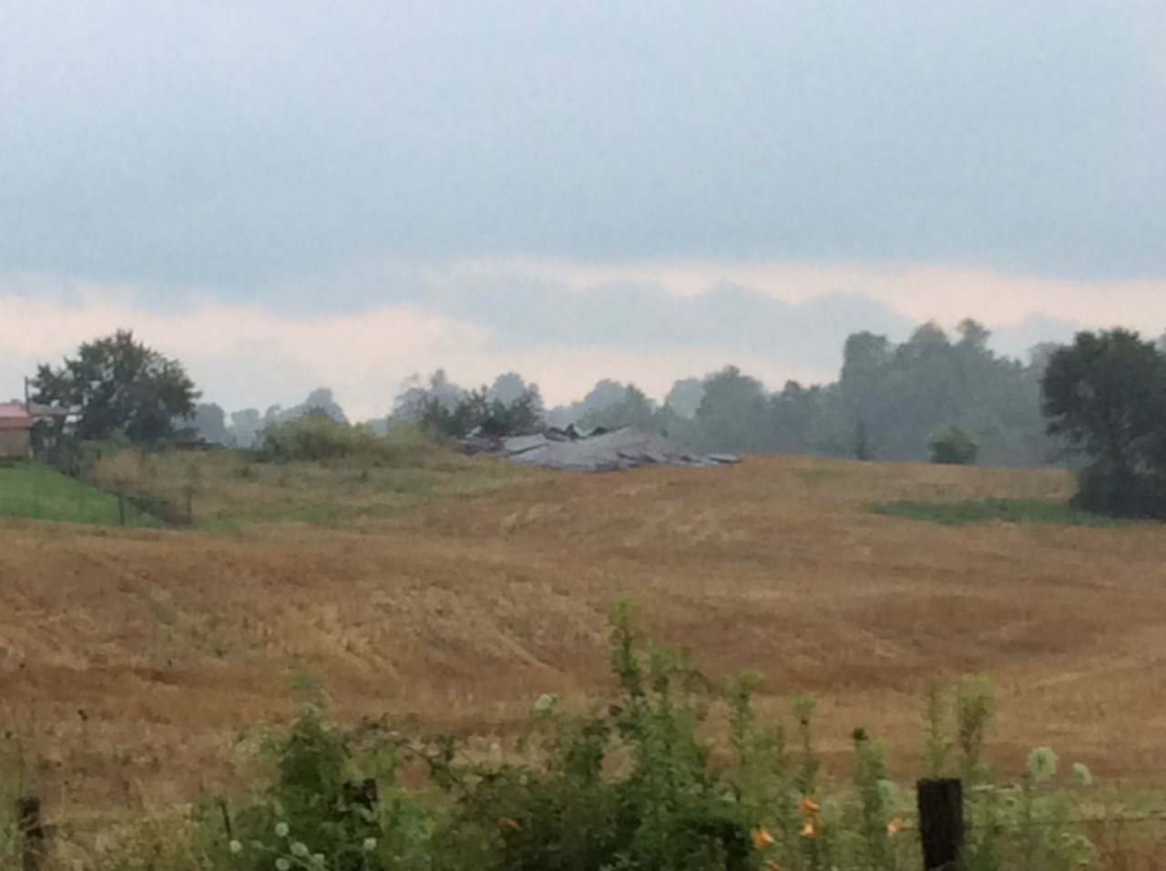
...NWS damage survey for 7/1/2015 Pulaski Co. tornado...

Rating:                 EF0
Estimated peak wind:    75 mph
Path length /statute/:  0.3 miles
Path width /maximum/:   100 yards
Fatalities:             0
Injuries:               0

Start date:             July 1 2015
Start time:             400 pm EDT
Start location:         2.8 miles WSW Nancy, Pulaski Co, KY
Start Lat/Lon:          37.064 / -84.8021

End date:               July 1 2015
End time:               400 pm EDT
End location:           2.5 miles WSW Nancy, Pulaski Co, KY
End Lat/Lon:            37.0626 / -84.7968

Survey summary: Minor tree and structural damage was noted from
the brief touchdown of an EF0 tornado at the intersection of
Highway 1664 and Pierce Road. An old barn collapsed due to the
storm and some shingles were blown off a home. A few tombstones
were overturned in a cemetery.
 |
|
|||
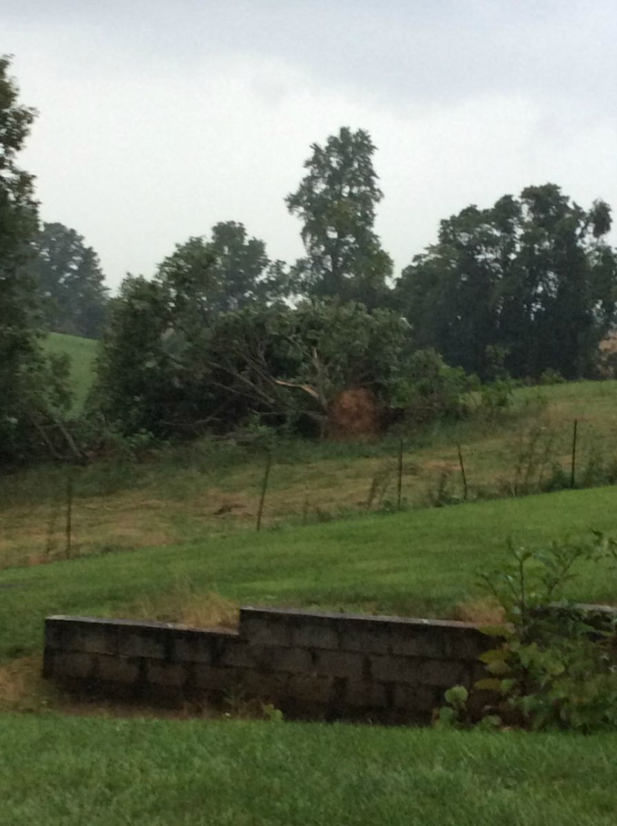
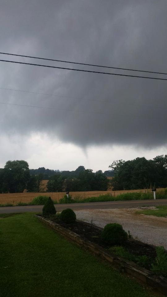
| Funnel cloud photo courtesy of Constable Danny Weddle | Tree uprooted from tornado off Pierce Road |
EF scale: The Enhanced Fujita Scale classifies tornadoes into the
following categories.

EF0...weak......65 to 85 mph
EF1...weak......86 to 110 mph
EF2...strong....111 to 135 mph
EF3...strong....136 to 165 mph
EF4...violent...166 to 200 mph
EF5...violent...>200 mph

Note:
The information in this statement is preliminary and subject to
change pending final review of the event and publication in NWS
Storm Data.
Warnings/Hazards
Decision Support - Outlooks
Current Weather Hazards
Hazards Criteria
Weather Story Graphic
Recent Storm Reports
Submit a Report
Forecasts
Decision Support - Forecast
Aviation Forecasts
Fire Weather Forecasts
Hourly Weather Forecast
Activity Planner
River Forecasts
Forecast Discussion
Current Conditions
Regional Radar
Decision Support - Current
Rivers and Lakes
Hourly Airport Weather
Local Radar
Satellite
Kentucky Mesonet
Past Weather
Local Climate Info
Temp/Precip Summary
How Much Rain Fell?
How Much Snow Fell?
Past Weather Events
Drought Information
Local Coop Observers
US Dept of Commerce
National Oceanic and Atmospheric Administration
National Weather Service
Jackson, KY
1329 Airport Road
Jackson, KY 41339
606-666-8000
Comments? Questions? Please Contact Us.