Widespread life-threatening flash and urban flooding continues in south-central Texas, with considerable flooding impacts possible across central Texas. Wildfire smoke is impacting air quality across much of the Great Lakes region into southern New England and the Mid-Atlantic. Monsoonal thunderstorms may produce isolated to scattered flash flooding across the Southwest into the Great Basin. Read More >
Overview
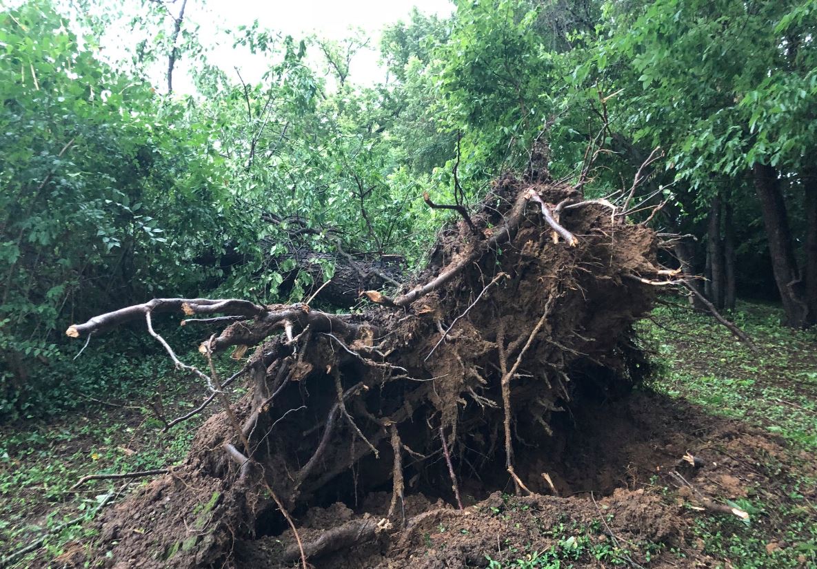
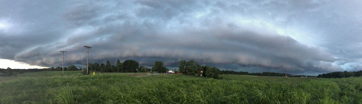
An upper level low over the southern great lakes helped to generate several rounds of showers and storms across east Kentucky on July 20th. Plentiful moisture moved northward into the Ohio river valley thanks to modest southerly flow. With ample daytime heating, explosive thunderstorm development was seen across central and eastern Kentucky. While a tornado and hail threat was seen initially across central Kentucky, the wind threat took over as thunderstorms evolved into a line of storms. Many reports of storm damage were received with the most extensive damage occurring along and north of the Mountain Parkway, particularly in Montgomery County where Emergency Management reported that 47 roads were closed at one point due to downed trees and power lines resulting in nearly 4,600 power outages. Additionally, a disaster declaration was made for the county as multiple buildings sustained damage. These included a tobacco warehouse that had its roof blown off as well as a hotel in Mount Sterling whose sign and building both sustained damage from severe straight-line winds.
 |
 |
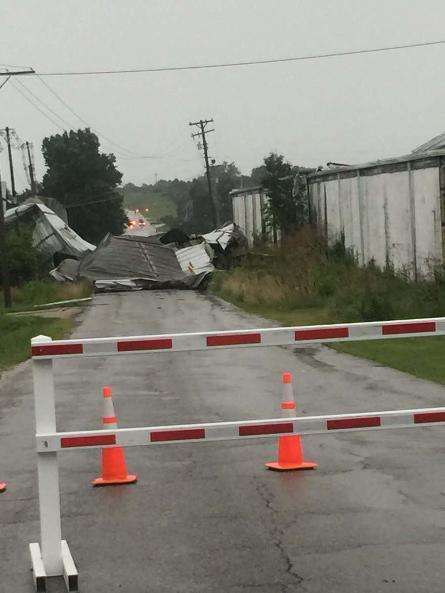 |
| Tree Down in Mount Sterling (Photo courtesy of Kendra Fugate) | Shelf Cloud in London (Photo courtesy of Johnnie Nicholson) | Clay Tobacco Warehouse in Mount Sterling (Photo courtesy of Kendra Fugate) |
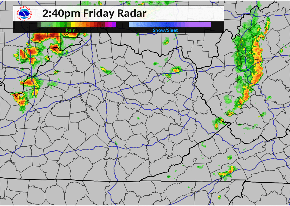
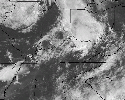
Radar and Satellite
|
2:40 PM - 11:40 PM Friday, July 20th |
11:00 PM - 8:00 PM Friday, July 20th |
Storm Reports
| Local Storm Reports received from July 20, 2018 | ||
 |
||
Rainfall Amounts
...24 HOUR RAINFALL REPORTS ENDING SATURDAY MORNING...

Location                     Amount    Time/Date       Provider
1 WSW Mt Vernon              4.12 in   0819 AM 07/21   AWS
5S McKee                     3.54 in   0800 AM 07/21   MESONET
Billows                      3.34 in   0730 AM 07/21   HADS
2 N Flemingsburg             3.21 in   0400 AM 07/21   COOP
Livingston                   2.81 in   0300 AM 07/21   MESOWEST
Gray Hawk                    2.72 in   0800 AM 07/21   HADS
Peeled Oak                   2.69 in   0800 AM 07/21   MESOWEST
4 S Owingsville              2.67 in   0800 AM 07/21   MESONET
London-corbin Apt            2.63 in   0753 AM 07/21   ASOS
1 SE Ringos Mills            2.57 in   0815 AM 07/21   GOES
1 SW London-Corbin Airport   2.46 in   0530 AM 07/21   COCORAHS
Garrich                      2.46 in   0500 AM 07/21   MESOWEST
Prewitt                      2.46 in   0827 AM 07/21   CWOP
2 ESE Grassy Lick            2.41 in   0730 AM 07/21   COCORAHS
1 S Stearns                  2.40 in   0700 AM 07/21   COCORAHS
1 NW Honeybee                2.28 in   0400 AM 07/21   MESOWEST
Willailla                    2.25 in   0700 AM 07/21   COCORAHS
Judy                         2.25 in   0600 AM 07/21   MESOWEST
3 S Level Green              2.22 in   0300 AM 07/21   MESOWEST
Barbourville (coop)          2.18 in   0800 AM 07/21   HADS
Leeco                        2.18 in   0700 AM 07/21   MESOWEST
1 S North Corbin             2.16 in   0800 AM 07/21   HADS
1 ENE Dishman Springs        2.13 in   0600 AM 07/21   MESOWEST
5 N Mount Sterling           2.13 in   0700 AM 07/21   COOP
Bluehole                     2.09 in   0819 AM 07/21   CWOP
1 SSW Hollyhill              2.09 in   0300 AM 07/21   MESOWEST
Gulnare                      2.09 in   0200 AM 07/21   MESOWEST
4 NE Morehead                2.09 in   0800 AM 07/21   MESONET
Farmers                      2.06 in   0815 AM 07/21   HADS
4 SW Blue Heron              2.04 in   0800 AM 07/21   HADS
Heisey                       2.02 in   0600 AM 07/21   MESOWEST
Reynoldsville                2.02 in   0200 AM 07/21   MESOWEST
Kerby Knob                   2.00 in   0630 AM 07/21   COCORAHS
12 SW Booneville             1.99 in   0800 AM 07/21   COOP
Wades Mill                   1.99 in   0600 AM 07/21   MESOWEST
Fainville                    1.98 in   0211 AM 07/21   CWOP
Corbin Dam                   1.90 in   0800 AM 07/21   USARMY-COE
Whitley City                 1.89 in   0400 AM 07/21   MESOWEST
3 E Barbourville             1.88 in   0800 AM 07/21   MESONET
1 ENE Gates                  1.87 in   0658 AM 07/21   COCORAHS
Dewey Lake                   1.87 in   0730 AM 07/21   GOES
2 NNW Blue Heron             1.84 in   0730 AM 07/21   HADS
Saxton                       1.83 in   0800 AM 07/21   HADS
Bradshaw                     1.82 in   0400 AM 07/21   MESOWEST
Manchester                   1.82 in   0815 AM 07/21   USGS
Mills                        1.81 in   0600 AM 07/21   MESOWEST
3 NW Ruth                    1.81 in   0827 AM 07/21   CWOP
3 N Whitley City             1.80 in   0800 AM 07/21   MESONET
Clover Bottom                1.78 in   0800 AM 07/21   COOP
Mount Sterling Apt           1.77 in   0755 AM 07/21   AWOS
2 NW Cooper                  1.76 in   0800 AM 07/21   HADS
Elkhorn City                 1.75 in   0730 AM 07/21   HADS
Rockholds                    1.74 in   0500 AM 07/21   MESOWEST
Waltersville                 1.72 in   0815 AM 07/21   HADS
Flatgap                      1.72 in   0500 AM 07/21   MESOWEST
Brush Creek                  1.70 in   0600 AM 07/21   MESOWEST
24 E Harlan                  1.68 in   0800 AM 07/21   MESONET
Pineville                    1.67 in   0730 AM 07/21   HADS
1 S Blairs Mills             1.63 in   0300 AM 07/21   MESOWEST
Williamsburg                 1.62 in   0800 AM 07/21   HADS
13 S Pikeville               1.62 in   0800 AM 07/21   MESONET
Beefhide                     1.59 in   0600 AM 07/21   MESOWEST
4 N Beattyville              1.59 in   0900 AM 07/21   COOP
Clay City                    1.58 in   0200 AM 07/21   MESOWEST
2 W Stanton                  1.57 in   0800 AM 07/21   COOP
Lawson                       1.56 in   0700 AM 07/21   COCORAHS
Tallega                      1.55 in   0815 AM 07/21   HADS
1 WSW Hilda                  1.54 in   0400 AM 07/21   MESOWEST
1 SW Pikeville               1.54 in   0800 AM 07/21   HADS
Cressy                       1.52 in   0800 AM 07/21   COOP
Triangle Mtn Raws            1.52 in   0802 AM 07/21   RAWS
Meldrum                      1.51 in   0730 AM 07/21   HADS
1 NW Myra                    1.50 in   0825 AM 07/21   MESOWEST
Cumberland                   1.50 in   0500 AM 07/21   MESOWEST
Somerset Raws                1.48 in   0801 AM 07/21   RAWS
Hindman                      1.47 in   0300 AM 07/21   MESOWEST
1 NNW Lucky Fork             1.47 in   0800 AM 07/21   MESOWEST
Saxton                       1.46 in   0600 AM 07/21   MESOWEST
4 WSW Mount Victory          1.46 in   0300 AM 07/21   MESOWEST
Virgie                       1.46 in   0500 AM 07/21   MESOWEST
2 W Fishtrap Lake            1.44 in   0745 AM 07/21   HADS
Heidelberg                   1.44 in   0815 AM 07/21   USARMY-COE
1 NNW Clio                   1.44 in   0827 AM 07/21   CWOP
3 WSW Mouthcard              1.43 in   0815 AM 07/21   MESOWEST
Fedscreek                    1.42 in   0800 AM 07/21   COOP
Buckhorn Lake                1.42 in   0815 AM 07/21   COOP
Dewitt                       1.41 in   0500 AM 07/21   MESOWEST
Cumberland River             1.41 in   0730 AM 07/21   GOES
Cave Run Lake                1.40 in   0805 AM 07/21   COOP
Mcandrews                    1.38 in   0200 AM 07/21   MESOWEST
Clayhole                     1.38 in   0700 AM 07/21   COCORAHS
Gimlet                       1.36 in   0800 AM 07/21   COOP
1 E Paintsville              1.35 in   0700 AM 07/21   COOP
1 NE Speight                 1.34 in   0500 AM 07/21   MESOWEST
Inez                         1.34 in   0300 AM 07/21   MESOWEST
3 N Harlan                   1.34 in   0700 AM 07/21   COOP
2 WNW Rockcastle Springs     1.33 in   0700 AM 07/21   COCORAHS
Deering                      1.32 in   0700 AM 07/21   COCORAHS
Wasioto                      1.31 in   0500 AM 07/21   MESOWEST
1 N Muses Mills              1.28 in   0820 AM 07/21   MESOWEST
2 WNW Coleman                1.27 in   0600 AM 07/21   MESOWEST
Roundstone                   1.27 in   0600 AM 07/21   MESOWEST
Deering                      1.26 in   0827 AM 07/21   CWOP
Booneville                   1.26 in   0800 AM 07/21   HADS
1 SSW Marrowbone             1.26 in   0300 AM 07/21   MESOWEST
Dillon                       1.24 in   0500 AM 07/21   MESOWEST
1 W Confluence               1.24 in   0810 AM 07/21   MESOWEST
Arjay                        1.23 in   0700 AM 07/21   MESOWEST
Peabody Raws                 1.23 in   0801 AM 07/21   RAWS
Stearns River                1.22 in   0730 AM 07/21   USARMY-COE
Sand Hill                    1.21 in   0730 AM 07/21   HADS
Viper                        1.21 in   0705 AM 07/21   COCORAHS
Hazard                       1.21 in   0730 AM 07/21   HADS
Virgie                       1.20 in   0815 AM 07/21   USARMY-COE
Paintsville River            1.20 in   0745 AM 07/21   USARMY-COE
Phelps                       1.19 in   0725 AM 07/21   MESOWEST
Johns Creek                  1.16 in   0730 AM 07/21   USGS
1 ENE David                  1.15 in   0300 AM 07/21   MESOWEST
Jackson Apt                  1.15 in   0815 AM 07/21   RAWS
Yellow Creek                 1.13 in   0826 AM 07/21   RAWS
Middlesboro Apt              1.12 in   0755 AM 07/21   AWOS
2 NE Waltz                   1.12 in   0600 AM 07/21   MESOWEST
1 E Olympia Springs          1.12 in   0700 AM 07/21   MESOWEST
1 WSW Pikeville              1.11 in   0300 AM 07/21   MESOWEST
2 E Inez                     1.11 in   0700 AM 07/21   COOP
2 S Booneville               1.11 in   0800 AM 07/21   MESONET
NWS Jackson                  1.10 in   0753 AM 07/21   ASOS
Harlan                       1.07 in   0500 AM 07/21   MESOWEST
Pippa Passes                 1.07 in   0400 AM 07/21   MESOWEST
Ezel                         1.06 in   0700 AM 07/21   COOP
2 SE Whitesburg              1.05 in   0700 AM 07/21   COOP
Laurel Lake Dam              1.02 in   0800 AM 07/21   USARMY-COE
1 WNW Big Laurel             1.00 in   0800 AM 07/21   MESOWEST
1 W Hosea                    1.00 in   0500 AM 07/21   MESOWEST
Lunah                        1.00 in   0600 AM 07/21   MESOWEST
2 SSE Sudith                 0.99 in   0300 AM 07/21   MESOWEST
Bush                         0.99 in   0500 AM 07/21   MESOWEST
Diablock                     0.99 in   0825 AM 07/21   CWOP
3 WSW Prestonsburg           0.97 in   0700 AM 07/21   COOP
Rogers                       0.96 in   0700 AM 07/21   MESOWEST
2 SW West Liberty            0.96 in   0800 AM 07/21   MESONET
1 SSE Ned                    0.95 in   0500 AM 07/21   MESOWEST
Jackson                      0.94 in   0800 AM 07/21   HADS
Carr Fork Lake               0.94 in   0815 AM 07/21   COOP
Big Sandy Raws               0.92 in   0809 AM 07/21   RAWS
1 SE Ligon                   0.92 in   0500 AM 07/21   MESOWEST
Maytown                      0.92 in   0800 AM 07/21   MESOWEST
1 SE Grays Knob              0.91 in   0500 AM 07/21   MESOWEST
Koomer Ridge                 0.90 in   0809 AM 07/21   RAWS
Hyden River                  0.88 in   0815 AM 07/21   USARMY-COE
2 E Odds                     0.87 in   0200 AM 07/21   MESOWEST
2 SW London-corbin Airport   0.87 in   0700 AM 07/21   MESOWEST
4 W Paintsville              0.87 in   0800 AM 07/21   MESONET
Cranks Creek Reservoir       0.86 in   0800 AM 07/21   GOES
3 SE Jackson                 0.85 in   0800 AM 07/21   MESONET
1 ENE Corgleton              0.84 in   0300 AM 07/21   MESOWEST
Brodhead                     0.84 in   0700 AM 07/21   MESOWEST
1 SW Jackson                 0.84 in   0700 AM 07/21   MESOWEST
Martin                       0.84 in   0300 AM 07/21   MESOWEST
1 ENE Fritz                  0.84 in   0400 AM 07/21   MESOWEST
Raccoon                      0.83 in   0600 AM 07/21   MESOWEST
New Clover Fk River          0.81 in   0730 AM 07/21   GOES
Hendricks                    0.81 in   0800 AM 07/21   COCORAHS
Salyersville                 0.80 in   0200 AM 07/21   MESOWEST
Meldrum                      0.80 in   0700 AM 07/21   MESOWEST
Climax                       0.80 in   0800 AM 07/21   MESOWEST
5 N Hindman                  0.80 in   0800 AM 07/21   MESONET
Whitesburg                   0.79 in   0730 AM 07/21   HADS
1 SSW Wayland                0.79 in   0300 AM 07/21   MESOWEST
1 SSW Bowen                  0.75 in   0820 AM 07/21   CWOP
1 NE Barnetts Creek          0.72 in   0200 AM 07/21   MESOWEST
Stanton                      0.72 in   0700 AM 07/21   MESOWEST
Mount Pisgah                 0.71 in   0400 AM 07/21   MESOWEST
Barnetts Creek               0.69 in   0815 AM 07/21   HADS
South Wallins                0.68 in   0500 AM 07/21   MESOWEST
2 NW Whitesburg              0.66 in   0800 AM 07/21   MESONET
2 WNW Viper                  0.64 in   0400 AM 07/21   MESOWEST
Tomahawk                     0.64 in   0200 AM 07/21   MESOWEST
Kingdom Come State Park      0.64 in   0400 AM 07/21   MESOWEST
Skyline                      0.60 in   0700 AM 07/21   COOP

Observations are collected from a variety of sources with varying
equipment and exposures. We thank all volunteer weather observers
for their dedication. Not all data listed are considered official.
Environment
 |
 |
 |
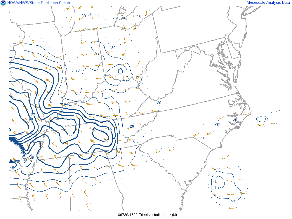 |
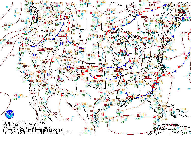
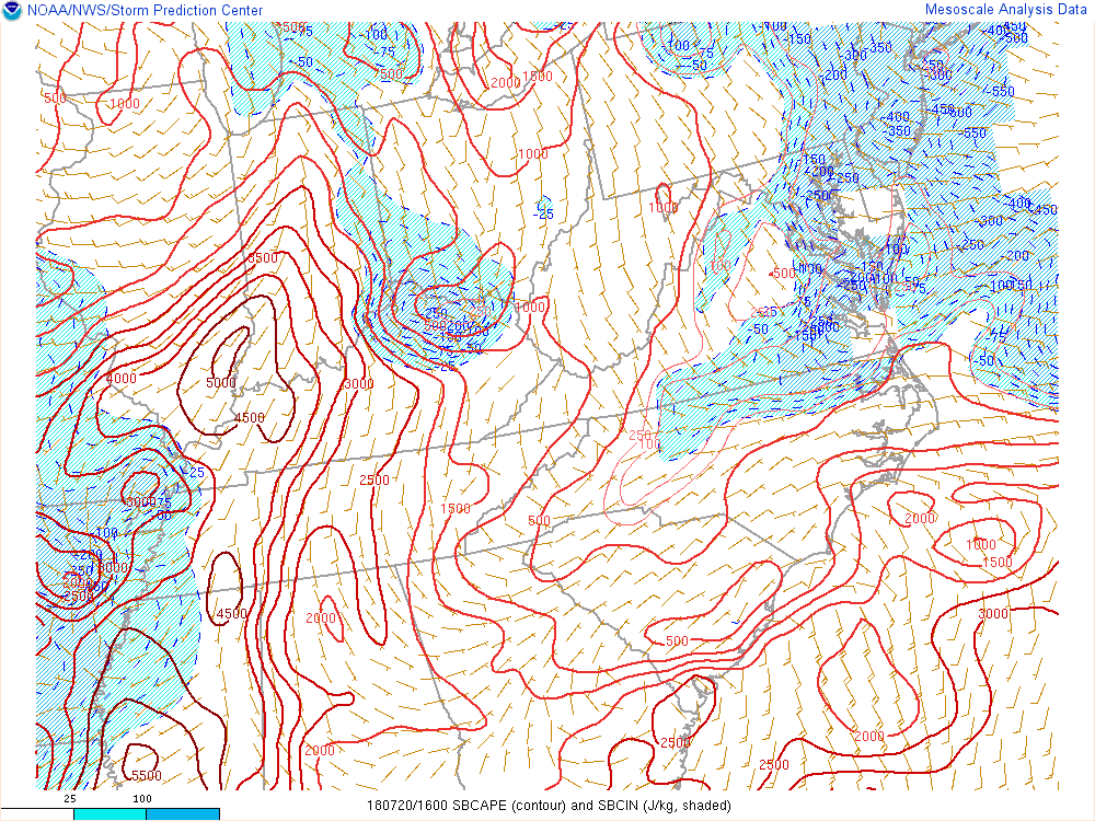
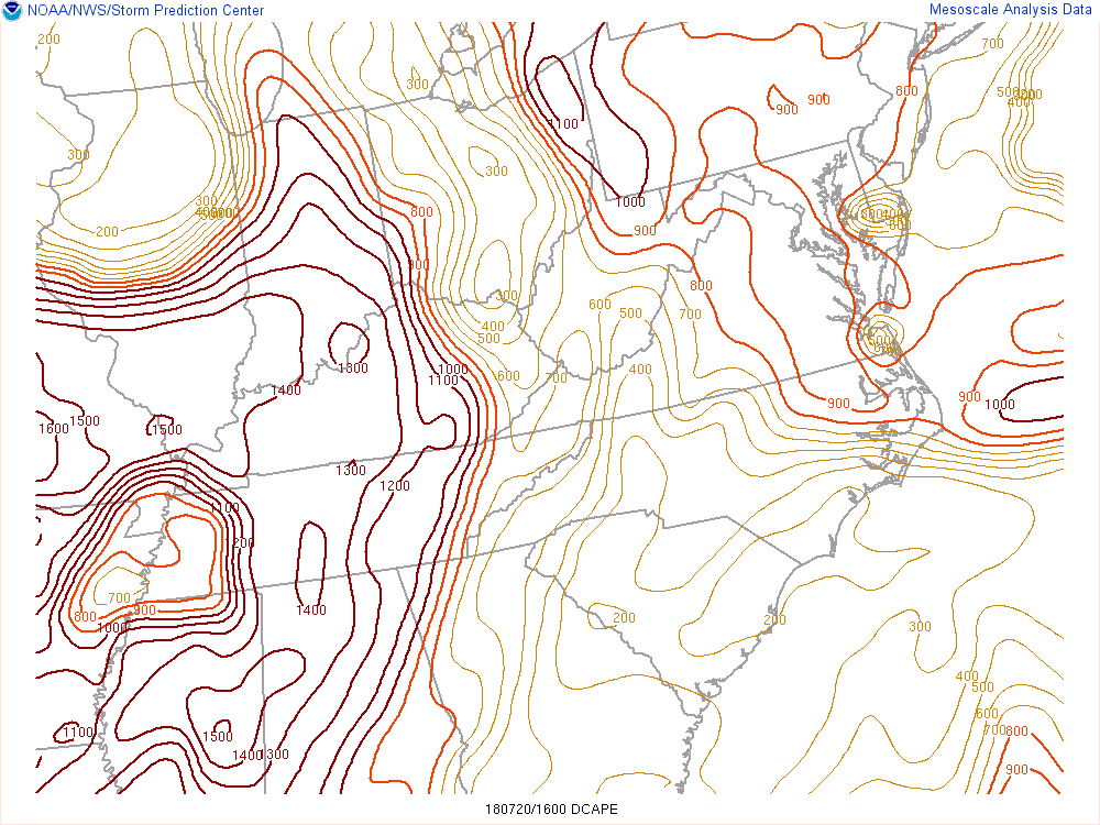
| 5 pm Surface Analysis | Surface Based Cape (12-8 pm) | Downdraft Cape (12-8 pm) | Effective Bulk Shear (12-8 pm) |
Severe Thunderstorm Outlooks (Issued by Severe Storm Prediction Center)
 |
 |
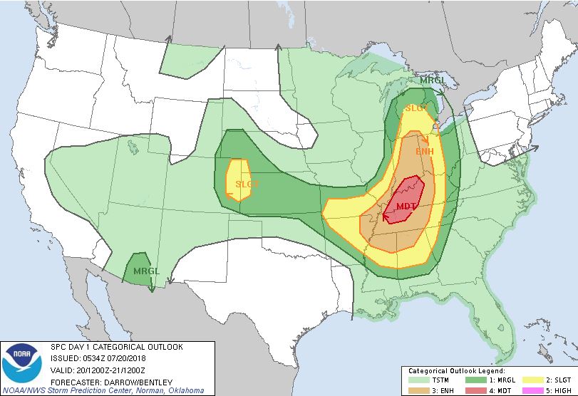 |
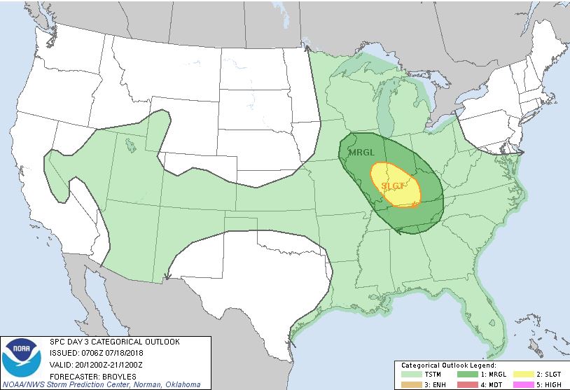
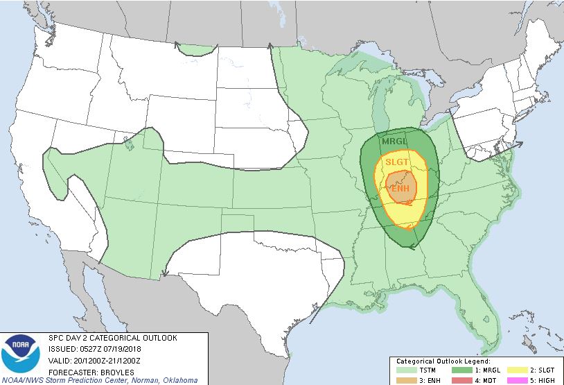
| Day 3 Severe Convective Outlook | Day 2 Severe Convective Outlook | Day 1 Severe Convective Outlook |
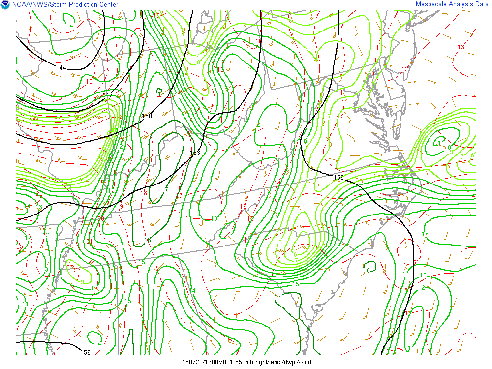
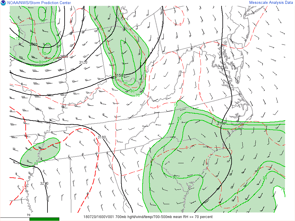
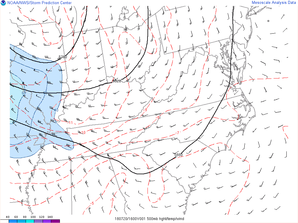
Upper Levels (All images contain loops between noon and 8 pm)
 |
 |
 |
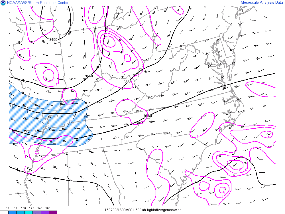 |
| 850mb Analysis | 700mb Analysis | 500mb Analysis | 300mb Analysis |
 |
Media use of NWS Web News Stories is encouraged! Please acknowledge the NWS as the source of any news information accessed from this site. |
|