Jackson, KY
Weather Forecast Office
Overview
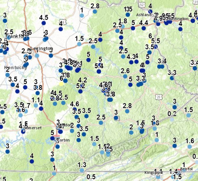
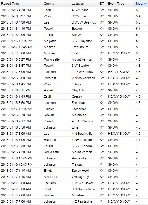
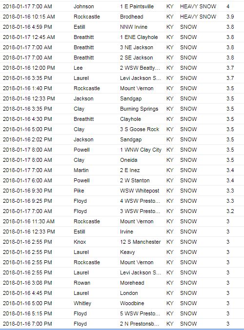
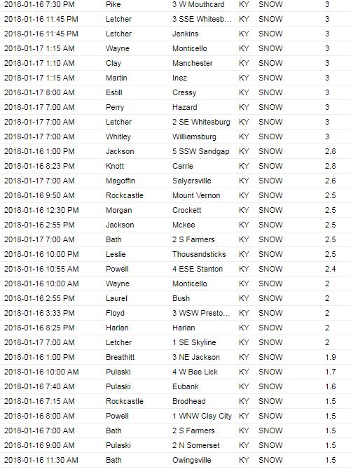
An arctic cold front and upper level disturbance slowly crossed Kentucky from late Monday, January 15th, through Tuesday, January 16th. Both the slow movement of this system along with the development of several heavier snow bands on the 16th brought widespread accumulating snow to eastern Kentucky, with snowfall totals ranging from 1 to 6 inches. With very cold air filtering in as the snow came to an end, roads continued to be hazardous into the morning of January 17th. This led to numerous vehicular accidents, including one on Interstate 75 near London which caused multiple lanes to be shut down for a couple of hours.
 |
 |
 |
| Main Street in Ravenna (photo courtesy of Estill County Emergency Management) | Hwy 578 North of London (photo courtesy of Johnnie Nicholson) | Pike County (photo courtesy of Mary Reed Runyon) |
 |
 |
 |
|
Lakeshore Drive in Burnside (photo courtesy of Laura Wagner) |
Intersection of Hwy 914 and Hwy 27 in Somerset (photo courtesy of LaTonya Vernon) | Estill Ave in Irvine (photo courtesy of Estill County Emergency Management) |
Storm Reports
Environment
|
|
 |
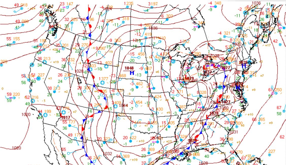
| Surface analysis depicting a strong arctic front that moved through during the morning of the 16th. | 500 mb analysis (about 15,000 - 18,000 feet aloft) showing a strong and prolonged period of upper level energy swinging through eastern KY. |
 |
Media use of NWS Web News Stories is encouraged! Please acknowledge the NWS as the source of any news information accessed from this site. |
|
Warnings/Hazards
Decision Support - Outlooks
Current Weather Hazards
Hazards Criteria
Weather Story Graphic
Recent Storm Reports
Submit a Report
Forecasts
Decision Support - Forecast
Aviation Forecasts
Fire Weather Forecasts
Hourly Weather Forecast
Activity Planner
River Forecasts
Forecast Discussion
Current Conditions
Regional Radar
Decision Support - Current
Rivers and Lakes
Hourly Airport Weather
Local Radar
Satellite
Kentucky Mesonet
Past Weather
Local Climate Info
Temp/Precip Summary
How Much Rain Fell?
How Much Snow Fell?
Past Weather Events
Drought Information
Local Coop Observers
US Dept of Commerce
National Oceanic and Atmospheric Administration
National Weather Service
Jackson, KY
1329 Airport Road
Jackson, KY 41339
606-666-8000
Comments? Questions? Please Contact Us.